The Essex Coast - Walton-on-the-Naze to St Osyth
|
Monday 21 February 2022
|
2 comments |
![]()

Walton-on-the-Naze to St Osyth
The third stage of a weeks walking along the Essex Coast between Manningtree and Maldon
NOTE
This is a walk summary intended to provide the user with just the essential information in order to navigate the walk route. Fully detailed information notes, refreshment stops and walk features are not included in this. A full write up will be included in the near future.
Walton-on-the-Naze to St Osyth - Essential Information
Walk Statistics (calculated from GPX):
- Start location: Walton-on-the-Naze
- End location: St Osyth
- Distance: miles ( km)
- Total Gain: ft ( metre)
- Total Descent: ft ( metre)
- Min Height: ft ( metre)
- Max Height: ft ( metre)
- Walk Time:
- Walk Grade: Easy
- Terrain: Footpath, Beach
Maps:
The following maps and services can assist in navigating this route. There are links to printed maps and links to downloadable GPX route data for importing into navigational software and apps.
- Ordnance Survey Explorer Map
- OS Explorer 184 - Colchester
- GPX Route File
Route Verification Details
- Date of Walk: 04/09/2010
- Walk Time: 12:45:00 to 17:45:00
- Walkers: Griff, Kat
- Weather Conditions: Hazy blue skies, fairly warm
Walk Notes
Route: Follow the seafront path through to Jaywick from where a path along the sea defences leads to St Osyth Beach. Although the path continues here it runs into barriers down into the sea preventing access to Point Clear, so we used the track up to the main road to St Osyth. There was an option to walk into Point Clear but with time pressing on and the last bus not far off we waited for the ride back into Clacton in order to catch a train back to base-camp. I have walked between Point Clear and St Osyth on numerous occasions in the past having friends who lived in Point Clear so I may include this simple walk in the blog at a later date.
Pub: Moon and Starfish, Weatherspoons Pub, Clacton: this is on the corner of main road just up from the pier. A typical busy Weatherspoons pub with a variety of ales at very good prices.
Walk Feature: Jaywick: it may seem strange to mention Jaywick as a walk feature, but I include this as Peter Catons 'Essex Coast' book mentions that Clacton people call Jaywick a Shanty Town and to appreciate this fact you really need to go there and walk through it. Rows of seafront wooden chalet houses, some derelict, some inhabited and others not, but all in varying states of disrepair. Each chalet has a garden and in most cases each garden is uncared for with laundry hanging to dry amongst rubble and rubbish whilst cars are parked up alongside on the unmade roads. Every so often there is one home where someone has spent a bit more time to present a more tidy house, but these are very much in the minority.
Walk Feature: Martello Towers: These were built as defensive forts during the Napoleonic wars. There are 5 Martello towers between Clacton and Point Clear, the 3 at Clacton are unused, one at Jaywick Holiday camp is used as an arts venue for visual and digital arts and has an observation tower and the one at Point Clear is used as an aviation museum
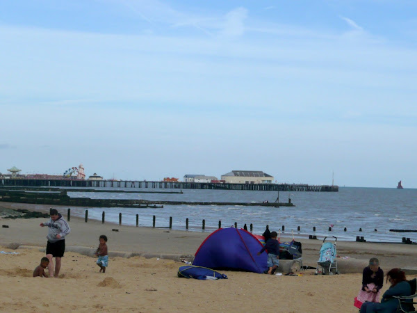
Notes: Walton-on-the-Naze is the home to propensity of beach huts! I have never seen so many in one place, they are terraced up the cliff face in places. The walk along the promenade walking was very easy, although a bit hard on the soles of the feet on the concrete surface.
As we approached Holland-on-Sea wall notices informed us of the distance along the promenade to Clacton to encourage people to walk for health reasons. Not sure why anyone really would want to walk for health reasons. It is far better to walk for pleasure. The notices gave their distances in km which I can work with quite comfortably in mathematical terms but certainly do not understand as a walking parameter. I am not so sure whether anyone took the messages offer up, there were plenty of people about but most seemed content with sitting by ice-cream shops and beach huts and a few would make us jump as they cycled up behind us. As we headed out to Jaywick we saw fewer and fewer people until there was no-one out along the seawall to St Osyth beach apart from a lone walker with a small rucksack on his back who passed us in the opposite direction.
It is somewhat unfortunate that we couldn't walk down to Point Clear as I have very fond memories of walking the marsh up St Osyth Creek. Many years ago I even helped salvage a decaying boat from the marshes and many a pint has been supped at the Ferry Boat Inn and Old Ma Gradys Good Time Emporium (which has now gone). Even the bus service has changed since those halcyon days, I remember it as a small friendly hopper service with a helpful friendly driver - now it is the familiar advertising infested First Group bus complete with grumpy driver.
Accommodation: Grange Farm Camp Site, Thorpe-le-Soken - an excellent and recommended site with basic facilities and friendly staff. It is close to the railway station and has a resident owl!
Transport: Train from Thorpe-le-Soken to Walton-on-the-Naze, return from St Osyth to Clacton on First group 17 bus service, return to Thorpe-le-Soken by train from Clacton. Clacton station early Saturday evening is devoid of any impression of it actually being a working railway! If the idle carriages had not been standing on the platforms I would have thought this was part of Mr Beechings cuts back in the 1960's. The station building is up for sale. Iron railings bar virtually all entrances onto the platform. Tickets have to be bought from a machine and the toilets are locked with a notice on them informing that the police will be monitoring them for indecent behaviour. There was no sign of a policeman, unless he had locked himself in the loo as part of a surprise arrest. In fact, there was no sign of anyone apart from a couple of would-be passengers looking equally as lost as us. Sorry to rant, but maybe, just maybe, dear National Express if you are listening, if you put a little personality and soul and presence into these places we wouldn't have indecent behaviour and locked loos and deserted stations. As it was, the place gave the impression that I had woke up on an intergalactic space freighter where the only company was the tannoy which offered messages in a computerised woman's voice about an impending arrival and the nearest human being was several light years away and the only other lifeforms is some alien being who likes to do indecent things to unsuspecting humans.
Summary of Document Changes
Last Updated: 2022-02-21
Images


why cant you walk to point clear and is it true that the sea since 1965 has reclaimed all the shops and the c aff
ReplyDeleteHello Maria. I was reading Peter Catons book 'Essex Walk' as I walked this route. He had attempted to walk along the coast all the way to Point Clear despite all the frequent warning signs advising him against such a trek. He was eventually forced back when he was obstructed by tall fences that went down into the sea - these are by the first houses of Point Clear. I do remember fences on the Point Clear side and its to stop people wandering onto their private beaches.
ReplyDeleteI am not certain what shops you mean. My first visits to this area were back in the mid 80's but nothing seems to have changed with respect to erosion so I am not sure.