Angles Way - Oulton Broad to Beccles
|
Friday 28 December 2018
|
No comments |
![]()
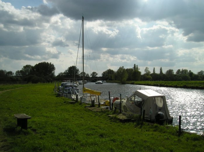
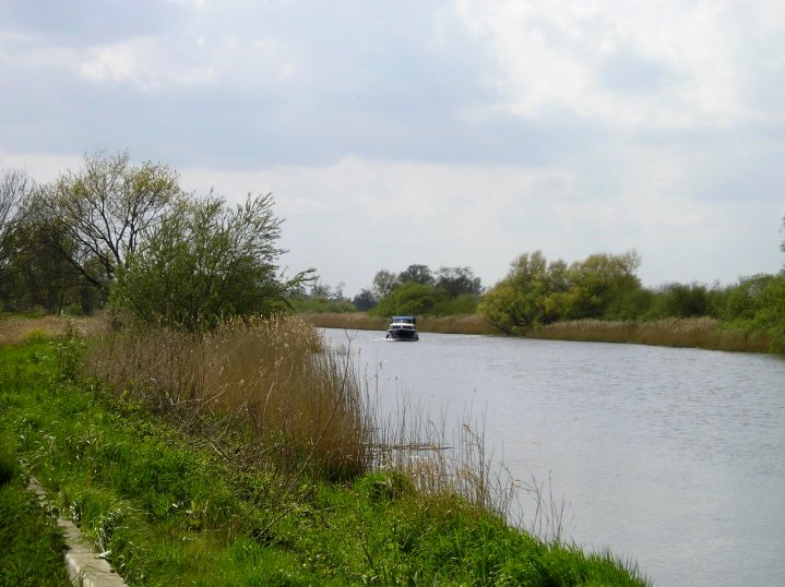
A 9 mile walk along the Angles Way between Oulton Broad and Beccles in Suffolk
The path between Oulton Broad and Beccles doubles up as both The Angles Way and the East Suffolk Coast Line walk. There is not much to this walk other than following the winding path alongside the River Waveney. It is a pleasant enough stroll but without much activity on the river it can become a little monotonous until Beccles approaches. Nonetheless, what a better way than to spend a sunny afternoon other than ambling alongside the river.
Oulton Broad to Beccles Walk - Essential Information
Walk Statistics:
- Start location: Oulton Broad
- End location: Beccles
- Distance: miles ( km)
- Total Gain: ft ( metre)
- Total Descent: ft ( metre)
- Min Height: ft ( metre)
- Max Height: ft ( metre)
- Walk Time:
- Walk type: Linear
- Walk Grade: Easy
- Terrain:
Maps:
The following maps and services can assist in navigating this route. There are links to printed maps and links to downloadable GPX route data for importing into navigational software and apps.
- Ordnance Survey Explorer Map
- OS Explorer 231 - Southwold & Bungay
- GPX Route File
Transport:
Details of public transport that is required for the walk
Train Service
- Service Details
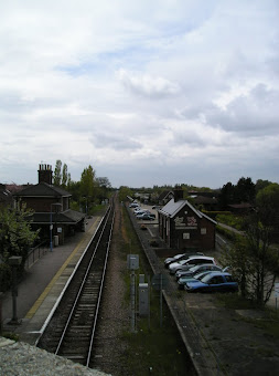
- East Suffolk Line - Train from Beccles to Oulton Broad South - hourly service during weekdays and Saturdays
- Timetable
- http://www.nationalrail.co.uk/
Route Verification Details
- Date of Walk: 2010-05-20
- Walk Time: 13:00 to 16:00
- Walkers: Griffmonster, Kat
- Weather Conditions: Cool - glimpses of sunshine
Walk Notes
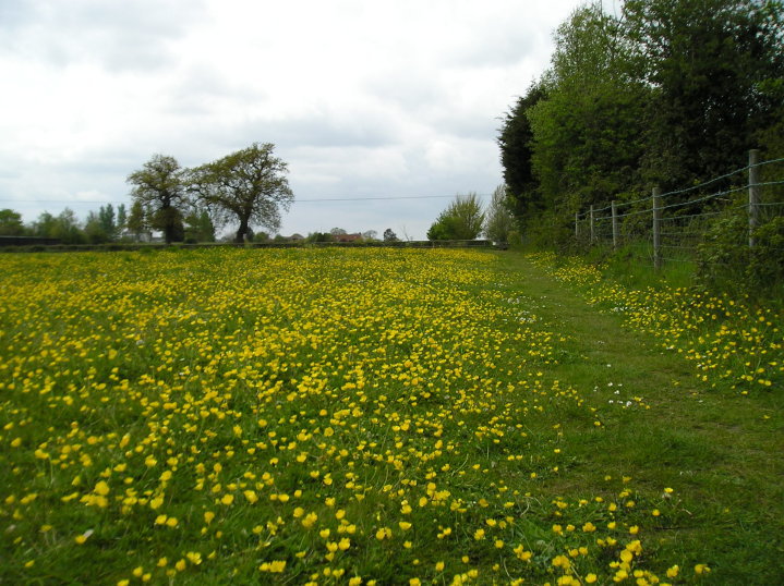
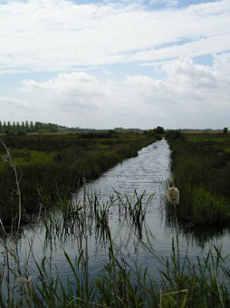
The start of the walk was very pleasant, strolling through the meadows out to the River Waveney from Oulton Broad South railway station. Once up on the river bank it is pretty much the same scene throughout which became a little monotonous as there was little activity on the river. At the site of the Great Yarmouth to Beccles Railway Swingbridge we encountered a young couple with a rather large Doberman dog which was off the lead. The beast came hurtling at us and was not looking very playful either which was a bit disconcerting. The chap did manage to call the beast to heel but it did give a moment of apprehension.
One big disappointment about the walk was the lack of pubs along the route. We did stop off at the Ivy House Country Hotel but felt a little out of place sitting in a rather lavish lounge. I have since been told that The Swan Inn at Barnby is just off route with a track leading from the footpath. Maybe another time.
Although not exactly on the walk, Beccles Common is easily reached from Beccles Quay and can be an additional walk in itself. This is the location for the included feature of the Beccles Man from the Sky.
Directions
Both Angles Way and East Suffolk Line waymarkers provide a well signed route, though it is hard to get lost as the path follows the River Waveney
From Oulton Broad South railway station take the track on the north side of the line and follow the waymarkers through the caravan park, past Ivy House Country Hotel and through a meadow to the marshes. Here a track heads down towards the river. I have to admit that it was unclear exactly which way to proceed to get to the river and I think the path we took was not the actual Angles Way when referenced against the map. Nonetheless, what ever route you take, you will end up by the river and walking along the river defences all the way to Beccles
Pubs
Ivy House Country Hotel , Oulton Broad View in OS Map | View in Google Map
- Address
- Ivy Lane, Oulton Broad
- Website
- https://ivyhousecountryhotel.co.uk/
A mixture of converted farm buildings and new build, this country Hotel tucked away down a quiet country track advertises itself as a the perfect place for barn weddings and civil ceremonies. Attached to the hotel are four acres of Country gardens and lily ponds that go out to the broadside footpath.
A rather plush country hotel with a bar. No cask ale but the barmaid was quite happy for us walkers to come in and sit down for a drink.
Features
Beccles FenView in OS Map | View in Google Map
Beccles Fen and Marsh is located on the eastern side of Beccles. It was given to the people of the town by Queen Elizabeth I in 1584 who granted a charter. This event is depicted on the Town Sign. The Town Council, Suffolk Wildlife Trust and the Broads Authority maintain the marsh as a haven for wildlife and have provided three waymarked trails of 1½ (white walk), 3 (red walk) and 4 miles (green walk).
In 2006 flood defence work on the fen unearthed three long rows of wooden posts inserted into the ground. Initial thoughts were that the posts were to mark a causeway, but the real purpose of the site remains a mystery, it could be that of a ritual gathering point, similar to the one discovered at nearby Barsham. Experts have used tree rings to date the wood to the spring of 75 BC. An information board by the river details the findings.
Great Yarmouth to Beccles Railway Swingbridge: View in OS Map | View in Google Map
Just before the river bends round towards Beccles there is the remains of the brick supports to the old Yarmouth to Beccles Railway swingbridge. The line was opened in 1859 and closed 100 years later in 1959. The swingbridge was one of a pair, the other being between Haddiscoe and St Olaves. These were crossed at walking pace and were, until 1927, operated by signal boxes, with pilot men on the footplate for the crossing. This line carried express services from Liverpool Street to Yarmouth, covering the distance in as little as 2.5 hours in 1904. Eventually the cost of maintaining the Yarmouth to Beccles line to express standards became prohibitive and reports of the line's closure surfaced in 1955, yet it was not until 2 November 1959 that the Beccles line finally closed to regular traffic.
References
The Mysterious Beccles Man from the SkyView in OS Map | View in Google Map
To the southeast of Beccles Quay lies Beccles Common. This is the location where the Beccles Man from the Sky was said to have been sighted. The report comes from 1977 and the first appearance was in either February or March of that year. Maureen Gaines lived with her family on a small holding on the common. She had twin daughters aged three and a half and it was they, in an alarmed state, who had alerted her to a mysterious man who they had said had jumped from an aeroplane and was approaching the house. The man had a frightening appearance with yellow hair which had caused them to run back to the house from the stable area where they had been playing. Maureen calmed her children down and then went out to investigate but, despite looking around all the outbuildings, she found no-one around.
A few days later on returning from a shopping trip, she was walking up the Avenue, across the common to her house when she caught sight of a strange man flopping about the path. He straightened his posture and started walking towards them. At the sight, her daughters exclaimed that it was 'the man from the aeroplane'. He was tall, over 6ft, and had blue/grey clothing similar to a boiler suit that tightened against his ankles and wrists. His hands were covered in gauntlet style gloves and he wore boots on his feet and had earphones that issued what seemed like white noise, interrupted by a loud foreign sounding voice. He passed by them without a word, his strange pinky red eyes staring straight ahead. She inquisitively turned around to see where he was going but there was no sign of him. Despite the lack of cover on the common, he was no-where to be seen. She even retrod her steps but the figure had vanished.
This was not the end of the story for some days later, whilst out collecting firewood on the common, Maureen and her children witnessed what looked like an egg shaped caravan standing on two legs and with a single window at the front. This seemed odd as the area it occupied was very marshy and not a place one would sensibly park a caravan. Her daughters, on seeing this object exclaimed 'There's the aeroplane' and insisted it was the same aeroplane that the mysterious man had descended from a few days earlier. Not wanting to go nearer, she did find a spot in some woodland where she could have a closer look and it was here that she caught sight of what appeared to be the same mysterious man standing by the 'caravan'.
Whether this was just a strange traveller who had fired the children's imagination or something more exotic, we may never know. It is certainly something out of the ordinary and the children's original alarmed comments indicates the 'caravan' could fly. This does bear some similarities to the 1960's Lonnie Zamora incident where the police Sergeant encountered an egg shaped object standing on legs accompanied by two tall men in overalls. In this incident, he then witnessed the object take off. The case has never been satisfactorily explained.
References
Summary of Document Changes
Last Updated: 2021-12-07
Angles Way, Distance:Medium, East Suffolk Line Path, Features:Railway Heritage, full-detail, OSmap:231, Riverside Walk, Suffolk


0 comments:
Post a Comment