Leiston to Hazlewood Circular Walk Summary
Sunday, 29 July 2018
|
No comments
|
![]()
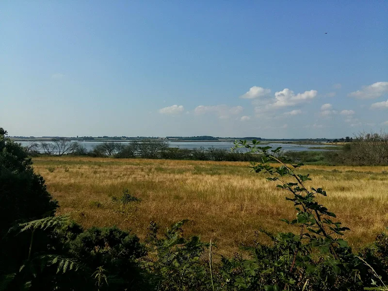
A somewhat challenging circular walk to Suffolks ancient parish of Hazlewood
Hazlewood was an ancient parish that bordered the River Alde in the Plomsgate Hundred of Suffolk. In 1934 it was annexed with the neighbouring parishes of Friston and Aldeburgh although names in the landscape still bear testament to its existence, including Hazlewood Common, the ultimate destination of this walk.
This is a challenging walk in respect of 20 yards of jungle to navigate through in order to get to The Grange farmhouse. Navigation of this neglected footpath does involve crawling on all fours as well as climbing across fallen trees. Not a walk for the feint hearted.
This challenge borders a field which was part of a WWI airfield that was in operation between October 1915 and September 1919. Known locally as Hazlewood Aerodrome, this grass airstrip was one of several support sites for RNAS Great Yarmouth and served as a night landing ground. It was also used by aircraft responding to Zeppelin raids. Little remains of the site as all support buildings have now either been demolished or collapsed although there is reputedly some concrete footings that can still be seen.
Other features on this route are the ancient Great Wood and some post medieval quarries. Return is across Aldringham Common where the former Aldringham Providence Baptist Chapel can be seen. Built in 1812, this chapel hidden away on the common was replaced in 1915 with a design by the Suffolk architect, poet and artist, Cecil Howard Lay. It has since been converted into a private residence.

Walk Statistics
- Start location: Leiston
- Distance: miles ( km)
- Total Gain: ft ( metre)
- Total Descent: ft ( metre)
- Min Height: ft ( metre)
- Max Height: ft ( metre)
- Est. Walk Time:
- Walk type: Circular
- Walk Grade: difficult
- Terrain: Footpaths, tracks and pavement
- Obstacles: The route is easy apart from the short distance from Millers Covert to Grange Farm. The footpath has been neglected for many years and even though markers are still intact, the area is very much overgrown. A trodden path does lead the way but takes some effort to get past the dense undergrowth and fallen trees.

Maps
The following maps and services can assist in navigating this route. There are links to printed maps and links to downloadable GPX route data for importing into navigational software and apps.
- Ordnance Survey Explorer Map
- OS Explorer 212 - Woodbridge & Saxmundham
- GPX Route File
Route Validation Cards
Validation Date - 2018-07-21
- Time of Walk: 09:00 to 11:30
- Validators: Griffmonster
- Weather Conditions: Warm sunny day
- Notes: Initial route undertaken
Summary of Document Changes
Last Updated: 2026-04-20
- 2021-03-17 : Update website improvements and removal of ViewRanger reliance
- 2021-12-01 : Removal of ViewRanger links due to its imminent demise
- 2026-01-12 : Major website update with all walks recast to the new format


0 comments:
Post a Comment