Essex Coast - Burnham-on-Crouch to Southend
|
Tuesday 28 August 2018
|
No comments |
![]()
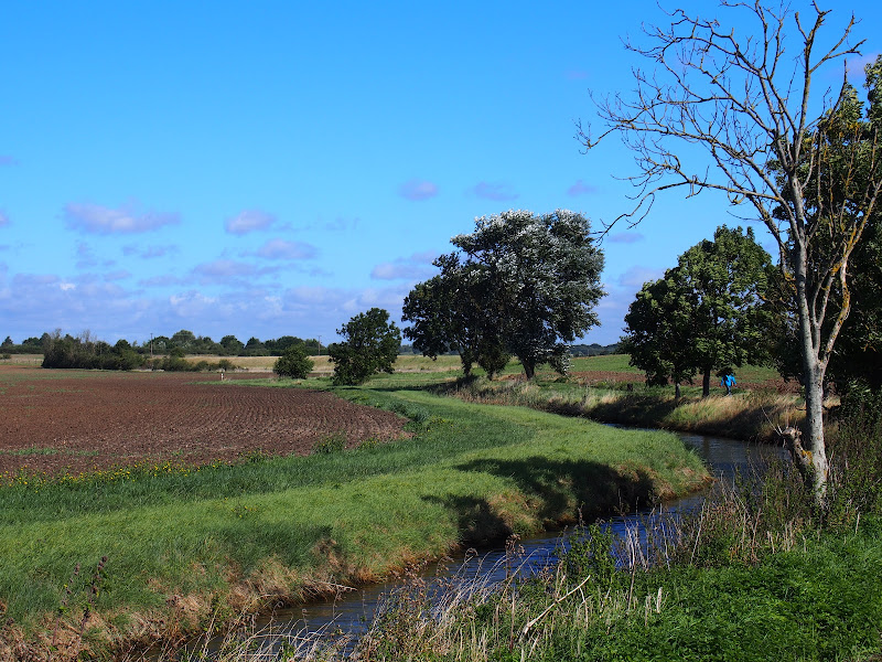
A walk around creeks and countryside of coastal south Essex
The start of the walk is a call to the ferryman. He is based on the far side of the River Crouch and a telephone call has him sailing across in no time. The ferry drops its passenger on Wallasea Island which sets the scene for the day. It is an island but only separated from the mainland by a creek. This low level land is full of creeks, dykes, ditches and it is difficult to determine what is an island and what is part of the mainland.
For this walk we navigate across to the village of Paglesham and then down to the banks of the River Roach which we follow up to the town of Rochford. One could simply catch the train at Rochford and return to Burnham. It wouldn't be a bad idea if you are following this route as the remaining leg to Southend is predominantly urbanised and not a pleasure to walk. The alternative to taking the road is to follow the creeks through to Shoeburyness but that is a whole days walking in itself.
There are limited places for refreshment along this route. There is the Punch Bowl pub at Paglesham but this has limited opening hours. In this instance we returned to Burnham-on-Crouch where the Queens Head is a little back street pub that specialises in micro brewery ales which are rare to find in this part of Essex, in fact any ale of any description is hard to find in this part of Essex.
Essex Coast - Burnham-on-Crouch to Southend - Essential Information
Walk Statistics:
- Start location: Burnham-on-Crouch
- End location: Southend
- Distance: miles ( km)
- Total Gain: ft ( metre)
- Total Descent: ft ( metre)
- Min Height: ft ( metre)
- Max Height: ft ( metre)
- Walk Time:
- Walk type: Linear
- Walk Grade: moderate
- Terrain: footpaths and country lanes - the end section along urban roads
Maps:
The following maps and services can assist in navigating this route. There are links to printed maps and links to downloadable GPX route data for importing into navigational software and apps.
- Ordnance Survey Explorer Map
- OS Explorer 176 - Blackwater Estuary
- GPX Route File
Accommodation:
Waterside ParkcampsiteView in OS Map | View in Google Map
- Website
- https://www.parkdeanresorts.co.uk/location/essex/
- Description
- Parkdean resorts Waterside Park on the banks of the Blackwater estuary. This was taken over by Countrywide Park Homes in December 2017 amid accusations of intimidation towards holiday park plot owners. It is uncertain whether touring sites are still available here. Certainly during Autumn 2017 the site was amenable and the staff accommodating. More recent Trip Advisor reports since the take over are not encouraging.
Transport:
Details of public transport that is required for the walk
Burnham ferry - Ferry Service
- Service Details
- Burnham ferry - The Ferry links Essex Marina on Wallasea Island with Burnham-on-Crouch Town Quay (opposite the Anchor pub) across the River Crouch. This is a foot ferry that also allows cycles and runs 6 days a week excluding Wednesdays from Easter (Good Friday) to the end of September.
- Timetable
- Burnham ferry
Various - Train Service
- Service Details
- Greater Anglia - Southend Victoria to Burnham on Crouch, change at Wickford
- Timetable
- Greater Anglia
Route Verification Details
- Date of Walk: 2017-09-12
- Walk Time: 09:30 to 15:30
- Walkers: Griffmonster, Kat
- Weather Conditions: warm with sunny spells
Directions
Summary of Document Changes
Last Updated: 2021-12-07


0 comments:
Post a Comment