The Peddars Way - Castle Acre to Heacham
|
Thursday 24 February 2022
|
1 comment |
![]()

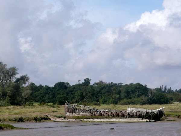
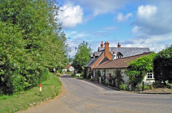
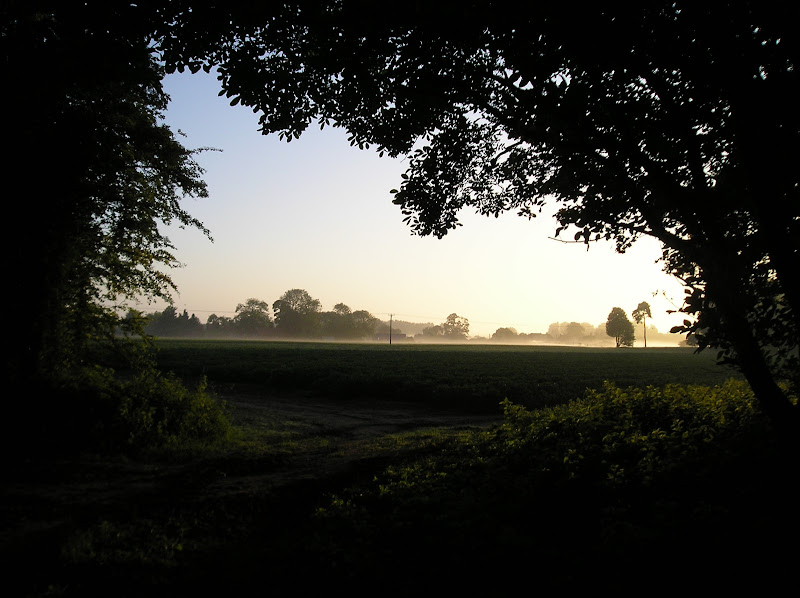
Castle Acre to Heacham
A trek along the Peddars Way, following an excursion to Heacham for accommodation.
|
Thursday 24 February 2022
|
1 comment |
![]()
A trek along the Peddars Way, following an excursion to Heacham for accommodation.
|
|
1 comment |
![]()

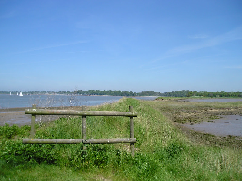
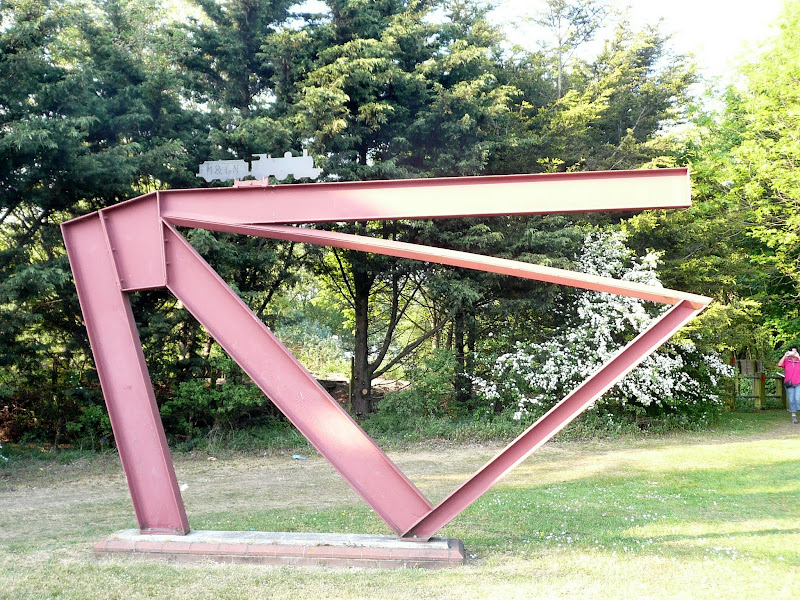
A long and straight trail across lanes and tracks from Watton to Castle Acre.
|
|
1 comment |
![]()

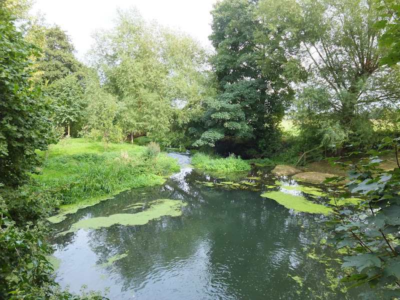
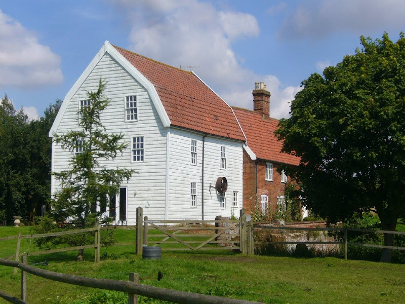
An easy trek across Breckland on the initial stages of the Peddars Way.
|
Monday 21 February 2022
|
1 comment |
![]()
The fourth stage of a weeks walking along the Essex Coast between Manningtree and Maldon.
|
Wednesday 15 January 2020
|
1 comment |
![]()
A 17 mile walk along the banks of the Orwell River in Suffolk starting at Felixstowe and ending in the centre of Ipswich
The Stour and Orwell path is an extension to the southern end of the Suffolk Coast Path and follows the coast along the estuaries of the Orwell and the Stour. The start of the walk is characterised by the earthen river defences along which the footpath navigates. From Levington Creek an alternative route is used to pay a visit to the 13th century Ship Inn before proceeding through Broke Hall Woods to rejoin the official route through to Ipswich.
|
Thursday 19 December 2019
|
No comments |
![]()
A 17 mile walk along the Angles Way from Diss to Harleston and onto Wortwell
There is plenty of history along this section of the Angles Way as it follows the course of the River Waveney. Numerous archaeological finds have been found along the route dating from prehistoric times through roman pottery and remnants of the middle ages. There are lost villages, halls and churches to provide ample opportunity for exploration as the path meanders across the Norfolk Suffolk border.
|
Wednesday 18 December 2019
|
1 comment |
![]()
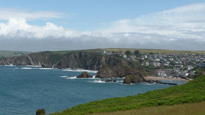
A 17 mile walk along the South West Coast Path between Churchstow and Salcombe.
This walk heads out from Churchstow through country lanes down to the South West Coast Path at Bantham on the Avon estuary. The Coast Path starts with easy walking along the low cliffs past Thurlestone and includes an 80 yard footbridge across South Milton Ley before it arrives at Hope Cove, a picturesque little fishing village. The section from Bolt Tail to Bolt Head is a little more strenuous with the path tracking up and down the cliffs and around a few craggy sections with steps built out of the stone. At Bolt Head the coast bears round to the north passing Sharp Tor which is cut out of the cliff-face, before it heads down into the pretty village of Salcombe.
|
|
No comments |
![]()

A 23 mile walk along the Lincolnshire Coast between Cleethorpes and Mablethorpe
Although a Lincolnshire Coast Path has yet to be established, this walk sets out a viable route for all budding coast walkers. This follows defence banks and permissive paths with a little road walking where necessary.
|
Tuesday 17 December 2019
|
No comments |
![]()

A 16 mile walk along the Suffolk Sandlings Path between Bromeswell and Snape taking in Rendlesham and Tunstall forests
The route leads across gorse covered heathland and through forest which typifies the modern landscape of the Sandlings. The forests are a modern development, set up with the founding of Forestry Commission during the 1920's to provide Britain with a sustainable source of timber. One cannot fail to notice the twin airbases of Woodbridge and Bentwaters, the scene of a infamous military encounter with a UFO during December 1980.
|
Tuesday 10 December 2019
|
No comments |
![]()
An 18 mile walk along the Icknield Way between Baldock and Fowlmere
Although not renowned for its hills, this part of Hertfordshire has some high ground which gives fantastic views out across Hertfordshire and Cambridgeshire and the Icknield Way sticks to the higher ground all the way from Baldock to Royston. There are numerous picturesque villages and hamlets along the route with leafy green tracks and trails to make it a jolly fine days walk.
|
Wednesday 27 November 2019
|
No comments |
![]()
The Marriott's Way links Aylsham and Norwich following the former trackbed of the Midland and Great Northern Railway.
The Marriott's Way is a footpath, bridleway and cycle route, which follows the routes of two disused railway lines, and runs between the historic market town of Aylsham and the medieval city of Norwich. Along with the mileage markers which are created from old rails complete with a metal rubbing plaque, there are numerous concrete sculptures, village markers, interactive sound boxes and benches which all provide added interest and information along the route.
|
Friday 5 April 2019
|
No comments |
![]()
A 16 mile walk along the East Suffolk Line Path between Leiston and Wickham Market
Although the official route for the East Suffolk Line Path links the stations at Saxmundham and Campsea Ashe, this provides an alternative route using the local bus service to link the two ends. Highlights along the route include the picturesque Beversham Mill and the legendary Blaxhall Stone which is said to progressively grow in size.
|
Saturday 9 February 2019
|
No comments |
![]()
A challenging 8 mile hike along the South West Coast Path between Charmouth and West Bay
At only 8 miles, do not underestimate this walk. It is an arduous hike over the hills and across the valleys of coastal Dorest. The highlight is the peak of Golden Cap, which at 191m is the highest point on the English South Coast. The golden greensand rock that crowns the cliff top is what gives this peak its name.
This walk was due to start at Lyme Regis but a cliff fall had taken a section of the coast path and the only method to walk between the town and Charmouth was to use the main coast road which is certainly not conducive to most ramblers. The path has subsequently been reinstated with a route that cuts across timber Hill and minimizes the use of the road.
From Charmouth the route takes a country lane known as Stonebarrow Lane which quite naturally leads up Stonebarrow Hill with a slow and steady climb. At its 148m summit, the path heads to the cliff side then follows the cliff top paths. The going now gets tougher as the path descends to the valley where Westhay Water cascades down, launching itself off the cliffs below and onto the shingle beach. There is a short climb across the following ridge and back down to Ridge Water and another cascading stream that terminates itself in a similar manner. All the time Golden Cap is looming in the distance, beckoning with its challenge. Drawing the walker onwards, but first, another valley needs to be crossed first, Gabriels Mouth. The name is probably derived from a forgotten village known as Stanton St Gabriel which used to lie up the valley. The ruins of the church still exist but other than a farmhouse the village is lost in the landscape.
The ascent of Golden Cap now begins from the bottom of the valley at 40m. After the initial climb out of the valley the path flattens out a little before the major climb up the zigzagging path to the summit. A total climb of 151m. A lot of effort but oh so worth it. At the top the views are outstanding, behind one can view the panorama all around Lyme Bay and beyond. Ahead the coast tapers down to Chesil Beach and on the horizon Portland can be seen.
There is a steady descent from Golden Cap down to the hamlet of Seatown where the Anchor Inn pub is perched above the beach. Benches parade the broad grassy garden overlooking the beach and offers the ideal opportunity to celebrate ones efforts thus far. Palmers ales are on offer and a real thirst quencher. On this occasion the temperatures were an unusually balmy hot summers day with clear blue skies and a summer sun blazing with all its fury.
From Seatown the path climbs up to Ridge Cliff then continues over Doghouse Hill and Thorncombe Beacon before descending down to Eype Mouth. A stream trickles below a wooden footbridge then disappears into the shingle beach. Boats lie upturned in the shelter of the grassy banks of the valley.
There is a final hurdle over West Cliff into West Bay. One may expect another little village nestled in the valley but West Bay has grown over the years and is full of modern conurbations and chips stalls that surround the little harbour. All a little brash after the rural settings encountered on route. The river Brit flows out through the harbour. Originally known as the River Wooth, it had a name change with the establishment of Bridport.
One can continue onwards to Burton Bradstock but for this day, with the draining heat and the arduous climbs the walk was terminated at West Bay and legs were rested at The George Hotel where more of the delicious Palmers Ales were consumed with a spot of lunch.
At the time of walking this route there was a bus service all the way through from West Bay to Salcombe Regis where we had set up base camp. This no longer appears to be the case although there are buses that link West Bay with Charmouth. On this occasion it seemed a good choice to return to Charmouth to explore a little more.
|
Tuesday 5 February 2019
|
No comments |
![]()
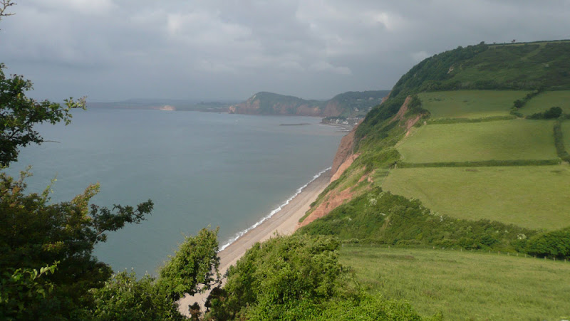
A challenging but rewarding 17 miles hike along the South West Coast Path between Salcombe Regis and Lyme Regis
This is an extensive hike that can be split in two at Seaton. The first half has a number of steep descents and climbs as the path negotiates the numerous combes where streams exude to the sea. The second half is a point of no return that navigates through the undercliff to Lyme Regis. There is no way out and this is an extensive hike through the densely vegetated landscape.
17 miles seems like a perfectly decent distance for a day walk. However with the SWCP one has to take into account the landscape and in this specific walk it is a challenge to complete the full distance and one should be an experienced walker to take this on in one go. If there is any uncertainty then it should be broken down into two smaller walks with Seaton as the convenient point to split the walk.
Having stated this the scenery is awesome from start to finish. With base camp at Salcombe Regis, there is a convenient path that takes one down to the coast path on the eastern side of the deep valley that leads to Salcombe Mouth. Despite being half way up the valley side there is still steep climb out to get over the 156m Dunscombe Cliffs. The path then drops right down to beach level at Weston Mouth before climbing back to 162m as it negotiates Weston Cliff. There's more effort required to get around Branscombe, eventually getting back down to beach level at Branscombe Mouth. Once one is up then one has to go down and once one is down one has to go up.
The coast then turns and one drops down into the village Beer. Yes, Beer. What a great name for a village. Whenever anyone enters Beer then it only seems appropriate that one should toast its name with its namesake beverage. The The Anchor Inn provides an ideal opportunity for such a celebration, a well placed hotel that has a garden on the opposite side of the road through the village, overlooking the seafront. A great position, great ale and, as expected, a very popular place for folk similarly toasting the village name. Its all about location and a beer in Beer is the best location in my beerbook.
There a climb over Beer Hill and the path then descends down into Seaton. Now this small town brings back memories when, during the 1980s, I had a week of camping just outside the town. There was one specific pub that was frequented during that week and they brewed their own beer. If I remember correctly each brew had a railway themed name. Starting at the tame Rail Ale it went through to the powerful dark Sleeper. I believe this was the Beer Engine brewery which appears to have relocated to Exeter. On one specific night at this house of repute, the landlord had gone out for the evening, the Chef was drunk and the barman was liberally plying all and sundry with copious amounts of ale, much of it without charge. That evening the Sleeper Ale lived up to its name.
Unfortunately I could not remember the location or the name of this pub and with many more miles to go then a swift drink at the Hook and Parrot was called for before headign otu on the second half of the days expedition. This seafront bar was clearly aimed at the tourist trade although they did have some ale on offer.
It must be stressed that the walk from Seaton to Lyme Regis, although only some 7 miles is nonetheless a challenging hike with no way out other than returning the way one came. This route navigates through the Axmouth to Lyme Regis Undercliffs Nature Reserve, an area of dropped cliff forming a broad shelf part way down the main cliff. The trail is rough, steps are uneven, paths can be muddy and slippery, as experienced on this expedition despite there being little rainfall in the week leading up to the walk. The whole area is covered in tall trees and dense vegetation that some describe as a jungle. There's not much in challenging climbs but the sheer effort to get through this is demonstrated by the warning signs as one enters the area. In addition one should be aware that Lyme Disease carrying ticks can be encountered in the area and one should take suitable precautions against them.
Having said all this, the trek through the undercliff is an amazing experience and although there are only glimpses of the sea, there is so much more to see and discover. The path undulates around the contours, up and over the various hillocks and around the crags and boulders. Ruined buildings are at the heart of the reserve, the remains of a landslip. Flora, fauna and wildlife abound and one could easily take a full day slowly meandering through this seclude piece of nature.
It has to be admitted that emerging from the undercliff and down into the harbour area of Lyme Regis was a rewarding and satisfying feeling that the distance had been completed. The legs complained. The feet hummed. This endurance was duely rewarded with a pint of Palmers beer to soothe the thirst and revive the muscles as feet were put up on the benches outside the Cobb Arms. It is worth a rest at this busy pub before moving along the beach front to town centre where buses stop for the return journey. And whilst one waits there is always the chance for another pint of Palmers at The Rockpoint Inn although in November 2018 the pub was taken over by the St Austels Brewery so maybe the beers have now changed.
|
Sunday 3 February 2019
|
1 comment |
![]()
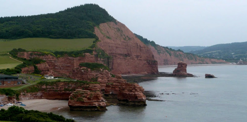
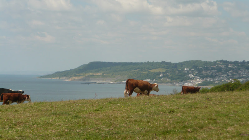
A pleasant and not too challenging 16 miles ramble along the South West Coast Path between Exmouth and Salcombe Regis
This route is a great introduction to the South West Coast path with all the amazing panoramas, cliff top views and a few challenging ascents and descents. But nothing too demanding. This walk uses the Salcombe Regis campsite as its base location but the walk can simply be terminated at Sidmouth.
This was the first stage of a 10 day walking expedition along the Jurassic Coast section of the South West Coast Footpath between Exmouth and Poole. It is a great part of this long distance trail and if this is ones first visit then, like us, the lure of the fantastic scenery and amazing paths seduced us back in the following years to continue to walk of the whole SWCP trail.
This particular walk was undertaken on the day of arrival which resulted in limited time to undertake it due to having to arrive on site and pitch the tent. However, performing this during the mid summer provides ample evening light to complete the distance. The arrival at the Salcombe Regis campsite was a revelation in itself. Located at the head of the valley leading down to Salcombe Mouth and with views of the deep blue sea beyond and the sloping hillsides full of small fields of pasture intermingled with woodland. A fantastic view that makes one just want to submerge oneself into the landscape. And it was peaceful. Very quiet with few tourists on the campsite and just a distant sounds of donkeys at the nearby donkey sanctuary. I am sure one could scream here and nobody would hear you, you voice would just melt into this idyllic landscape.
Luck was on our side for this walk. There was a bus operated by Stagecoach which linked Sidford, some 15 minutes walk from the site, with Exmouth and the start of the walk. Unfortunately this 157 service no longer appears to serve Sidford and one must continue down into Sidmouth to catch the same bus.
The South West Coast Path is a naturally start end point at Exmouth with the river Exe forming a natural boundary where a ferry connects to the next stage at Starcross. The trail then continues from the ferry and follows the estuary along the Exmouth seafront. It is easy to find as one just has to head to the beach and start walking, following the esplanade all the way along the edge of town where there are a flight of zig-zagging steps to get to the top of the cliffs for the real walk onward.
This section of coastline is a popular tourist destination and there are numerous holiday camps and caravan parks that dot the cliff tops. Despite this, the area is dominated by open fields and rolling countryside with fantastic coastal views as the path heads up to West Down Beacon at 129m. There is then a steady descent down to the town of Budleigh Salterton and a chance to find refreshment. Cliff Road leads from the beach to the main thoroughfare through town and at the junction is the Feathers Hotel. This was a pure chance discovery as are most of the pubs and inns frequented on this site. This was a good choice as there were four local ales on offer and a welcoming host and a drink to toast the start of what was looking like a grand expedition.
Beyond Budleigh Salterton the path has to head inland to negotiate a route around the Otter Estuary Nature Reserve. This is the River Otter and not an otter nature reserve. I think that if you are an otter enthusiast then you would be sorely disappointed with the distinct lack of the semi-aquatic carnivorous mammals. The path follows a 1.5 mile excursion around the marsh and wetland of the estuary before the trails heads back along the cliffs once again.
There is an amble across to Ladram Bay where one encounters the impressive sandstone sea-stacks, weathered and eroded. The views of these island stacks cant fail to amaze and it is well worth taking some time out to gaze and admire and capture a little essence in a photo The trail descends down to the beach road before making a slow steady ascent of the imposing wood covered hill beyond. The going gets more challenging before the summit is reached. This is High Peak and at 157m is the highest point along this short section of the trail. This climb takes a little effort but is well worth it for the view. The eastern side is a slow descent that takes the coast path into Sidmouth.
On this occasion, it was early evening by the time we reached Sidmouth, sometime around 7pm. The town was busy, not full of tourists but a lot of locals since the FA World Cup was in progress and England's National Team were taking on the lowly Algeria in the evening game. After finding a chip shop to feast on what must be one of the nations favourite meals, it only seemed right that we should endorse our patriotic rite and frequent a hostelry to catch the impending game. Expectations were high that England would show their metal and commanding experience and professionalism and demolish this lowly upstart to the sport. A seafront bar was located that was openly advertising the game. The Marine appeared to be one of those tourist enticing bars that left expectations of lots of fizzy beer and loud-mouthed youth but on entering we was pleasantly surprised. Two cask ales were being served on tap, and a few seats available amid the mild mannered audience. It has to be said that the bar was more like an electrical showroom with the number of TV screens that decorated the walls and I was unsure whether this was specific to this event or whether it was the norm. Unfortunately the game was a complete let down. The 0-0 scoreline said it all with the England layers ambling along like they were on a Sunday walk in the park. Their passing was abysmal and their play unenthusiastic and slow-footed. Having said that the Algerian team must have been delighted with their performance in keeping England contained.
Disappointed with the result we left the pub at 9.30 and photographed a public convenience sign. It said it all. By this time the light had stated to fade and it was going to be a challenge in getting up to the campsite as the route negotiated various pieces of woodland. The first hill of trees to the east of the town heads up to the cliff tops and this soon demonstrated the lack of light. Torches were of assistance but nothing is anywhere near as good as daylight. Nonetheless taking ones time arrival at base camp was completed and the end came to what had been a fantastic day.
|
Friday 1 February 2019
|
No comments |
![]()
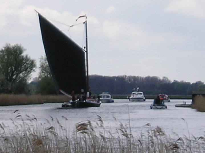
A 20 mile walk through the Norfolk Broads following the rivers Thurne and Bure from Potter Heigham to Great Yarmouth
A walk that follows the rivers Thurne and Bure down to the town on Acle. There is then some challenging navigation across Halvergate marshes to end up walking along the banks of Breydon Water into great Yarmouth. This really is the epitome of what everyone imagines of the Norfolk Broads. Broad open skies and large open flat landscapes.
|
Sunday 20 January 2019
|
No comments |
![]()

An 18 mile along the sea defence banks from Fosdyke to Sutton Bridge
A fairly extensive walk into the wide open expanse of the Wash along defence banks that lead the way around the extremities of the reclaimed land. It is awe-inspiring, it is remote. An RAF bombing range occupies a length of the furthermost parts but this does not restrict the use of the path. The eastern side of this walk is said to be the area that King John lost the crown jewels in the 13th century when he attempted to cross the Wash.
|
|
No comments |
![]()
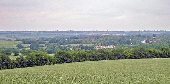
A 16 mile walk along the Icknield Way between Fowlmere and Hinton
The path keeps to the ridge along the hills, though the land now flattens out as it heads eastwards. There are picturesque villages and hamlets as the route winds its way through some traditional old English countryside.
|
Thursday 17 January 2019
|
No comments |
![]()
A 25 mile walk along the Icknield Way between Herringswell and Knetishall Heath
This section of the Icknield Way reveals just how remote some areas of Suffolk can be. Apart from a couple of isolated hamlets there is nothing but forest trails and fields for the full 25 miles through to Knettishall Heath. This is perfect for those who like the solitude but one does need to make sure ample food and water supplies are taken for this lengthy hike.
|
Saturday 12 January 2019
|
No comments |
![]()

An 18 mile walk down the Blyth Valley in Suffolk from Halesworth to Blythburgh, then across the heaths and commons to Leiston.
It was the legendary hell hound that supposedly came this way in 1577 and terrified parishioners of Blythbrugh church after doing a similar job at Bungay. This walk is in two sections, the first section follows the River Blyth along the Waveney Way to Blythburgh with the option to continue on to Southwold. The Waveney Way is a Ramblers Association walk and does not have waymarkers along the route. An optional second section cuts across to Westleton and onto Leiston. Both Southwold and Leiston have public transport links to Halesworth making the walk achievable as a linear route without the requirement of assistance of a taxi.
A 10 mile walk following the southern side of the parish boundary of Leiston in Suffolk This walk follows the route of a 17th century peramb...


