Route details, maps, pubs, features, local history and folklore for a wide variety of walks focusing primarily on Norfolk and Suffolk

Walks
Showing posts sorted by relevance for query Caister. Sort by date Show all posts

Wednesday 21 November 2018

Winterton to Great Yarmouth Beach Walk

Hemsby

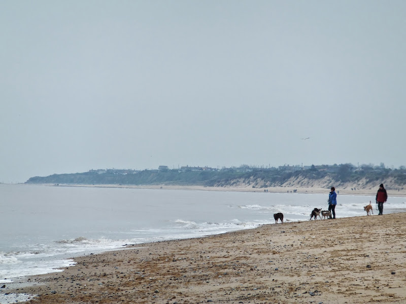
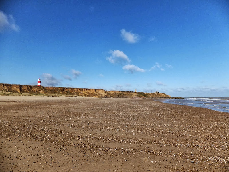
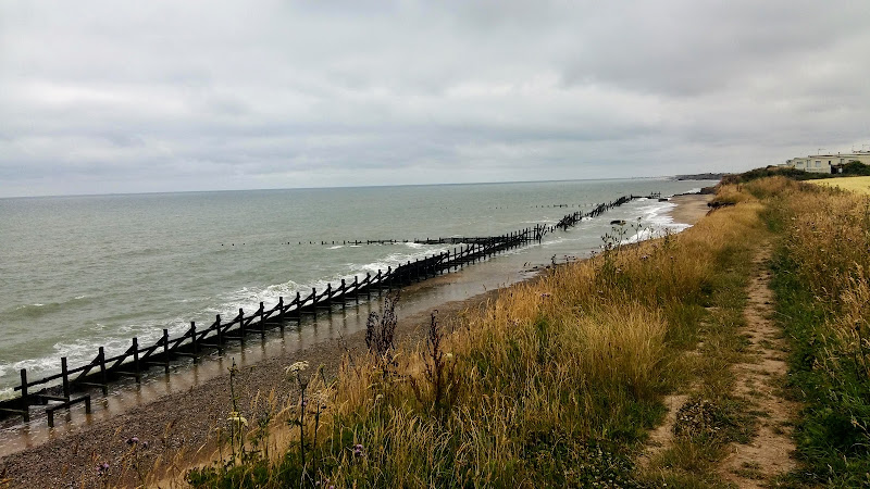
A 9 mile beach walk between along the Norfolk coast from Winterton to Great Yarmouth

This walk is probably better known as Robinson Crusoe's walk since this is where Daniel Defoe places his character, in the novel of the same name, after being shipwrecked with a resulting walk to Great Yarmouth. Although such a stormy day would not make the best of walks, when the sun shines and the tide is out this really is a great walk.

Thursday 10 January 2019

Happisburgh to Winterton Beach Walk

Happisburgh from Eccles

An 11 mile beach walk between along the Norfolk coast from Happisburgh to Winterton

Providing the tide is right, this is a fantastic beach walk with miles of golden sand and, if you are lucky, the sight of seals basking in the sunshine. Probably one of the best beach walks on this coastline.

Tuesday 16 October 2012

Norfolk Coast Path Proposed Route

Proppsed route through the Winterton dunes

Details of the proposed route for the 19.2 miles of the Norfolk Coast Path between Hopton and Sea Palling

Details have been published for the proposed route of the Norfolk leg of English Coastal Footpath between Hopton to Sea Palling. Much of the proposed route is along existing footpaths and walked routes as well as beach sections. The entire distance can be walked at present either following the proposed route or just using the beach, given the right tide conditions. This proposal, if adopted, will extend the Norfolk Coast Path from Hunstanton to Hopton.

Tuesday 30 September 2014

Proposed Route for the Norfolk Coast Path from Hopton to Sea Palling Released

Proppsed route through the Winterton dunes

Details of the proposed route for the 19.2 miles of the Norfolk Coast Path between Hopton and Sea Palling

Details have been published for the proposed route of the Norfolk leg of English Coastal Footpath between Hopton to Sea Palling. Much of the proposed route is along existing footpaths and walked routes as well as beach sections. The entire distance can be walked at present either following the proposed route or just using the beach, given the right tide conditions. This proposal, if adopted, will extend the Norfolk Coast Path from Hunstanton to Hopton.

Saturday 29 December 2018

Boudicca Way - Norwich to Shotesham

Shotesham Common

A 12 mile walk roughly following Norfolk's Boudicca Way

This walk uses the Boudicca Way to navigate from Norwich to Shotesham, with an excursion away from the official route to the ruins of the Roman town Venta Icenorum. Shotesham forms the furtherest reaches of the Boudicca Way on this route, from where country lanes cuts across country to the A140 where there is a frequent bus service back into Norwich.

Tas Valley Way - Cringleford to Tasburgh

Small lake at Carleton Carrs

A 12 mile walk along Norfolk's Tas Valley Way

Probably one of the least known long distance paths in Norfolk, the Tas Valley Way links Norwich and Attleborough following the River Tas. This first section navigates through to Mulbarton, then onto Flordon before going off route to Tasburgh where there is a pub and public transport back to Norwich.

Wednesday 18 December 2019

Bure River Walk from Coltishall to Brampton

Buxton Mill

An easy and captivating walk along Norfolks River Bure

Not only does this walk provide some classic Norfolk scenery and historic features but it also traces the route said to be taken by the phantom carriage of Sir Thomas Boleyn in his annual act of penance for betraying his daughter Anne when she was sentenced to be executed. The walk is then made into a circular route by returning via the Bure Valley Path alongside the narrow gauge Bure Valley railway.

Tuesday 29 July 2014

Norfolk Coast Path Extension

Coastline from Mundesley to Happisburgh

A 21 mile extension has recently been completed to the Norfolk Coast Path taking it through to Sea Palling

As part of the English Coast Path project, the Norfolk Coast path has now been extended to Sea Palling with waymarkers and direction signs being added during the first half of July. This includes a redirected section between Beeston and Cromer that now follows the coast rather than its original route which headed inland through the hills above Cromer.

Saturday 28 July 2018

Cromer to Hopton 40 mile Challenge Walk

Salt marsh

Extensive full day hike around the eastern section of the Norfolk Coast Path

This walk should only be undertaken by experienced long distance walkers or those who have specifically trained for such a feat. This specific route was undertaken from 5am with a high tide around 6am. This allowed for a beach walk from Waxham through to Caister as an alternative to the official dunes paths. A support car was employed to provide the return journey and offer assistance in case of emergency.

Walk Summaries

Latest walk summaries are basic information sheets for walks that have yet to be fully documented. These provide links to maps, public transport and walks stats, although detailed notes and features are not included.

Latest Walk Summaries

Featured Walk

In Search of Sizewell Chapel

A 10 mile walk following the southern side of the parish boundary of Leiston in Suffolk This walk follows the route of a 17th century peramb...

What is GPX

All you need to know about GPX, electronic mapping and how to use modern apps and mobile devices as navigation devices

Popular Walks

Maps