Route details, maps, pubs, features, local history and folklore for a wide variety of walks focusing primarily on Norfolk and Suffolk

Walks
Showing posts sorted by relevance for query Diss. Sort by date Show all posts

Tuesday 8 January 2019

The Angles Way - Knettishall Heath to Diss

Royden Church viewed from across the Waveney Valley with its interesting octagonal upper tower that sits on a round base

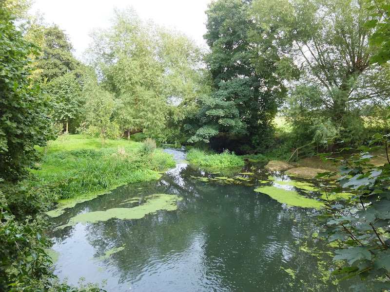
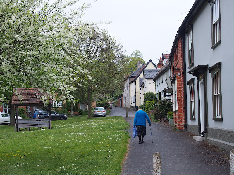
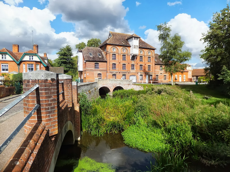
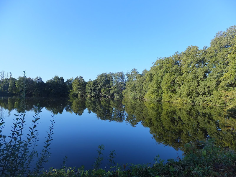
A 15 mile walk from the Breckland end of the Angles Way to Diss

This is a picturesque ramble through the numerous fens that follow the course of the Little Ouse and The Waveney Rivers. Thelnetham Fen, Hinderclay Fen, and Redgrave and Lopham Fen are all managed wetlands with well kept paths and a variety of flora, fauna and wildlife. The path also passes through Wortham Ling, an area of managed common land that dates from medieval times. Even though the start of the walk at Knettishall Heath is difficult to get to using public transport, the walk is well worth the effort.

Thursday 19 December 2019

The Angles Way - Diss to Wortwell

Millpond near Weybread House, Harleston

A 17 mile walk along the Angles Way from Diss to Harleston and onto Wortwell

There is plenty of history along this section of the Angles Way as it follows the course of the River Waveney. Numerous archaeological finds have been found along the route dating from prehistoric times through roman pottery and remnants of the middle ages. There are lost villages, halls and churches to provide ample opportunity for exploration as the path meanders across the Norfolk Suffolk border.

Tuesday 20 March 2018

Eye to Hoxne Circular Walk

Hoxne village

A 10 mile walk around the Suffolk villages of Eye and Hoxne

Hoxne is said to be where St Edmund was Martyred by the Viking invaders in the 9th century. The village is full of reminders of the gruesome event including the cross which marks the place of the oak tree his assailants tied him to, beat him, fired arrows at and eventually beheaded and the bridge he reputedly hid trying to escape his captors.

Saturday 29 December 2018

Boudicca Way - Norwich to Shotesham

Shotesham Common

A 12 mile walk roughly following Norfolk's Boudicca Way

This walk uses the Boudicca Way to navigate from Norwich to Shotesham, with an excursion away from the official route to the ruins of the Roman town Venta Icenorum. Shotesham forms the furtherest reaches of the Boudicca Way on this route, from where country lanes cuts across country to the A140 where there is a frequent bus service back into Norwich.

Saturday 28 April 2018

Norwich Riverside Walk

View to Whitefriars bridge

A simple 2.5 mile walk alongside the River Wensum through Norwich.

This picturesque walk through the centre of Norwich links the Marriott's Way at Barn Road roundabout on the inner ring road with The Wherryman's Way and Boudicca Way at Norwich Railway Station. There is a lot of history to the bridges over the River Wensom and associated folklore which is detailed in the features to this walk.

Sunday 9 December 2018

Gipping Valley River Path - Stowmarket to Needham Market

Hawks Mill and millpond

An easy 5 mile walk following Suffolk's River Gipping between Stowmarket and Needham Market

The river Gipping forms the source to the mighty Orwell River. At Stowmarket it is no more than a babbling stream that winds its way through the Suffolk countryside. The path keeps to the riverside throughout with no difficult obstacles other than styles, making a pleasant stroll between these two places. With some fantastic pubs at either end it makes a good little pub crawl.

Wednesday 23 February 2022

The Peddars Way - Thetford to Knetishall Heath

Thetford to Knetishall Heath

A trek from Thetford to the start of the Peddars Way

Thetford is the closest town to the start to the Peddars Way and there is no public transport between Thetford Railway Station and the starting point at Knetishall Heath. Looking at the OS Map, there is no direct route other than to walk along the main A1066 Thetford to Diss road. This is a busy road with no pathway and there is a good 4 miles walking before turning off down village lanes through Rushford where a little peace and serenity is regained to set the tone for the Peddars Way.

Sunday 23 February 2020

The Angles Way - Wortwell to Earsham

Lakes at wortwell

An 8.75 mile walk along the Angles Way from Wortwell to Earsham

It is not often that a country ramble coincides with a Brewery visit. On this route there are two, the historic St Peters brewery and the Waveney Brewing Company based at the Queens Head pub in Earsham. Although St Peters is a little off route a visit to this exquisite old building is thoroughly recommended. Also just off route is the village of Flixton where there is the remains of Flixton Priory and a church with a unique tower plus the setting for a spooky story.

Walk Summaries

Latest walk summaries are basic information sheets for walks that have yet to be fully documented. These provide links to maps, public transport and walks stats, although detailed notes and features are not included.

Latest Walk Summaries

Featured Walk

In Search of Sizewell Chapel

A 10 mile walk following the southern side of the parish boundary of Leiston in Suffolk This walk follows the route of a 17th century peramb...

What is GPX

All you need to know about GPX, electronic mapping and how to use modern apps and mobile devices as navigation devices

Popular Walks

Maps