Route details, maps, pubs, features, local history and folklore for a wide variety of walks focusing primarily on Norfolk and Suffolk

Walks
Showing posts sorted by relevance for query Knodishall. Sort by date Show all posts

Friday 4 January 2019

A Walk Around the Churches of Knodishall and Friston

An 8.4 mile circular walk around the Suffolk villages of Knodishall and Friston

An easy ramble across the Suffolk countryside, with the highlight being the hidden ruins of St Peters Church in the old parish of Buxlow, now a part of Knodishall. There's some fascinating history on this walk along paths that are off the beaten track but nonetheless well maintained.

Thursday 7 January 2021

In Search of Leiston Gibbet, Friday Market Heath and St Andrews Green

Land by the River Hundred at Aldringham

A 6 mile walk around the heaths and commons of Coldfair Green

This walk follows an investigation to seek out the location of the Leiston Gibbet and an area of heathland that was known in the 1600's as Friday Market Heath. The only reference to these places comes from an old book from 1910 entitled 'The Chronicles of Theberton' which details the route past the gibbet. This walk attempts to retrace this route by navigating along the heathland and footpaths around the River Hundred which marks the boundary between the hundreds of Blything and Plomestead. Extensive research which has been undertaken and documented in the feature of this walk with some revealing insights to long forgotten places.

Saturday 15 December 2018

The Sandlings Walk - Knodishall to Snape

A 13 mile circular walk along the Sandlings Walk between Knodishall and Snape

With limited public transport this walk offers a circular route to incorporate the Sandlings path from Knodishall to Snape. Starting and ending at nearby Leiston it incorporates The Sailors Path and the Suffolk Coast Path to make a worthwhile day walk. The route passes Friston mill and Hall and the burial grounds where a Saxon burial ship was discovered. With pubs at Friston and Snape it provides for a great days ramble.

Friday 6 December 2019

A Country Amble between Leiston and Saxmundham

Broad footpath marked out across the fields to Saxmundham

A 5 mile walk across the Coastal Suffolk landscape between Leiston and Saxmundham

This walk searches out footpaths to connect the neighbouring towns of Leiston and Suffolk. Although there is no direct route, the paths chosen are certainly more conducive to the walker than the busy road route. With the churches of Leiston and Knodishall on the route, plus the mysterious Harris's Pit in the parish of Sternfield there is enough to interest the avid rambler. Sternfield also has the notoriety of being the village from which the last woman to be burnt at the stake in England came.

Saturday 18 August 2018

The Sandlings Walk - Knodishall to Sizewell Belts

Sizewell Belts

A 9 mile circular walk that links Knodishall and Sizewell Belts along Suffolk's Sandlings Trail

An easy walk across the typical heaths and commons of Coastal East Suffolk that make up the Sandlings. There is woodland, marsh, and rambling sandy heath full of flora fauna and wildlife.

NOTE: The section from Sizewell through to Leiston Common, Sizewell Belts is no longer part of the official Sandlings path. It has been rerouted along the beach in front of the power station and then through Kenton Hill woods. This Sizewell Belts walk as described here is still accessible using permissive paths.

Monday 17 December 2018

The Sandlings Walk

The Sandlings Waymarker

An overview of the Sandlings Walk, a 55 mile long distance path through the forests and heaths of East Suffolk

The Sandlings is a 55 mile walk starting at Rushmere Heath on the eastern side of Ipswich with Southwold, passing through the remaining fragments of East Suffolks Sandling Heaths. The trail leads through Rendlesham, Tunstall and Dunwich forests and also includes riverside walks at Woodbridge and heathland walks across Rushmere Heath, Sutton Heath, Thorpeness Common and Dunwich Heath..

Saturday 11 May 2019

In Search of Polsborough Gate

track to Aldeburgh Road

A 9.5 mile walk following the old Snape Road to the Sailors Path

This walk links Leiston with the Sailors Path following the old traditional road that used to link the town with Snape. There is then an outstanding ramble across Black heath and Hazlewood marshes through to Aldeburgh where a regular bus service links back with the start. Along this route was what in the 1700s was known as Polsborough Gate, a landmark whose position and derivation is unknown but with a little research some information about it can be determined

Sunday 12 December 2021

In Search of Leiston's Ancient Pagan Sites, the Procession Rayles and Gallows

Harrow Lane

A 7 mile walk following the western parish boundary of Leiston in Suffolk, as described in a document from the middle-ages

This walk attempts to follow the instructions of a perambulation around the western side of the Leiston Parish boundary that was undertaken in the year AD1620. Leiston's history is renowned for its Abbey and the Garret's works, but this walk also discovers the site of a possible ancient pre-Christian shrine or temple, the location of the Leiston gallows and the procession route taken by those attending this gruesome public spectacle.

Friday 10 August 2018

Leiston to Buxlow Church Ruins - Walk Summary

Salt marsh

A country ramble to the lost parish of Buxlow

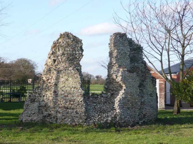
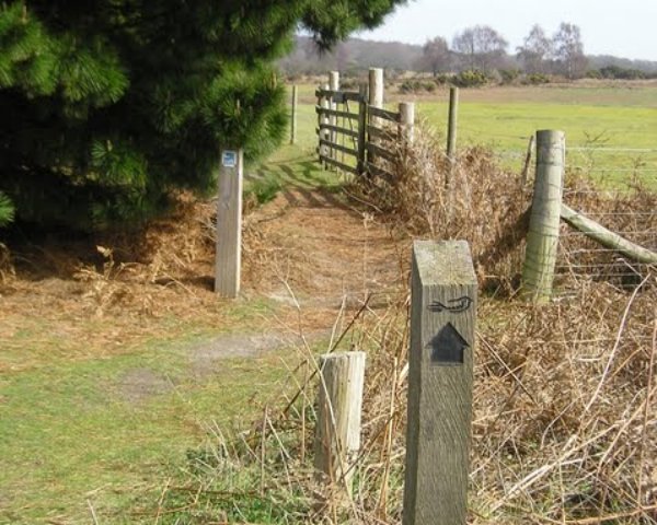
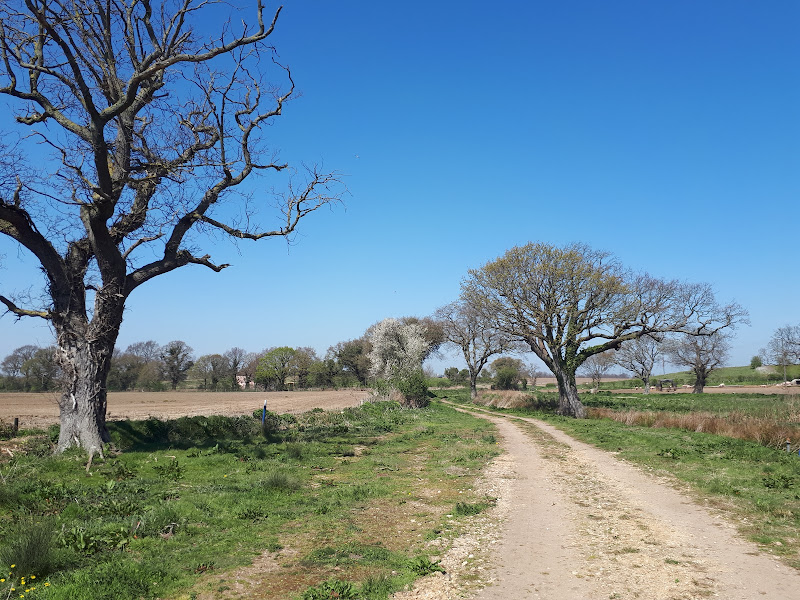
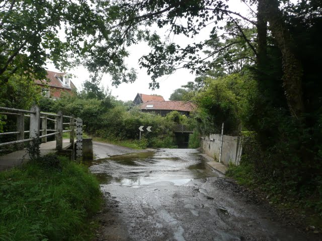
This walk provides a days ramble to view the ruins of Buxlow church. Many may have never heard of the parish of Buxlow, even those local to the area, and they can be forgiven for their ignorance since the parish was consolidated with Knodishall on 22nd February 1721.

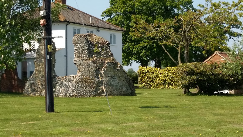
Little is left of Buxlow church, which was dedicated to St Peter. There is merely a remnant of a wall from the old round tower that now rests in the garden of a domestic house which is viewable from the track that runs between the two houses. There are suggestions that the church was one of those recorded for Knodishall in the Domesday book and records certainly show there was a rector of the parish from 1301 onwards. By the middle of the 17th century it was reported to be 'decayed and ruinated tyme out of mind' although a rectors of the parish were still being recorded up to 1716 when Robert Witchingham held the honour.

Whilst admiring this piece of history the lady from the adjacent house engaged us in conversation stating that there have been many archaeological finds in the fields to front of the ruins. She even remarked of the many Roman coins that were constantly being unearthed. This is certainly not recorded on the Suffolk Heritage website so this is merely word of mouth. This does spark the imagination as the nearby hamlet of East Green is one of the suggestions of the long lost Roman station of Sitomagus. Maybe there was a connection from East Green to Aldringham which local folklore states was was a Roman port, the river Hundred in those days said to be navigable to sea going ships.

Note that a similar walk is described on this site with an alterntive route. This can be found on the page titled A Walk Around the Churches of Knodishall and Friston.

Friday 5 April 2019

The Alde Valley Walk - Leiston to Wickham Market

Beversham Mill

A 16 mile walk along the East Suffolk Line Path between Leiston and Wickham Market

Although the official route for the East Suffolk Line Path links the stations at Saxmundham and Campsea Ashe, this provides an alternative route using the local bus service to link the two ends. Highlights along the route include the picturesque Beversham Mill and the legendary Blaxhall Stone which is said to progressively grow in size.

Thursday 3 January 2019

Tracks and lanes to Glemham

Benhall Ford

A 22 mile route that can be either walked or cycled through the Suffolk countryside around Snape, Blaxhall and Glenham

A glorious route through the Suffolk countryside using a mixture of lanes, tracks, bridleways and little used country roads. This can be either walked or cycled and provides a full days outing taking in the picturesque villages of Snape, Blaxhall, Little Glemham, Great Glemham and Benhall which these days is split into two with the A12 separating Benhall Low Street from Benhall Green. Along the route is the Parham Airfield Museum, although this is only open on Sundays between April to October.

Sunday 22 September 2019

In Search of Sizewell Chapel

Broom Covert

A 10 mile walk following the southern side of the parish boundary of Leiston in Suffolk

This walk follows the route of a 17th century perambulation around the southern side of the Leiston Parish boundary. The walk uses the ancient track down to Sizewell and continues down to Thorpe before turning inland to follow the River Hundred through to Cold Fair Green. The details are contained in two articles, this being the first, focusing on the medieval history of Sizewell.

Wednesday 9 January 2019

In Search of The King of the Belgians

King of the Belgians pub

A pub crawl to the Huntingdonshire pub known as The King of the Belgians

The unique pub name of The King of the Belgians is not the only reason to search out this hostelry. It has a excellent range of ales, offers good food, provides good company and has an intriguing history with regard to its names. This walk uses the road from Houghton so it is an easy stroll with other pubs along the route.

Sunday 24 July 2011

New Sandlings Waymarker Design

The Suffolk Coast and Heaths Area of Outstanding Natural Beauty (AONB) Unit has started to replace the old Sandlings Waymarkers with a new design. These green plastic plaques have been mounted over the previous logo on existing fingerposts. The new plaques carry a nightjar logo and are part of resigning process that is being carried out throughout the long distance walk that links Ipswich and Southwold. During the resigning process damaged fingerposts are being replaced.

Sunday 4 February 2018

In Search of Sizewell and Thorpe Beacons

Sizewell

A 10 mile walk following the southern side of the parish boundary of Leiston in Suffolk

This is the second article devoted to the walk following the route of a 17th century perambulation around the southern side of the Leiston Parish boundary. This article is concentrates on two landmarks from the past, namely Sizewell and Thorpe Beacons, which are thought to have been part of the Armada warning system.

Walk Summaries

Latest walk summaries are basic information sheets for walks that have yet to be fully documented. These provide links to maps, public transport and walks stats, although detailed notes and features are not included.

Latest Walk Summaries

Featured Walk

In Search of Sizewell Chapel

A 10 mile walk following the southern side of the parish boundary of Leiston in Suffolk This walk follows the route of a 17th century peramb...

What is GPX

All you need to know about GPX, electronic mapping and how to use modern apps and mobile devices as navigation devices

Popular Walks

Maps