Route details, maps, pubs, features, local history and folklore for a wide variety of walks focusing primarily on Norfolk and Suffolk

Walks
Showing posts sorted by relevance for query Orford. Sort by date Show all posts

Saturday 29 December 2018

Suffolk Coast Path - Orford to Butley Ferry

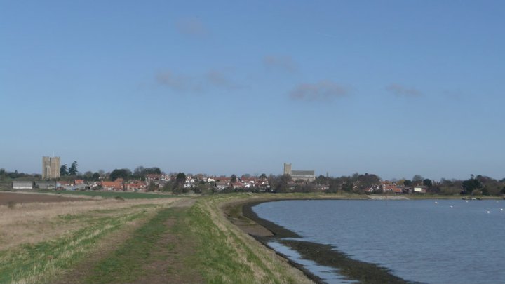
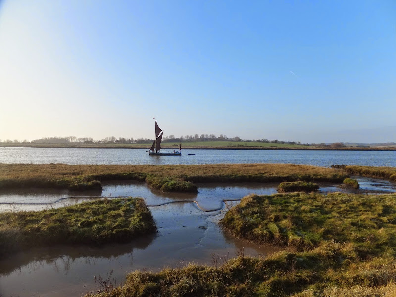
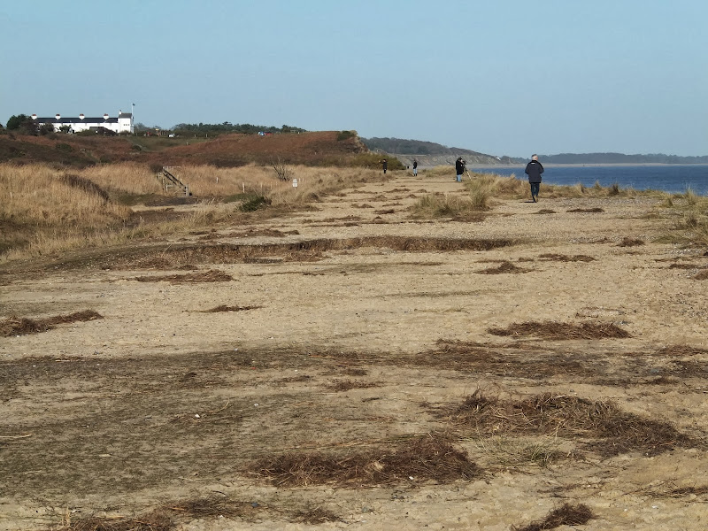
A 6.5 mile Suffolk circular walk along the banks of the Ore and Butley rivers between Orford and the Butley Ferry river crossing at Gedgrave.

The Suffolk Coast Path Orford Loop has two routes back onto the main trail, the first returns from Orford up to Chillesford but an alternative is to follow the lane from Orford to Gedrgrave and down to Butley Ferry. Although this crossing only operates from April to October, a pleasant and easy circular walk can be made from Orford returning along the top of the river defences.

Wednesday 5 December 2018

The Orford Loop, Tales of Castles and Mermen

A 16 mile walk around the Orford Loop section of the Suffolk Coast Path

The main Suffolk Coast Path cuts through Tunstall Forest from Iken Cliff to Chillesford. However, more recently, a path has been added which allows access to Orford by following the Alde estuary. This then cuts back across Gedgrave marshes and Sudbourne Hall to return to the main path at Chillesford.

Saturday 6 November 2010

Expedition to Orfordness Lighthouse

The iconic Orfordness lighthouse

A 9 mile walk from Slaughden Quay to Orfordness

This walk is an arduous ordeal across shingle but worthwhile to see the site where the iconic Orfordeness lighthouse once stood. There are warning signs deterring visitors from straying beyond Slaughden but the large number of fishermen that dot the shoreline throughout demonstrates that public access is tolerated along the beach. This fascinating, stark and eerie landscape is really a sight to behold.

Sunday 9 February 2020

Suffolk Coast Path

Martello Tower at Bawdsey

An overview of the Suffolk Coast Path, a 60 mile long distance path following the coast of Suffolk

A 60 mile long distance footpath from Felixstowe to Lowestoft in easy stages through some of the characteristic landscapes of the Suffolk Coast and Heaths Area of Outstanding Natural Beauty. The path also includes the Orford Loop which provides access through to Orford and the Butley Ferry. Alternative beach walks, providing the tide is right, can be undertaken throughout.

Saturday 8 December 2018

Captains Wood, Sudbourne

Captains Wood

A 2.4 mile walk around the ancient woodland of Captains Wood just outside the hamlet of Sudbourne

This is a hidden gem of a walk close to the Suffolk Coast in woodland which is currently under the management of the Suffolk Wildlife Trust. The ancient woodland is full of life, colour and a natural wildness that is a pleasure to behold. A waymarked path provides easy access around the wood so one cannot get lost. Just take ones time and take it all in.

Saturday 15 December 2018

A Walk through the The Vale of Slaughden

Thames barge heading down river

An exhilarating 4 mile walk along the defence banks of Suffolk's River Alde estuary beginning and ending at Slaughden Quay

Once known as the Vale of Slaughden, the area below Aldeburgh presents a big open landscape across the marsh with the wide estuary waters of the River Alde as it meanders alongside the coast. Once upon a time Slaughden was a bustling fishing village but in present day it is all under the waves and a narrow spit of shingle is all that divides the North Sea from the gentle waters of the river.

Saturday 11 May 2019

In Search of Polsborough Gate

track to Aldeburgh Road

A 9.5 mile walk following the old Snape Road to the Sailors Path

This walk links Leiston with the Sailors Path following the old traditional road that used to link the town with Snape. There is then an outstanding ramble across Black heath and Hazlewood marshes through to Aldeburgh where a regular bus service links back with the start. Along this route was what in the 1700s was known as Polsborough Gate, a landmark whose position and derivation is unknown but with a little research some information about it can be determined

Thursday 3 January 2019

Tracks and lanes to Glemham

Benhall Ford

A 22 mile route that can be either walked or cycled through the Suffolk countryside around Snape, Blaxhall and Glenham

A glorious route through the Suffolk countryside using a mixture of lanes, tracks, bridleways and little used country roads. This can be either walked or cycled and provides a full days outing taking in the picturesque villages of Snape, Blaxhall, Little Glemham, Great Glemham and Benhall which these days is split into two with the A12 separating Benhall Low Street from Benhall Green. Along the route is the Parham Airfield Museum, although this is only open on Sundays between April to October.

Saturday 26 January 2019

An Extended Walk around the Rendlesham UFO Trail

A 12 mile circular walk starting at Eyke and incorporating the UFO Trail in Suffolk's Rendlesham Forest

The Rendlesham UFO trail is a waymarked 3 mile trail around the eastern end of Rendlesham Forest that navigates around the key areas that were involved in the Rendlesham Forest Incident of 1980 in which both civilian and military personnel witnessed unexplained craft land within the forest. Although this can be walked by parking up at the visitor car-park in the forest, a longer alternative is to take the footpaths from Eyke, and make a day of this most wonderful and intriguing part of Suffolk.

Tuesday 17 December 2019

Bromeswell Village Walk

St Edmunds church

A very easy 2 mile walk around the Suffolk Village of Bromeswell

The Sandlings Path avoids the busy road between Melton and the footpath across the Heathland to Rendlesham Forest by navigating around the quiet village of Bromeswell. Although only a short distance, it is worth taking ones time to explore this quiet village with its typically East Anglian church of St Edmund.

Wednesday 9 January 2019

Holt to Mannngton Circular Walk

An 18 mile circular walk using footpaths and bridleways through the attractive Norfolk countryside between Holt Country Park and the Mannington Estate.

This trail takes in woodland, open countryside, lanes and even a stream which one has to jump across to provide a variety of landscape. The majority of the route is clearly waymarked although the start in Holt country park lacks initial direction as does the section around the Mannington Estate. The only disappointment was the lack of pubs, the Hare and Hounds at Baconsthorpe having last closed its doors in 2010.

Sunday 22 December 2013

The Aftermath of the 2013 Storm Surge at Minsmere

Flattened dunes by the Northern Sea Wall to Minsmere

A 10 mile circular walk to witness the damage caused by the 2013 Storm Surge

The 2013 Storm Surge proved to be the highest tide in 60 years. Although much of the flooding had recede the evidence remained of where the waters reached. Viewing the changes in coastline shows just how vulnerable this stretch of the Suffolk coast really is, especially in view of the fact that such storms appear to be increasing in frequency. The walk returns through the heath and forest via Dunwich Heath and Eastbridge where the results of Octobers St Jude storm are evident from the many fallen trees.

Tuesday 18 December 2018

Cleveland Way - Saltburn to Staithes

Cleveland Way marker at Skinningrove

A 9 mile walk following the Cleveland Way between Saltburn and Staithes

This walk passes over the highest point on the east coast of England, a 670 foot high cliff at Boulby. The entire route bears the marks of numerous quarrying operations from over the centuries. The village of Skinningrove is roughly half way, and it is this place that holds a legend of a merman being captured and held in one of its cottages.

Sunday 8 December 2013

2013 Storm Surge at Sizewell and Thorpeness

The strange egg-shaped object on the left is most likely a piece of fallen cliff

A walk at high tide of the 2013 Storm Surge between Sizewell and Thorpeness

This is a photographic excursion of the 2013 Storm Surge down the Suffolk Coast. With media firmly concentrated on events in South Africa the only real way to find out was happening was to visit this destructive storm surge oneself. Although this part of Suffolk was relatively unscathed it still presented awe-inspiring seas and crashing waves.

Friday 18 January 2019

A Walk through the Garden of Suffolk

A 14 mile walk between Saxmundham and Darsham along the East Suffolk Line Walk.

It is Yoxford that gives us the name of this walk which is part of the East Suffolk Line Walks and this specific ramble extends the line walk to return to Leiston where a regular bus service connects the two ends. Yoxford sits on the banks of the River Yox surrounded by three country house parks; Sibton Park that contains large well stocked fishing lake; Grove Park situated in the village; and Rookery Park on the Leiston road. This has earned Yoxford the name of the 'Garden of Suffolk'. The whole route of this walk is a pleasant amble through the rural fields of Suffolk with a return journey through the pretty country lanes following the Minsmere river through to Middleton, Theberton and finally Leiston.

Walk Summaries

Latest walk summaries are basic information sheets for walks that have yet to be fully documented. These provide links to maps, public transport and walks stats, although detailed notes and features are not included.

Latest Walk Summaries

Featured Walk

In Search of Sizewell Chapel

A 10 mile walk following the southern side of the parish boundary of Leiston in Suffolk This walk follows the route of a 17th century peramb...

What is GPX

All you need to know about GPX, electronic mapping and how to use modern apps and mobile devices as navigation devices

Popular Walks

Maps