Route details, maps, pubs, features, local history and folklore for a wide variety of walks focusing primarily on Norfolk and Suffolk

Walks
Showing posts sorted by relevance for query Wendover. Sort by date Show all posts

Tuesday 8 January 2019

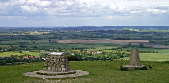
The Ridgeway - Ivinghoe Beacon to Great Kimble

An 17 mile walk along the Ridgeway between Ivinghoe and Great Kimble

An exhilarating walk at the start of the Ridgeway going in an east to west direction. Some outstanding scenery from the Chiltern hills and a few challenging climbs but well worth the effort. The walk takes in the grounds around Chequers, the Prime Ministers country residence, and theres a local tale of a ghostly lady at the Swan in Kimble and a story of when the Prime Minister turned up at Kimble's Bernard Arms.

Sunday 20 January 2019

Walk Around the Wash - Fosdyke to Sutton Bridge

River Nene at Scott Lighthouse

An 18 mile along the sea defence banks from Fosdyke to Sutton Bridge

A fairly extensive walk into the wide open expanse of the Wash along defence banks that lead the way around the extremities of the reclaimed land. It is awe-inspiring, it is remote. An RAF bombing range occupies a length of the furthermost parts but this does not restrict the use of the path. The eastern side of this walk is said to be the area that King John lost the crown jewels in the 13th century when he attempted to cross the Wash.

Tuesday 20 March 2018

Eye to Hoxne Circular Walk

Hoxne village

A 10 mile walk around the Suffolk villages of Eye and Hoxne

Hoxne is said to be where St Edmund was Martyred by the Viking invaders in the 9th century. The village is full of reminders of the gruesome event including the cross which marks the place of the oak tree his assailants tied him to, beat him, fired arrows at and eventually beheaded and the bridge he reputedly hid trying to escape his captors.

Saturday 15 December 2018

The Icknield Way - Tring to Sundon

The start of the Icknield Way linking Tring and Sundon taking in the Dunstable Downs

Some exhilarating walking through the Dunstable Downs with accompanying magnificent views. The Icknield Way has now been routed around the urban sprawl around Dustable and Luton so although urbanisation is never far away it is sufficient to keep a very much rural setting.

Walk Summaries

Latest walk summaries are basic information sheets for walks that have yet to be fully documented. These provide links to maps, public transport and walks stats, although detailed notes and features are not included.

Latest Walk Summaries

Featured Walk

In Search of Sizewell Chapel

A 10 mile walk following the southern side of the parish boundary of Leiston in Suffolk This walk follows the route of a 17th century peramb...

What is GPX

All you need to know about GPX, electronic mapping and how to use modern apps and mobile devices as navigation devices

Popular Walks

Maps