Sheringham to Cromer Circular Walk
Tuesday, 24 December 2019
|
No comments
|
![]()
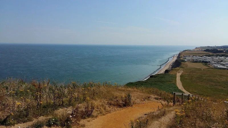
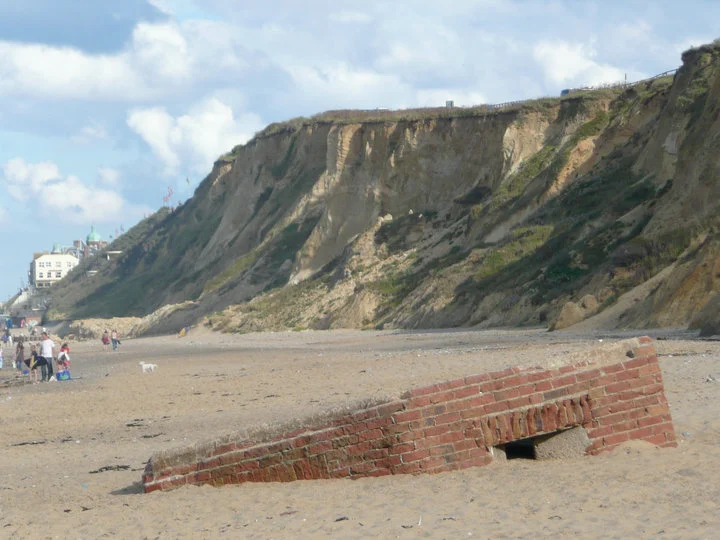
An easy 8 mile Norfolk coastal walk along beach and clifftops between Sheringham and Cromer
The Norfolk Coast Path was rerouted in 2014 as part of its inclusion to the England Coast Path. It now navigate alogn the cliff tops for most of the distance along what used to be permissive paths that have now become public. This walk uses both coast path and beach to create a delightful walk along this awe-inspiring section of the North Norfolk coast. Do check tide times and make sure the beach walk is undertaken 2 hours either side of low tide.

Walk Statistics
- Start location: Sheringhamn
- Distance: miles ( km)
- Total Gain: ft ( metre)
- Total Descent: ft ( metre)
- Min Height: ft ( metre)
- Max Height: ft ( metre)
- Est. Walk Time:
- Walk type: Circular
- Walk Grade: Easy
- Terrain:

Maps
The following maps and services can assist in navigating this route. There are links to printed maps and links to downloadable GPX route data for importing into navigational software and apps.
- Ordnance Survey Explorer Map
- OS Explorer 252 - Norfolk Coast East
- GPX Route File
Walk Notes
This small section of the North Norfolk coast has a special place in my life. Family holidays started here in the early 1960s and continued through to the present day. When all the other kids from school were taken to Great Yarmouth for their yearly adventure to the seaside, we were taken to the Runtons, a place they would always question Where?
. And you know something, I still prefer the charm of these North Norfolk villages to the brashness of Yarmouth and this part of Norfolk is frequently visited, now only being a couple of hours away.
Therefore from an early age, it was traditional to walk to Cromer or to Sheringham, beach one way, cliff top the other. There has always been a cliff top path, albeit only a permissive path that camp site owners would allow walkers to use. Thhe only section where this is not possible is at East Runton. Back in the day it used to pass in front of Woodhill campsite, but as the cliffs slowly eroded the path was lost with it, and nearly my families static caravan which had to be moved annually each winter to prevent it toppling over.
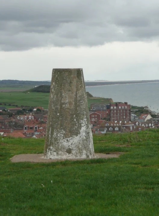
The beach walk is superb, with vast acres of sandy beach at low tide, and crabbing pools in the rocks around west Runton slipway. There is always something new to see on this beach and with the continually eroding cliffs, each year it is a brand new scene. The highlight of the clifftop walk is Beeston Bump, the challenging 64m high hill that provides views up and down the coast. These days the paths up the the top have been made much easier with well made steps and relaid surfaces. My old Nan would always cheat and take the alternative path around the foot of the hill, but when as kids we would chase up to the top.
Directions
A simple circular route following clifftop paths in one direction and the beach in the other.
From Sheringham take the prom eastwards. Keep to this until one can get down on to the beach beyond the defense boulders. There now follows a great wander across the sand through to Cromer. You cant get lost! Just make sure this is done so that it coincides with low tide along the route.
Return follows the clifftop out of Cromer. Keep to the Coast Path markers. This will continue along the cliffs until the first caravan park just beyond the large grassed area used for parking. Head to the road, then navigate to just beyond the allotments on the right. The route now takes a footpath down to a track between the caravan parks to emerge in the centre of East Runton. Continue through the village, up the hill and past the grassland on the right used for Car Boot Sales. next field is the Woodhill campsite where the path leads through the first gated entrance, then follows the perimeter road up to the reception block. Turn left just beyond this and cross the entrance road over to the field beyond. The path cuts across this and back to the clifftop. There route now keeps to the cliff tops until Sheringham, leading over Beeston Bump. After it passes a putting green, take the path down to the prom, which leads down a flight of steps next to a small house with the name of The Wee Retreat, a nod to the fact that this used to be a public lavatory.
Features
Beeston Bump: View in OS Map | View in Google Map
It is most disconcerting that new building development is now encroaching upon Beeston Bump, a hideous monstrosity is now situated at the base of the bump peeking around its edge to the sea. The bump is slowly being eroded and when the day comes and the bump finally falls to the sea I will happily watch the monstrosity succumb to the same fate.
References
Sheringham Poppy Line: View in OS Map | View in Google Map
Sheringham is the terminus for the North Norfolk Railway, also known as the Poppy Line. This preserved steam railway runs the 5 miles between Sheringham and Holt along the former route of the Midland and Great Northern Joint Railway and has recently been reconnected to the National Rail network allowing steam specials to run from London and Norwich.
Work on rebuilding the line started in 1965, and on 4 June 1967, two steam locomotives were delivered. The operating company, North Norfolk Railway plc, was launched in 1965 following the granting of two Light Railway Orders. In May 1973, the railway was the scene of filming of the episode The Royal Train of the popular TV programme Dad's Army. The main restoration sheds are located at Weybourne with new carriage storage sheds more recently built near Holt with Heritage Lottery Funding.
References
Cromer Lifeboat Station: View in OS Map | View in Google Map
The current lifeboat station on the end of Cromer pier was re-built between 1997-1999 to replace the smaller older one which was re-located to Southwold in Suffolk where it is used as a lifeboat museum. There has been a lifeboat service operated from Cromer for two centuries - predating the establishment of the RNLI. The lifeboat station is open to the public and is well worth the visit.
References
Image Gallery
Route Validation Cards
Validation Date - 2019-11-23
- Time of Walk: 10:00 to 16:00
- Validators: Griffmonster Kat
- Weather Conditions: Blustery wind and sunny spells
- Notes: Initial route undertaken
Summary of Document Changes
Last Updated: 2026-03-30
- 2021-03-17 : Update website improvements and removal of ViewRanger reliance
- 2021-12-01 : Removal of ViewRanger links due to its imminent demise
- 2026-01-12 : Major website update with all walks recast to the new format


0 comments:
Post a Comment