Saxmundham to Rendham Circular Walk
Saturday, 25 January 2020
|
No comments
|
![]()
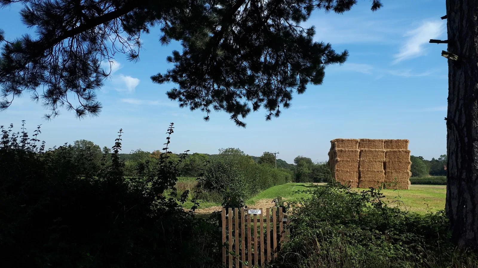
Circular Walk between Saxmundham and the village of Rendham
Six mile circular walk across the Suffolk countryside with a worthy stop off at the White Horse pub at Rendham. Woodland, open fields, babbling brooks make this typical of this part of Suffolk. And there is history to, with the Roman bronze head being discovered in the river at Rendham back in 1907. How did it get there?

Walk Statistics
- Start location: Saxmundham
- Distance: miles ( km)
- Total Gain: ft ( metre)
- Total Descent: ft ( metre)
- Min Height: ft ( metre)
- Max Height: ft ( metre)
- Est. Walk Time:
- Walk type: Circular
- Walk Grade: Easy
- Terrain: Footpaths, Country Lanes
- Obstacles: There are two crossing of the main A12 highway. Take care crossing this busy road.

Maps
The following maps and services can assist in navigating this route. There are links to printed maps and links to downloadable GPX route data for importing into navigational software and apps.
- Ordnance Survey Explorer Map
- OS Explorer 212 - Woodbridge & Saxmundham
- GPX Route File
Walk Notes
This specific instance of this walk was undertaken with a single intention. A beer festival. The Rendham White Horse Beer Festival. An annual event held each August bank holiday, and what a better way to get there than a walk to earn some well crafted ale for ones efforts. It has to be said, that even if there is no beer festival the White Horse always offers a great selection of ale as does the nearby Sweffling White Horse that is also easily accessible from this route.
The start of the walk is Saxmundham, a small Suffolk town with publc transport links to Lowestoft and Ipswich. So go on, leave the motor at home and grab a train or bus to head to Sax and undertake the walk with the knowledge that one can safely have a good walk through the Suffolk countryside and few pints of good beer.
The walk leads out of Saxmundham via Mill Road and onto a footpath that leads behind the houses. Unfortunately at the end of this is a new development which OS maps have yet to catch up with. Although the new housing estate is depicted on the latest OS maps, the footpath appears to follow its original course ploughing through the newly constructed houses and roads. On the ground there is also no clear direction or indication to direct the hapless walker through the estate, the rights of way apparently buried under a mass of concrete, tarmac, bricks and mortar. I was under the impression that rights of way had to be retained and this was difficult to establish here. It was clear this construction company did not want any walker, hiker or rambler traipsing upon their monstrosity or maybe the organization was in cahoots with the motor industry to persuade all the householders that legs in the 21st century are no longer required and wheels are the way forward despite the accumulated scientific evidence of the worlds climatologists. Despite this, after much searching and cursing the Oh God of Footpaths (a deity who resides in the same realms as Mr Pratchetts Oh God of Hangovers), and after discovering numerous blind alleys and dead ends that litter this characterless construction, we eventually found the designated path out. It is hidden between the houses around the back of Drake Close. Just keep your eyes peeled along the line of houses, there is no waymarker.
The path crosses the main A12 trunk road which needs considerable care in crossing with cars hurtling along this straight section of road and there are always drivers that seem to think that a pedestrian is a legitimate target. Take care. Things do get easier after this. The end of the sprawling urbanisation, the end of the traffic. From here on we have countryside and peace. Proper Suffolk countryside. Unspoilt by progress, thankfully, although the big city vultures are lurking in the background waiting to urbanize such areas.
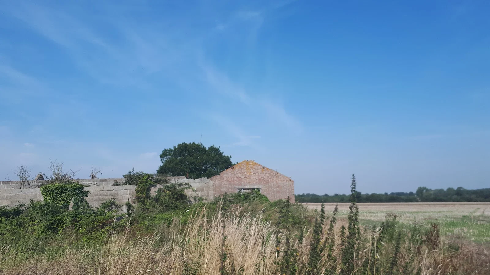
The path leads across the first field towards what looks like a ruin. In fact this was once Hill House, probably part of the farm of the same name, but now a dilapidated bygone from a past century. Keep to the left of the ditch and follow the field boundaries. On this occasion recent harvesting had obliterated all traces of the path so it did require referencing the OS map for the first field until a waymarker was encountered. It has to be said that where the path turns right alongside a ditch, it is easier to take the track on the opposite side. The path links in with this further down anyway.
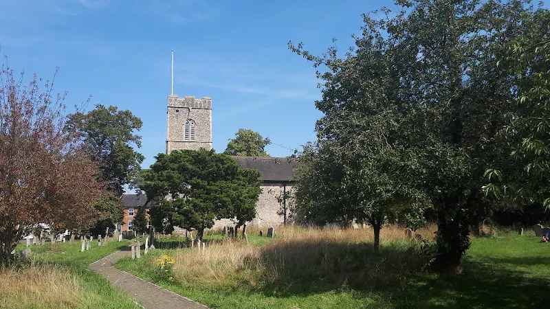
The route emerges onto Deadmans Lane for a brief few yards before taking another footpath. This is no more than a country lane with an unusual name whose origins I cannot conclusively determine. Such road names abound around the country and can be linked with the route that coffins were taken for burial. It is noticeable that at the end of this road is St Mary's Church in Benhall parish which dates from the 14/15th century so the idea of this being the processional route for ones last journey seems have some justification.
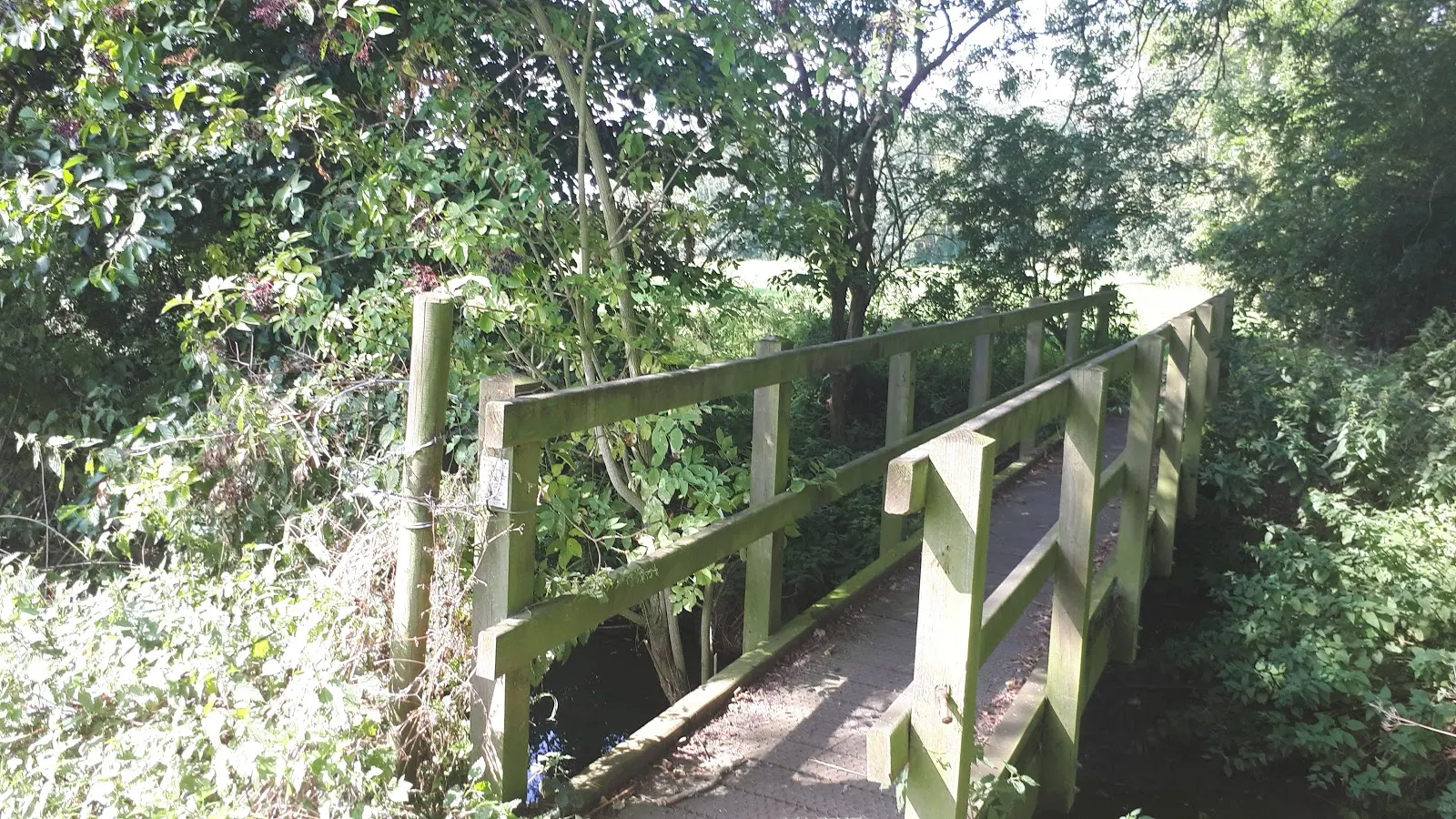
We now follow footpath around to Dodd's Wood, a piece of ancient forest that is a sheer pleasure to walk through. The path through the woodland is well used and easy to navigate with trail markers that lead the way. The path drops down some 20m through the woodland emerging into the valley where the River Alde meanders its course. We follow a track up the valley that leads to Grove Farm. It is close to the farm cottages where the bronze head of the Roman Emperor Claudius was discovered in 1907, the main feature of this walk that is discussed below. The path crosses the River Alde and then junctions with another path. Ahead is Sweffling. To the right is Rendham.
There is another wood to pass through before one drops down onto the road that leads into the village. After crossing the road bridge over the river, the best option is to take the footpath through the church yard and then pay a visit to this humble place of worship. A church for Rendham is listed in the Domesday book of 1086, although this was probably a wooden structure albeit located on the same site as the present church, which dates from the 14th and 15th century with refurbishments in the 17th and 19th centuries.
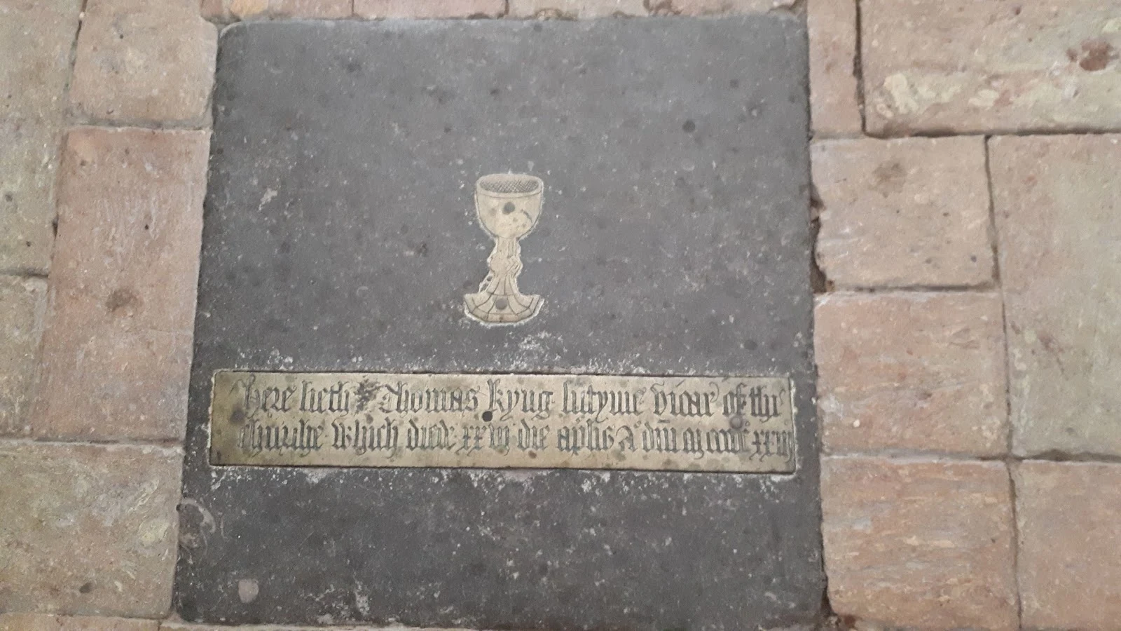
This church has a treasure contained within its confines, something that most visitors may pass over without realising. This is a rare example of a medieval chalice brass located in the centre of the nave floor. The brass is inscribed with a dedication to the Vicar of the parish, declaring his death on 26th April 1523. It is difficult to decipher the faded old English inscription but there are several transcriptions in books that date back to the early 20th century and all seem to transcribe this as Here lyeth Thomas Kyng sutyme vicar of this churche who died XXVI daye Aprile AD MCCCCCXXIII
, although I struggle to determine exactly how some of these words equate to the actual inscription, especially the word sutyme
which looks like lutyme to me but neither seems to be a proper word, either modern or old English.
Most medieval brasses were destroyed by the iconoclasts of the 16th and 17th century such as the renowned Suffolk Puritan William Dowsing who was titled as Commissioner for the destruction of monuments of idolatry and superstition
and systematically travelled around the churches of East Anglia ordering the destruction of all paintings, monuments and brasses that demonstrated idolatrous references. It is noticeable that there is no entry for Rendham in Dowsings published diaries and it is thought that he may have missed the church since, up until the reformation, the church belonged to Sibton Abbey and therefore had no wealthy benefactor to adorn the interior with religious icons. The inscription also does not include any invocation for prayers for the dead which was common on such brasses and considered to be superstitious and this may have well saved the item from being destroyed.
And so we come to the pub for a deserved rest at the White Horse that stands opposite the church. This is a typical village local where fine ale and home cooked food and a chat with the locals is the order of the day. The way old village locals should be.
The return journey is a similar distance and uses a footpath that passes by the residence known as Rendham Barnes which some say takes its name from the ancient Manor of Barnies (sales literature for the house uses the spelling Bernays). John Kirby records in his 1764 publication, A Suffolk Traveller, that The Manor of Barnies formerly belonged to Sibton Abbey, and was granted by Edward VI to Anthony Denny. It is now Mr Powel's
. The house that stands here is late Victorian so certainly does not harken back to those days and it is also notable on OS maps from the period that the area is marked as The Oaklands. The name of Rendham Barnes did not occur on the OS Maps until the 1920s so maybe this was no more than marketing ploy. Who knows? The Manor of Barnes undoubtedly existed but information on its boundaries is sparse.
We continue along a country lane to what is left of the ancient Carlton Green which is no more that woodland these days. This patch of land follows the Gull Stream, a tributary to the River Fromus, through to Carlton Church. This should not be confused with the Gull stream that springs from Sweffling at Gull Covert and runs into the Alde. They seem to like to stick to the same name for things around here. Pubs are called the White Horse. Streams are named Gull streams! It makes it easeir to remember if things are called the same. However I have not found any evidence that people have common first names in these parts. This route once again crosses the A12 trunk road. Take care crossing it! The grounds in which the church is located is all part of the former Carlton Park which William White describes in 1885 in his History Gazeteer of Suffolk as Carlton Hall a large handsome mansion in an extensive and well wooded park, is occupied by Lieut. Col H F Bonham
. The hall still exists but the parkland is now taken over by arable farmland and a recreation ground.
We end the walk traipsing back into Saxmundham through another housing estate that has hidden the original footpath that once crossed the area. The paved paths roughly follow the course of the original right of way and there is another partially hidden that leads through to Harpurs Lane and back to the town centre.
Directions
Footpath, tracks and lanes across some typical Suffolk countryside
At the town crossroads take Mill Road. Pass by the housing estat road on the left and there is a footpath just beyond the junction. Continue down this and where it meets a road continue straight ahead down the side of the fire station. This emerges in a new housing estate, on Gilbert Road. Unfortunately there are no footpath signs to direct the unwitting rambler to the rerouted path that once existed here. Take Drake Close on the right and the path is through the fence on the left which immediately emerges onto the main A12. Cross straight over and follow the path across the field heading for the ruined buildings straight ahead. Keep to the left of these, following the field boundary alongside the ditch. Where this ends head for the turning of the field boundary diagonally across the next field. At this point there is a waymarker which points down the left side of the ditch. This can be taken although it is easier to take the right side of the ditch and follow the track which the path joins further up. The track then bends around to emerge onto Deadmans Lane.
Turn right then take the first footpath on the left. This follows the field boundary, and the the edge of woodland. At the top turn right to follow another footpath which junctions this. Continue along this, which then follows the boundary to more woodland. Before this path turns right, take the path on the left into the edge of the woodland. These leads through a strip of forest and then into the ancient Dodds Wood which is a pleasure to pass through. Keep to the waymarked path which eventually emerges onto a track. Turn right and follow the track which roughly follows the course of the River Alde.
The track passes a cottage and continues onwards as a footpath. Where it meets a hedge, turn left. This passes over the river and up to some more woodland. Follow the path through the wood and then continue straight ahead to a hedge with a waymarker. Turn right and follow the path which passes through a hedge, over a field and through a strip of woodland. On emerging from the wood the field drops down to a stile to lead out onto the road. Go straight ahead, over the river bridge and into Rendham. The church is on the right and the pub straight ahead.
Where the road turns sharp right with the pub ahead, continue around the bend then take the first left. Follow this lane to the top then turn right. At the end where the lane junctions follow it around to the right, then take the path on the left. Follow this until it emerges onto a country lane. Turn right and follow the lane as it bears around to the left. keep to this until it dips down into a valley where there is woodland on the left. Take the path on the right.
The path leads through to the A12, then continues on the other side. Keep to the path until it emerges along a hedgerow to a field. Follow this, heading towards Carlton Church. Pass the church and follow the path that leads through a park and into the back of Brooke Farm housing estate. An alley leads through to the road through the estate. Cross straight over and follow the path through to Henley Close. Turn left and follow this road. Where the road bend around in a hook, look out for a path on the left which leads through to Harpurs Lane. Continue down to the main road, turn right and follow the road into Saxmundham town centre.
Pubs
White Horse pub Rendham, Rendham View in OS Map | View in Google Map

- Address
- Bruisyard Road, Rendham
- Website
- https://whitehorserendham.co.uk/
Friendly village pub serving home made food, including many traditional English dishes made from freshly prepared and locally sourced produce. A range of Real Ales all served from the barrel. The pub has hosted a beer festival each August Bank Holiday since 2004.
What an excellent little beer festival with a great selection of ales, predominantly local small breweries. Friendly, local, and awesome. Of the ales sampled, the Crouch Vale Mosaic was very good, as all of their ales are, The Shalfords offering of Braintreee Market Ale was a very pleasant hoppy session bitter and the Kursaal Gold from Leigh on sea is well worth the mention and my favourite was Cabin's Mary Celeste, a very rewarding new world IPA
Features
The Rendham bronze head of the Roman Emperor ClaudiusView in OS Map | View in Google Map
There are ample references to the life size bronze head that was discovered in the River Alde at Rendham by two local schoolboys in 1907 who initially thought it was a football. Discarded as no more than a piece of junk it was placed on top of a fence post. Its antiquity was eventually recognised by a local schoolmaster who bought it for five shillings, eventually selling it on to the British Museum in 1965 for some £15,000 where it is still on display to this day. It is said to be the likeness of either the Roman Emperor Claudius (reigned AD 41-54) or Nero (reigned AD 54-68) with most accounts assuming it to be Claudius for reasons unknown.
It is a mystery as to how or why it was found in the River Alde. Admittedly there have been numerous Roman artefacts discovered in the area and even a site that may have once have had a Roman Villa on it. Therefore although a Roman presence can be established there is nothing to deduce that the area was important enough to have had a bronze life size statue of an Emperor.
There are many publications that suggest the head may be linked to the Iceni Revolt against the Romans. This occurred in AD60, led by their renowned Queen, Boudica. The Iceni were an ancient Briton tribe that occupied Norfolk and Suffolk who held a lot of resentment against the Roman invaders. It is well known and recorded that they marched upon the Roman settlement of Camulodunum, modern day Colchester. The Romans had sized this settlement from the local Trinovantes tribe and had then forced them to pay taxes to construct a temple dedicated to the emperor Claudius on their seized land. Naturally the Trinovantes also bore a grudge and joined the battle which from all accounts was a resounding victory. Following this vistory they marched onto Londinium (London) to wreak similar havoc, their rage only crushed when the Roman army was reinforced by several legions as Boudica headed northwards to the Midlands.
The Rendham community website makes the suggestion that Boudica passed through Rendham on the way to Camulodunum and it was here that another encounter took place, the Battle of Pipney Hill, although it states that it is uncertain who they fought against, either the local community or the Romans. There is a road by this name to the north east of the village although I can find no other reference to such a battle other than the website itself. This may be local folklore that has not found its way into any publication.
The main suggestion regarding the bronze head is that brought back by the villagers from Rendham who accompanied Boudica in battle. A typical account of such folklore is recorded on Simon Knotts Suffolk Churches website where he was told by a lady in the church, that as a schoolchild she was taught that ... the head was removed by the Iceni hoards who attacked Camulodonum with Boudicca in AD87, and used as a football as they headed home in the triumph of victory, to their camps in Norfolk. At Rendham, the ball went in the river.
This does strike me as common local folklore probably built around the discovery of the head in the early 20th century. The fact that Camulodonum had a temple to Claudius does strengthen the folklore with a connection of Boudica, Camulodonum and Claudius.
There is no documentation thus far discovered to establish that Boudica or her army ever passed through the village either before or after the victory at Camulodonum. We must also question how such a bronze head survived in the same place in the river for nearly two millennia without being moved by flood waters or the constant flow of the river. It would be a better suggestion that the head was discarded further up stream and has moved downstream over the centuries. The source of the Alde is not too far away at Brundish and it passes across an old Roman road at Badingham, therefore even if it had been thrown into the river from some Roman dignitary passing through the area, it has made little progress over the centuries. Another option was that it was discarded in later centuries by an owner who did not know of its significance and has thus far moved relatively little distance.This makes a lot more sense considering that the whitewashed object had sat on a fence in public view for some years before the schoolmaster recognised its significance.
It should also be noted that the river has silted up over the years. Speaking with local people, even in the last 50 years there has been noticeable restriction in the width of the water flow of the river. I have also been told by several folk that tradition has it that Rendham once had a harbour which was located near the old school. The river was said to have been navigable to sailing ships coming in from the coast. There is no documentation thus far found to establish the fact but it is in common with other minor streams in the area such as the Hundred River which was also said to have had a harbour around Aldringham. This is not a far fetched idea considering that the before sluices were added to these rivers they would have been far more tidal estuaries. Therefore going back to medieval, Saxon and Roman times, where there is scant documentation, there is every reason to take on board such folklore and tradition. This adds weight to the fact that it is dubious that if the head was thrown into the river during the Roman occupation of Britain it would have travelled a lot farther down stream. As a tidal river the head would have surely travelled further downstream on the outgoing tides.
What ever means resulted in the head being deposited into the river, it is the village of Rendham that claims the prize find and its associated folklore and is proud of the fact, the head being prominently depicted on the village sign. It has to be said that folklore is the soul of a community and provides the rich history and tapestry of the folk who have lived there. So we can go along with the folklore version as there is nothing better to conclude, it is as good a story as any other to provide the reason, the purpose and the whys and wherefores as to how the head got there.
References
- Rendham village website page for the history of the village
- British Museum page for the Bronze Head of Claudius
- Boudica, Collingridge, Vanessa, 2005
- Suffolk Archaeology and History archive article Vol XIII Pt 2, Rendham. Unique Roman Find, Charles Ganz, 1908
- Suffolk Archaeology and History archive article Vol XXIV Pt 3, Roman Suffolk, Rev. Ivan E. Moore, M.A., B.D., 1948
- Suffolk Archaeology and History archive article Vol XXIV Pt 3, Roman Finds At Sweffling, Percy Clark, 1909
Image Gallery


Route Validation Cards
Validation Date - 2019-08-24
- Time of Walk: 10:30 to 15:30
- Validators: Griffmonster, Kat
- Weather Conditions: Warm sunny day
- Notes: Initial route undertaken
Summary of Document Changes
Last Updated: 2026-04-20
- 2020-01-14 : Initial Publication
- 2021-03-17 : Update website improvements and removal of ViewRanger reliance
- 2021-12-01 : Removal of ViewRanger links due to its imminent demise
- 2026-01-12 : Major website update with all walks recast to the new format


0 comments:
Post a Comment