Route details, maps, pubs, features, local history and folklore for a wide variety of walks focusing primarily on Norfolk and Suffolk

Walks
Showing posts sorted by relevance for query Linton. Sort by date Show all posts

Sunday, 20 January 2019

The Icknield Way - Fowlmere to Linton

A 16 mile walk along the Icknield Way between Fowlmere and Hinton

The path keeps to the ridge along the hills, though the land now flattens out as it heads eastwards. There are picturesque villages and hamlets as the route winds its way through some traditional old English countryside.

The Icknield Way - Fowlmere to Linton - Essential Information

Walk Statistics:

  • Start location: Fowlmere 
  • End location: Hinton 
  • Distance:   miles (  km)
  • Total Gain:   ft (  metre)
  • Total Descent:   ft (  metre)
  • Min Height:   ft (  metre)
  • Max Height:   ft (  metre)
  • Walk Time:  
  • Walk type: Linear
  • Walk Grade: Easy
  • Terrain:

Maps:

The following maps and services can assist in navigating this route. There are links to printed maps and links to downloadable GPX route data for importing into navigational software and apps.


Accommodation:

Crown Inn, LintonB&BView in OS Map | View in Google Map
Website
Description
Bed and Breakfast at the Crown Inn, Linton

Route Verification Details

  • Date of Walk: 2009-06-21
  • Walk Time: 08:00 to 15:00
  • Walkers: Griffmonster
  • Weather Conditions: Light grey skies with occasional sun and warm

Walk Notes

The previous evening I had taken an excursion off route to find a place to pitch at a small campsite at Fowlmere. This provided a cheap pitches for hikers and was in close proximity to the village where there was the usual amenities for food and drinks. For this days walk I had managed to find a bed and breakfast accommodation at The Crown Inn in the Cambridgeshire village of Linton, some 16 miles ahead which gave ample time to cover the distance and to enjoy the walk. This was somewhat heartening as I had covered some 60 miles in three days and it was a welcome relief to have a few miles less to cover.

The previous evening an old friend had joined me at camp, bringing along a few bottles of ale. There was one left. Marstons Old Empire, a well hopped IPA. At 5.7% this was not to be tangled with and with due consideration it was something to celebrate at the end of the days walk. But then the thought of carrying extra weight in my bag for a day gave second consideration. One always needs to reduce weight as much as possible when hiking with a full kit and having bottles of beer was taking the idea of necessities a bit too far. There was only one thing for it. Breakfast beer. The bottle was opened, the rich nectar plundered and the camp de-pitched to saunter off with a sprightly spring in my step!

The walk started with a stroll down the lane onto the main road from where there is a short walk along another lane down to the Icknield Way trail. Now, this was early morning, sometime around 7.30-8am and the A505 trunk road was heaving. A mass of traffic in both directions. Commuters going between Royston and Cambridge. Never ending lines of traffic with one person in each car. The freedom of the highway. Staring up someone else's exhaust. It took more than several minutes to cross this monstrosity. Waiting for a moment when there was a break in traffic travelling in both directions then taking ones life in ones hands to sprint across. It was a relief to hanker away from that turgid road, back to the solitude of open countryside.

The Icknield Way was rejoined at Heydons Ditch which is assumed to be a Saxon earthwork that was probably dug out for defence purposes. It leads up the hill to the village of Heydon, climbing some 90m over 1.5 miles. Once past the modern brick houses at the start of the village, one passes typical English thatched cottages, then there is a triangular green with a bench on it with the village church opposite. A place to sit and take it all in for a few minutes before continuing the journey. This was to set the theme for the day, with the numerous Stereotypical English villages that adorn the hills along this part of the trail. When I say hills, this is nothing like the Cotswolds this is just higher ground.

Next village is Chrishall with its duckponds and then Elmdon which once boasted a Norman castle although all that exists now is a mound. The its on to Strethall. Each village is connected with paths through cultivated fields. This really is rural England in all its glory.

Beyond Strethall the path descends down the hills to cross the M11 motorway. This is a along a straight track across the fields that leads into Great Chesterford. It runs along the course of an old Roman Road and has large hedges, somewhat overgrown either side of the narrow footpath.The going became difficult, with thoughts of battling out through one hedge and walking the field-side. I persevered, blindly pushing forward through the undergrowth and the overhanging branches. A rabbit hole caught me out and left me stumbling with a twisted ankle. Thankfully no serious damage was sustained from this mishap.

A footbridge traverses the motorway and drops down onto a road which runs alongside the railway to a crossing. The crossing is one of the modern automated barrier kind and the lights were flashing and the gates down. Alongside this, down in a gulley is an alternative route under a bridge. But for any avid train spotter the crossing is worth standing at. As did a car. It must have been driven by a train spotter. We waited. And waited. Straining ears to listen to an approaching locomotive. But nothing. It must have been five minutes at least if not more when the barriers started to move upwards having no visible train pass. But before they lifted to the full extent, the descended back down and we had to wait for another invisible train. These new classes of invisible train reserve a particular disdain among the train spotter fraternity as not only can they not be seen but the object of collecting their number is even even more of a challenge. When the barriers finally lifted I had witnessed two invisible trains and had not a clue what numbers they were. I shall underline them on the blank page at the back of the locospotters book, obviously a page dedicated to invisible engines.

The route passes the Crown and Thistle pub in Great Chesterford. A welcome break before the last section to Linton where the benches outside allowed me to remove my boots and put my feet up without shocking a customer base with aromas of sweaty soles. An hour was spent here slowly supping on a pint and watching life go by without a care in the world. Eventually one has to get back to the purpose in hand, re-lace the boots, strap on the gear, deposit the glass in the pub and head off, back up the hills. As stated previously, these are not obvious hills, but one still climbs to 114m on this stretch of the walk and from the highest point on Great Chesterford Common one can gaze down to Linton in the valley beyond. The Icknield Way is an ancient track and the obvious choice would be to follow the ridges of hills which would be less susceptible to boggy and marshy conditions.

Directions

From Fowlmere take the Chrishall Road down to the A505. Turn right and follow the A505 for a few hundred yards where a minor road on the left takes you back down to the Icknield Way. the ancient Icknield Way crosses this road at Three corner Plantation but the modern route is found by taking the track on the right for 300yds where the route takes the Heydon Ditch on the left. From here follow the waymarkers through Heydon, Chrishall, Elmdon and Strethall. The path now heads northwards where it joins a former Roman road from Braughing and Great Chesterford which is now just a path between two hedgerows which are pretty overgrown and can be a challenge to get along. Eventually this path crosses the M11 and enters Great Chesterford. Paths across fields lead the remaining distance through to Linton.

Heydon Ditch leads up the hill to Heydonan interesting sign at the duck pond in Chrishall
On the left Heydon Ditch leads up the hill to Heydon; On the right an interesting sign at the duck pond in Chrishall

Pubs

Crown and Thistle, Great Chesterford View in OS Map | View in Google Map

Address
Crown and Thistle, Great Chesterford
Website

A traditional pub dating from the 16th century when it was a coaching inn. The pub is renowned for its food. Guest ales.

Review

There are two wooden benches on the side of the road in front of the pub which are good for walkers to rest their feet and watch the world go by. They had two ales on offer, Adnams Bitter and Fullers London Pride. The Pride was very satisfying.

The Crown Inn, Linton View in OS Map | View in Google Map

Address
The Crown Inn, Linton
Website

Large building offering B&B, in a self contained block at the rear of the building. A brasserie-style restaurant offers a variety of food including daily specials which features fresh fish and meat dishes sourced from local suppliers. Guest ales on offer.

Review

There was a distinct lack of staff when I turned up at 4pm. As I waited on the benches at the side of the pub one resident declared that he was fed up with the lack of service and was collecting his belongings to transfer to another pub further up the road. No complaints about the beer and food though. I stuck with Woodfordes Wherry throughout the evening, a personal favourite at the time. It was young, fresh and full of hops as it should be.

Chrishall village sign the former Braughing to Great Chesterford Roman Road, now just an overgrown track between two hedges that leads out to the M11.
On the left Chrishall village sign ; On the right the former Braughing to Great Chesterford Roman Road, now just an overgrown track between two hedges that leads out to the M11.

Features

Heydon DitchView in OS Map | View in Google Map

The Heydon Ditch is a large earthwork that runs in a straight line from Heydon to Fowlmere. It would have consisted of an earth bank and ditch but most of this has now been lost to agriculture. The present day Icknield Way follows its course from close to the A505 down into Heydon. The ditch is said to date from Saxon times and was built as either defences or enclosures. Local legend dating back hundreds of years states that it is haunted by the ghosts of giant warriors, and headless Saxon skeletons were uncovered during excavations in the 1950s.

ChrishallView in OS Map | View in Google Map

The village of Chrishall was listed in the Domesday Book as Cristeshalla, or "nook of land dedicated to Christ" which is one of only two English settlements whose name contains the word "Christ". At 482ft above sea level, the village is the highest point in Essex. Following the Norman Conquest the area around Chrishall was given to Eustace of Boulogne who built and occupied a house on a hill to the south of the current church. He named the house "Flanders" and it was there that his daughter Matilda of Boulogne, later wife of King Stephen was raised. The house survived until the 15th century, and is believed to have stood on the site of Chiswick Hall, itself built in the 17th century by Sir John James. The church of The Holy Trinity dates from the 12th Century and is Grade I Listed Building.

ElmdonView in OS Map | View in Google Map

Along with Strethall and Chrishall, Elmdon is one of the Essex ridge villages which remained isolated since the main roads passed them by. Until the 19th century its chief industry was woolcombing and weaving worsteds and fustians. Today Elmdon is a commuter village at the meeting of three roads. This central point consists of a small triangular green, where the war memorial is sited and surrounded by many picturesque cottages.

StrethallView in OS Map | View in Google Map

The name of Stretshall means 'nook' or 'sheltered corner' on the 'street' – a reference to the Roman road which ran through here from Braughing to Great Chesterford, following the line of an even more ancient trackway. Whilst the present day village can only be approached up two dead-end roads, it was once a major communication route in this part of the world. Local legend tells of a story during the civil war where three Royalist brothers named Richards were besieged in the manor house by Parliamentary troops from the camp on Thriplow Heath. The brothers escaped, having held off the Roundheads for a day and a night. Another legend tells of the shooting of a gypsy by a farmer named Nehemiah Perry in 1849. Perry lived in the manor house into which the gypsy accompanied by two others had broken into. Perry caught them on the staircase and shot Abraham Green dead. At the inquest a verdict of Justifiable Homicide was recorded and Perry was congratulated on his courage. The corpse was initially displayed in the Church tower for a few days for identification which enabled an enterprising sexton to charge 3d to would-be viewers. After no-one claimed the body, Perry despatched it in a game hamper to his medical adviser, Dr George Paget, at the Cambridge University Anatomy School. To this day, the skull of Abraham Green can still be seen in the Duckworth Collection of the Department of Biological Anthropology while about half of his bones are kept in the Museum of Zoology.

Great ChesterfordView in OS Map | View in Google Map

The ancient village of Great Chesterford sits on the banks of the River Cam. It has been inhabited by Bronze Age followed by the Romans who erected many buildings including a tax office and a temple and alos built a wall around the town. The church of All Saints dates from the 13th century, and has had many additions over the years. Local legend tells of the silver bells which hung in the church tower and were hidden in an underground passageway which ran between the Church, the Old Vicarage and the Crown House Hotel to keep them safe from government soldiers. They have never been found, although some traces of the passageway have been uncovered.

Summary of Document Changes

Last Updated: 2021-12-07

2010-12-15 : Initial publication
2016-11-05 : General website updated
2019-01-20 : General website updates and rewrite of notes
2021-03-17 : Update website improvements and removal of ViewRanger reliance
2021-12-01 : Removal of ViewRanger links due to its imminent demise

Sunday, 30 December 2018

The Icknield Way - Linton to Herringswell

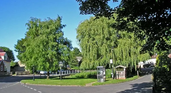
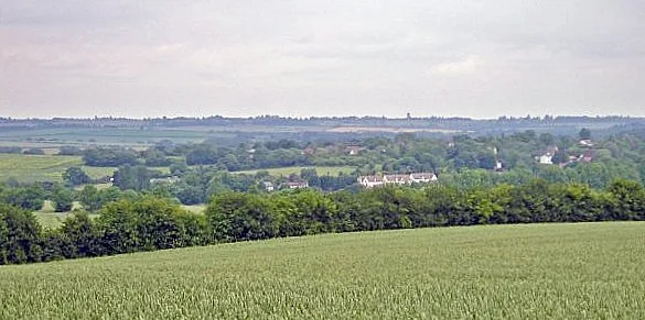
A 26 mile walk along the Icknield Way between Linton and Herringswell

This section of the Icknield Way passes through some idyllic and typical English landscapes where village greens, thatched cottages and traditional country pubs nestle in with babbling brooks and the gently swaying fields of barley that cover the rolling hills. It is a sheer pleasure to wander through. The only issue with this walk is the lack of accommodation unless one makes diversions away from the trail.

The Icknield Way - Linton to Herringswell - Essential Information

Walk Statistics:

  • Start location: Hinton 
  • End location: Woods south of Herringswell 
  • Distance:   miles (  km)
  • Total Gain:   ft (  metre)
  • Total Descent:   ft (  metre)
  • Min Height:   ft (  metre)
  • Max Height:   ft (  metre)
  • Walk Time:  
  • Walk type: Linear
  • Walk Grade: Easy
  • Terrain:

Maps:

The following maps and services can assist in navigating this route. There are links to printed maps and links to downloadable GPX route data for importing into navigational software and apps.


Accommodation:

Herringswell WoodlandWild campView in OS Map | View in Google Map
Description
Wild camp in woods south of Herringswell

Route Verification Details

  • Date of Walk: 2009-06-22
  • Walk Time: 08:30 to 21:30
  • Walkers: Griffmonster
  • Weather Conditions: Clear blue summer skies, hot

Walk Notes

From the research done in the weeks prior to setting out on the Icknield Way I had come to the conclusion that I would need to wild camp on this section. That was not a decision taken lightly but something deduced from other hikers attempting to walk the extensive section between Linton and the end of the trail at Knetteshall Heath. It is true that wild camping is not actually legal in England but given a lack of accommodation on route and no alternatives then a discreet, out of sight location is the last resort. Providing one leaves no mess, no litter then what harm can be done? In my book one has to leave any site as if you had never been there.

Therefore with this in mind, I started out the day in leisurely mood without any clear destination and with the idea of just getting as far as I could by the end of the day! After a good mornings walk I stopped off at the Bull at Burrough Green and it was such a pleasant experience sitting there in the sun that I spent a full hour lazing in that pub garden. This set the trend for the day, stopping off at The Marquis of Granby in Stetchworth to sit and watch the world go by, then lazing on the green at Cheveley before continuing with pub stops at Ashley, Dulham and Gazeley. The most disappointing part of the pub crawl was the fact that all the inns apart from the Affleck Arms at Dulham were Greene King houses. This brewery appears to have a virtual monopoly in the area. The Affleck Arms was a real treat though, this is just off route but well worth searching out and I thoroughly recommend it. Excellent ale, excellent company and excellent old pub.

This was the day of the kissing gate - the previous day had been all about styles in all manner of construction and glory and now it was the day of the kissing gate. Although their construction was similar throughout they became the accustomed entrance and exit to every boundary and every new footpath. It is strange how the method of footpath restriction changes and I can only put this down to the crossing of the county borders.

This trail also led through some excellent landscapes that portrayed typical English countryside, the sort of scenes that would aptly fit on chocolate box tops and jigsaw puzzle scenes. Vast open landscapes of gently rolling hills; Fields of gently waving barley bowing majestically in the breezes under deep blue skies; Traditional old pubs and thatched cottages adorning village greens; Babbling brooks and streams and villages full of tumbledown cottages. This truly was the heart of England.

There was obviously a lot of money in these villages and no doubt the inhabitants merely commuted to their senior jobs in the affluent centres of commerce such as Cambridge or were connected to the horse racing industry with Newmarket also being close by. Indeed there was much to connect to such an industry with a multitude of horse paddocks along the route. This was even more evident in the Crown pub in Ashley where at 6ft tall I was positively a giant amongst the clientel. On entering the establishment I witnessed a group of men sat on barstools around the bar. These were not so much as bar stools as height compensators for when one of their group jumped down he reduced his height by a considerable amount and scurried off to the toilets like a small child. These were obviously all professional jockeys.

Maybe it was the fact of incurring constant refreshment stops but by the end of the day I had covered well over 25 miles and was still feeling as fresh as a daisy. The only reason that prevented pursuing more miles was the failing evening light. I had started looking for suitable places to pitch after the village of Dulham and this was after enquiring of the possibility of a room for the night at the Affleck Arms. Unfortunately the rooms were all taken, the last lodging being reserved just a matter of hours earlier.

The the light well and truly fading as I traipsed along a track that led through the woods near Herringswell. This woodland looked quite a suitable location with plenty of space between the trees and the ground covered in soft forest litter. I waited for a dog walker to wander out of sight before nipping into the woodland and springing up the tent. Once cleared of the fallen twigs and branches I found the ground to be very soft and comfortable, in fact I would say you could not have got a better bedding to sleep upon. No sooner had I pitched than the light was gone and it was pitch black. I couldn't see a thing in the tent, I have never known such complete darkness.

I attempted to drift into sleep but there is always the nagging feeling that I may get disturbed from some angry land owner. An animal came and sniffed at the tent then went away. Then I heard distant barking and then another bark called back its sound distinctively closer. This continued every few seconds. At first I thought it was dogs from the nearby village but it was soon quite apparent that the noises were emanating from the forest. I convinced myself that this country does not have wolves or any other nasty creatures that eat humans and tried to ignore the noise. It carried on until I eventually drifted into sleep. Later, on my expeditions, I was informed that the barking was muntjac deer - they sound the same as a dogs bark and it is quite common to hear them calling to each other in woodland.

On the left, Meal deals at the Marquis of Granby in Stetworth. On the right, the former malting kiln at Dalham On the left, Meal deals at the Marquis of Granby in Stetworth. On the right, the former malting kiln at Dalham
On the left On the left, Meal deals at the Marquis of Granby in Stetworth. On the right, the former malting kiln at Dalham ; On the right On the left, Meal deals at the Marquis of Granby in Stetworth. On the right, the former malting kiln at Dalham

Directions

From Linton High Street turn down Meadow Lane on the left as the High Street bears to the right. After 150 yards there will be a waymarker on the right, follow this through the built up area and finally the path will lead up the hill to the water tower from where a good view of Linton is to be had. The trail now leads via a roman road through to Balsham where there is an Icknield Way milestone declaring 'Peddars Way 43 miles' and 'Ridgeway 63 miles'. A broad farm track now leads to Willingham Green and down into Brinkley from where a path across the fields takes you to Burrough Green. The path continues down by the side of the Bull public house, this leads across a series of paddocked fields through to Stetchworth. Walk along the road into the village and the path is located opposite the Marquis of Granby public house and leads across a housing estate road and down the back of a series of houses before going downhill to Devils Dyke. Continue following the paths through some very typical english contryside and paddocks, past Woodditton, through Cheveley and onto Ashley. Follow the Gazeley road out of Ashley downhill to where it meets the river Kennet, turn right and walk through the meadows to Dalham. At Dalham village turn left and head for the church. A path turns right and leads through woodland and across fields to Gazeley where it follows road out of the village towards the A14. There is a path through the fields just prior to reaching the A14 but this rejoins the road to go under the dual carriageway. There is an industrial area on the left, walk through this and a track then leads up through woodland towards Herringswell.

Via Devana - The Roman Road to Chester

Pubs

The Bull, Burrough Green View in OS Map | View in Google Map

Image of pub
Address
The Green, Burrough Green
Website

Lovely little village pub set back from the road just off from the village green serving Greene King ales. There is a garden in front of the pub. Food served.

Review

Sitting on the benches in front of the pub watching the world go by was most excellent waste of an hour. Had a pint of Greene Kings Delgardos Heros, a one-off brew to mark the occasion of the rugby world cup.

The Marquis of Granby , Stetchworth View in OS Map | View in Google Map

Image of pub
Address
High Street, Stetchworth

Greene King pub on the junction of the main roads through Stetchworth. Home cooked food.

Review

I arrived as the pub was about to close. The A-board outside advertised Belly Pork with Potatoes and Veg plus a beer for £6 - had I been earlier I would have certainly gone for this excellent deal.

The Crown, Ashley View in OS Map | View in Google Map

Image of pub
Address
Newmarket Road, Ashley
Website

This pub dates from at least the 1700's when records show that it was owned by a James Langley. In 1866 it was put to auction with the details recorded as a newly erected brick, stone and tile built carriage house, a loose box, stabling for six horses, a small barn, a cart lodge and a range of piggeries plus a small yard. The property finally passed to Greene King ownership in 1890 to which it has remained ever since.

Review

When I entered the pub I appeared to be the only person over 5ft tall. It then dawned upon me that the this was close to Newmarket and was probably a popular haunt for jockeys. Standard Greene King ales.

The Affleck Arms, Dalham View in OS Map | View in Google Map

Image of pub
Address
Brookside, Dalham
Website

Charming thatched village pub dating from the 16th century. The pub's name is derived from the Affleck family whom owned the estate that it was built upon. Formerly a Greene King house, the pub is now free of tie and regularly has four guest ales on offer. Accommodation and food available. Reputedly haunted by a Grey Lady.

Review

Very friendly and popular and both the choice of ale and the ale itself was most excellent. IT wasnt long before conversatio sparked up and it soon became apparant that I had missed out on an available room by a mere hour. Well worth searching out and highly recommended.

The Chequers, Gazeley View in OS Map | View in Google Map

Image of pub
Address
The Chequers, Gazeley
Website

Village pub said to date from the 16th century that was a Greene King house up until 2018. It has subsequently been taken over by an independent owner and is brewing their own beer under the Munsons Brewery name.

Review

On entering the pub I felt distinctly out of place. That moment when all eyes focus on the stranger walking through the door. I was served with minimal conversation. All eyes kept a cautious focus on me, the stranger. I supped up quickly and made my way.

On the left, Basham village green. On the right, Icknield Way milestone - 43 miles to the Peddars Way, 63 miles to the Ridgeway.On the left, Basham village green. On the right, Icknield Way milestone - 43 miles to the Peddars Way, 63 miles to the Ridgeway.
On the left On the left, Basham village green. On the right, Icknield Way milestone - 43 miles to the Peddars Way, 63 miles to the Ridgeway.; On the right On the left, Basham village green. On the right, Icknield Way milestone - 43 miles to the Peddars Way, 63 miles to the Ridgeway.

Features

Via DevanaView in OS Map | View in Google Map

Between Hinton and Balsham the Icknield Way joins a short section of Via Devana, an old Roman Road linking Colchester with Chester. The name Via Devana was coined in 1750 by Charles Mason, a Cambridge geology professor. The name reflects the Roman name for Chester, Deva. An information board details the natural flora and fauna along this section.

BalshamView in OS Map | View in Google Map

Originally settled during Saxon times, the village of Balsham was totally destroyed by Viking raiders in 1010. A sign on the village green commemorates the sole survivor of the attack who escaped by hiding in the parish church. The church of The Holy Trinity is an impressive building, the bell tower dates from the 13th century, whilst the chancel dates from the early 14th century.

Devils Ditch (Devils Dyke)View in OS Map | View in Google Map

Devil's Dyke is generally assumed to be an Anglo-Saxon earthwork which starts on flat farmland and then passes to the west of Newmarket and runs along the edge of the July Course at Newmarket Racecourse before rising gently to an altitude of 100m as it reaches the wooded hills around Woodditton. It crosses the Icknield Way just to the northeast of Stetchworth. In places it is 20 feet wide and 30 feet deep and is thought to have been used to demarcate the boundary of a tribe's influence as well as a barrier to the British tribes to the west.

DalhamView in OS Map | View in Google Map

Dalham is a pretty liitle village full of thatched cottages that sits on the River Kennet. Dalham Malting Kiln is a curious feature sitting on the roadside in Dalham. The former malting kiln is listed in the Register of Historic Buildings and was built in the early Victorian era. There is an inscription on one of the hand-made bricks which reads 'J.D 1846', though it may have been constructed significantly earlier than this as the Enclosure Map of 1820 indicates it was then owned by William Ruffell, who also built and owned the windmill on Stores Hill. Dalham Hall is a Grade 2 listed country house and 33000-acre estate. There is no recorded date as to when the Hall was first constructed though there are records dating back to 1313. Thomas Stuteville bought the estate in 1417, when it is presumed that he rebuilt the house and his family occupied the residence until it was bought by Gilbert Dolben in 1697. There have been numerous other owneres including Cecil Rhodes, although he passed away before taking residence. The hall and its associated stud are currently owned by the ruler of Dubai, Sheikh Mohammed bin Rashid Al Maktoum.

The impressive Church of The Holy Trinity at Basham

Gallery

Below are a selection of images taken from from the photo album for this walk. Feel free to browse through these or click on an image to view a larger version in the Gallery.

Summary of Document Changes

Last Updated: 2021-12-07

2010-12-10 : Initial Publication
2013-03-01 : updated photos
2018-12-30 : General website updates and rework notes
2021-03-17 : Update website improvements and removal of ViewRanger reliance
2021-12-01 : Removal of ViewRanger links due to its imminent demise

Indexes and Info

East Suffolk PRoW Access

The Public Rights of Way (PRoW) within the Suffolk Coastal area between Aldeburgh and Southwold are subject to being blocked up and diverted due to the extensive industrial projects that are currently taking place in the area including the Sizewell C development and various wind farm projects. A PRoW Access page has been written to detail known issues in the area

Walk Summaries

Latest walk summaries are basic information sheets for walks that have yet to be fully documented. These provide links to maps, public transport and walks stats, although detailed notes and features are not included.

Latest Walk Summaries

Featured Walk

In Search of Sizewell Chapel

A 10 mile walk following the southern side of the parish boundary of Leiston in Suffolk This walk follows the route of a 17th century peramb...

What is GPX

All you need to know about GPX, electronic mapping and how to use modern apps and mobile devices as navigation devices

Popular Walks

Maps

Diary of a Suffolk Common

The ramblings and musing of the Griffmonster