Leiston to Reckford Circular Walk Summary
Thursday, 9 August 2018
|
No comments
|
![]()
A circular walk encapsulating Leiston Airfield, Theberton woods and the Minsmere River
A walk that encapsulates the varied landscape of the East Suffolk are. There is history, there is ancient woodland and a wander along the river. An ideal escape to potter around the route and a glorious summers day.

Walk Statistics
- Start location: Leiston
- Distance: miles ( km)
- Total Gain: ft ( metre)
- Total Descent: ft ( metre)
- Min Height: ft ( metre)
- Max Height: ft ( metre)
- Est. Walk Time:
- Walk type: Circular
- Walk Grade: easy
- Terrain: Footpaths, tracks and country lanes
- Obstacles: The route is fairly easy to follow. It should be noted that the river bank walk can become somewhat overgrown during summer periods. The path is regularly walked but despite this the going can become tough. There is also a short section along the main road from Potters Street to the footpath to Leiston Abbey. There is a rough verge along this section and also, dependant upon the crop, the field edge can also be accessible

Maps
The following maps and services can assist in navigating this route. There are links to printed maps and links to downloadable GPX route data for importing into navigational software and apps.
- Ordnance Survey Explorer Map
- OS Explorer 212 - Woodbridge & Saxmundham
- GPX Route File
Walk Notes
Few may have heard of Reckford, and indeed as a location it is pretty much lost in the landscape. There is a Reckford Road in the neighbouring village, there is a 16th century Reckford Farmhouse, and there is the Reckford Bridge but to all intents and purposes the community of Reckford is not recognised, just a small area of the village of Middleton. Whether the area was ever judged to be a village is unknown. Nonetheless we will make it the destination of this circular walk.
Few may have heard of Reckford, and indeed as a location it is pretty much lost in the landscape. There is a Reckford Road in the neighbouring village, there is a 16th century Reckford Farmhouse, and there is the Reckford Bridge but to all intents and purposes the community of Reckford is not recognised, just a small area of the village of Middleton. Whether the area was ever judged to be a village is unknown. Nonetheless we will make it the destination of this circular walk.
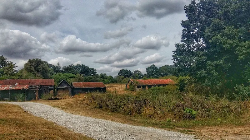
The walk has much to feast ones eyes upon. The former WWII Leiston airbase commonly known as RAF Leiston hosted the USAF 357th Fighter Group who were locally known as the Yoxford Boys. Little is left although there is a memorial that pays homage to the US crews that flew out of this airfield and never returned. There are some hidden remnants in the landscape, a broken up runway that crosses the farmland, old buildings that have camoflaged themselves in the undergrowth and now either lie redundant of have been put to use as farm buildings.
The walk continues onto the broadleaved woodland known as Theberton Woods before navigating down the quiet country lanes and tracks to Reckford.
Return is along the banks of the Minsmere river to Eastbridge then back to Leiston via the Abbey ruins.It should be noted that the river band path can be very muddy and waterlogged during winter months and can become overgrown in late summer. Therefore the walk is best undertaken during the late spring or early summer. An alternative if the river path is unpassable, is to proceed across the river bridge and take the path marked as Black Slough on the map. Where this meets the lane, turn sharp right onto another public footpath which will will lead onto a dirt track, take the right onto another track at the end and then straight on as it meets the road that leads into Eastbridge.
Route Validation Cards
Validation Date - 2018-08-04
- Time of Walk: 11:00 to 15:00
- Validators: Griffmonster
- Weather Conditions: Warm sunny day
- Notes: Initial route undertaken
Summary of Document Changes
Last Updated: 2026-04-20
- 2018-08-04 : initial publication
- 2021-03-17 : Update website improvements and removal of ViewRanger reliance
- 2021-12-01 : Removal of ViewRanger links due to its imminent demise
- 2026-01-12 : Major website update with all walks recast to the new format


0 comments:
Post a Comment