Sandlings Walk - Rushmere to Melton Walk Summary
Sunday, 26 August 2018
|
No comments
|
![]()
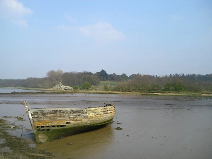
The Suffolk Sandlings path between Rushmere, on the eastern side of Ipswich, and Melton
The Sandlings is a long distance path linking Ipswich and Southwold through the Suffolk Coast and Heaths Area of Outstanding Natural Beauty.
A starting point is provided at Rushmere Heath, close to Ipswich Hospital and takes a rural route out behind Kesgrave and through to Martlesham. The trail then heads down to Martlesham Creek, a sizeable creek off of the River Deben that creek was said to be used in 18th century smuggling days as a discreet place to offload contraband. A riverside path then provides access all the way through to Melton. This is the highlight of the walk, a true delight to wander no matter what time of the year.
Although there are no specific pubs along the route, a short diversion gives access to The Black Tiles at roughly the half way point. There is public transport linking the two ends with 800 First Group bus service departing from outside Melton railway station. The 64 service follows a similar route and departs from The Street in Melton. There is no Sunday service.
Features along the route include an anonymous grave on Martlesham Heath known as Dobbs' Grave, reputedly the resting place of a shepherd boy named Dobbs who committed suicide. The area is purported to be haunted some saying it to be the ghost of Brainy Dobbs, an airman from Martlesham Heath airfield.
Martlesham Heath Control Tower Museum is located a little further along and pays homage to RAF Martlesham Heath, which contributed to the development of aviation as well as being a key airfield during two world wars. Open on Sundays from Easter to October.
The impressive renovated Tide Mill sits on the banks of the Deben at Woodbridge and is a worthwhile attraction to take time out and visit. The mill, over 800 years old, is said to be the oldest in the country.

Walk Statistics
- Start location: Rushmere Heath
- End location: Melton
- Distance: miles ( km)
- Total Gain: ft ( metre)
- Total Descent: ft ( metre)
- Min Height: ft ( metre)
- Max Height: ft ( metre)
- Est. Walk Time:
- Walk type: Linear
- Walk Grade: moderate
- Terrain: Footpaths and tracks
- Obstacles: There are no particular difficult obstacles on this route. The river is tidal but this should not cause any issues with the path unless there are exceptional high tides or storm surges.

Maps
The following maps and services can assist in navigating this route. There are links to printed maps and links to downloadable GPX route data for importing into navigational software and apps.
- Ordnance Survey Explorer Map
- OS Explorer 197 - Ipswich, Felixstowe & Harwich
- GPX Route File
Transport
First Group - Bus Service
- Service Details
- 64 - First Group 64 service connects Ipswich, Woodbridge, Wickham Market, Saxmundhamm, Leiston and Aldeburgh.
- Timetable
- Suffolk On Board Website
First Group - Bus Service
- Service Details
- 65 - First Group 65 Service linking Ipswich, Woodbridge, Melton and Rendlesham.
- Timetable
- Suffolk On Board Website
Route Validation Cards
Validation Date - 2010-04-25
- Time of Walk: 11:00 to 16:00
- Validators: Griffmonster, Kat
- Weather Conditions: Cool with showers
- Notes: Initial route undertaken
Summary of Document Changes
Last Updated: 2026-04-20
- 2021-03-17 : Update website improvements and removal of ViewRanger reliance
- 2021-12-01 : Removal of ViewRanger links due to its imminent demise
- 2026-01-12 : Major website update with all walks recast to the new format


0 comments:
Post a Comment