Saxtead and Earl Soham Circular Walk Summary
Thursday, 9 August 2018
|
No comments
|
![]()
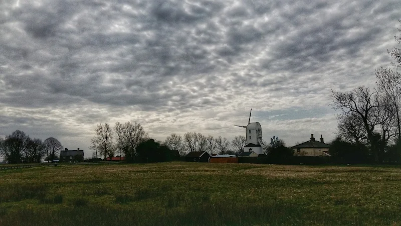
A country ramble through rural Suffolk taking in the villages of Saxtead and Earl Soham
This walk can be described as a typical Suffolk rural ramble. Quiet country lanes and accessible footpaths make this suitable for anyone.
Highlights begin almost immediately with the working Saxtead Green Post Corn Mill, preserved and maintained by English Heritage. As the route descends into Earl Soham there is the 13th century church of St Mary which is well worth visiting. The village of Earl Soham is a real piece of picture postcard Suffolk with its broad leafy main street providing an air of tranquillity. At the western end the road passes across the River Ken which is no more than a babbling brook that feeds into the River Deben.
At the edge of the village is the traditional old pub known as The Victoria. Unspoilt and unmodernised, this is a delight to visit. It once hosted a brewery, but due to demand it was moved across the road and has subsequently moved out of the village although it still supplies the pub with its traditional local ales.

Walk Statistics
- Start location: Saxtead
- Distance: miles ( km)
- Total Gain: ft ( metre)
- Total Descent: ft ( metre)
- Min Height: ft ( metre)
- Max Height: ft ( metre)
- Est. Walk Time:
- Walk type: Circular
- Walk Grade: easy
- Terrain: Country lanes and footpaths.
- Obstacles: There is a short section along the main road in order to access the first country lane. As the footpath returns to Saxtead, it crosses a ditch by way of a simple wooden bridge. The footpath route should turn left then immediately right to cross the next field. On this occasion the path was obliterated by a newly sown crop. The alternative, as shown on this route, is to turn right and follow the path into the Windmill Lodges holiday park and follow the track out onto the road

Maps
The following maps and services can assist in navigating this route. There are links to printed maps and links to downloadable GPX route data for importing into navigational software and apps.
- Ordnance Survey Explorer Map
- OS Explorer 212 - Woodbridge & Saxmundham
- GPX Route File
Route Validation Cards
Validation Date - 2018-04-07
- Time of Walk: 11:30 to 14:30
- Validators: Griffmonster, Kat
- Weather Conditions: Warm sunny day
- Notes: Initial route undertaken
Summary of Document Changes
Last Updated: 2026-04-20
- 2021-03-17 : Update website improvements and removal of ViewRanger reliance
- 2021-12-01 : Removal of ViewRanger links due to its imminent demise
- 2026-01-12 : Major website update with all walks recast to the new format


0 comments:
Post a Comment