Somerset Coast Path - Bridgwater to Cannington
Tuesday, 25 September 2018
|
No comments
|
![]()
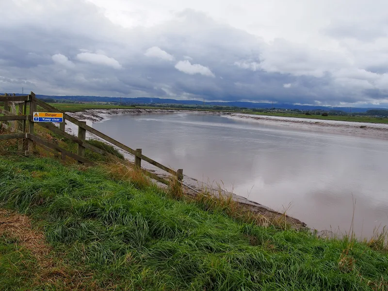
A walk along the banks of the River Parrett from Bridgwater to Cannington
This 9 mile walk is part of the Somerset section of the England Coast Path and follows the defence banks of the River Parrett from Bridgwater to Cannington. Although the village of Cannington is not exactly on the river, it does provide a public transport link back to Bridgwater and there are clear paths and tracks that link the trail to the village.
The River Parrett at this point is a wide tidal estuary with long slow winding bends in its course as it navigates to the sea. WWII Pill boxes sit around each bend, strategically placed to guard against the threat of German invasion up the river. The fields on either side are pastureland for cattle and sheep and once beyond Dunball there is little sign of civilisation. The river is notable for its lack of craft, the docks of Bridgwater and Dunball, collectively known as the Port of Bridgwater, are now long gone so no commercial traffic utilizes the water course. Even pleasure craft are notable by their absence.
It should be noted that at the time of this walk report, September 2018, there was a series of works along the river bank necessitating marked diversions. According to the order notices these works will be in place until mid 2019. The diverted paths are not immediately clear and one should follow the roped lines and the seemingly out-of-place red road signs that direct pedestrians.
The route from the defence banks to Cannington uses a footpath clearly marked on OS Maps. It should be noted that this path is a some distance beyond where it is marked on the map and one should continue to the field boundary where there is a stile, then follow the farm track.
As with many defence paths, the grass banks in this instance were in particular need of a trim. Overnight rain had left the vegetation sodden resulting in very wet feet. No matter how many times boot manufactures indicate their footwear is waterproof, experience proves that no boot is completely waterproof. Just remember that it is only water and feet and boots soon dry out. Just enjoy the walk, the seclusion and the landscape.

Walk Statistics
- Start location: Bridgwater
- End location: Cannington
- Distance: miles ( km)
- Total Gain: ft ( metre)
- Total Descent: ft ( metre)
- Min Height: ft ( metre)
- Max Height: ft ( metre)
- Est. Walk Time:
- Walk type: Linear
- Walk Grade: moderate
- Terrain: River defence banks
- Obstacles: Defence bank works that will last into 2019 are located along the river, diversions through the meadows are signposted

Maps
The following maps and services can assist in navigating this route. There are links to printed maps and links to downloadable GPX route data for importing into navigational software and apps.
- Ordnance Survey Explorer Map
- OS Explorer 140 - Quantock Hills & Bridgwater
- GPX Route File
Accommodation
Unity Farm, Brean Sands, Burnham-on-SeacampsiteView in OS Map | View in Google Map
- Website
- https://unityholidays.co.uk/
- Description
- A family oriented holiday park with entertainment, static caravans as well as touring pitches
Transport
First Group - Bus Service
- Service Details
- 14 - First Group 14 Service linking Bridgwater and Cannington
- Timetable
- First Group (Somerset) Website
Route Validation Cards
Validation Date - 2018-09-12
- Time of Walk: 10:00 to 14:00
- Validators: Griffmonster, Kat
- Weather Conditions: Overcast but warm. Over night rain resulted it being very wet underfoot
- Notes: Initial route undertaken
Summary of Document Changes
Last Updated: 2026-04-20
- 2021-03-17 : Update website improvements and removal of ViewRanger reliance
- 2021-12-01 : Removal of ViewRanger links due to its imminent demise
- 2026-01-12 : Major website update with all walks recast to the new format


0 comments:
Post a Comment