Beach walk from Brean village to Brean Down
Wednesday, 3 October 2018
|
No comments
|
![]()
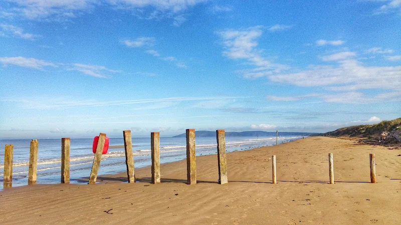
Beach walk from Brean village to Brean Down
A glorious walk across the acres of sand that make up Brean beach. This is the clasic British beach walk where the sea ebbs away into the distance at low tide leaving a vast expanse of compacted sand to walk across. With the promontory of Brean head jutting out to the north and the island of Steep Holm lurking in the distance it makes for some interesting views.
Return can either be directly back along the sands which offer firm sand even at most high tides, or along the beach road where there are ample bars and restaurants that accompany the numerous holiday camps that adorn this area.
Probably the best time to walk this beach is early morning when the beach is devoid of people and the dawn is breaking from the landward side. With a moody sky where clouds deflect the sunlight in every direction then this beach becomes a true wonder to walk along.

Walk Statistics
- Start location: Unity Farm, Brean
- Distance: miles ( km)
- Total Gain: ft ( metre)
- Total Descent: ft ( metre)
- Min Height: ft ( metre)
- Max Height: ft ( metre)
- Est. Walk Time:
- Walk type: Circular
- Walk Grade: moderate
- Terrain: Beach
- Obstacles: There are warning signs cautioning against walking the sands at low tide due to sinking sand and mud

Maps
The following maps and services can assist in navigating this route. There are links to printed maps and links to downloadable GPX route data for importing into navigational software and apps.
- Ordnance Survey Explorer Map
- OS Explorer 153 - Weston-super-Mare & Bleadon Hill
- GPX Route File
Accommodation
Unity Farm, Brean Sands, Burnham-on-SeacampsiteView in OS Map | View in Google Map
- Website
- https://unityholidays.co.uk/
- Description
- A family oriented holiday park with entertainment, static caravans as well as touring pitches
Route Validation Cards
Validation Date - 2018-09-13
- Time of Walk: 07:30 to 10:00
- Validators: Griffmonster
- Weather Conditions: moody skies with dawn breaking
- Notes: Initial route undertaken
Summary of Document Changes
Last Updated: 2026-04-20
- 2021-03-17 : Update website improvements and removal of ViewRanger reliance
- 2021-12-01 : Removal of ViewRanger links due to its imminent demise
- 2026-01-12 : Major website update with all walks recast to the new format


0 comments:
Post a Comment