Bishop Auckland, Palace Deer Park Walk
Wednesday, 29 July 2026
|
No comments
|


A walk around the Bishops Palace Deer Park
A short walk exploring the deer park associated with the Bishops Palace in Bishop Auckland. The circular route follows the River Gaunless up to its outflow into the River Wear, then returns back to the entrance of the Bishops Palace.

Walk Statistics
- Start location: Bishop Auckland
- Distance: miles ( km)
- Total Gain: ft ( metre)
- Total Descent: ft ( metre)
- Min Height: ft ( metre)
- Max Height: ft ( metre)
- Walk Time:
- Walk Grade: Easy
- Terrain: Footpath, Road

Maps:
The following maps and services can assist in navigating this route. There are links to printed maps and links to downloadable GPX route data for importing into navigational software and apps.
- Ordnance Survey Explorer Map
- OS Explorer 305 - Bishop Auckland
- GPX Route File
Walk Notes

The deer park through which this walk passes is free to visit and open each day from dawn till dusk. The Auckland Palace is open daily but requires a ticket to enter.
Beginning at the Market Place, you pass through the Gothic Clock Tower Gateway, built by Bishop Richard Trevor in the 1760s. This marks the transition from the busy town into the private world of the bishops.
Beyond the gate, the palace rises ahead on its ridge-top site. For centuries this was not merely a residence but the administrative centre of the Prince-Bishops’ territory, where political, judicial, and religious power were exercised. The approach was designed to make visitors feel they were entering the domain of a ruler rather than simply a churchman.
Entering the palace grounds, you encounter a mixture of medieval and Georgian architecture. The oldest parts date back to the 12th century, while later bishops remodelled the buildings to create a more comfortable country residence.
The palace occupies a commanding position above the Wear Valley, allowing extensive views over the surrounding countryside. This elevated setting was one reason the site was chosen originally. It provided security, prestige, and dramatic scenery.
to your right are the Palace Gardens and Terraces, restored by The Auckland Project. Today these include the Walled Garden, North Terrace Garden, Paradise Garden, Wilderness Garden, and Faith Garden. The terraces provide sweeping views over the parkland below.
In the 18th century, these viewpoints were part of a carefully choreographed landscape. The visitor’s eye was drawn outward from the palace toward the deer park and its ornamental features.
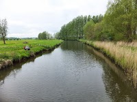
The Deer Park can be accessed either by descending the steps to the gardens, and bearing off to the left, or heading straight ahead and taking the footpath on the right as the drive turns a sharp left. The wooded parkland offers plenty of ancient sweet chestnut and cherry trees with the path bounded by the river. This is a 150-acre remnant of a much larger medieval hunting estate established more than 800 years ago by the Bishops of Durham.
On the left, as you follow the river, is what looks like a ruin that resembles a miniature Gothic castle but is in fact a Deer House, built to shelter and feed deer, built around 1760 for Bishop Richard Trevor. The structure contains a central feeding courtyard surrounded by arcades. A first-floor room allowed the bishop and his guests to dine while overlooking both the deer and the wider landscape. It was part practical animal shelter, part hunting lodge, and part ornamental folly.
The route eventually reaches Trevor Bridge, built in 1757 by Bishop Trevor. It is the grandest surviving bridge in the park and was deliberately positioned to create a dramatic crossing point and frame views through the landscape. For those who want to extend the walk, crossing this into further parkland will lead you to the estate’s Ice House, dating from the 1700s, and an unusual pyramid-shaped stone structure known as the Obelisk. This served as a well head connected to the palace’s 18th-century water supply system.
Keeping to the rivers’ course brings you to Jock’s Bridge which is a handsome 18th-century stone bridge crossing the river Gaunless just before it enters the Wear. The bridge is Grade II listed and forms part of the historic Auckland Park landscape.
Following the River Wear westwards brings you to a grassed area with a terrace of houses overlooking the river, known locally as the Batts. The name is generally believed to derive from “The Butts”—the medieval archery practice grounds where local men were required to train with the longbow. Over time “Butts” became “Batts” in local usage.
The Batts occupies a broad stretch of riverside meadow on the south bank of the River Wear, immediately below the old town of Bishop Auckland and beneath the steep descent of Wear Chare. Today it appears as a peaceful green space, but historically it lay on the edge of the medieval town and was vulnerable to flooding.
The road up Wear Chare will lead you back to the start of the walk at the entrance to the Bishops Palace. It is possible to follow the riverside path a little further up to the Newton Cap Viaduct, the great Victorian railway viaduct that strides across the Wear valley, then return via the roads from there.
All in all this is a great introduction to Bishop Auckland.
Directions
The route starts on the north side of Bishop Auckland town, on Market Street where the entrance to Auckland Palace can be seen through an ornate stone gated arch with a clock tower.
- Head through the arch and continue along the drive with the buildings to the left.
- On the right there are walled gardens terraced on the slope that leads down to the park and river. At the far end is a flight of steps that leads down to the gardens. Take this, but rather than going to the gardens, take the left and follow the footpath through the woodland. This will lead down to the river.
- Keep to the rivers course, following the well defined footpath.
- The river bends around. After some time you will see what appears to be a ruin on your left atop a hill. This is the deer house, it is easy to access and is worth investigating.
- Continue along the river side, which soon comes to a bridge, known as Trevor’s Bridge. You can navigate under this rather than use the main path.
- A little further on is Jock’s Bridge where the river flows out into the River Wear. At this point turn left onto the road heading west, with the River Wear on your right.
- Watch for a footpath that leads across the grassed area on the right, this is a better route than walking the road.
- At the point where there are a terrace of houses on the left, head back to the road. This is the area known as the Batts, with an information board detailing its history.
- Follow the steep hill, known as Wear Chear away from the river
- At the junction, turn left and follow the road through to the start of this walk
Pubs
The Stanly Jefferson, Bishop Auckland

- Address
- 5 Market Place, Bishop Auckland, County Durham, DL14 7NJ
- Website
- https://www.jdwetherspoon.com/pubs/the-stanley-jefferson-bishop-auckland/
The pub is named after Stan Laurel, he of the famous Laurel and Hardy comedy double-act fame. Born Stanley Jefferson, Stan Laurel was christened here and, in 1903, attended the grammar school. After finishing schooling, he moved to Gainford Academy, and his family ultimately relocated to Glasgow, Scotland in the summer of 1905, where his comedy career would eventually begin to take shape.
As with most Spoons pubs, there is a lot of history within the building including information and photographs of Stan Laurel, the birth of steam, the victorious Bishop Auckland football team who won the Amateur FA Cup in 1935, beating Wimbledon 2-1 in a replay.
Cask ale is on offer including examples of local ales.
Features
The area around Auckland Palace (historically known as Auckland Castle and often referred to as the Bishop’s Palace) is one of the most significant ecclesiastical landscapes in England. It combines a medieval palace, a historic deer park, gardens, hunting features, and later Georgian landscape improvements.
The Palace (Auckland Castle)
The palace originated as a residence of the Bishops of Durham in the 12th century and developed into the principal seat of the powerful Prince-Bishops. Positioned on high ground above the valleys of the Rivers Wear and Gaunless, it was both a residence and a symbol of political authority. The complex contains medieval, Restoration, and Georgian architectural phases, including:
- St Peter’s Chapel, originally the medieval Great Hall.
- Grand state apartments remodelled in the late 18th century.
- The famous Long Dining Room housing the Zurbarán paintings.
- Extensive terraces, walls, and formal approaches.
- The Deer Park
The deer park is one of the oldest parts of the estate, with origins probably dating to the 11th or 12th century. Medieval bishops used it for hunting, recreation, and displaying wealth. Historical records mention:
- Large herds of deer.
- Woodland managed for hunting.
- Fish ponds and water features.
- Extensive park pale (boundary) enclosures.
- Occasional herds of wild cattle before the 17th century.
The park covers roughly 120 hectares (about 300 acres today, though historically larger) and retains much of its eighteenth-century layout. The rolling landscape was deliberately shaped to create dramatic views of the palace and surrounding valleys.
The Deer House (Deer Shelter)
The most unusual structure in the park is the Auckland Castle Deer House, built around 1760 for Bishop Richard Trevor.
Despite looking like a miniature Gothic castle ruin, it was actually designed for deer. Features include:
- Arcaded sandstone walls.
- Pinnacles and battlemented parapets.
- A central open courtyard.
- Sheltered feeding areas for deer.
- Rooms where the bishop and guests could rest, picnic, and enjoy views during hunts.
It is considered a remarkable example of Georgian Gothic Revival architecture and is now protected as a scheduled monument.
Fish Ponds
Several medieval fish ponds survive within the parkland. Fish were essential for the bishops’ household, particularly because religious fasting days required alternatives to meat.
These ponds were restored in the 17th century by Bishop Cosin after earlier neglect and remain important evidence of how the estate functioned economically as well as recreationally.
Walled and Kitchen Gardens
South of the main approach are extensive historic gardens enclosed by high walls.
Features include:
- Productive kitchen gardens supplying the palace.
- Orchard areas.
- Glasshouses.
- Formal terraces overlooking the park.
The gardens have undergone extensive restoration in recent years as part of the Auckland Project and now reflect both their historic and productive roles.
Clock Tower Gateway
One of the most distinctive entrances to the estate is the Clock Tower Gateway, built in 1760 by Bishop Trevor.
This Gothic-style entrance forms the ceremonial approach from Bishop Auckland marketplace into the palace grounds. It acts as a transition from town to episcopal estate and remains one of the estate’s most recognizable landmarks.
Bridge over the River Gaunless
A picturesque 18th-century bridge carries a park drive across the River Gaunless.
The bridge was designed as part of the landscaped approach through the deer park, carefully revealing views of the Deer House and eventually the palace itself. This sequence of views was typical of Georgian landscape design.
Ancillary Service Buildings
Near the palace are ranges of former:
- Stables.
- Carriage houses.
- Storage buildings.
- Estate service yards.
Many of these incorporate medieval fabric but were adapted during the 18th and 19th centuries to support the functioning of the bishop’s household.
Overall Character
What makes the Auckland Palace landscape special is that it is not simply a castle with grounds. It is a nearly complete prince-bishop’s estate, where the residence, hunting park, deer management structures, fish ponds, gardens, ceremonial approaches, and service buildings all survive as parts of one historic landscape that evolved over almost 900 years.
Images


Route Validation Cards
Validation Date - 08/06/2026
- Time of Walk: 17:30:00 to 19:00:00
- Validators: Griff, Helen M, Stephen C
- Weather Conditions: Glorious blue evening skies
- Notes: Initial route undertaken
Summary of Document Changes
Last Updated: 2026-07-30
- 2026-07-29 : Initial publication






0 comments:
Post a Comment