England Coast Path - Dunwich Heath Diversion
Saturday, 8 August 2026
|
No comments
|


England Coast Path Dunwich Heath Diversion
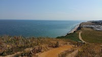
Due to the Summer 2026 wild fire that tragically devastated Dunwich Heath in Coastal Suffolk, the entire Heath area, including the coastal margin, and all footpaths within an extended area are now out of bounds to the public. This could last for up to 6 months before it is declared open again. The route described on this walk is the recommended diversion for those undertaking the England Coast Path section between Aldeburgh and Southwold.

Walk Statistics
- Start location: Minsmere Sluice
- End location: Dingle Marsh
- Distance: miles ( km)
- Total Gain: ft ( metre)
- Total Descent: ft ( metre)
- Min Height: ft ( metre)
- Max Height: ft ( metre)
- Walk Time:
- Walk Grade: Easy
- Terrain: Footpath, Track and Country Lane

Maps:
The following maps and services can assist in navigating this route. There are links to printed maps and links to downloadable GPX route data for importing into navigational software and apps.
- Ordnance Survey Explorer Map
- OS Explorer 212 - Woodbridge & Saxmundham
- GPX Route File
Walk Notes
This route is the recommended diversion around Dunwich Heath where all public rights of way have been declared out of bounds to the general public. The route passes through the villages of Eastbridge and Westleton providing plenty of scope for refreshments and provisions. The diversion is expected to be in place until at least the start of 2027.
The Fire started in late July 2026 and has devastated some 150 hectares of heathland and forest, part of which is traversed by the England Coast Path. The whole area, including the coastal margin, is currently out of bounds for the general public. Do not attempt to continue along the beach as you will eventually be turned back by officials who are monitoring the area. unknown when the area will re-open to the public.
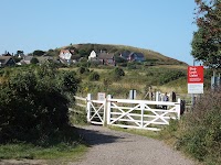
There is a simple sign at Minsmere Sluice to warn walkers that there is no access to Dunwich Beach. There are no diversion signs along the diversion route therefore either use an OS map or this GPX for navigation.

Once the England Coast Path does reopen, this route will remain as a complimentary alternative to the official coast path route. Incorporating the Coast Path to this route will then make a good 12 mile circular walk for visitors to either Dunwich, Eastbridge or Westleton. This will take in the diverse landscape of this area encompassing heath, forest, coast and marsh.
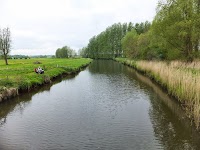
Note that the section from Minsmere Sluice to Eastbridge can become flooded and muddy during winter months and periods of heavy rain.
Directions
The route follows parts of the Sandlings Long Distance Path and provides scenery of marsh, heath and forest.
- At Minsmere Sluice, head inland on the signposted path
- The ruins of the original Leiston Abbey can be seen on a hill to the left, this can be visited by taking the path through a gate, returning onto the main path by turning right at the ruins and following the path out of the field.
- Where the sharply path bends round to the left, do not go ahead through the five bar gate, take the path immediatley to the right to continue in the same direction inland
- The path leads out to the Eastbridge road. Turn right and follow the path through the village
- Keep to the road until there is a sharp bend to the right leading into the Minsmere Bird Reserve. A track leads straight on up a hill - take this.
- Follow the track for 0.3 miles. On the left is a footpath that passes through a gate. Take this.
- Keep to the path which leads through wooded heath, up a hill and out onto more heathland. This eventually comes to a road. Turn left and continue up the road.
- Where the path branches, take the right fork into Westleton village.
- At the junction turn right and follow the road through the village.
- Continue for 0.5 miles. Just past Heath View on the left is a public footpath on the right. Take this.
- Keep to the main path heading in the same direction for 0.5 miles. This then meets with the Sandlings path. Keep straight ahead.
- The path leads down to a stream, across the stream and up to a junction of paths. The Sandlings turns to the left, but we need to bear right and take the path that forks to the left.
- Keep to the path until it leads out onto a road. Turn left and immediately right into the forest opposite.
- Go straight across the path parallel to the road and keep heading in the same direction. At the next junction turn left.
- After 0.1 miles take the right.
- At the end of this path turn left. Follow the path which will soon turn sharp right and lead through the forest and emerge back onto the coast path.
Route Validation Cards
Validation Date - 08/08/2026
- Time of Walk: 08:00:00 to 14:00:00
- Validators: Griff
- Weather Conditions: Warm, sunshone, blue skies
- Notes: Initial route undertaken
Summary of Document Changes
Last Updated: 2026-08-22
- 2026-08-08 : Initial publication
- 2026-08-22 : Latest situation regarding blocked up paths and expected timeline to reopening the Heath to the public






0 comments:
Post a Comment