Priests Way - Kingston to Swanage
Tuesday, 3 November 2026
|
No comments
|


An 7.7 mile hike between Kingston and Swanage on the Purbeck Peninsular in Dorset
This walk provides an alternative to the Coast Path, navigating along the ancient trail known as the Priests Way. This makes for a fairly easy hike across the Purbeck hills, with a frequent daily bus service linking the two ends.

Walk Statistics
- Start location: Kingston
- End location: Swanage
- Distance: miles ( km)
- Total Gain: ft ( metre)
- Total Descent: ft ( metre)
- Min Height: ft ( metre)
- Max Height: ft ( metre)
- Walk Time:
- Walk Grade: Moderate
- Terrain: Footpath, track, road

Maps:
The following maps and services can assist in navigating this route. There are links to printed maps and links to downloadable GPX route data for importing into navigational software and apps.
- Ordnance Survey Explorer Map
- OS Explorer OL15 - Purbeck and South Dorset
- GPX Route File
Walk Notes
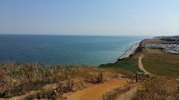
This walk was undertaken as an alternative to walking the South West Coast Path route which had been undertaken some years before. It does briefly navigate along the SWCP before diverting from the coast and up to Worth Matravers where it picks up The Priests Way.
The two ends of the walk are linked by the Morebus Breezer 40 bus service. At the Swanage end, the bus picks up at the Swanage Heritage Railway station, which provides a point of interest whilst waiting for the bus.
For more information on the Priests Way see the Features section of this page.
Directions
Introductory Paragraph
- From the main Kingston bus stop, close to the Scott Arms pub, take West Street down the side of the pub.
- Take the first junction on the left South Street. St James church is on the right just after the junction.
- Continue down South Street which will eventually turn to a track. After 1.5 miles it meets the South West Coast Path. Turn left and follow the Coast Path.
- This follows the valley up to some buildings an an access road. Turn right onto the road. After 250 yards, turn right onto the Coast Path to proceed back down the opposite side of the valley.
- As the path draws towards the coast, with Chapmans Pool down on the right, there is a public footpath on the left leading through the stone wall and heading inland. Take this.
- The footpath leads to a small car park. Go directly out of the car park and onto the footpath opposite.
- The path emerges onto a road at the buildings of Weston Farm. Turn left for a few yards then right at the junction.
- Continue through to Worth Matravers. The road will bend sharp left, then right through the village.
- Keep to the road out of the village and at the forked junction take the right fork with the Square and Compass pub on the left.
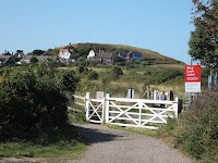
- After 350 yards, there is a footpath on the right that diverges from the course of the road. Access is through a gate, take this and continue along the path, over a small road and onward until it junctions with another footpath. Bear right onto this which is the Priests Way.
- The trail is now well marked with the distinctive round markers depicting a monk with a cross. Keep to this all the way through to the start of Swanage.
- The trail emerges onto a track at the back of houses which leads down onto a residential road. Bear left onto this road, and at the junction take the right (Priests Road). This junctions with High Street, bear right and the road leads into the centre of town close to the sea front.
- To get to the station, at the junction take Institute Road, then Station Road. The bus stop is alongside the station entrance.
Pubs
The Square and Compass, Worth Matravers

- Address
- Worth Matravers, Swanage, Dorset, BH193LF
- Website
- https://squareandcompasspub.co.uk/
The Square and Compass in Worth Matravers is universally celebrated as one of the UK’s most unspoiled traditional gems. Operating as an inn since 1752, this Grade II listed rubblestone building initially served as a pair of simple stone cottages before transforming into The Sloop alehouse, a notorious 18th-century haven for coastal smugglers. Around 1830, a local stonemason took over the tenancy and renamed the inn after the foundational tools of his trade, paying tribute to the thriving limestone quarrying industry that defined the village. Managed continuously by the Newman family since 1907, the pub has stubbornly resisted modernization, remaining one of only five establishments in the country to be featured in every single edition of the CAMRA Good Beer Guide since 1974.
The interior of the inn functions as a living piece of social history, entirely skipping the conventional bar counter in favour of a timeless, bar-less layout. Visitors step into a simple flagstone corridor and place their orders directly through two small timber serving hatches cut straight into the taproom wall. True to its rustic roots, the pub completely avoids commercial gastropub menus, choosing instead to serve only a simple, highly rated selection of hot homemade pies and pasties. This modest fare pairs perfectly with a rotating line-up of real cask ales and their own renowned home-pressed cider, which is brewed on-site by the landlord using locally harvested Purbeck apples.
Beyond its food and drink, the inn doubles as a unique cultural and historical museum. Housed within a converted wing of the building is a world-class collection of fossils and archaeological treasures excavated locally over six decades, featuring massive prehistoric reptile bones like Pliosaur and Ichthyosaur remains found in the nearby Kimmeridge Clay. Outside, the front garden replaces standard patio furniture with a collection of massive, hand-carved stone stools and tables overlooking the dramatic English Channel. Serving as the ideal western finish line for walkers completing the Priest’s Way, the inn remains a vibrant community hub where hikers, locals, and dogs gather for open-air folk music events, pint in hand, amidst Dorset’s rugged coastal landscape.
Features
The Priests Way
The history of the Priest’s Way spans nearly a thousand years, transitioning from an Iron Age settlement track to a vital medieval religious corridor, and later, a bustling route for the local stone quarrying and smuggling industries.
Prehistoric & Roman Roots
Long before it was used by the church, parts of the track served as an access route for early local industries. Archaeological excavations near the Swanage end of the path (at Herston) have uncovered Late Iron Age and Early Romano-British occupation sites, including three short stone cist burials and pottery dating back to the 1st century AD.
The Medieval Ecclesiastical Link
The path earned its name in the Middle Ages due to a historical quirk in how local parishes were organized.
- The Mother Church: In the 12th and 13th centuries, St Nicholas’s Church in Worth Matravers was the primary, wealthy mother church of the region.
- The Chapel of Ease: At the time, Swanage was just a small, humble fishing village (“Swanwic”). St Mary’s Church in Swanage acted merely as a “chapel of ease”; a secondary church built for the convenience of parishioners living too far from the main parish.
- The Priest’s Journey: Because Swanage did not have its own dedicated rector, the priest stationed at Worth Matravers had to regularly walk or ride on horseback across the rugged Purbeck hills to minister to the fisherfolk, celebrate Mass, and attend his pastoral duties to the local population. This came to an end in 1487 when the roles officially reversed. Swanage had outgrown Worth Matravers in population and economic influence, prompting the ecclesiastical authorities to make St Mary’s the main parish church and downgrade Worth Matravers to the secondary chapel.
Quarrymen, Lime Kilns, and Smugglers
After its religious importance waned, the track remained a vital artery for the Purbeck Limestone industry.
- Dry Stone Walls: The distinctive stone walls lining the track were built using material cleared directly from the adjacent fields. If you look closely, you can still see the varied craftsmanship, some sections feature stones laid perfectly flat, while others are stacked diagonally.
- Industrial Traffic: For centuries, the path was pounded by heavy carts transporting stone from inland quarries down to the coast, alongside agricultural workers heading to local lime kilns to create “quick lime” for farming and mortar.
- Smuggling at Spyway Barn: During the 18th and 19th centuries, the path played a role in Dorset’s lucrative smuggling trade. Contraband (like brandy and tobacco) landed covertly on the cliffs at nearby Dancing Ledge was hauled up the hills and stored at Spyway Barn, right on the Priest’s Way, before being secretly moved into the roof of the Langton Matravers church.
Modern Preservation
By the late 20th century, parts of the ancient track had fallen into disrepair, becoming heavily rutted and virtually impassable during the winter months. Recognizing its historical value, the local councils, Dorset Council, and the National Trust partnered in 2014 to completely restore the trail. They resurfaced the path with local crushed limestone to make it a sustainable, year-round public bridleway, ensuring walkers can follow the exact route walked by medieval rectors centuries ago.
Key Points of Interest Along the Trail
- Keates Quarry Dinosaur Footprints: Located just off the main track near Langton Matravers, this site preserves 140-million-year-old fossilised sauropod tracks left in the Purbeck limestone.
- Spyway Barn: A historic National Trust property along the path that features wildlife and history displays detailing the area’s ancient quarrying and smuggling heritage.
- Dancing Ledge Detour: A popular, slightly more challenging side-scramble leads down to the cliffs, where you can view old limestone quarries and a unique, man-made tidal swimming pool.
- The Square and Compass Inn: Located at Worth Matravers, this historic pub is well worth a visit - see the Pubs section of this page.
References
- PDF leaflet of the Priests Way
- Historic England - Early Romano-British Occupation; Priests Way Caravan Park, Herston, Swanage
- Wikipedia article for The Priests Way
- Langton Matravers Parish Council webpage for The Priests Way
- The Dorset Rambler blog page about the Priests Way
- Visit Dorset article on the Priests Way
St James Church, Kingston

St James’s Church is often referred to as the “Cathedral of Purbeck” due to its grand scale relative to the tiny village. The church has a fascinating history tied to the wealth of the local Eldon family. For centuries, Kingston relied on a small 12th-century chapel of ease under the parish of Corfe Castle. In 1833, John Scott, the 1st Earl of Eldon, replaced the medieval chapel with a new Gothic Revival building. However, this church would soon be overshadowed by an even grander vision.
Dissatisfied with the size of the 1833 building, John Scott III (the 3rd Earl of Eldon) commissioned the famed High Victorian Gothic architect George Edmund Street to design a spectacular new church. Built between 1874 and 1880, this cathedral-like masterpiece was constructed using local Burr limestone, Portland stone, and polished Purbeck marble, costing an astonishing £70,000 at the time. It initially served as a lavish private chapel for the Eldon estate.

In the 1920s, the church was handed over to the Church Commissioners and official parish services transferred to the grand Victorian building. This left the older 1833 church redundant, and it was eventually converted into a private residence in 1985. This building still exists and is located on the road to Swanage (West Street) just beyond the bus stop, up from the Scott Arms pub. It is easily recognized by its tower. Today, the “Cathedral of Purbeck” stands as a Grade I listed landmark, widely celebrated for its striking architecture, exceptional acoustics, and its historic ring of ten bells.
Church of St Nicholas of Myra, Worth Matravers

The Church of St Nicholas of Myra in Worth Matravers is one of Dorset’s oldest and most complete Norman churches, with roots stretching back to around AD 1100. Built on a site with likely late-Saxon origins by local landowner Roger Arundel, the building retains its classic medieval layout, featuring an unaltered nave, chancel, and west tower. Over the 13th and 14th centuries, the church underwent minor alterations, including the addition of Early English lancet windows and an external corbel table featuring uniquely carved medieval figures.
Architecturally, the church is celebrated for its exquisite Norman craftsmanship. Visitors are greeted by a late-12th-century south doorway decorated with a rare Coronation of the Virgin carving, while the interior is dominated by a grand, deeply carved zig-zag chancel arch. Though it fell into a period of decay, a major Victorian restoration between 1869 and 1872 successfully stabilized the structure, securing its status as a Grade II* listed building.
Beyond its architecture, the churchyard holds a significant place in medical history. It is the final resting place of Benjamin Jesty, a local farmer who successfully used cowpox to immunise his family against smallpox in 1774. His pioneer work predated Edward Jenner’s famous breakthrough by more than twenty years, making this quiet parish church a unique landmark of both Dorset heritage and global history.
Images


Route Validation Cards
Validation Date - 2023-07-02
- Time of Walk: 10:30:00 to 15:00:00
- Validators: Griff, Kat
- Weather Conditions: Overcast but warm
- Notes: Initial route undertaken
Summary of Document Changes
Last Updated: 2026-11-03
- 2026-11-03 : Initial publication






0 comments:
Post a Comment