Wareham Town Trail
Tuesday, 3 November 2026
|
No comments
|


A simple 2 mile walk around the historic features of Wareham
Wareham is one of the finest surviving examples of an Anglo-Saxon fortified town in England. This circular trail navigates around the town taking in some of its ancient history along with its natural beauty.

Walk Statistics
- Start location: Wareham
- Distance: miles ( km)
- Total Gain: ft ( metre)
- Total Descent: ft ( metre)
- Min Height: ft ( metre)
- Max Height: ft ( metre)
- Walk Time:
- Walk Grade: Easy
- Terrain: Footpath, road

Maps:
The following maps and services can assist in navigating this route. There are links to printed maps and links to downloadable GPX route data for importing into navigational software and apps.
- Ordnance Survey Explorer Map
- OS Explorer OL15 - Purbeck and South Dorset
- GPX Route File
Walk Notes
This is one of those walks we stumbled upon by chance. Using Wareham as a base for multiple walks on the Isle of Purbeck, it wasn’t until walking through the town that we realised its historical significance.
There is an official town trail, The Wareham Town Walls Walk which is publicised both online and along the route with information boards to help the tourist discover the history. The walk described here takes in many aspects of the Wareham Town Walls Walk but also includes additional exploring. The various features seen along the route are detailed in the Directions section of this page.
A short history of Wareham is also provided in the Features section of this page.
At the end of the walk, we navigate to the historic thatched Kings Head pub where good food and cask ales are always on offer.
References
Directions
These directions include information about the historic features that are passed along the route. There are information boards along the way that will add more information.
- The trail starts at Wareham Quay on the southern edge of the town. From this point, head towards the town up South Street and take the first left, Abbot’s Quay, then right into Tanners Lane.
- The Rectory of Lady St. Mary parish church’s is at the end of Tanners Lane as you then turn left into Pound Lane. This handsome building replaced an earlier, medieval rectory that was entirely consumed by the Great Fire of 1762. Its most famous resident was the Reverend John Hutchins MA, who served as the Rector of Wareham from 1744 until his death in 1773. It was inside the walls of this parish house that Hutchins painstakingly compiled his monumental, multi-volume masterpiece: “The History and Antiquities of the County of Dorset.”
- As you walk round Pound Lane you pass the Rectory’s garden wall. Embedded in the brickwork is a beautifully preserved Norman Arch. Local legend states that this stonework was salvaged from the ruins of Wareham Castle.
- Further down Pound Lane on your left lies the site of Wareham Castle. Following the Norman Conquest, William the Conqueror ordered a massive stone fortress to be constructed in this southwest corner of the town to keep a tight leash on the rebellious Saxon population. Historical records indicate the stronghold was fully completed by 1110. While it saw plenty of action, particularly during the brutal Civil War between King Stephen and Empress Matilda, no one knows exactly when or how it was finally demolished. Today, a private house stands on the mound that once held the castle.
- At the end of Pound Lane there are two roads directly ahead Streche Road on the left, named after John Streche, a wealthy 15th-century benefactor who left money to the town, and West Road on the right. Between these are the remains of the West Wall, an earthen defence wall which can be walked along. Take the path along the top. This soon dips down to a road, then continues along the top of the earth wall opposite.
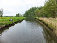
- Where the earth wall turns to the right, take the path on the left, almost turning back on oneself. This leads down the bank, then turns round to lead down to Wareham Common and the River Piddle. The name stems from the 10th-century Old English or Germanic word Pidelen, which translates to “marsh,” “fen,” or “muddy stream”. In the 19th century, Victorian mapmakers and upper-class locals deemed the name “Piddle” too vulgar for polite society. They attempted to rename the lower stretches of the waterway The River Trent or the North River. While the alternative name “Trent” can still be found on old estate maps and property boundaries, the original Saxon “Piddle” remains the official name today.
- Take the riverside path until it leads up to the North Wall, the continuation of the earth wall, at Shatters Hill. In local Dorset dialect and old English street naming traditions, “Shatters” is a direct, polite evolution of a much coarser word for human waste or sewage. Historically, the lane ran downhill toward the marshy floodplains of the River Piddle (Wareham Common). Before the advent of modern plumbing or organized town infrastructure, the ditch running alongside this steep slope served as a natural, open gravity-fed channel for the town’s waste to run out of the defensive walls and down toward the common. Over the centuries, the rough local nickname for the “waste ditch” stuck, gradually softening into the street name we see on the map today: Shatters Hill.
- At the end of the Hill turn left onto North Causeway for a brief excursion to the North Bridge, a Grade II listed structure and Scheduled Monument that serves as the historic northern gatehouse to the town. Historical records from 1483 document an early stone bridge at this exact location, which historians believe replaced a strategic Saxon or Norman wooden drawbridge system. If you step down to the western riverbank, you can see that the bridge is an architectural patchwork stitched together across centuries; the northern pointed arch dates back to its medieval roots, the central and southern arches were rebuilt by Dorset stonemasons in 1667, and the entire structure was widened in 1846 to clear horse-carriage bottlenecks. Look closely at the upstream side to spot the sharp triangular stone cutwaters designed to split the current, featuring overhead stone recesses that once acted as safety refuges for pedestrians dodging wide carts.
- Return back up North Causeway, past Shatters Hill until you come to a church on the left. This is St. Martin on the Walls Church which stands on the North Walls of the town. The church dates back to around 1030 AD, featuring early wall paintings and a memorial to Lawrence of Arabia.
- By the side of the church is a walkway, take this which leads through to St Martins Lane. Turn left, then at the end, right onto Mount Pleasant. A little further on, to the left, is a footpath, take this.
- The footpath leads around a grassed area bound by low earth banks known as the Bowling Green and the area is a Scheduled Monument, though its exact historical origins are still debated. One popular local legend suggests the flat clearing was engineered in the Tudor era for mandatory community archery practice, where townsfolk were legally required to hone their skills with the longbow. However, while it does not appear on town maps from 1746, it is clearly marked on surveys from 1762 as the “Bowling Green Garden,” matching an 18th-century craze where wealthy Georgian society constructed manicured lawns for the fashionable pastime of lawn bowls. Whatever its original intent, the quiet enclosure took on a much louder public role by the 19th century, when it transformed into a regular site for seasonal town fairs. The quiet ramparts were regularly packed with travelling merchants, boxing booths, shooting stalls, hoopla rings, and massive helter-skelters. Today, the earthwork has returned to a peaceful green space. If you look closely at the eastern end of the rectangular bank, you can still trace the original ramped causeway that allowed Georgian bowlers—and later, Victorian fairgoers—to walk directly onto the green straight from the summit of the Saxon town walls.
- Keep to the footpath which eventually merges onto East Walls, which is a residential road. At the end it turns sharp right onto Connegar Lane with a cemetery on either side. This is part of the grounds to Wareham Priory. The name of the road is a direct linguistic fossil derived from the Middle English words “coney” (meaning rabbit) and “garth” (meaning yard or enclosure). When translated, Connegar Lane literally means “Rabbit Warren Lane.” The lane is where the medieval Priory kept its domestic rabbit warren to supply the monks’ kitchens with meat.
- Follow the lane round into Church Lane, then onto Church Street. On the left is the entrance to Priory Church of Lady St. Mary. The priory was founded around 705 AD by St. Aldhelm, Bishop of Sherborne. This became the burial place of King Edward the Martyr after his brutal murder at nearby Corfe Castle in 978 AD. His body was later moved to Shaftesbury. The modern Church is constructed on the same site as the original Minster. The church boasts a 14th century chancel and Tudor Tower with a ring of 10 bells. The Church contains a number of interesting objects, including five 7th-to-9th-century Brittonic inscribed stones, a 12th century lead font and two 13th century military effigies.
- Continue along Church Street which leads out to the Quay, the start of the walk. For refreshments they are pubs around the quay, but we have picked the Kings Arms. Head up through town on South Street, continue across the crossroads onto North Street and the pub is on the left.
Pubs
Kings Arms, Wareham

- Address
- 41 North St, Wareham BH20 4AD
- Website
- https://www.kingsarmswareham.co.uk/
The Kings Arms stands out like a beautiful anomaly in the town centre. While the surrounding streets are dominated by grand post-fire Georgian red brick, this striking pub is built from colour-washed rubble and capped with a massive, sweeping thatched roof.
The building’s architectural footprint dates back to the 18th century, functioning originally as a private dwelling. Its true historical claim to fame is its miraculous survival. On that fateful Sunday in July 1762 when the Great Fire of Wareham razed two-thirds of the town to the ground, the shifting summer winds pushed the embers just clear of this section of North Street. As a result, its highly flammable thatched roof escaped completely unscathed. By 1860, the building officially became a licensed public house, inheriting the name of a former tavern from South Street. Today, it remains one of the few places where you can drink under the same thatch that witnessed the town’s greatest disaster.
The pub boasts a traditional interior featuring a characterful public bar with an original flagstone floor, an inglenook fireplace with an open roaring log fire in winter, and a distinct drinking corridor. A dedicated Dining Area where home-cooked pub food, classic Sunday roasts, and occasional themed dining evenings are served.
There is a changing selection of traditional cask ales.
A secluded beer garden offers a peaceful place to drink and converse.
Features
Wareham History
The Saxons who settled here named the growing settlement Wer-ham; literally meaning “the homestead by the weir” or river-dam. Because it sat at the head of a navigable river with established cross-channel trade routes, it fast became one of the most important towns in the Kingdom of Wessex. Its high status is confirmed by the Anglo-Saxon Chronicle, which notes that King Beorhtric of Wessex was buried here in 802 AD.
Wareham’s strategic wealth eventually caught the attention of Danish raiders. In 875 AD, a massive, battle-hardened Viking army led by Prince Guthrum marched south from East Anglia. They caught the Saxons completely off guard, storming Wareham and occupying the town. Simultaneously, a massive fleet of 120 Viking longships sailed into Poole Bay, anchoring in the river to blockade the settlement.
King Alfred the Great marched a Wessex army to the gates, realizing that a direct assault on the river-protected town would be a bloodbath. Instead, he besieged the occupiers, starving them out until Guthrum agreed to terms in 876 AD.
The Vikings swore a sacred oath upon a holy ring dipped in sacrificial blood, the highest, most binding vow a Norseman could make—promising to leave Wessex forever. They lied. Under the cover of a pitch-black night, the Viking cavalry slaughtered the Saxon hostages they had traded, broke out of the town, and fled west toward Exeter.
However, karma struck swiftly on the water. The blockading fleet of 120 Viking ships tried to sail down the Dorset coast to join them but was caught in a violent summer storm off the cliffs of Swanage. Every single ship was wrecked, drowning thousands of Norse warriors and permanently crippling Guthrum’s campaign.
Realizing that Wessex could not rely on shattered treaties or lucky storms, Alfred launched a revolutionary defensive strategy. He transformed Wareham into a Burh—a fortified, garrisoned market town. He ordered the construction of the massive, 2,200-yard earth ramparts that still survive today, turning Wareham into the fourth largest fortress in Wessex. The walls were capped with heavy timber palisades and wooden fighting towers.
Inside the walls, he laid out the precise grid system of streets. This wasn’t for aesthetic reasons; it was a military design allowing soldiers stationed at the central crossroads to run down North, South, East, or West Street to reinforce any section of the wall under attack in mere minutes.
To fund the garrison, Alfred granted Wareham a royal market charter and established two royal mints. Striking its own silver coinage, Wareham became an economic powerhouse.
Alfred’s engineering was so effective that when the Vikings returned to attack up the River Frome in 998 AD and again under King Canute in 1015 AD, the town’s core defences held strong, cementing Wareham as an unyielding fortress of the Dark Ages
Wareham is one of the finest surviving examples of an Anglo-Saxon fortified town in England which retains much of its Saxon ramparts and grid system of roads. However, as you look around the town centre, you will notice a striking contrast: these dark-age layouts are lined with handsome 18th-century red-brick architecture. This unique look is the result of the Great Fire of 1762. On a windy summer Sunday, hot ashes thrown onto a rubbish heap behind the Bull’s Head Inn sparked a catastrophic blaze. It destroyed over 130 timber and thatch buildings—roughly two-thirds of the town. The town was rebuilt in the grand Georgian style of the day, but builders were ordered to follow Alfred’s original Saxon street grid, creating the stunning historic blend you see today.
Images


Route Validation Cards
Validation Date - 2023-07-06
- Time of Walk: 10:30:00 to 15:00:00
- Validators: Griff, Kat
- Weather Conditions: Sunny intervals, warm
- Notes: Initial route undertaken
Summary of Document Changes
Last Updated: 2026-11-03
- 2026-11-04 : Initial publication






0 comments:
Post a Comment