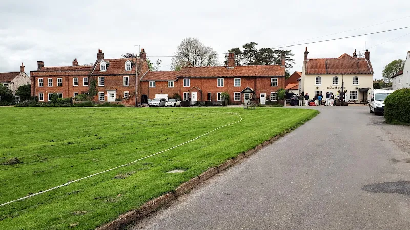
The intention of the days outing was to visit some key areas that had suffered under the December Storm Surge. The intention of this walk was to include Blakeney, Cley and Salthouse, however the path from Blakeney to Cley is closed due to multiple breaches of the sea defences as a result of the surge. The defences from Cley up to the beach have also been breached resulting in the closure of this section of coast path. At least there is a viable alternative at Cley using the beach road, whereas the alternative between Blakeney to Cley is the main Coast Road which is not a recommended walk due to the lack of pavement and the busy nature of this well used coastal route. There is one other alternative route via Wiveton Downs and Glandford. Although this offers some spectacular views it is not really a coast path - this route will be covered in a posting on this site in the near future. Therefore on this particular day of heavy showers and gale force westerly winds Blakeney was reached using the Coasthopper service.
So, in cardinal order of west to east, here is a description of the damage encountered. Firstly Blakeney where the Norfolk Coast Partnership lists the storm surge damage as:
Blakeney Freshes was totally inundated with seawater (c. 157 ha, to a depth of 1 - 2+ metres). There are numerous breaches in the sea wall (total c. 500 metres), some of which are at saltmarsh level so that monthly high water spring tides will put more water onto this area. Water is being evacuated from the Freshes through the one functioning sluice, so the water level has dropped a little in 5 days.
At the time of the surge the media was full of pictures displaying a boat marooned on top of the quay after the floods had receded. This has now been removed and appears to be the same cruiser which languishes in a forlorn state against the sea defence adjacent to the first breach. The rusting hull has several notices taped to it, these are orders for removal. Obviously no-one has claimed the boat. There is no indication of where it came from and it may well have been torn from its mooring and been brought in on the flood tide leaving the owners lost as to its current whereabouts.
A little closer to the harbour is a Wayfarer dinghy sitting atop of the defences and blocking the coast path. This was obviously deposited here by the tide. Not that there is any point to continuing along the coast path with the breach by the cruiser being a full 20 yards in length and beyond that a fence denying access further along the path. Reports from the Environment Agency and Norfolk Council website attest to there being multiple breaches along this path through to Cley. The EA are currently assessing the damage and they have stated that the repair would be both costly and challenging. Therefore the agency is consulting environmental bodies and the people of Blakeney on the future of protecting the Freshes marsh and hence the reinstatement of the coast path. It would be a very sad loss to have this section of coast path permanently closed as it is an excellent example of the landscape that is typical of the Norfolk Coast Path and one which I have personally walked on many occasions and found a real pleasure in doing so.
I do get the impression that the abandonment of the marsh to the sea is something which the residents are firmly against. The marshes and the coast path are the reason for visitors coming to the village. As the landlord of the Kings Head in Blakeney was heard to say whilst we dropped in for a pint, "if there is no coast path or marsh then why would anyone want to visit". It was interesting to listen to this man who experienced the flood first hand. Although he was not specifically speaking with us, he was nonetheless relating the stories to another couple. He depicted the level of the water in the bar then emphasized that the level dropped a full ten inches when the waters first breached the defences and flooded into the marsh.
Moving onto Cley, once again the Norfolk Coast Partnership has listed the details of the damage:
- Two major breaches in the shingle bank, at Salthouse (400m west of Little Eye) and Pope’s Marsh (east end of Sea Pool).
- Extensive wash-back of shingle, up to 100m onto marshes.
- Beach car park covered in shingle, other car parks extensive debris.
- North Hide washed away, other hides damaged or inaccessible due to boardwalk damage.
- Extensive stretches of boardwalk damaged.
- Extensive areas of fencing lost, damaged or buried under shingle.
- Several bridges damaged or washed away.
Despite starting out on the coast path past Cley windmill, progress is soon hampered by a fence blocking the way with a typed notice to declare the path closed due to breaches caused by the storm surge. In reality much of this has already been repaired and some walkers were seen to have clambered up the defence bank beside the beach road to walk along it. Hopefully this will be officially reopened in the near future as, although the road is not particularly busy, it is nonetheless single track and one has to constantly make way for passing vehicles.
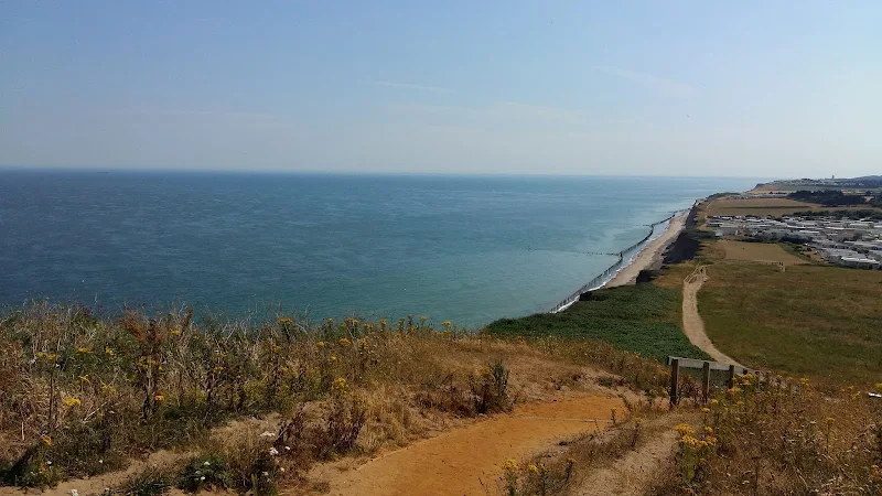
Cley beach gave a sample of the damage along this section of coast. The shingle that typifies this length of the coast path has shifted to such an extent that it was unrecognisable. The Cley beach car park was covered in deep shingle. The square shelter where I have taken rests on its seats on previous occasions was half buried in shingle. The old WWII pillbox is nearly underneath the shingle. Shingle has been swept across the marsh. The shingle ridge that defended the marshes is now flattened all the way through to Salthouse car park. This really has changed drastically since our last visit. There was even a section of coastline on the beach side where the shingle had eroded to the sandy structures that lie beneath, with assorted debris strewn across the beach at this point. Sections of brick wall. Large stones and chunks of concrete which gave a moonscape appearance. Further along, and throughout the distance to Salthouse were numerous metal rails sticking vertically out of the shingle. Eroded with rust. Encrusted in stony crustaceans. They line in regular procession along what used to be the height of the ridge. At a guess these are probably old WWII defences but this needs verifying.
It was along this stretch of shingle that the USAF Helicopter crashed in January 2014. There are no reminders left of this tragic accident other than some of the metal defences cut down into a pile of debris which may have been done to gain access to the area it came down.
There are a couple of areas where major breaches left a flow of water between sea and marsh. These are evident from the banks that have formed either side of where the water flowed. Although the natural tide action has now sealed these breaches no doubt future breaches will be seen at these points. Local media has recently stated that this is part of a natural healing process with the sea rebuilding the shingle ridge. I personally think this is rather optimistic as the same process occurs along the Suffolk broads at Easton, Covehithe and Benacre. Storms regularly breach across the beach forming channels of water and then calmer weather results in the tide repairing the breach but there is never a build up of a ridge to provide a lasting seal.
The beach car park at Salthouse is unrecognisable. The only give away that it was the car park is the post that contained the emergency telephone. This eight feet high post had a yellow emergency telephone at chest level and was topped with a clear notice. All that is now visible of this is the sign at the top with the rest buried beneath the shingle, giving a clear indication of the depth of the shingle that has swept across the car park.
Coasthopper Bus Service
One last point on a different subject is the changes to the Coasthopper bus service. This has been a successful, well used service for both locals and visitors to North Norfolk, providing an easy method to navigate to the various destinations along the coast path for sectional walkers. The service provides a link between Cromer, Hunstanton and Kings Lynn, half hourly in summer and hourly in winter and has a dedicated crew of drivers who are friendly, helpful and at times entertaining, providing local information and even poetry recitals. The buses can be flagged down at any point and the driver will stop if safe to do so. It has always been one of the reasons for returning to the Norfolk Coast Path in my humble opinion.
However, the service has been running at a substantial loss and Norfolk Council are cutting back on providing the shortfall. As stated, the service is successful in the number of passengers it caters for but the major problem has been that the majority of these passengers are bus pass holders and, certainly during summer months, are taking advantage with lengthy journeys for which the company are only reimbursed with the standard flat fare. Whether a bus pass passenger travels one mile or sixty, the bus company only receives a sum of, I believe, a little over one pound. This is where the loss is being made as on most journeys the fare paying passenger is very much in the minority. One driver stated that they are legally obliged to take bus pass users and the only way around this is to make the service into a pre-booked service which would totally defeat its purpose.
In the winter of 2014 Stagecoach took over Norfolk Green who has been providing the Coasthopper service for many years and there has already been a noticeable change in the service and its costs. It has always been a series of three separate services, namely CH1, Kings Lynn to Hunstanton, CH2, Hunstanton to Wells and CH3, Wells to Cromer, although effectively the buses using the route would just change their service number as they went along resulting in a continuous and seamless journey with no connections to be met.
The service now appears to have fragmented so one now needs to change buses at Wells in order to continue the journey. I suspect this has been implemented so that bus pass passengers then need to obtain a second ticket for their onward journey and the company then gets a reimbursement for both parts of the journey. Normal through tickets are still available for fare paying passengers but there are no guaranteed connections. I cant blame the company for adopting this policy when they are effectively giving free rides, as they cannot run at a loss forever. However, I do feel that the whole idea of offering free bus passes has not been thought through properly and the Government really needs to either address the abuse of the system or provide the appropriate funding to compensate the companies that are having to provide the service. There have been petitions against this, notably from Norfolk Council who has to provide the refunds but the Government has turned a deaf ear to these objections. There is also a petition to save the coasthopper which I would ask for all who are concerned to sign
There has also been a large increase in the fares to help fund the bus pass passengers. I don't resent those with bus passes from taking advantage but I do resent the mess that the bus pass policy has resulted in. Even so, a day pass now costs £9.00 and gives access to all the Coasthopper services along the route. That isn't bad for a day out.
Whilst writing this article Stagecoach managing director, Andrew Dyer, was quoted as saying that he was confident the summer timetable would run, but that the position was not definite for the winter season. I just hope this service continues to operate as it has always done. It would be a very sad loss if it is discontinued and I am sure a lot of businesses along the route will suffer from the lack of visitors.
The service was subsequently passed on to two companies, Sanders and Lynx. Its future is uncertain