Bittern Line Walk - North Walsham to Wroxham
Sunday, 24 January 2021
|
No comments
|
![]()
An 11 mile walk linking the Bittern Line stations of North Walsham and Wroxham
A rewarding days walk through the Norfolk countryside that links the railway stations of North Walsham and Wroxham. The route passes across an historic battleground, through woodland, encountering picturesque hamlets and village churches along the way. The end section uses the Bure Valley Railway path that follows the narrow gauge steam railway past Coltishall and down to Wroxham station.

Walk Statistics
- Start location: North Walsham
- End location: Wroxham
- Distance: miles ( km)
- Total Gain: ft ( metre)
- Total Descent: ft ( metre)
- Min Height: ft ( metre)
- Max Height: ft ( metre)
- Est. Walk Time:
- Walk type: Linear
- Walk Grade: Easy
- Terrain: Footpaths, tracks and country lanes
- Obstacles: Well defined route throughout

Maps
The following maps and services can assist in navigating this route. There are links to printed maps and links to downloadable GPX route data for importing into navigational software and apps.
- Ordnance Survey Explorer Map
- OS Explorer 252 - Norfolk Coast East
- Ordnance Survey Explorer Map
- OS Explorer OL40 - The Broads
- GPX Route File
Accommodation
Woodhill Park CampsiteView in OS Map | View in Google Map
- Website
- https://www.woodhill-park.com/
- Description
- Located on the clifftops at East Runton, half way between Sheringham and Cromer, this highly recommended touring site is ideal for exploring North Norfolk with public transport available to many destinations from the entrance to the site.
Transport
Greater Anglia - Train Service
- Service Details
- Bittern Line - Bittern Line linking Norwich with Cromer and Sheringham
- Timetable
- Bittern Line
Walk Notes
This is yet another walk along the Bittern Line railway that links Norwich and Sheringham, this specific walk linking the stations of North Walsham and Wroxham. The route does omit Worstead Station for which a road and country lane route would be required to complete the distance. This route provides a much more pleasant affair and is suitable as a days walk although one should take food and drink as there are few places where refreshments are available.
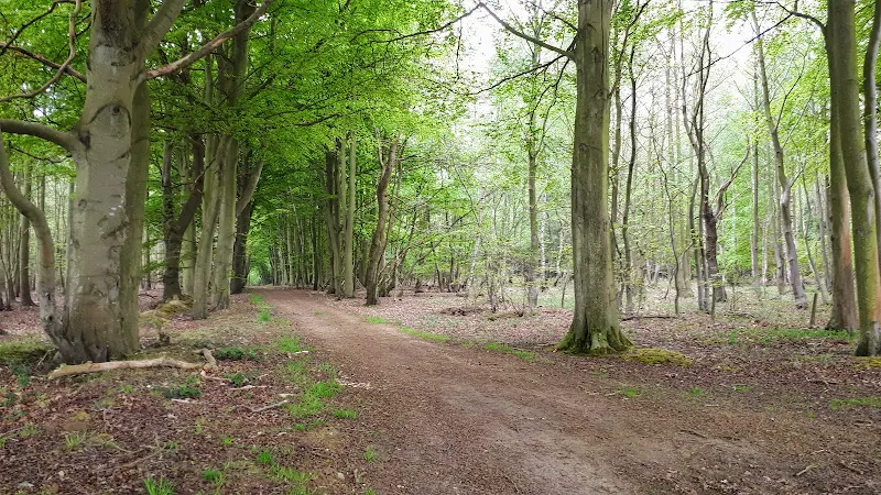
The walk starts at North Walsham railway station from where a short walk out of town leads to the footpath through to the woodland on North Walsham Heath. The footpath is not difficult to find as it is waymarked down the lane between the water towers and the end of the terrace of houses. A short broad tarmac track leading onto fields that developers are hoping to build upon. But wait! Before heading across the fields in stout and determined fashion, take a step closer to the water tower, and there, humbly placed on a flint lined base and backed by a brick and flint wall is the historic Stump Cross. A well weathered stone base that once held a stone cross. This is said to date from the 14th century and was most likely nothing more than a wayside cross despite what the plaque on the wall states, proudly proclaiming that this was the place where the Battle of the Peasants' Revolt took place in 1381.
It is true that the fields that lay ahead was the location where the forces of Henry De Spenser, Bishop of Norwich, confronted the Peasant Rebels led by John Litester. The peasants were aggrieved at legislation that had forced them to work for low wages during a period when there was a shortage of labour following the ravages of the Black Death which had severally reduced the population. Introduction of additional taxes provoked rebellions across the eastern counties and a force of untrained rebels led by Litester confronted the trained forces of the Bishop, himself a nobleman and former soldier.
The fields and the recognised location of the Battle are some distance from the cross and it is most likely that the cross was a convenient geographic feature that could mark the terrible event in which, so some say, hundreds or even thousands of rebels were slaughtered across the fields and in the woodland as they attempted to flee the onslaught. Others are said to have fled to North Walsham church where they barricaded themselves inside only to be massacred by the Bishops forces who broke down the doors. Litester was eventually captured and publicly executed. How true these details are is open to conjecture as it is purely folklore and handed down stories since there are no eye witness accounts documented of the battle although it is undisputed that the battle took place.
As stated earlier, these fields are being proposed for a massive housing development. I wonder just how many of those new householders will hear the wailing souls of tortured rebels screaming out in the still night air and disturbing their slumbers. Or see phantom disfigured peasants menacingly lurking in their hallways. Having said this, I have found no ghostly tales from this area and for any casual rambler who strolls across this area and through the woods on a pleasant sunny day, then nothing could be further from ones mind than ghosts and ghoulies. We can only hope if there is a ghostly presence that it scares the developers away from this historic site.
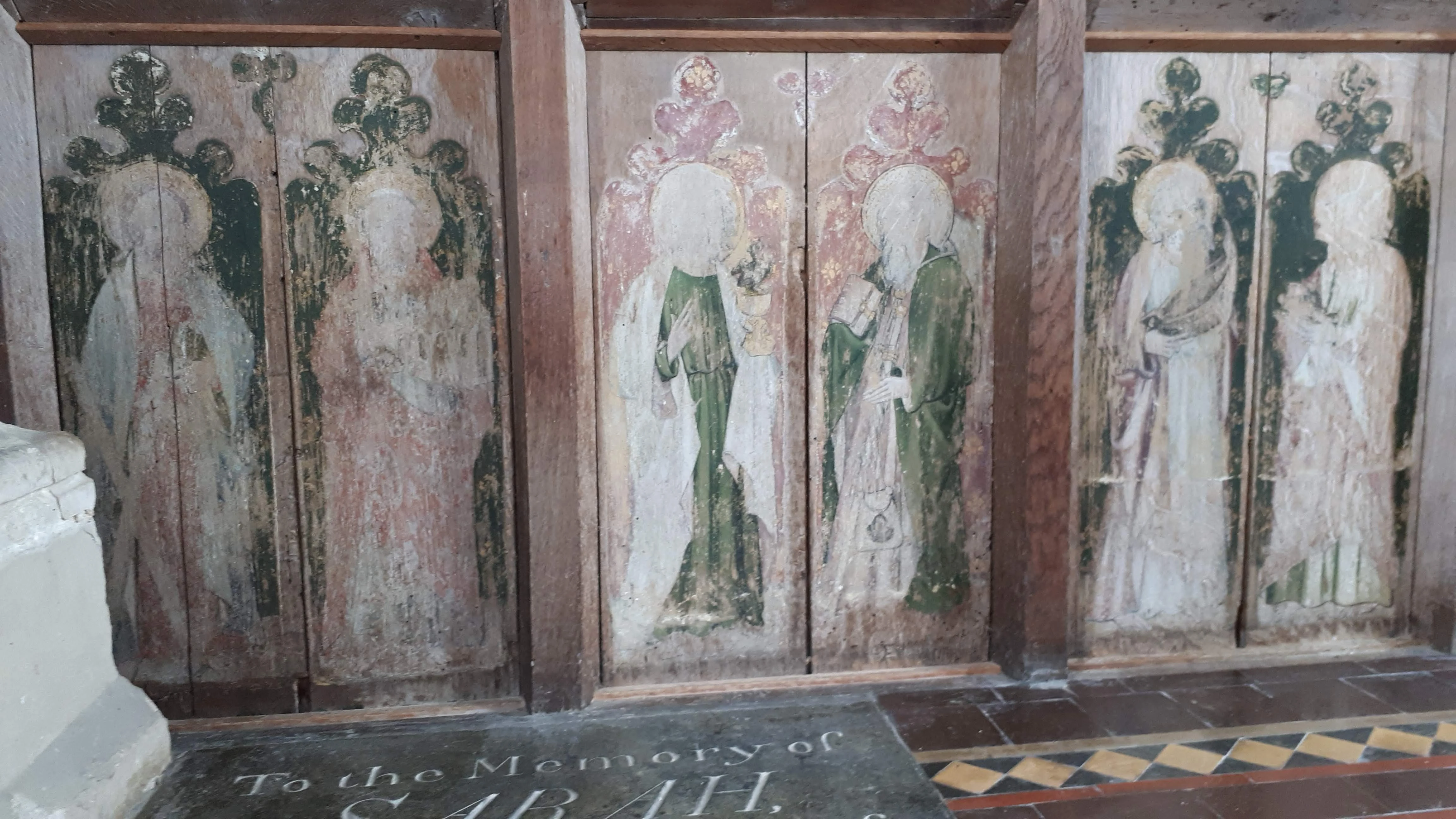
The path through the woods leads out across the Swanton Hill Common and onto the lane that passes through the picturesque hamlet of Swanton Hill. A footpath leads down the side of one of the houses and makes a straight line course through to the Swanton Abbott church of St Michael which lies some distance from the village beyond. It is well worth taking some time out here to view the interior of this historic church. A heavy 13th century iron plated oak door leads into the humble abode. The rood screen that separates nave and chancel is probably the most amazing of artefacts in this church. These wooden panels bear the remains of icons that were painted during the 15th century. They have been defaced from the course of time and the hands of the puritan iconoclasts but are nonetheless worth seeking out. Another interesting artefact is a small brass plaque set into the aisle that features three languages in its inscription, Greek, English and Latin, commemorating the interment of Elizabeth Knolles who passed away aged 60 on September 18th 1641.
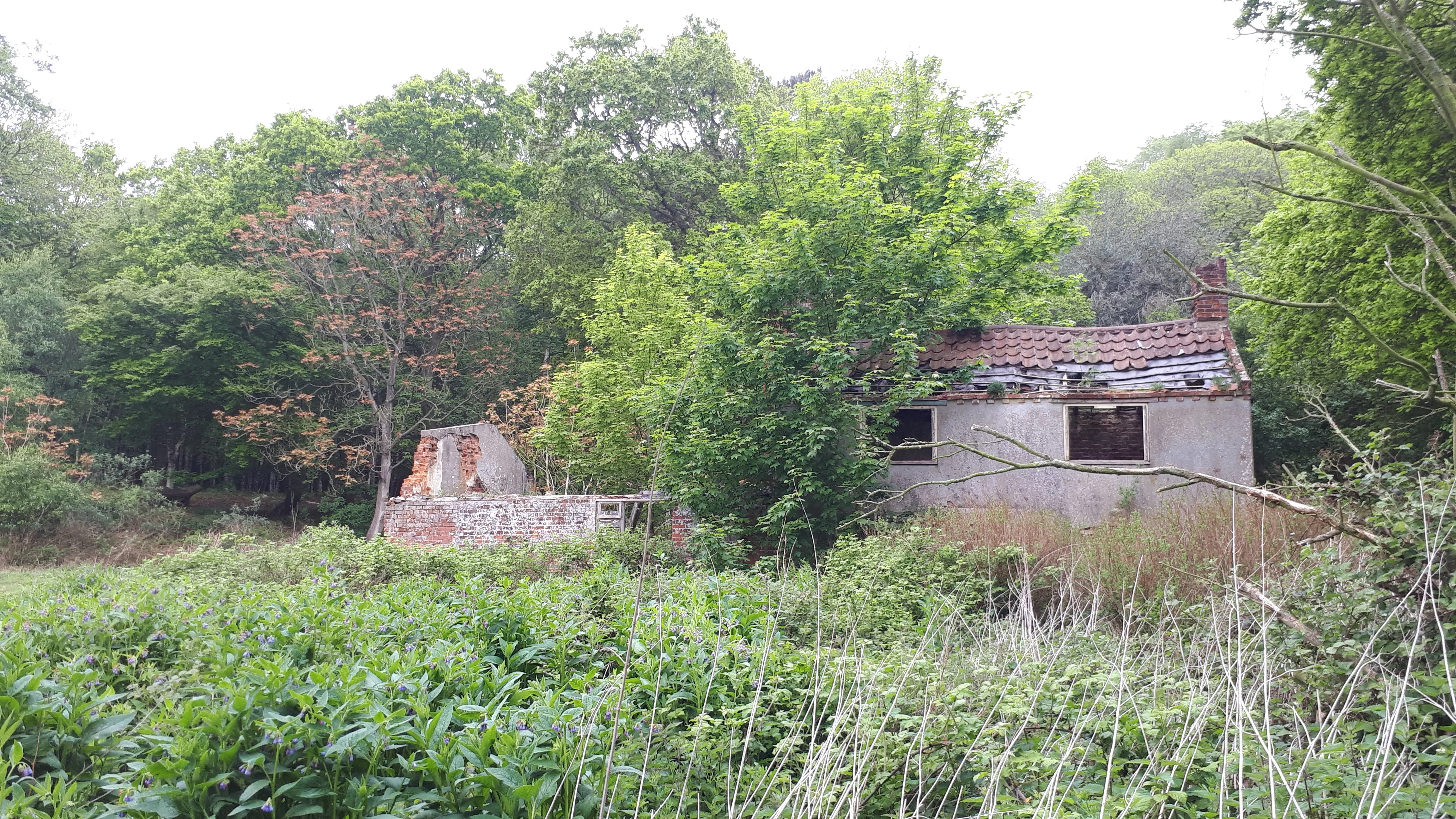
The walk continues passing through the village of Swanton Abbott with the unfortunate sight of yet another closed pub. Well the former Jolly Farmers certainly looked closed on this occasion with no sign of life other than a pub related sticker in a rear window to indicate that it was once a pub. In the spring of 2019 the local community attempted to take over its running but it certainly looks to have closed its doors for good so we can only assume this attempt failed.
Pressing on, one comes to the narrow meadows alongside the Stakebridge Beck stream which curves around the valley to drain into the River Bure. The path follows the meadows with numerous ageing stiles to negotiate before emerging on the Skeyton road. This is rough ground that has probably been left undisturbed for centuries and is a sheer pleasure wandering across it. The path is easy to pick out, well trodden by ramblers, dog walkers, farm vehicles and feet in general.
The country lane this brings one out on requires a short left then right onto the next footpath through to Lamas. However, if one time the walk right and one has the time, a short distance away to the right and well within sight is the Skeyton Goat Inn which provides a worthy excursion from the route for refreshment.
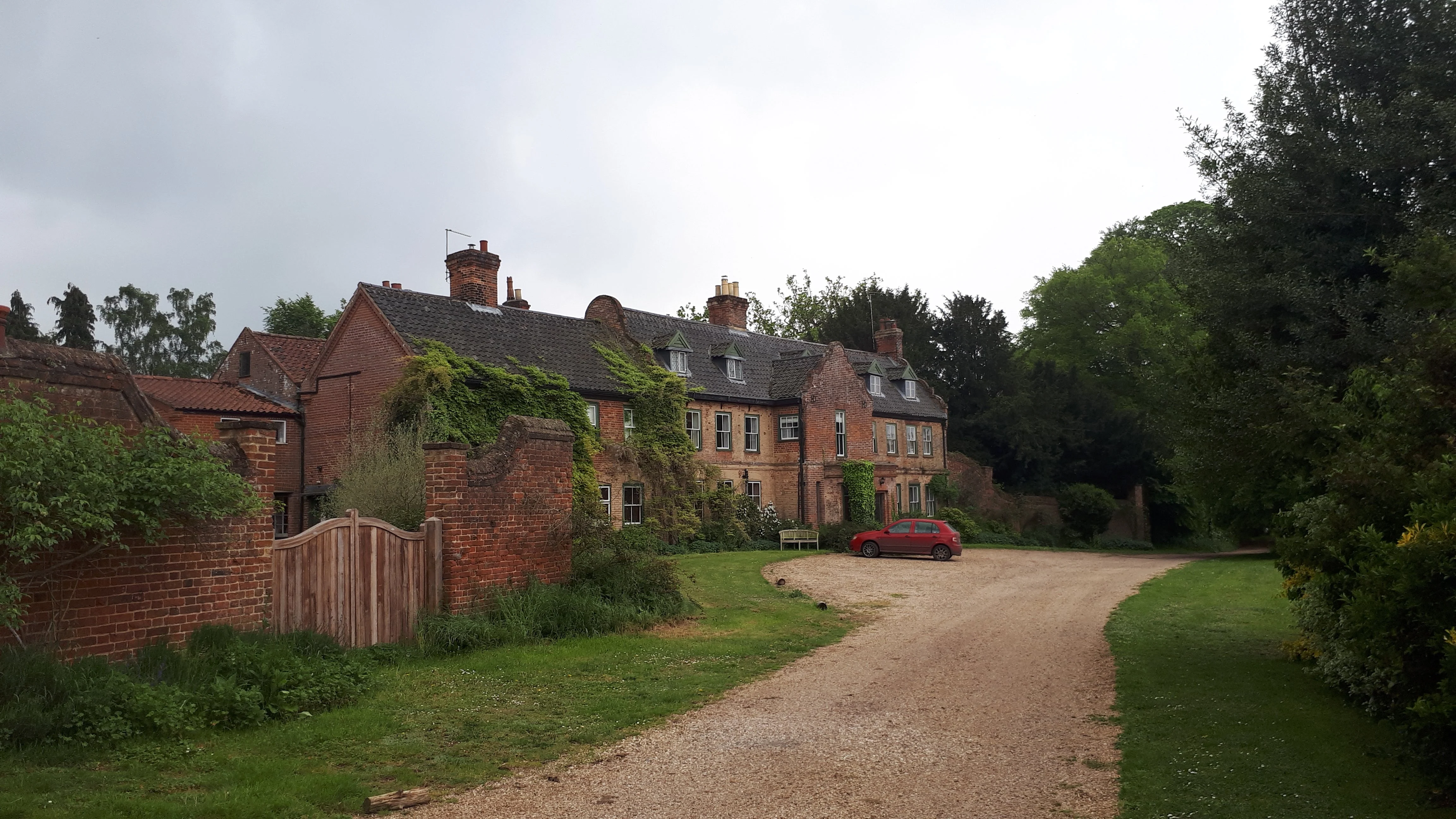
There is a footpath leads down the side of a cottage and then along the field boundaries beyond. It cuts across the field on a farm track then descends into the village of Lamas, passing by Lamas Hall, a large 17th century manor house overlooking the parkland to Lamas church.
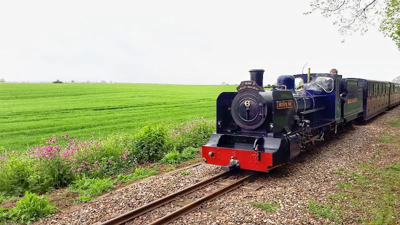
Country lanes and tracks lead down to the Bure Valley Railway, joining it at the 16th century Little Hautbois Hall. There is then a 3 mile wander alongside the narrow gauge railway into Wroxham station with the delights of steam trains passing as one proceeds onwards. There are always lots for smiles and waves from the crew and passengers such is the friendliness of this great little Norfolk railway.
Route Validation Cards
Validation Date - 2019-05-18
- Time of Walk: 09:00 to 13:00
- Validators: Griffmonster, Kat
- Weather Conditions: Overcast with sunny periods
- Notes: Initial route undertaken
Summary of Document Changes
Last Updated: 2026-04-20
- 2019-06-03 : Initial publication
- 2021-03-13 : Update to include website improvements
- 2021-03-17 : Update website improvements and removal of ViewRanger reliance
- 2021-12-01 : Removal of ViewRanger links due to its imminent demise
- 2026-01-12 : Major website update with all walks recast to the new format


0 comments:
Post a Comment