Route details, maps, pubs, features, local history and folklore for a wide variety of walks focusing primarily on Norfolk and Suffolk

label

Norfolk Label Search

Fen Rivers Way: Kings Lynn to Downham Market

looking back at Wiggenhall St Germans

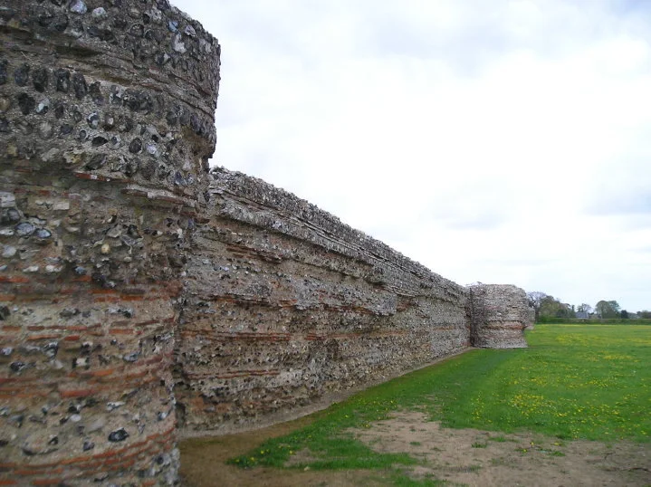
The northern most section of the Fen Rivers Way long distance path

This 12.5 mile linear walk linking Kings Lynn and Downham Market following the River Ouse. The landscape is flat with the broad unwavering river leading the way. There are churches and even a ruined church to provide interest. An easy, straightforward walk.

A Circular walk to Geldeston Locks from Beccles

Riverside walk to the Geldeston Locks pub

A scenic riverside walk linking Beccles with the historic Geldeston Locks pub, this route offers meadow paths, peaceful stretches of the River Waveney, and glimpses of Norfolk’s rich folklore and heritage. Perfect for an afternoon outing, it combines gentle countryside walking with a memorable stop at one of the region’s most characterful pubs.

A Hike along the Marriotts Way

Sculpture that marks the start of the Marriotts Way at Norwich

The Marriott's Way links Aylsham and Norwich following the former trackbed of the Midland and Great Northern Railway.

The Marriott's Way is a footpath, bridleway and cycle route, which follows the routes of two disused railway lines, and runs between the historic market town of Aylsham and the medieval city of Norwich. Along with the mileage markers which are crafted from old rails, complete with a metal rubbing plaque, there are numerous concrete sculptures, village markers, interactive sound boxes and benches which all provide interest and information along the route.

Angles Way - Belton to Great Yarmouth

An 8 mile walk along the Angles Way from its start at Great Yarmouth to Belton

The journey along the Angles Ways begins with a walk along the banks of Breydon Water to Belton. Along this route can be seen the impressive remains of the Roman fort Gariannonum at Burgh Castle. This is a simple afternoons walk with a frequent bus service linking Great Yarmouth and Belton for the return journey. On this occasion we walked the path in reverse having set up camp at Belton.

Dilham and Honing Circular Walk

General Representative Walk Image from this walk

A circular walk taking in the Weavers Way, Honing and Dilham

This walk explores a part of the Weavers Way long distance trail, taking in the restored Honing station before departing to follow the Dilham canal around to the village of Dilham where the Cross Keys pub provides a worthy place to take a break.

Norfolk Coast Path - Heacham to Brancaster

General Representative Walk Image from this walk

A walk of beach, prom, dunes and marsh. A thoroughly varied landscape all told

From the cliffs of Hunstanton to the marshes of Thornham, this walk gives a variety of scenery. The Norfolk Coast Path is an excellent way to explore this part of the British Coast and what better way to start than at the westerly end. Even though Hunstanton is the official start, there is a promenade from Heacham for those wanting to go that little bit farther. There's long sandy beaches, there's multi-coloured cliffs, there's dunes, marshes, nature reserves and creeks and even a Norfolk hill from where where you can view across The Wash to Skegness on a clear day. With excellent public transport links, plenty of watering holes and accommodation, this is indeed a most thoroughly recommended walk.

The Peddars Way - Castle Acre to Heacham

General Representative Walk Image from this walk

A trek along the Peddars Way, following an excursion to Heacham for accommodation.

After three days of walking, the Peddars Way finally reaches the Norfolk coast. Heacham is not officially on the Peddars Way or the North Norfolk Coast Path, but it was the only place we could find available accommodation in the Sedgeford and Ringstead area for that particular night. It had been a tough few days walking on hard tracks and lanes which had took its toll on the feet so the prospect of gentler coastal walking gave a focus to complete this National Trail and continue on the North Norfolk Coast Path. This section of the walk with its open landscape and undulating hills allowed us to see just how straight the trail was - it could be seen stretching out into the distance for miles.

The Peddars Way - Watton to Castle Acre

General Representative Walk Image from this walk

A long and straight trail across lanes and tracks from Watton to Castle Acre.

Once at Little Cressingham the Peddars Way draws a long straight line through across the landscape. Gentle undulations provide little in the way of changing scenery and The Blue Lion at North Pickenham provides a very welcome half way point to rejuvenate ones energies and rest ones weary legs and feet from the hard tracks and metalled lanes. Castle Acre is a novel little village with its castle and priory ruins, both of which are well worth exploring.

The Peddars Way - Knetishall Heath to Watton

General Representative Walk Image from this walk

An easy trek across Breckland on the initial stages of the Peddars Way.

Being an old Roman road, the original Peddars Way is dead straight and there is little modern deviation from the original path all the way through to the North Norfolk Coast. This first stretch cuts through heath and Nature Reserves of Breckland using established broad farm tracks which present an easy going walk.

The Peddars Way - Thetford to Knetishall Heath

General Representative Walk Image from this walk

A trek from Thetford to the start of the Peddars Way

Thetford is the closest town to the start to the Peddars Way and there is no public transport between Thetford Railway Station and the starting point at Knetishall Heath. Looking at the OS Map, there is no direct route other than to walk along the main A1066 Thetford to Diss road. This is a busy road with no pathway and there is a good 4 miles walking before turning off down village lanes through Rushford where a little peace and serenity is regained to set the tone for the Peddars Way.

Cromer to Pretty Corner

General Representative Walk Image from this walk

Walk from Cromer through the hills and woodland to Pretty Corner

Pretty Corner is woodland around former quarries that is located in the hills above Sheringham. For a more adventrous and rewarding walk, one can walk from Cromer, navigating through the woodland that cover the hills above the coast. Some great views and and magnificent woodland. Return can be made by bus back to Cromer

Blakeney to Binham Circular Walk

General Representative Walk Image from this walk

A great full days walk that takes in the ruins of Binham Priory

An excellent wander across the Norfolk countryside which takes in the magnificent ruins of Binham priory and the awesome landscape where the route navigates through the valley of the Stiffkey river to the coast path

Hunstanton to Wells Night Walk

Hunstanton to Wells Night Walk

A challenge walk along the Norfolk Coast between Hunstanton and Wells

An evening and night walk along the Norfolk Coast between Hunstanton and Wells. This coastline changes with the time of day and although many walk this during the daytime, the evening and night provides a whole new insight to the path as well as seeing very few folk about.

NOTE

This is a walk summary intended to provide the user with just the essential information in order to navigate the walk route. Fully detailed information notes, refreshment stops and walk features are not included in this. A full write up will be included in the near future.

Hunstanton to Wells Night Walk - Essential Information

Walk Statistics (calculated from GPX):

  • Start location: Hunstanton 
  • End location: Wells 
  • Distance:   miles (  km)
  • Total Gain:   ft (  metre)
  • Total Descent:   ft (  metre)
  • Min Height:   ft (  metre)
  • Max Height:   ft (  metre)
  • Walk Time:  
  • Walk Grade: Challenging
  • Terrain: Footpath

Maps:

The following maps and services can assist in navigating this route. There are links to printed maps and links to downloadable GPX route data for importing into navigational software and apps.


Route Verification Details

  • Date of Walk: 08/07/2017
  • Walk Time: 19:00:00 to 02:00:00
  • Walkers: Griff, Helen, Robert
  • Weather Conditions: Dark

Walk Notes

A word of warning on this walk, make sure you have arrangements when arriving in Wells as there is no public transport in the early hours of the morning and accommodation hosts probably would not appreciate being woken at that time of day. Food and water are essential as are torches. Despite a good moon, there are places which are shaded and without a torch a tree root can become lethal in the dark, these innate beings tend to try to catch you out.

Night walks were something I had undertaken in my earlier years and this was the first time in many many years I had undertaken such an experience. There is an exhilaration when beginning such a walk, setting out as the sun is heading downwards. Without doubt the experience is unique but there are challenges. One has to fight not only the effort of the miles but also ones body's inclination that it should be asleep. Havi9ng said this, the views and the experiences are well worth all that effort. To walk as the sun slowly s#descends to the horizon, to witness the coast in nothing more than silver moonlight, to dance through the darkness where you meet no-one and hear nothing but the call of an owl and the distant lapping of waves is unique.

On this instance we started early evening at Hunstanton after a meal at a local pub. The sunset was seen between Thornham and Brancaster. Complete darkness was experience through the woods between Holkham and Wells. We had set quite a pace on this and ended at Wells at 2am. Allow more time for a more sedate walk. Prior arrangements had been made to be picked up.

Summary of Document Changes

Last Updated: 2022-02-06

2022-02-06 : Initial publication

Images

East Runton to Aldborough Circular Walk

Aldborough

A 17 mile circular walk through the countryside of North Norfolk linking East Runton and Aldborough

Aldborough is the quintessential English village with a pub facing the large village green where the sound of willow on leather can be heard from the afternoon games of cricket that are frequently staged during lazy summer afternoons. You cannot get a more stereotypically English village than Aldborough.

The Original Paston Way Route

Norfolk countryside

Walking the original route to Norfolk's Paston Way

The Paston Way is a long distance trail around north east Norfolk that takes its names from the eminent Paston family who lived in the area during the 15th century, originating from the village of Paston. Although the route of the trail has been altered in more recent years in order to incorporate additional villages and churches in the area, originally it was a sub-20 mile trail with branches to outlying villages and churches. The original route can still be accessed and is a great way to spend a days walking between Norfolk's North Walsham and Cromer.

diversity_3

Popular Walks