Angles Way - Belton to Great Yarmouth
Monday, 1 September 2025
|
No comments
|
![]()
An 8 mile walk along the Angles Way from its start at Great Yarmouth to Belton
The journey along the Angles Ways begins with a walk along the banks of Breydon Water to Belton. Along this route can be seen the impressive remains of the Roman fort Gariannonum at Burgh Castle. This is a simple afternoons walk with a frequent bus service linking Great Yarmouth and Belton for the return journey. On this occasion we walked the path in reverse having set up camp at Belton.

Walk Statistics
- Start location: Wild Duck Camp Site, Belton
- End location: Great Yarmouth
- Distance: miles ( km)
- Total Gain: ft ( metre)
- Total Descent: ft ( metre)
- Min Height: ft ( metre)
- Max Height: ft ( metre)
- Est. Walk Time:
- Walk type: Linear
- Walk Grade: Easy
- Terrain: Predominantly riverside paths

Maps
The following maps and services can assist in navigating this route. There are links to printed maps and links to downloadable GPX route data for importing into navigational software and apps.
- Ordnance Survey Explorer Map
- OS Explorer OL40 - The Broads
- GPX Route File
Accommodation
Wild Duck Camp SiteView in OS Map | View in Google Map
- Website
- https://www.haven.com/parks/norfolk/wild-duck
- Description
- Wild Duck Camp Site (part of Haven Holidays), Belton
Transport
First Group - Bus Service
- Service Details
- 7 - First Group bus service 7 Great Yarmouth to Belton
- Timetable
- Available here
Walk Notes
Wild Duck campsite at Belton does not allow you on site before 12 noon so by the time we got walking it was well gone 1pm. We walked through to Burgh Castle where we knew there was a pub, the Fishermans Inn, which is located on the river bank. Unfortunately it was still closed for the winter season upon passing, although I would hasten to add that this is now no longer the case and it offers a full 365 day a year opening.
It was at this point I realised that I had left my wallet back at the tent, so we had to return via the road to Belton and restart the walk. What was going to be a 8 mile stroll turned into a 12 mile walk. Nonetheless, it was worthwhile, with the highlight definitely being Gariannonum. I have never seen an ancient structure of such proportions. It was truly awe-inspiring. Unfortunately it was two days too late to witness the ghostly re-enactment of the battle between Seberg and Gonard as detailed in the feature below. Maybe another year!

It was interesting to see Breydon Bridge lifted as we walked along the banks of Breydon Water. I have passed over this bridge on many occasions but have never witnessed it open so this was a first. As we walked, cruisers headed in and out of Great Yarmouth, the ones heading out making slow headway against the outgoing tide. These were virtually all holiday cruisers, I could make a wild guess that the broads folk just wait for the tide to turn. Walking under Breydon Bridge you soon come into Great Yarmouth and the first housing is a terrace of houses in front of waste-ground with their brick walled gardens facing west and looking much like a scene from the northern industrial lands with kids making the most of the walls and wasteland.

Directions

Head northwards through Belton along Station Road North until the road bends sharply right into St Johns Road. Take the track to the left veering off to the right as it passes Windmill View. This path then leads down to the riverside. Turn Right and follow the river going behind the marina. The path then continues along the riverside to Gariannonum where time can be taen out exploring this ancient Roman construction. The path continues on the northern side of the ruins, leading down wooden steps to the riverside.
At the Fishermans Inn, the path turns left to follow around the river side of the pub which has seasonal opening times. If closed, an alternative refreshment can be found at the Queens Head by taking the track to the right and continue along Church Road to where it junctions with High Road. Keep straight ahead and the Queens head is just beyond the junction with Back Lane.
The path continues along the banks of Breydon Water, under Breydon Bridge and onto the first terraced housing of Great Yarmouth. Follow the road to left of the terrace. Where the road turns right, go straight ahead through a small car park and onto Steam Mill Lane which follows the river to the bridge. To get to the official start end of the path, continue left over the bridge and follow the North Quay until there is a path across an old metal bridge across the River Bure. The start is marked by a sculpture embedded in a brick plinth and is the meeting point of The angles Way, The Weavers Way and The Wherryman's Way.
For pub refreshments both the Mariners and the Troll Cart are worth seeking out. From the bridge, turn right and take the first narrow alley on the left between HSBC and Lloyds banks. This is one of Great Yarmouth's historic Rows which were developed up until the 19th century. They were the result of a law which only allowed building development within the Medieval town walls and with limited space houses were built as close together as possible resulting in these so called Rows. This particular one is numbered 59 which is displayed on the side of the HSBC building. The Mariners is at the bottom of this Row on the right and always has a good range of ales. Turn left past the Mariners and then right onto Regent Street. At the end turn right onto King Street then the next left. The Troll Cart is found as the road becomes pedestrianised by the bus station.
Pubs
Queens Head, Burgh Castle View in OS Map | View in Google Map

- Address
- Queens Head, Burgh Castle
A popular oak beamed public house and restaurant. Food includes home-made pies, curries and stews with a carvery on Sundays. Accommodation is available and the pub also has its own private fishing facilities stocked with Large Carp and Tench.
During December 2016, the landlord has issued a notice that the pub was to be demolished as it was no longer considered to be a viable concern (see full article in Great Yarmouth Mercury. It would appear that this was a premature statement since the pub is still thriving in 2025.
The pub was busy, I guess the trade from the nearby holiday camps. A pleasant pint of Brains' Reverend James.
The Troll Cart, Great Yarmouth View in OS Map | View in Google Map

- Address
- The Troll Cart, Great Yarmouth
- Website
- https://www.jdwetherspoon.com/pubs/the-troll-cart-great-yarmouth/
This Wetherspoons pub takes its name from the Troll Carts which were developed to pass along the narrow Rows within the town's medieval walls. Up until the 19th century Great Yarmouth had laws which only allowed building within its Medieval town walls which resulted in houses being built as close together as possible. This gave rise to the Great Yarmouth Rows, narrow alleys that led between the buildings. The Troll Cart was developed as a means to transport goods down these narrow thoroughfares which could be as little as 30 inches wide. There was said to have been a total of 145 Rows running parallel to each other and they were originally given names derived from local characters and buildings including the famous Kitty Witches which ran from King Street to Middlegate street. This was probably named after a baker who lived in the Row during the 17th century, named Kit Witchingham. In 1804 the Rows were given numbers to make navigation easier as some of the Rows had as many as three different names attributed to them. Some of the numbers can still be seen on the end of the Rows.
The pub is themed with many old picture and illustrations including some interesting ones of the witch trials depicting the supposed witches and the names of their familiars. In 1646 sixteen alleged witches from Great Yarmouth were trialled and executed by the notorious Matthew Hopkins, the Wytchfinder General.
One has to give credit to J D Wetherspoons as they do tastefully theme their establishments with local history and it is worth taking time perusing the old photos and artefacts that adorn the walls. As with all Wetherspoons pubs a good range of ales is always on offer.
Very busy large town centre establishment opposite the bus station. Typical Wetherspoons' selection of interesting ales including a rather curious peach flavoured ale.
Features
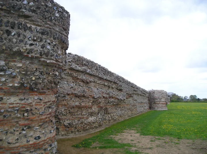
GariannonumView in OS Map | View in Google Map
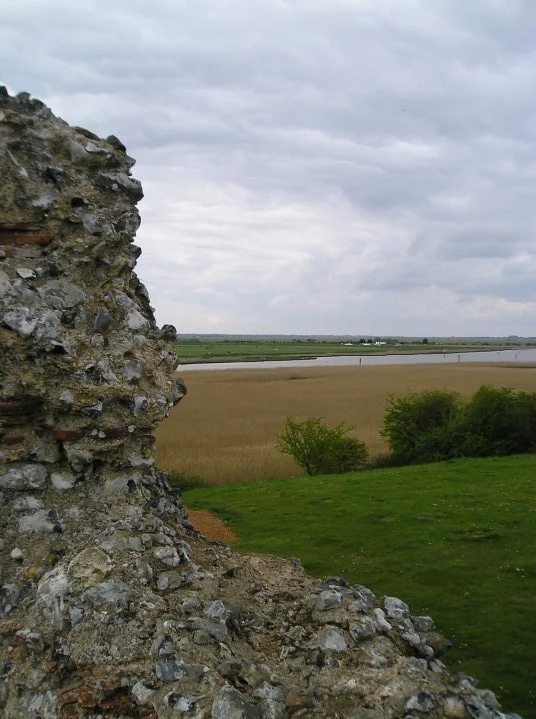
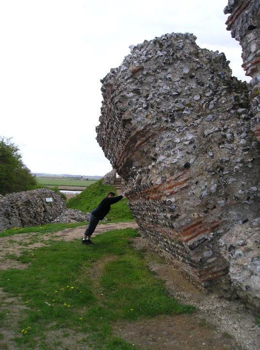
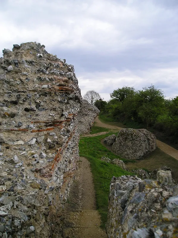
Situated on a raised location overlooking Breydon Water, Gariannonum was a Roman fortress built around 280AD as a defence against invading Saxons. Three of the four massive sides of the fort still stand – 9 feet thick and 14 feet high and built from knapped flints and mortar, interspersed with layers of red Roman tile for strength. Surviving fantastically intact, it can be matched by few other Roman sites in Britain.
According to Dr C Sampsons book from the 1930's Ghosts of the Broads
, in 418AD, after the Romans had left, this part of the coast was invaded by Danes, Saxons and Jutes. At that time a Dane called Gonard had taken control of Gariannonum. Gonards armies butchered the local Saxon communities and took their leader Siberg as prisoner. Sibergs brother, Cerdag, came down from the north and surrounded Gariannonum with his armies. He sent in a messenger with a white flag to convey the message to Gonard that he should surrender as they had the fort surrounded. Gonard killed the messenger and launched his body in true Monty Python fashion from the battlements down into Breydon Water. With this, Cerdags armies attacked and slaughtered the troops of Gonard, with Gonard being beheaded by Seberg himself. It is said, that on the anniversary of this event, on 27th April each year, just before dawn the re-enactment of the assassination of Sibergs men takes place, with the battle sounds ringing out across Breydon Water. Then on 3 July, the body of a man with a white flag tied around his neck comes hurtling through the air from the precincts of the castle to land upon the foreshore.

It is uncertain where Dr Charles Sampson obtained his stories for his book, and indeed some of the names within it do appear to be totally fictitious. The names Siberg and Cerdag are both unknown in historical context, though they could be corruptions of the Saxon names Sigeberht and Cerdic. Nonetheless it would be interesting to hear if anyone has actually witnessed the bizarre ghostly enactments at Burgh Castle.
Image Gallery


Route Validation Cards
Validation Date - 2010-04-29
- Time of Walk: 13:00 to 17:30
- Validators: Griffmonster Kat
- Weather Conditions: Cool and overcast spring afternoon
- Notes: Initial route undertaken
Summary of Document Changes
Last Updated: 2026-04-20
- 2021-03-17 : Update website improvements and removal of ViewRanger reliance
- 2021-12-01 : Removal of ViewRanger links due to its imminent demise
- 2026-01-12 : Major website update with all walks recast to the new format


0 comments:
Post a Comment