Polzeath to Pentire Point Circular Walk
Wednesday, 22 July 2020
|
No comments
|
![]()
Short circular walk around the headland that fronts Pozeath
An awesome wander around Pentire Point from the village of Polzeath. This is a must for anyone who visits this classic piece of Cornish coastline. A few challenges but nothing that an average walker can muster

Walk Statistics
- Start location: Polzeath
- Distance: miles ( km)
- Total Gain: ft ( metre)
- Total Descent: ft ( metre)
- Min Height: ft ( metre)
- Max Height: ft ( metre)
- Est. Walk Time:
- Walk type: Circular
- Walk Grade: Moderate
- Terrain: Footpaths
- Obstacles: The final section in front of New Polzeath can be walked along the beach at low tide. Take note of the tide times prior to embarking on this walk before attempting the beach route

Maps
The following maps and services can assist in navigating this route. There are links to printed maps and links to downloadable GPX route data for importing into navigational software and apps.
- Ordnance Survey Explorer Map
- OS Explorer 106 - Newquay & Padstow
- GPX Route File
Accommodation
Valley Camping and Caravan Park, PolzeathView in OS Map | View in Google Map
- Website
- https://www.valleyholidaypark.co.uk/
- Description
- A friendly and welcoming family owned camp and caravan site close to the beach at polzeath
Walk Notes
During undertaking the challenge of the South West Coast Path, Griffmonster Walks used Polzeath as a base on two separate occasions. One circular walk was always a joy to amble along and was undertaken several times. This was the popular route out to The Rumps and Pentire Point, the headland that juts out from the bay where Polzeath nestles.
The headland is in fact two conjoined headlands known as the Rumps which is fronted by a small island named The Mouls. A narrow neck joins the headland to the mainland and it is this formation that made it a good defensive site in times gone by. Some 2000 years ago an iron age fort was established here. Little is left of the fortification these days and to the casual walker passing by there is little to giveaway the ancient structures that once adorned this granite promontory. To the more trained eye then there are telltale evidence of banks and ditches that defended attacks from the landward side. Archaeological investigations of the area in the 1960s revealed ramparts and indications of roundhouses as well as signs of domestic civilisation such as pottery, beads, weaving spindles and bones.
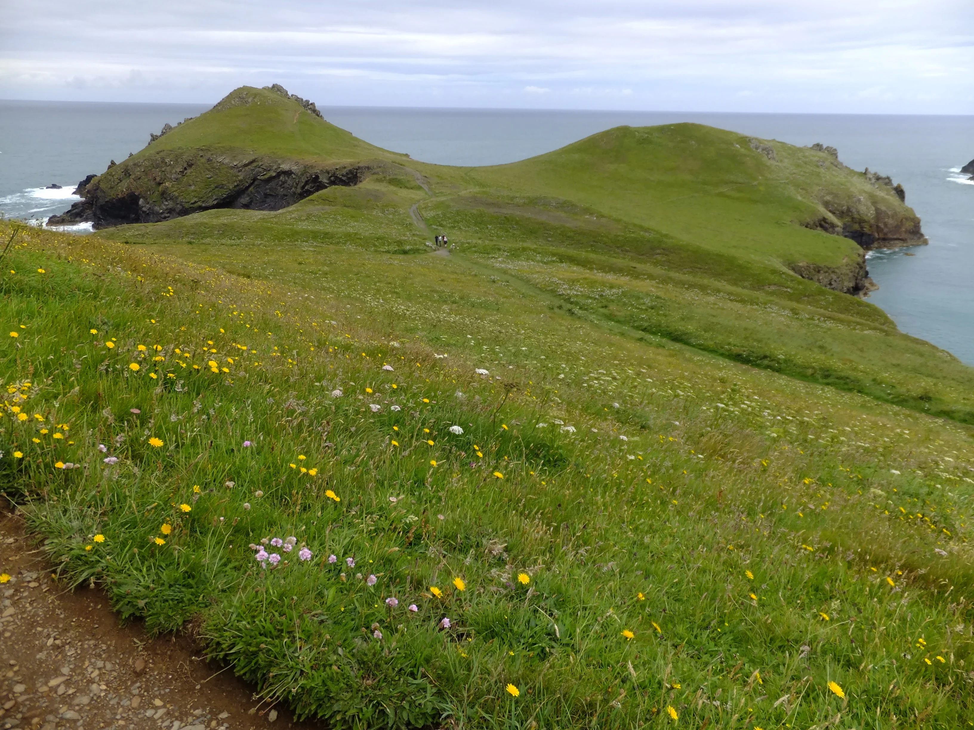
For the more adventurous there are paths that lead out to the tip of the headlands before making ones way back along the western side of the promontory towards Pentire Point. Looking back to the The Rumps will reveal the humped rocks of Rumps Point looking like a dragon rising up from the sea. There are probably myths and legends about this but I have yet to find them in published format.
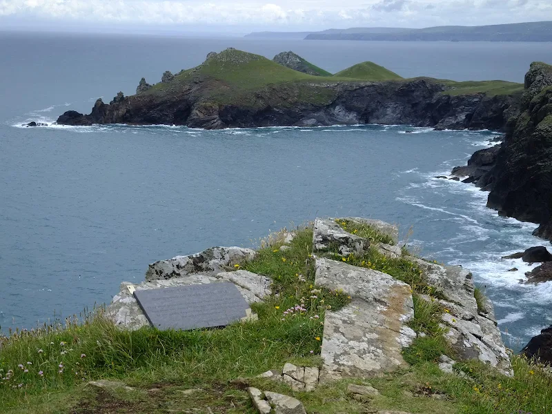
As we reach Pentire Point where the coast turns to head back to Polzeath, there is a plaque set upon a stone on the cliff-top. Upon the plaque is an inscription that is entitled For the Fallen
under which is a subtitle, Composed on these cliff, 1914
followed by the quoted stanza of poet Laurence Binyon's work commonly known as The Ode.
The plaque was put in place in 2001 to commemorate the fact that Binyon had written these words on this very headland. The words are in honour of the casualties of the British Expeditionary Force at the Battle of Mons and the Battle of the Marne in the opening phase of the war on the Western Front.

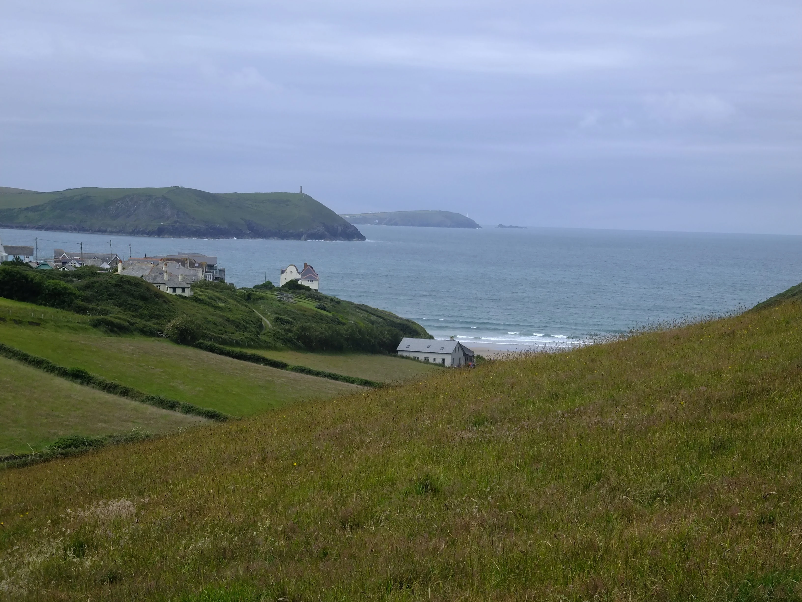
The last part of this walk heads back down to Polzeath. If one times the walk right then access to the beach can be gained at Slipper Point, just before New Polzeath where the coast path leads around Pentireglaze Haven. This sandy bay accesses the vast beach in front of Polzeath. Be careful and only attempt this if it is around low tide.
Directions
Route Validation Cards
Validation Date - 2016-06-30
- Time of Walk: 10:30 to 13:00
- Validators: Griffmonster, Kat
- Weather Conditions: Blue skies with some fluffy clouds, warm
- Notes: Initial route undertaken
Summary of Document Changes
Last Updated: 2026-04-20
- 2020-07-21 : Initial Publication
- 2021-03-13 : Website map updates
- 2021-03-17 : Update website improvements and removal of ViewRanger reliance
- 2021-12-01 : Removal of ViewRanger links due to its imminent demise
- 2026-01-12 : Major website update with all walks recast to the new format


0 comments:
Post a Comment