Wroxham to Norwich via Spixworth
Sunday, 5 January 2020
|
No comments
|
![]()
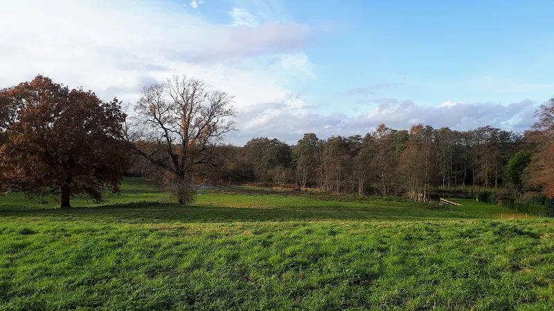
A 10 mile linear walk between Wroxham and Norwich
Walk linking the Bittern Railway Line stations of Wroxham and Norwich. The route cuts across to Spixworth using tracks and country lanes from where there is pedestrian access through to the centre of Norwich. Spixworth has an interesting history of folklore which is discussed in the features of this walk.

Walk Statistics
- Start location: Wroxham Railway Station
- End location: Norwich Railway Station
- Distance: miles ( km)
- Total Gain: ft ( metre)
- Total Descent: ft ( metre)
- Min Height: ft ( metre)
- Max Height: ft ( metre)
- Est. Walk Time:
- Walk type: Linear
- Walk Grade: Easy
- Terrain: Footpaths, Country Lanes, Tracks, Pavement
- Obstacles: No issues with this walk

Maps
The following maps and services can assist in navigating this route. There are links to printed maps and links to downloadable GPX route data for importing into navigational software and apps.
- Ordnance Survey Explorer Map
- OS Explorer OL40 - The Broads
- GPX Route File
Accommodation
Woodhill Park CampsiteView in OS Map | View in Google Map
- Website
- https://www.woodhill-park.com/
- Description
- Located on the clifftops at East Runton, half way between Sheringham and Cromer, this highly recommended touring site is ideal for exploring North Norfolk with public transport available to many destinations from the entrance to the site.
Transport
Greater Anglia - Train Service
- Service Details
- Bittern Line - Bittern Line linking Norwich with Cromer and Sheringham
- Timetable
- Bittern Line
Walk Notes
This is a continuation of the walks created to follow the Bittern Line which runs from Sheringham to Norwich. There is another station between Wroxham, where this walk starts, and Norwich, namely Salhouse. When planning this walk the initial thought was to follow the route of the railway as close as possible. Although there are footpaths and tracks that connect Wroxham and Salhouse, beyond this presents a bit more of a challenge. There are footpaths through to Rackheath but the remaining distance into the city requires road walking where there is no pavement. These roads are used as rat-runs by traffic heading into and out off Norwich and it certainly would not be either pleasant or advisable to attempt hiking alongside them.
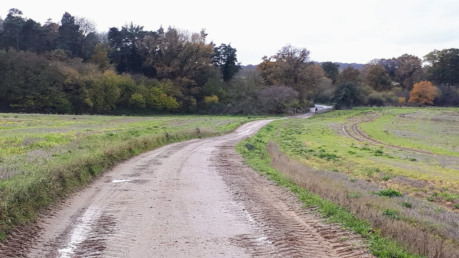
Therefore after rethinking the route, the idea to walk via Spixworth was considered. This has the advantage of using tracks and lanes through to Spixworth after which there are pavements all the way into Norwich. On reflection, after walking this, it does appear to have been a wise decision and on the specific day this walk was undertaken after many days of heavy rain, the route provided was mostly hard surfaced with little mud or standing water.
The route heads out of Wroxham using Church lane which is accessed off of the main road. On the left, set back from the road, is a 17th century manor house which certainly stands out from the other more modern buildings. Beyond the houses the road turns into a track that follows the bend in the river Bure which can be seen at the foot of the meadow on the right of the track. Beyond the river lies Belaugh broad although this cannot be seen as it is hidden by woodland.
As we leave the view of the river, we pass woodland on the right known as the Hills and Holes Plantation. Such a title is often given to ancient sites of disused iron workings although in this case there is no solid evidence that such activity ever took place here. It is true that there are signs of quarrying but nothing to determine what was being quarried. In fact there is no more than one hill and one hole and as such some have suggested this was no more than a marl pit used to extract the London Clay that was used as fertilizer.
Beyond the end of this woodland we take a left turn to head up a track to the lane that will take us through to Spixworth. The lane is not much more than the track although it does have a hard surface. This leads past another wood preceded by a cottage which on old maps is marked as Lodge
and was presumably a connected to Wroxham Hall that once stood within the woodland. The 18th century Hall was demolished in 1960 although some of its ancillary buildings still remain, hidden from view by the woodland.
The track curves down to join Dobbs Lane which turns into Rackheath Lane just beyond the junction. On the left, before one reaches the junction, one can glimpse a church in the distance, sitting alone in the fields. This is All Saints, the church to the medieval parish of Great Rackheath which no longer exists having been absorbed into the general parish of Rackheath. This church still serves as the Rackheath parish church even though the modern village is some 1 mile distant as the crow flies. One would assume that the medieval community was built around the church and such a speculation would fit in with a suggestion that the origin of the parish name is the old English that translates as landing-place near a gully
since the church sits above a stream known as Dobbs Beck which may have provided a convenient place to establish a harbour. This water course is a tributary to the river Bure and passes under Dobbs Lane at the point of the junction. The name Dobbs appears to be a common name with both beck and the lane taking the title, together with a cottage known as Dobbs Cottage which once stood the junction of the lane, and woodland known as Dobbs Plantation. Whoever Dobbs was, he certainly had influence although I can find no clue as to who he may have been.
We now continue onward to Spixworth, a village that sprawls across the land to the west of the B1150 North Walsham road. Although the Manor of Spixworth can be traced back to Saxon times and is recorded in the Domesday Book it wasn't until the 20th century that the housing estates that one is greeted with on arrival were constructed. This does give any visitor approaching the village the feeling of a clear lack of identity, the anonymous houses nothing more than an overspill conurbation of Norwich. Judging by the traffic that enters and leaves the village it provides the distinct feel that this is nothing more than a dormitory for city workers who have no real connection with the parish other than a status symbol of the postcode in which they live.
There is a village sign that offers an intriguing collage of pictures. On one face is a depiction of the parish church of St Peter which dates from the early 12th century, and a stream which is presumably Stone Beck, around which there are a variety of animals being tended by a shepherd although it looks like his job description should be broadened to include cows and pigs. Under this pictorial representation is the word Spikeswurda, the Norman name of the parish as recorded in the Domesday Book.
On the reverse side is a pictorial description of the Spixworth Hall, demolished in 1950, which lies on the far side of the Buxton Road. In front of the Hall is a winding drive on which there is a carriage drawn by two horses, presumably, as the full moon is depicted above the house, this represents the folk tale of the ghostly Judge Peck who is said to roam the district in such a fashion on the night of the full moon (see feature below for full details of this folk tale). In the foreground stands a bearded man wearing knee breeches with a long stick in his left hand and a lantern held aloft by his right hand. This effigy appears to pertain to the ghostly folk tale of The Old Night-Watchman which is also researched below.
The route through the modern houses of Spixworth brings us out onto the Buxton road close to a gate house to the old hall. There is then a traipse into Norwich, across the new Northern Distributor Road and into the housing of the city. This is not too bad walking, the pavement certainly kept away from the road before the urban jungle starts to take over.
It is a sense of relief to escape into Catton Park, a Grade 2 listed public park of open grassland sown with a mixture of grasses and wildflowers. A haven of peace for the city dwellers which certainly seems very popular judging by the number of folk we encountered within its confines.
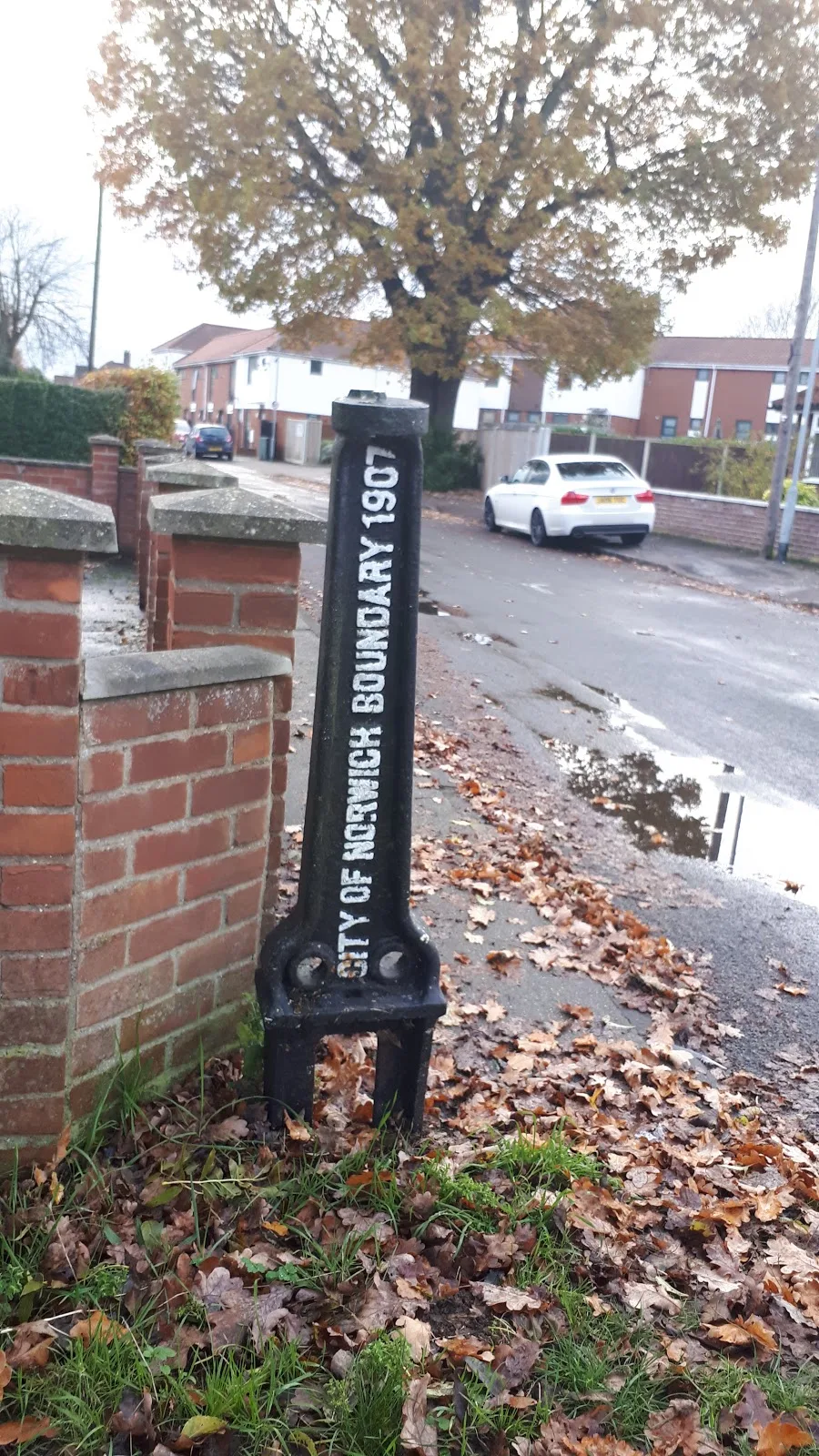
The walk continues passing a City of Norwich boundary marker dated 1907. The city has certainly burgeoned since those days. A fact that I can personally attest to after first visiting the city back in the early 1980's with regular visits ever since. One has to wonder if and when it will all stop, or whether it will just keep expanding until Norfolk sinks under the weight of the extra bricks and concrete beneath the waves of the North Sea. Unfortunately the development and population increase appears to be driven by businessmen and bureaucrats seeking big returns rather than logic of sustainable resource.
The final part of the walk takes down to the train station for a return to Wroxham. If this is undertaken between dawn and dusk then one can walk through the grounds of the Cathedral and down to the river to take the riverside path. If not, it i a walk through the heart of the city.
Directions
Tracks, country lanes and path from Wroxham to Norwich
Leave Wroxham station and walk through the car park keeping to the river side until the path meets the main road. Turn right and take the footbridge across the river, continuing along the road side. Take Church Lane on the right. This leads over the railway to a junction beyond, turn left and follow this road. The road soon turns to a track and leads out into the countryside. Just beyond the woodland on the right is a cottage, take the track off to the left up to a junction. Turn right and follow this track through to the junction with Dobbs Lane. Continue straight ahead. Keep to this country lane until it meets the main road. Cross straight over and into Spixworth. Just before the village sign, take a left turn into Rosetta Road and follow this down, turning right into Park Road. Turn left at the end onto Buxton Road. This crosses the NDR and continues into Norwich.
At the point where there is some parkland on the left amid the housing, there is also an entry into CAtton park on the opposite side of the road, take this and follow the paths around the perimeter until it leads out onto Oak Lane. Turn right and follow the road to the junction. Cross straight over. Continue down this road. After passing Angel Road Junior School take a left onto Long Row, then first right onto Traverse Street. The Duke of Wellington pub is at the end of this as it junctions Waterloo Road.
Turn right from Traverse Street onto Waterloo Road, the next left onto Albany Road. At the end turn right and continue down into the city. At the Artichoke pub cross straight over onto Magdalen Street. Continue down this, under the flyover and a little furth up the street where the Kings Head pub in on the right.
Keep on ahead down Magdalen Street, then continue straight ahead as it junctions with Tombland and the Cathedral on the left. At the far end of the cathedral take the lane through Ethelbert Gate. This leads down to Pulls Ferry at the river. Turn right onto the riverside path. Continue until it meets the road by the Compleat Angler pub. Turn left and the station is across the road.
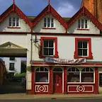
Pubs
Duke of Wellington, Norwich NR3 1EG View in OS Map | View in Google Map
- Address
- Waterloo Rd, Norwich NR3 1EG
- Website
- www.dukeofwellingtonnorwich.co.uk/
Originally a 1930s corner shop and bakery known as the Waterloo Stores. In 1937 Lacons brewery turned the building into a pub, taking the name of The Iron Duke which is still displayed as a tiled sign above the main door. The pub continued under the stewardship of Lacons until 1965 when Whitbread became took the licence, then passing onto Adnams before it became a free house, changing its name to the Duke of Wellington in 2002.
The present owners are John and Kay Edwards who also own Wolf Brewery and there is always a good range of both Wolf brews as well a very good selection of other ales mostly served from a dedicated tap room.
Always a fine selection of ale to be had here. On this occasion Bungays Bull in the Woods Brewery was on offer with the hazy Woodstock ale. Mighty fine and well refreshing.
The Kings Head, Norwich NR3 1JE View in OS Map | View in Google Map
- Address
- Magdalen St, Norwich NR3 1JE
- Website
- www.kingsheadnorwich.com/
Records show the Kings Head being a public house in the mid 1700s and little has changed with the building since those times. The pub architecture is testament to its heritage with gargoyles guarding the arch to the side courtyard and the emblem of the 19th century Crown brewery proudly adorning the centre of the arch. In more recent years the pub has been restored to a basic Victorian style bar and lounge where its wooden floorboards provide a rustic but clean look. Tradition is the theme throughout with conversation providing company and a simple bar billiards table providing entertainment.
The pub offers up to fourteen real local ales on tap and up to four more on stillage available, as well as a wide selection of Trappist and Belgian beers. This is a must for any discerning drinker to seek out.
A good old back to basics pub that is always welcoming and a wide range of distinctive real ales beers. So good we had to stay for some time!
Features
Legend of Judge PeckView in OS Map | View in Google Map
There is a legend local to Spixworth that tells of Judge Peck riding through the village in a phantom coach drawn by two horses at midnight on the night of the full moon, assumed to be as penance for some misdemeanour's that he had perpetrated during his life. In one instance both he and his wife rise from the tombs in Spixworth church and go no further than the church yard. The tale is told in numerous books and on websites yet there is little reference to where the story originates and why his ghost should be seen at all.
It would appear that Judge Peck refers to William Peck, Lord of the Manor from 1612 up until his death in 1634. The spelling of his surname can be found as both Peck and Pecke. He was undoubtedly a powerful landowner, owning 178 acres of land to the west of Buxton Road, which included extensive gardens and wooded parkland, and was responsible for the building of Spixworth Hall in 1607. However I can find no reference to him being a judge other than in the folk tale. Some have offered the connection of his son, Thomas, being the Sheriff of Norwich, then later Mayor of the city. If this is the case, and he was a particularly ruthless authority, then surely it would be the ghost of Thomas that should be contained in the tale, however all accounts of the tale always point to William.
Spixworth Church contains a lavish alabaster memorial dedicated to Peck and his wife Alice (Blois) which can be found in the north-east corner of the chancel. This consists of two reclining figures dressed in shrouds under a coffered arch surmounted on a scrolled pediment set on black marble columns with a Latin inscription, portraying Peck as a pious man and a generous benefactor to the poor
. However Flickr user JMC4 the Church Explorer paints a different picture of Peck although he does not reveal the source of his information. He annotates an image of the church memorial with the claim:
Sir William was reputed locally to be 'a miserable usurer ....... of grasping and miserly disposition'
Both the phrases a miserable usurer
and grasping and miserly disposition
are well used in publications from the 19th century but thus far no specific quote can be found in reference to Peck, or to why JMC4 has titled Peck as Sir. Could we assume that he was an arrogant man who held his own harsh court for misdemeanour's of his tenants and those within his employ?
During the turbulent years of the English Civil War it is said that Peck took sides with the Royalists and after the Roundheads victory, the family estate was commandeered and Peck had to buy back the land. There is obviously something wrong here because William Peck died some eight years before the wars started and land seizure was much more in common with the later puritanical years that followed.
There are references to William Peck having a desire to have his soul saved from his adversaries by bricking up his body rather than entombing it with the church memorial. If this was the case it would indicate that he had made enemies and may be the source of the tale that has pervaded over the centuries. In 1787 a wall in an alcove in the Spixworth Hall gallery was removed and it was recorded that this revealed the soul of William Peck although there is no record of what was actually discovered that determined it was evidence of his soul, presumably his bones.
There are plenty of East Anglian ghost stories that portray a lost soul condemned to charge across the landscape drawn by coach and horses for all eternity. Such instances that immediately come to mind at those of Thomas Boleyn from Blickling, Old Blunderhazard of Barsham and John Brooke from Blythburgh. Maybe the tales were a ritual method employed by the common folk to condemn the soul of the arrogant or wicked landowners that had made their lives a misery.
References
- Listed buildings - The church of St Peter, Spixworth.
- The Penguin Book of Ghosts: Haunted England, Jacqueline Simpson, Jennifer Westwood, Penguin UK, 2008
- Flickr image from jmc4 - Church Explorer with annotated information concerning the memorial of William Peck
- Spixworth Neighbourhood Development Plan
- A history of Spixworth and Grange Farm, Ray Warnes, 2005
- Lantern Magazine, Summer 1974
The Ghost of the Night WatchmenView in OS Map | View in Google Map
Spixworth village sign contains the pictorial description of a local folk tale commonly known as the The Ghost of Spixworth Hall. In the background of the sign is Spixworth Hall and in the foreground stands a bearded man wearing knee breeches with a long stick in his left hand and a lantern held aloft by his right hand and commonly known as the Night Watchman.
.png)
There are many ghost stories associated with the Hall, but one notable incident is related by a certain Arthur Longe which is worth a little investigation. Arthur Longe was a relative of the family who once owned the Hall, the Longe family being Lords of the Manor from 1688 up until it was demolished in 1950. In 1950 Longe published a book The Old Night-Watchman: The Ghost Of Spixworth Hall which included a personal account of one overnight stay he made at the hall. It is unclear of the date or year that this account pertains to but his references to using candles to light the way to the bedroom indicates that it is certainly before mains electricity had been cabled to the area. His detailed account describes how upon retiring for the night he had soon drifted to sleep but was sharply awoken with a start to be greeted by what he described as a typical Old London Watchman with his peculiar old lantern
. But as soon as he sprang up in bed the apparition disappeared. Terrified he hid under the sheets and eventually fell back to sleep.
Some time later he was awakened to a light shining on his face and opening his eyes glimpsed a woman standing at the foot of the bed with a lighted candle. At first he dismissed this as his mother who would often check on her children in such a manner but as he sprang up to acknowledge her, the realisation was that he was not at home, his mother was not there and the apparition disappeared before him.
Once again he went back to sleep, tired from the journey he had made driving to the hall but it was not long until his slumbers were once again disturbed by an ear piercing screech. At first he tried to logically put the sound down to a cat, but on inspection found no cat in the room. He concluded the Hall to be haunted and managed to survive the rest of the night without any more disturbance.
The account that he describes reflects local folklore which states that in 1480 the family who owned the Hall had a very pretty young daughter whom the family night watchman had looked after and protected from when she was a child. It was said that she was very fond of a specific cousin, although the cousin is never named. Unfortunately, the cousin received a letter commanding him to join the King's Host in Nottingham to fight in the lists, a duty he undertook only to be killed in battle. The girl, in a fit of grief threw herself into Sea Mere Lake and drowned. Her mother, on hearing the dreadful news let out a blood curdling scream which was said to linger in the head of all who heard it. Ever since that day the ghost of the young girl in her wedding dress is said to haunt the area, with the night watchman seen hunting for her.
One thing that sticks out here like a sore thumb is that the Hall was built in 1607 yet the story relates to 1480, over 100 years before the Hall was built. It would appear that the Hall was built on the site of the former medieval Manor House, so we can conclude that there was some sort of building at this site.
The date of 1480 is included in the description of the folklore within a 1986 publication, A History of Spixworth, by Ray Warnes, who footnotes the date with a reference to Burke's Landed Gentry. This appears to be an error as upon inspection of this reference it clearly states:
The Parish Registrar of Aswelthorpe mentions one Thomas Longe going to the King’s host at Nottingham in the year 1485.
In 2011 the will of Thomas Longe came to light which revealed that he was the first named common soldier who fought with the House of York during the Battle of Bosworth, a battle in which the Richard III suffered a decisive defeat by Henry Tudor on 22 August 1485. Not being a trained soldier, and being one of the first to enter the battle he was one of the first to be killed. Longe was part of the family that would go on to become the Lords of the Manor of Spixworth
The girl in question was obviously the daughter of the Lord of the Manor in 1485, although this is difficult to determine. The Bardolph family had inherited the title from the year 1286 through to William Peck who took the title in 1612 although the family name had changed over the centuries due to daughters marriages. It is recorded in 1474, in the will of William Catfield of Haddiscoe-Thorpe, who was then the Lord of the Manor, that upon the death of his wife, that he bequeathed the lordship to the right heirs of the said manor
, yet there are no names mentioned. By 1485 the Lordship was in the hands of Richard Southwell therefore we can only conclude that it was he that took the title upon the death of Alice Catfield.
This gives some vital clues. Richard Southwell is described as hailing from Woodrising, a small parish just northwest of Hingham. There is a Sea Mere Lake close to Hingham, usually known as plain Sea Mere which is described in modern times as natural circular kettle hole mere which was formed during the Holocene period approximately 10,000 years ago and covers 20 acres together with areas of fen, grazing marsh and woodland
. This provides a vital connection.
Richard Southwell is described as a knight and was born sometime around 1429. He married twice, once to Amy Witchingham who was born 1435 and then to Katherine Williams who was born 1474 and whom we could certainly rule out as the mother of the girl involved. Amy Witchingham bore five children, two sons, Robert and Francis, and three daughters, Amy, Elizabeth and Alice. Of these Amy died in 1535 and there are no records for the death of either Elizabeth or Alice who were born 1472 and 1474 which put them at 13 and 11 years old at the time of the death of Thomas Longe. The age appears young although it has to be said that during these times the legal consent for marriage was 12. Could Elizabeth be the girl in question?
References
- A genealogical and heraldic history of the landed gentry of Great Britain and Ireland, Burke, Bernard, 1879, p986
- The History and Antiquities of the County of Norfolk, Volume 7, Mostyn John Armstrong, J. Crouse, 1781, p67
- Geneology for Richard Southwell
- BBC News article, Norfolk man named as Battle of Bosworth Yorkist fighter, 30-08-2011
Catton ParkView in OS Map | View in Google Map
Catton Park is a 70 acre country park open to the public. It has special significance as it was the first commission of Humphry Repton as a landscape gardener.
Image Gallery


Route Validation Cards
Validation Date - 2019-11-22
- Time of Walk: 10:30 to 14:30
- Validators: Griffmonster, Kat
- Weather Conditions: Overcast
- Notes: Initial route undertaken
Summary of Document Changes
Last Updated: 2026-04-20
- 2019-12-31 : Initial Publication
- 2021-03-17 : Update website improvements and removal of ViewRanger reliance
- 2021-12-01 : Removal of ViewRanger links due to its imminent demise
- 2026-01-12 : Major website update with all walks recast to the new format


0 comments:
Post a Comment