Route details, maps, pubs, features, local history and folklore for a wide variety of walks focusing primarily on Norfolk and Suffolk

Walks
Showing posts sorted by relevance for query Knetishall Heath. Sort by date Show all posts

Wednesday, 23 February 2022

The Peddars Way - Thetford to Knetishall Heath

Thetford to Knetishall Heath

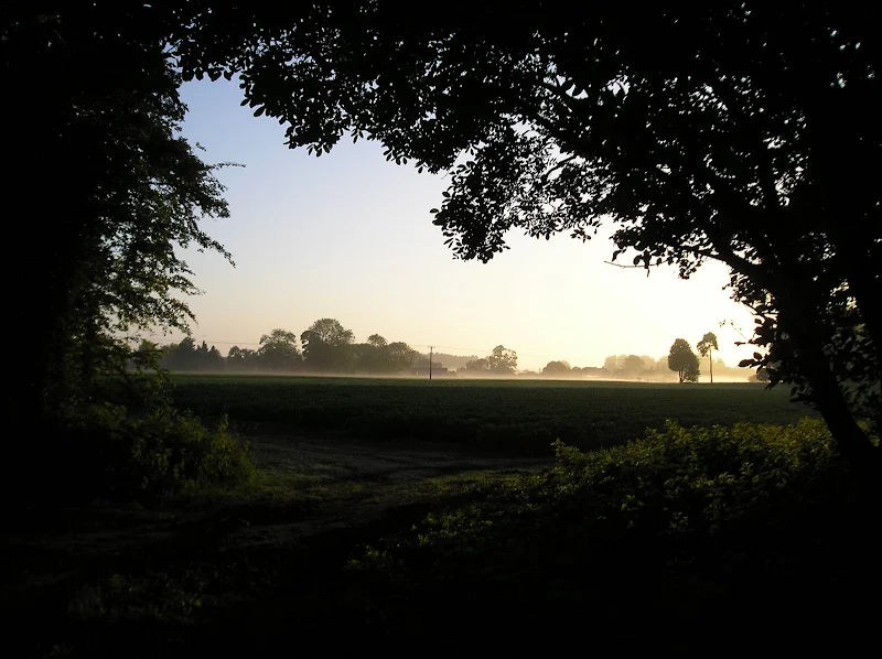
A trek from Thetford to the start of the Peddars Way

Thetford is the closest town to the start to the Peddars Way and there is no public transport between Thetford Railway Station and the starting point at Knetishall Heath. Looking at the OS Map, there is no direct route other than to walk along the main A1066 Thetford to Diss road. This is a busy road with no pathway and there is a good 4 miles walking before turning off down village lanes through Rushford where a little peace and serenity is regained to set the tone for the Peddars Way.

NOTE

This is a walk summary intended to provide the user with just the essential information in order to navigate the walk route. Fully detailed information notes, refreshment stops and walk features are not included in this. A full write up will be included in the near future.

Thetford to Knetishall Heath - Essential Information

Walk Statistics (calculated from GPX):

  • Start location: Thetford 
  • End location: Knetishall Heath 
  • Distance:   miles (  km)
  • Total Gain:   ft (  metre)
  • Total Descent:   ft (  metre)
  • Min Height:   ft (  metre)
  • Max Height:   ft (  metre)
  • Walk Time:  
  • Walk Grade: Tiresome road walking to start with, then easy
  • Terrain: Country Lane, Permissive Path, Road

Maps:

The following maps and services can assist in navigating this route. There are links to printed maps and links to downloadable GPX route data for importing into navigational software and apps.


Route Verification Details

  • Date of Walk: 30/05/20080
  • Walk Time: 13:00:00 to 16:00:00
  • Walkers: Griff
  • Weather Conditions: Clear blue summer skies, warm

Walk Notes

Route: Follow the A1066 out of Thetford until you come to a right hand turn to Rushford. Passing through Rushford, keep bearing round to the left on the country lanes. This will lead onto a straight section of road within a mainly wooded area where the starting point of the Peddars Way is located. It is clearly signposted on the left, together with a small car park and the waymarker for the Icknield Way on the right. The trail leads through the trees, across the Little Ouse River, which forms the boundary between Norfolk and Suffolk and back up to the A1066. Continue over the main road and into the forest on West Harling Heath. There are numerous tracks on the right that lead through the forest to reach the Dower House campsite.

Pub: The Travellers Rest, Knetishall Heath: 52.428987 0.895112 Plain and simple bar on the campsite offering pub food and keg beer.

Walk Feature: Kentishall Heath: Knettishall Heath Country Park is 350 acres of heathland, grassland and mixed woodland on the Breckland Heath. The Little Ouse river runs along the northern edge of the Heath and a number of walk trails are set out throughout the park. The Riverside Walk is an ideal route for a hot day, it also passes the grassland area grazed by Exmoor ponies and Hebridean sheep. Hut Hill, a bronze age burial mound over 4000 years old, can be discovered as part of the Heathland Trail whilst the Woodland Walk includes oak, Scots pine and birch and many more fine trees. Wildlife watching can be rewarding, deer live in the wooded areas and Common Lizards bask on open, sunny spots on the heath. The park is also the junction of three long distance trails, the Peddars Way, Icknield Way and Angles Way fan out into the wider countryside for the more serious walkers.

Notes: Knetishall Heath is less than 40 miles from where I live in Suffolk but to get there is quite an undertaking using public transport. Trains can get you through to Thetford but this involves changes at Lowestoft and Norwich and takes half a day to complete. Knowing this, I had allowed an additional day to that of my Northamptonshire friends who were due to join me the next day and were being given a lift first thing in the morning. My journey would therefore begin at Thetford and allow me to walk the initial mile or so along the Peddars Way up to West Harling Heath where there is a campsite nestling within the woodland. This would give me an easy day before the rigours of tackling the Peddars Way itself. According to various sites on the web, there used to be a bus to the start of the Peddars Way. Unfortunately this service no longer appears to operate which means this terrible section along the A1066 is unavoidable if one wants to get directly to the start of the National Trail. I usually time my walks, and over time have realised on level ground, with a fully loaded pack on my back, I usually average about 2mph including stops and 3mph on shorter sections with no stops. This has now become a rule of thumb for planning walks. The initial section down to the turn off to Rushford I managed to do well in excess of 4mph such was my want to get away from this busy road. That amazed me! Knettishall Heath is the host for the start (or end depending on direction walking) to the Peddars Way, the Icknield Way and the Angles Way. The Peddars Way marker is on the opposite side of the road to the Icknield Way marker and it is worth pausing to reflect that this ancient path runs from Hunstanton, down to Ivinghoe Beacon, as indicated on the Icknield Way marker (105 miles) and then on the Ridgeway through to Avebury and eventually the Wessex Ridgeway down to Dorset.

It is worth noting that an alteernative route would be to follow the Icknield Way Thetford extension which also connects Thetford and Knetishall Heath although this is considerably longer.

Accommodation: The Dower House Campsite

Transport: Train Saxmundham to Lowestoft/Lowestoft to Norwich/Norwich to Thetford

Summary of Document Changes

Last Updated: 2022-02-23

2011-01-17 : Initial publication
2022-02-23 : Convert to summary format

Images

Thursday, 17 January 2019

The Icknield Way - Herringswell to Knetishall Heath

A 25 mile walk along the Icknield Way between Herringswell and Knetishall Heath

This section of the Icknield Way reveals just how remote some areas of Suffolk can be. Apart from a couple of isolated hamlets there is nothing but forest trails and fields for the full 25 miles through to Knettishall Heath. This is perfect for those who like the solitude but one does need to make sure ample food and water supplies are taken for this lengthy hike.

The Icknield Way - Herringswell to Knetishall Heath - Essential Information

Walk Statistics:

  • Start location: Woods south of Herringswell 
  • End location: Dower House Campsite, Knetishall Heath 
  • Distance:   miles (  km)
  • Total Gain:   ft (  metre)
  • Total Descent:   ft (  metre)
  • Min Height:   ft (  metre)
  • Max Height:   ft (  metre)
  • Walk Time:  
  • Walk type: Linear
  • Walk Grade: Hard on the feet due to the rock-hard tracks
  • Terrain:

Maps:

The following maps and services can assist in navigating this route. There are links to printed maps and links to downloadable GPX route data for importing into navigational software and apps.


Accommodation:

The Dower HouseCamp siteView in OS Map | View in Google Map
Website
Description
The Dower House Campsite

Route Verification Details

  • Date of Walk: 2009-06-23
  • Walk Time: 05:00 to 15:30
  • Walkers: Griffmonster
  • Weather Conditions: Clear blue summer skies, very hot

Walk Notes

This is the final section of the Icknield Way from Buckinghamshire to Norfolk, which provides a link to the Ridgeway and Peddars Way National Trails. The previous evening had resulted in a wild camp in the woods close to Herringswell due to the lack of availability of accommodation. At first light the camp was packed and the area left like I had never even been there. Not a soul was around. Perfect.

The previous day had been hot. Very hot. This day was going to be even warmer and starting early would give an advantage of getting some miles in before the heat of the day. Of particular concern was water supplies, with under a litre of water left and no substantial civilisation being passed on route.

A mist hovered above the fields which presented a magical scene one could only stand and gaze at in wonder. The track from the woods leads into Herringswell and the Icknield Way then continues onto the village of Tuddenham. There was a half hope that maybe a newsagent would be encountered at Tuddenham where I could buy some water, but no such luck. A small terrier type dog gave chase to me as I headed out of the village down the lane towards Icklingham. Yapping and snapping like little dogs do. The lane out of Tuddenham is a long straight single track leading through to the River Lark then on into the village. From the map it appears that there should be a bridge across the river but as I came closer there was no sign of a bridge and thoughts crossed my mind of having to swim or wade across the water. The expected location of the bridge revealed nothing but a single large pipe spanning the river below. Probably a water or gas main. The sight was disheartening. The track led around to the left, following the river up stream. Then there, a few yards onwards was a simple footbridge. A relief!

The village of Icklingham provided another chance to find a newsagent for water supplies. No such hope! The traditional early morning newsagent appears to have disappeared from existence in the wilds of Suffolk. This really was the last chance and there would be no more signs of civilisation until Knetishall at the end of the hike. The trail heads along field boundaries to the east of the village, navigating along tracks and footpaths before turning north to lead through the Kings Forest. I found a point along these initial paths to sit down and the dewy grass and grab a bite to eat from the rucksack supplies that had been garnered from previous days walk. An orange. Several cereal bars. All washed down with a little water, leaving nearly half a litre. A whole day of hot sunshine was ahead. A big concern.

The last footpath joins a substantial track that leads into the forest and at this junction was a parked car where a couple were getting ready to walk their dog, kit being deployed from the hatchback. They offered a friendly hello and from their accent is was clear they were of American origin. I offered a reply which struck up more conversation. The man remarked on the weather forecast, declaring it would be the hottest day of the year, and on learning of my days hike proffered the requirement to have enough water. I showed him my last bottle and gave a little concern at this lasting the day. Without hesitation he walked to the drivers door and pulled out one of two half litre water bottles and insisted I take one. What a relief! I could not thank them enough. It was going to be a life saver that was for sure.

The King’s Forest was named to commemorate the Silver Jubilee of King George V and Queen Mary. The track that the Icknield Way uses runs directly through the forest in a long and straight line, south to north, for nearly 4 miles. Either side of this broad thoroughfare are regimented trees standing in ordered lines interspersed with heath. At the north end the track leads out onto a main road with some waste ground abundant in vehicle tracks where a parked up articulated lorry stood. The driver sat in the cab and watched, bemused, as some random hiker appeared from the forest and shed his load to sit and take a rest. I had come to the conclusion from the previous days walking that ample rest breaks resulted in more miles by the end of the day. So this was a 15 minute relax, a drink of water and a review of the map.

There is a footpath that runs parallel with the road for a short distance then crosses over the road and along a lane known as the Dukes Ride. At the end of this there is an option of following an alternative route into Thetford or to continue onward to Kentishall. I took the main route, which heads south east diagonally across fields until it meets a track where there is a turn back northeast until it meets another track and then it turns back south east. The landscape is flat although there are plenty of landmarks and trees as points of interest. The zigzagging track leads onto the busy A134 trunk road and necessitates a brief walk alongside this hectic highway before the trail takes another north east track to the village of Euston. It was now approaching midday and the heat was telling. The water was slowly but surely going down and there was still several hours of walking left in the day. I was back down to the last half litre of water. I would need to ration it.

Euston village is not so much a village as a large Hall and little else. Both the hall and gardens are open to the public and this was the destination of an elderly couple who were about to leave their car which they had parked up on a track alongside the road. They asked questions about the opening times for which I could not provide an answer. A short conversation ended with me being supplied with additional water. This does give one a lot more faith in humanity. This was a hot day. A 25 mile hike across a landscape with little in the way of real civilisation with a full kit on ones back. No pubs, no shops only the vast Suffolk landscape and temperatures well into the 80s Fahrenheit with nothing but sunshine and blue skies.

The final section of the route proved to be the most scenic with some pleasant heath and forest paths across Knetishall Heath which was a real pleasure to walk through. The end of the Icknield Way is where the path meets the road that runs along the north side of Knetishall Heath Country Park. One side of the road is the Icknield Way, the other is the Peddars Way. There is no monument, no rewarding statue, no glorification for this long distance trail or indeed the Peddars Way. Just a simple finger post that pointed south and declared Ivinghoe Beacon 105 miles. I had completed a little more than that, and put it down to the diversion around Luton and Dustable, but the extra distance was well worth it.

This end point is in the proverbial middle of nowhere. Not a good place to either start or end. One can walk into Thetford although this is along the road and not a good hike (see Thetford to Knetishall Heath). The option chosen in this instance was to walk onwards along the Peddars Way and then through the forest on West Harling Heath to the Dower House campsite which is located on the north east side of the forest. The campsite is located in a grassed area within the forest and was also used when walking the Peddars Way, as the starting point. The forest is full of trails and it makes for some pleasant rambling although on this occasion logging had prohibited public access from a large area of forest resulting in a not so pleasant wander along the road.

The campsite provides a convenient place for an overnight stay either on completion or prior to embarking on either the Peddars Way or the Icknield Way. Public transport from this area is limited. At the time of walking, there was a regular bus service to and from Norwich from the village of East Harling, just the other side of the campsite. A bus service still exists but these days it is very limited in its schedule. There is also a railway station on the road out of East Harling, but it is only served during rush hours.

In conclusion, having completed the Icknield Way I would thoroughly recommend it to any seasoned hiker. Although not a recognized National Trail, it is nonetheless well maintained, well way marked and across some great landscapes. It passes through a whopping six counties if one includes Norfolk at the very end. Having walked many trails, this, in my opinion, is one of the best and really needs a National Trail Status.

Directions

Follow the waymarked tracks through to Tuddenham village - continue straight through the village and on to Icklingham. You will find that the bridge crossing The River Lark, just before the Icklingham has been demolished (which on first sight is very disheartening) - but there is another footbridge a few yards to the left. From Icklingham head into the Kings Forest and a straight track leads all the way through to the B1106. The track continues 100 yards up the road. Here there is a branch, to the left the track leads into Thetford, to the right it takes you across to Knetishall Heath where it meets up with the Peddars Way. This track cuts across the fields to the hamlet of Euston and then onto Knetishall Heath

The River Lark at Icklingham

Pubs

The Travellers Rest, Knetishall Heath View in OS Map | View in Google Map

Address
The Travellers Rest, Knetishall Heath

Plain and simple bar on the campsite offering pub food and keg beer.

On the left, sunbaked tracks, typical of the entire days walk. On the right, a mighty old tree at Euston.On the left, sunbaked tracks, typical of the entire days walk. On the right, a mighty old tree at Euston.
On the left On the left, sunbaked tracks, typical of the entire days walk. On the right, a mighty old tree at Euston.; On the right On the left, sunbaked tracks, typical of the entire days walk. On the right, a mighty old tree at Euston.

Features

IcklinghamView in OS Map | View in Google Map

Icklingham is a village in Suffolk, England.It takes its name from an Iron Age tribe, the Iceni, who lived in the area and has the remains of a Roman settlement to the South. It was also one of the largest Anglo-Saxon settlements in the area.

Euston HallView in OS Map | View in Google Map

Euston Hall is a country house, with park by William Kent and Capability Brown and is the family home of the Dukes of Grafton. Euston first appears in the Domesday Book in 1087 as a manor belonging to Bury St. Edmunds Abbey. The estate, in near ruin, was purchased in 1666 by Henry Bennet, Earl of Arlington and Secretary of State to King Charles II. He constructed a grand house in the French style, built around a central court with large pavilions on each corner. In 1672 Charles II arranged a marriage between nine-year-old Henry FitzRoy, his illegitimate son by Barbara Villiers, and Isabella Bennet, the Earl of Arlington's five-year-old heiress. FitzRoy was created 1st Duke of Grafton in 1675, and the young couple went through a second wedding ceremony in 1679 when Isabella had reached the age of twelve, then the minimum legal ago to marry with consent. The Duke and Duchess inherited Euston Hall in 1685. In about 1750 their son, the Second Duke, decided to re-model the house and employed Matthew Brettingham. The domes at Euston were replaced by the low pyramid roofs seen today, and part of the house was refaced. In 1902, a disastrous fire destroyed the south and west wings and the fine Verrio ceilings. The house was soon rebuilt on the same plan, but later the south wing, and most of the west wing, were pulled down by the Tenth Duke in 1952.

The old park was designed by the diarist John Evelyn, a noted landscape gardener and an expert on trees, with a canal, straight rides and avenues. His designs for Euston included the walk through the pleasure grounds which can still be enjoyed today. The whole park and river layout was designed by William Kent in 1738, and is considered one of his great works. His temple and entrance archway survive. Capability Brown worked at Euston intermittently from 1776 to 1784. Euston's watermill was built in the 1670s by Sir Samuel Morland for irrigation and grinding corn. In 1731, it was redesigned by William Kent to resemble a church, and in 1859 an iron waterwheel was added by Charles Burrell. The Temple (not open to the public) is an unusual octagonal folly designed by William Kent in 1746. It was his last work. It has a magnificent octagonal banqueting hall rising to a dome.

Summary of Document Changes

Last Updated: 2021-12-07

2011-01-01 : Initial publication
2016-01-15 : General website updates
2019-01-17 : General website updates + rework notes
2021-03-17 : Update website improvements and removal of ViewRanger reliance
2021-12-01 : Removal of ViewRanger links due to its imminent demise

Thursday, 24 February 2022

The Peddars Way - Knetishall Heath to Watton

Knetishall Heath to Watton

An easy trek across Breckland on the initial stages of the Peddars Way.

Being an old Roman road, the original Peddars Way is dead straight and there is little modern deviation from the original path all the way through to the North Norfolk Coast. This first stretch cuts through heath and Nature Reserves of Breckland using established broad farm tracks which present an easy going walk.

NOTE

This is a walk summary intended to provide the user with just the essential information in order to navigate the walk route. Fully detailed information notes, refreshment stops and walk features are not included in this. A full write up will be included in the near future.

Knetishall Heath to Watton - Essential Information

Walk Statistics (calculated from GPX):

  • Start location: Knetishall Heath 
  • End location: Watton 
  • Distance:   miles (  km)
  • Total Gain:   ft (  metre)
  • Total Descent:   ft (  metre)
  • Min Height:   ft (  metre)
  • Max Height:   ft (  metre)
  • Walk Time:  
  • Walk Grade: Tiresome road walking to start with, then easy
  • Terrain: Footpath

Maps:

The following maps and services can assist in navigating this route. There are links to printed maps and links to downloadable GPX route data for importing into navigational software and apps.


Route Verification Details

  • Date of Walk: 31/05/2008
  • Walk Time: 09:00:00 to 16:00:00
  • Walkers: Griff, Steve M, Steve W, Martin
  • Weather Conditions: Clear blue summer skies, warm

Walk Notes

Route: The Peddars Way is a straight line across Norfolk and is very clearly marked with the National Trail acorns. Starting on West Harling Heath it heads north across the River Thet and up to the main A11. This is a busy dual carriageway and there are no underpass or bridge so it is a case of take your life in your hands and run between the gaps in the traffic. Immediately after there is the Norwich-Cambridge railway line to traverse which is just a simple gate and make sure no trains are about! The trail then passes through the village of Stonebridge before following the edge of the Stanford Battle Area, an army training site. After Merton Park, there is a sharp left on the farm tracks to head into Cressingham. At this point the track straight ahead leads directly down into Watton.

Pub: The Dog and Partridge, Stonebridge: http://www.dog-and-partridge.org.uk Excellent range of ales but a rather cantankerous landlord who threw Martin M out for eating a pastie in the pub garden as we waited for the pub to open. I believe the pub has since changed hands.

Pub: The Hare and Barrel, Watton: http://www.hare-and-barrel-hotel-norfolk.co.uk/ Pleasant hotel serving a couple of guest ales - nice pint of Brains' Reverand James. I managed to lose my house keys here and the Hotel found them and returned them to me by post. Most excellent service.

Pub: The Kings Arms, Watton: rather rough town pub - afraid not much choice of ale and the sample we quaffed was not very well kept. Had most of a pint and quickly left.

Walk Feature: Stones of the Songline for Norfolk: A Norfolk Songline was a multimedia arts project inspired by the Peddars Way, and as part of the project five stone sculptures were placed along the its length, the first placed near Stowbeddon Plantation and the last being at Holme next the Sea. The idea of a songline comes from the Australian Aboriginal belief system, in which each ancient track is the score of a vast, epic song, whose verses tell the stories of how the landscapes and its landmarks came into being. Each stone bears an inscription, these are, in order -

'The footprint of our ancestors
Familiar as our own faces
Remote as fossils
Written on clay
And washed away
Over & over
Over and over'

'Surveyors have made their lines on the land
Trapping Albion in a net of roads
A taut web on the edge of empire',

'The piety of every man and every woman's whispered prayer
Clasped in the grain of wood and stone & in the grace of ancient air',

'From Blackwater Carr to Seagate
Since the plough first broke the bread of land
Pightles and pieces plots & pastures
To every man his stony acre', and finally

'And I being here have been part of all this
Caught & thrown like sun on water
Have entered into all around me'

Walk Feature: Giant Hogweed at Merton Park: Giant Hogweed, also known as giant cow parsley, is a plant native to Central Asia. It was introduced to Britain in the 19th century, mainly for ornamental reasons and its most revealing feature is its size, which can be up to 5m tall. Care should be taken when handling the plant as its sap can cause burns and irritation to the skin.

Walk Feature: Stanford Battle Area: also known as the Stanford Training Area, is a British Army infantry training area covering approximately 30,000 acres of Breckland. The area was originally established in 1942 although tanks had trained here during in the First World War. The complete takeover involved the evacuation of the villages of Buckenham Tofts, Langford, Stanford, Sturston, Tottington and West Tofts and the battle area includes four historic churches, the one at West Tofts having been restored by Pugin, and a new "church" that forms part of the specially constructed village of Eastmere, which was originally built to provide experience of fighting on the northern European plains. The battle area was used in the filming of many of the episodes of the comedy series Dad's Army, especially those where the platoon goes on exercise.

Walk Feature: Waylands Wood: Close to the Peddars Way, and just outside of Watton is a piece of woodland called Waylands Wood whose old name is Wailing Wood. It is here that folklore tells us is the setting for the children's tale 'Babes in the wood'. The story is of two orphaned children who are left in the care of an uncle. The uncle hands the children over to cut-throats to be killed, in order to acquire their inheritance but they are unable to go through with the act and abandon the children in the wood. Left alone in the woods and unable to fend for themselves, the children eventually die, and are covered by leaves by the birds. It is said that the Uncle lived at the nearby Griston Hall. The ghosts of the murdered children are said to haunt Wayland Wood. The village signs at both Griston and nearby Watton depict the story.

There may be some truth in the folklore. In the 16th century the de Grey family owned Griston Hall and a family rift grew between Edmund de Grey and his brother Robert who was a devout catholic and refused to turn to the new Protestant church as was the want of Edmund. In 1562, Edmund de Grey died leaving his seven year old son Thomas to inherit the estate. Young Thomas became a ward of the crown and, according to the custom of the day, was sold in marriage to a Carbrooke heiress. As Robert stood to inherit the house and land if the boy died before he grew up there was a motive for murder. Sure enough, four years after his fathers death, young Thomas and his sister died mysteriously after a visit to his stepmother, Temperance Carewe, of Baconsthorpe and local gossip had it his uncle had somehow done away with them.

Notes: I was due to meet the rest of the walking party at the edge of West Harling Heath first thing in the morning. I managed to be late after I got talking to a walker camped out under a simple nylon shelter strung between the trees on Harling Heath. He was ex-army and was roughing it with the most basic of equipment and hoping to complete the 96 miles of the Peddars Way and North Norfolk Coast in just 3 days. That would be some going. It was interesting to hear his tales of lightweight walking and wild camping. His girlfriend turned up with a polythene bag full of oats - this was his lightweight nourishment which he duly set about mixing with water and making a porridge with a simple device which burnt for a few seconds with a fierce flame which he assured me was enough to cook the meal. Never saw him again so presumed he completed the walk in the time allocated!

It was a good feeling starting this walk. As we crossed the River Thet we met a couple who were also walking the trail. We would come to meet them throughout our entire journey between here and Cromer. They were on a package walking holiday - where the tour operator had organised accommodation and sent their belongings on to each stop so that all they had to do was walk. I am no purist when it comes to walking, and was pleased to see other people out walking. So here at the start we had all types of walkers, the dedicated and serious walker who treated it as a challenge, the couple who were leisurely taking a weeks walking holiday and us with our full packs on our back.

The Dog and Partridge pub at Stonebridge was a very welcome sight as time approached midday. There was 15 minutes till the pub opened and we sat in the rear pub garden to wait. There was a couple of other people also waiting. Martin decided to sooth his hunger by eating a pastie which he had stashed in his rucksack. The minutes passed and the door was unlocked and me and Steve M immediately set about getting some drinks in. Steve M was ordering the round when Steve G popped into the pub to tell us that Martin had been thrown off the premises for eating his pastie. There was no sign informing customers not to eat their own food. The pub was not even open at the time. Steve G decided to leave with Martin, saying the they would wait for us along the trail. It was most satisfying to witness a few months later the landlord being taken to court for allowing a customer to smoke on the premises. I think the pub has since changed hands, but if you go there, just be safe and keep your pasties firmly stashed away in your bags.

Accommodation: The Hare and Barrel Hotel, Watton

Transport: None

Summary of Document Changes

Last Updated: 2022-02-24

2011-01-23 : Initial publication
2022-02-24 : Convert to summary format

Images

Indexes and Info

East Suffolk PRoW Access

The Public Rights of Way (PRoW) within the Suffolk Coastal area between Aldeburgh and Southwold are subject to being blocked up and diverted due to the extensive industrial projects that are currently taking place in the area including the Sizewell C development and various wind farm projects. A PRoW Access page has been written to detail known issues in the area

Walk Summaries

Latest walk summaries are basic information sheets for walks that have yet to be fully documented. These provide links to maps, public transport and walks stats, although detailed notes and features are not included.

Latest Walk Summaries

Featured Walk

In Search of Sizewell Chapel

A 10 mile walk following the southern side of the parish boundary of Leiston in Suffolk This walk follows the route of a 17th century peramb...

What is GPX

All you need to know about GPX, electronic mapping and how to use modern apps and mobile devices as navigation devices

Popular Walks

Maps

Diary of a Suffolk Common

The ramblings and musing of the Griffmonster