Route details, maps, pubs, features, local history and folklore for a wide variety of walks focusing primarily on Norfolk and Suffolk

Walks
Showing posts sorted by relevance for query Surlingham. Sort by date Show all posts

Saturday, 29 December 2018

Wherrymans Way - Norwich to Thurton

River Yare at Bramerton

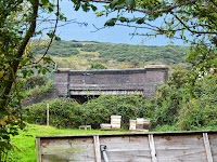
A 12.5 mile walk along Norfolk's Wherryman's Way

This is a delightful riverside walk following the River Yare out of Norwich and through to Rockland St Mary. Public transport can link the start and end by navigating down quiet country lanes to Thurton. Whitlingham Country Park provides an easy route to start and there's refreshment stops at Woods End and the Ferry Inn at Surlingham.

Indexes and Info

East Suffolk PRoW Access

The Public Rights of Way (PRoW) within the Suffolk Coastal area between Aldeburgh and Southwold are subject to being blocked up and diverted due to the extensive industrial projects that are currently taking place in the area including the Sizewell C development and various wind farm projects. A PRoW Access page details known issues in the area. There is also a link to the Works Tracker that contains details of known Blocking Up and Diversion Orders

Featured Walk

In Search of Sizewell Chapel

A 10 mile walk following the southern side of the parish boundary of Leiston in Suffolk This walk follows the route of a 17th century peram...

What is GPX

All you need to know about GPX, electronic mapping and how to use modern apps and mobile devices as navigation devices

Popular Walks

Diary of a Suffolk Common

The ramblings and musing of the Griffmonster