Wales Coast Path - Bangor to Llanfairfechan
Tuesday, 22 June 2021
|
No comments
|
![]()
An unashamed 10 mile walk along the North Wales coastline between Bangor to Llanfairfechan
The route starts inland to negotiate around the private grounds of Penrhyn Park which is a substantial excursion away from the coast. Despite this the walking is easy going and interesting and once alongside the beach provides some less frequented coastline.

Walk Statistics
- Start location: Bangor
- End location: Llanfairfechan
- Distance: miles ( km)
- Total Gain: ft ( metre)
- Total Descent: ft ( metre)
- Min Height: ft ( metre)
- Max Height: ft ( metre)
- Est. Walk Time:
- Walk type: Linear
- Walk Grade: Medium
- Terrain: Footpath, Track, Road
- Obstacles: It should be stressed that the broad sandy beaches are prone to cut off from tides with quicksand hazards. It is therefore wise to stick to the promenade

Maps
The following maps and services can assist in navigating this route. There are links to printed maps and links to downloadable GPX route data for importing into navigational software and apps.
- Ordnance Survey Explorer Map
- OS Explorer OL17 - Snowdon
- GPX Route File
Accommodation
Manorafon Farm Campsite, AbergeleView in OS Map | View in Google Map
- Website
- https://www.manorafon-farm-park.co.uk/stay/facilities/
- Description
- Compact and popular family campsite with easy access to town and public transport
Transport
Traveline - Service
- Service Details
- Both bus and trains link Conwy, Llanfairfechan and Bangor. Use Traveline website for the latest operators and information
- Timetable
- Traveline
Walk Notes
This was the first walk of a two part wander from Bangor to Conwy. This was broken down into two parts as Llanfairfechan made a convenient split if the weather or time went against us and we could therefore split a full day walk into two distinct walks. There is a train station at Llanfairfechan that links both Bangor to Conwy and the local bus service between the two towns also passes through the village.
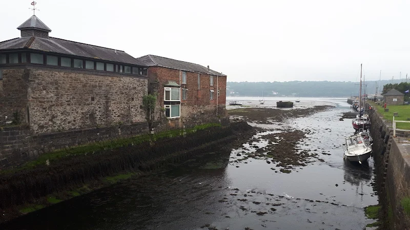
For this specific instance, where we had a basecamp at Abegele, it took two bus rides to get down to Bangor. Rather than heading into town, we alighted at Bangor Garth on the beach road. As an ageing hippy punk I would confidently state that towns are not my bag and would rather keep away so this stop was the last one before the hustle and the bustle of urbanisation was fully realised.
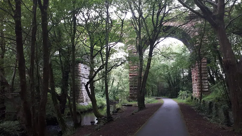
The walk has to initially divert away from the coast to avoid the private grounds of Penrhyn Castle. This begins with a pleasant wander along the former trackbed that follows the River Cegin. The railway that once followed the river was the Penrhyn Quarry Railway that brought slate down to the docks at Penhryn from the quarries at Bethseda, some 6 miles from the coast. The railway closed in 1962 and its track was lifted in 1965 for use on the Ffestiniog Railway.
Throughout this section the rain came down, sometimes in drizzles and sometimes a more persistent fine rain that seems to wet everything despite the waterproof protections. This was a pity, as despite the route not sticking to the coast, it was a pleasant meander. It has to be stated that there was no sign of the sea throughout out these first few miles. Stone railway bridges, a broad but shallow river, plenty of woodland but a distinct lack of coastal views or the sea. This should not be complained at. It is a lovely wander and is obviously appreciated by locals considering the number of joggers and dog walkers and cyclists who passed by us on the track despite the weather.
The path eventually leads away from this pleasant amble to cut across what looks like a new housing development. Kerb stones in place and more green land to be covered with brick and tarmac. Isnt it strange that after passing through loads of woodland and heading up onto this plain featureless landscape that one wants to answer the call of nature. Nature has this annoying trait about her. She waits until there is no opportunity to hide behind a tree and then squeezes ones bladder as a reminder. And not only was this a featureless landscape but also there was a beady eyed workman in a van by a roundabout that led nowhere. Opposite was a portaloo. A quick question would only be considerate as it was most likely the domain of such workmen. But then one look at the soiled artefact was enough to convince any self respecting person to continue onwards, legs not crossed but certainly not akimbo.
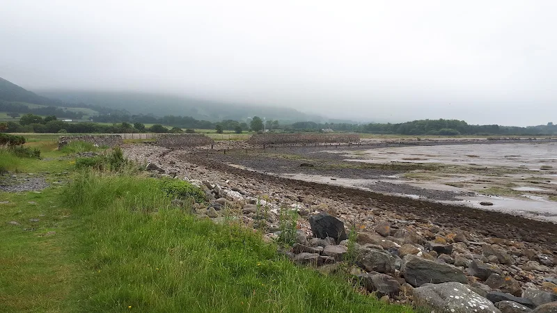
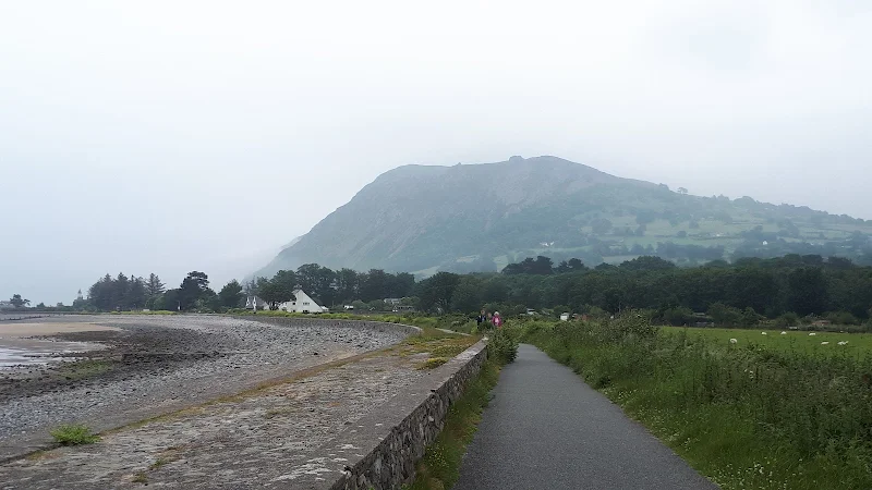
The route passes the 19th century church of Eglwys St Cross then leads down a lane past the the Spinnies Aberogwen North Wales Wildlife Trust Nature Reserve to rejoin the coast. It is then a full blown coastal walk all the way through to Llanfairfechan. Although in the misty rain the area probably did not show its best side, it was nonetheless a pleasant wander. The beach is predominantly pebbles, in some areas these could almost be described as small boulders and where the path leads down to the beach it can be challenging to get over some of these, certainly hindering ones progress. Fortunately, for most of this distance there is a track just above the beach which is a lot easier going.
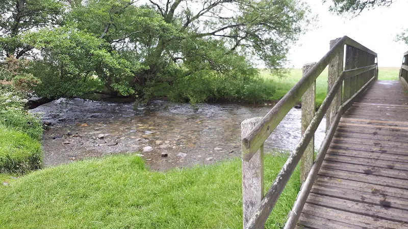
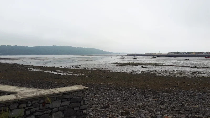
Half way along this coastal section the path passes over a wooden footbridge across the Afon Aber river which is no more than a large stream. On the landward side, and ahead one can see the Welsh mountains. Moel Wnion, 579m, and Tal y Fan at 610m. A constant reminder that this is not just a coast but a coast at the northern edge of Snowdonia, an amazing backdrop despite the mist attempting to hide this wonders of nature. The coast becomes a little wilder with marsh and scrub which is a pleasure to walk through. And then, Llanfairfechan beckons. Just beckons. It doesn't present itself or glorifies itself, but merely provide subtle hints of its existence, certainly like a dreary day such as this when few folk are about.
We take the opportunity of a simple shelter by the boating lake to grab a snack from the rucksack, a drink of water and a contemplation of what the afternoon may offer. And out of the shelter lurks the boating lake in the fine rain. The waters rippled in the breezes. We could have attempted to find a pub. But the shelter was worthy of our attention. It described the mornings walk of light greys, dampness and peacefulness.
Eventually we depart from the shelter and head into town. A road leads up from the beach, with a branch off to the station, and then a hill to the main road. Half way up the hill was a brick loo. An octagonal shaped brick loo. Ceertainly a construction that would enthral any public convenience spotter or enthusiast. Depsite its impressive design all that could be uttered on this occasion was how good it was to be able to stand in full confidence with legs akimbo .
Route Validation Cards
Validation Date - 25/06/2019
- Time of Walk: 09:00 to 13:00
- Validators: griff, kat
- Weather Conditions: overcast, some rain
- Notes: Initial route undertaken
Summary of Document Changes
Last Updated: 2026-05-16
- 2021-06-22 : initial publication of summary
- 2021-12-01 : Removal of ViewRanger links due to its imminent demise
- 2026-01-12 : Major website update with all walks recast to the new format


0 comments:
Post a Comment