Barnstaple to Braunton Walk Summary
Wednesday, 4 July 2018
|
No comments
|
![]()
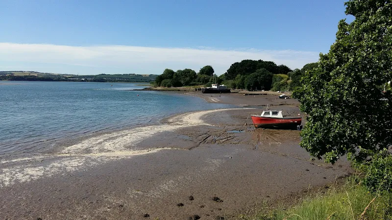
Easy walk along the South West Coast Path between Barnstaple and Braunton
An easy walk along the former LSWR railway trackbed which follows the Taw estuary. Amazing wide panoramas and level enough for wheelchair access.

Walk Statistics
- Start location: Barnstaple
- End location: Braunton
- Distance: miles ( km)
- Total Gain: ft ( metre)
- Total Descent: ft ( metre)
- Min Height: ft ( metre)
- Max Height: ft ( metre)
- Est. Walk Time:
- Walk type: Linear
- Walk Grade: easy
- Terrain: Paved track and cycle path throughout
- Obstacles: Beware of cyclists approaching from behind - keep to the left and walk single file

Maps
The following maps and services can assist in navigating this route. There are links to printed maps and links to downloadable GPX route data for importing into navigational software and apps.
- Ordnance Survey Explorer Map
- OS Explorer 139 - Bideford, Ilfracombe & Barnstaple
- GPX Route File
Accommodation
Hele Valley Holiday ParkcampsiteView in OS Map | View in Google Map
- Website
- www.helevalley.co.uk/
- Description
- Situated close to Ilfracombe, this family owned holiday park is set in the picturesque valley at Hele Bay. It offers a peaceful, clean and well maintained park with static caravans and lodges, camping pitches and camping pods. This site has been awarded Silver Awards from the Devon Tourism Awards, a David Bellamy Gold Award for Conservation and a Trip Advisor Excellence Certificate.
Transport
Stagecoach - Bus Service
- Service Details
- 21 - Stagecoach 21 Service linking Westward Ho!, Bideford, Barnstaple and Ilfracombe
- Timetable
- Stagecoach
Route Validation Cards
Validation Date - 2018-06-30
- Time of Walk: 09:00 to 11:30
- Validators: Griffmonster, Kat
- Weather Conditions: Bright warm sunny day
- Notes: Initial route undertaken
Summary of Document Changes
Last Updated: 2026-04-20
- 2021-03-17 : Update website improvements and removal of ViewRanger reliance
- 2021-12-01 : Removal of ViewRanger links due to its imminent demise
- 2026-01-12 : Major website update with all walks recast to the new format


0 comments:
Post a Comment