Stour and Orwell Walk - Cattawade to Shotley Gate Walk Summery
Friday, 17 August 2018
|
No comments
|
![]()
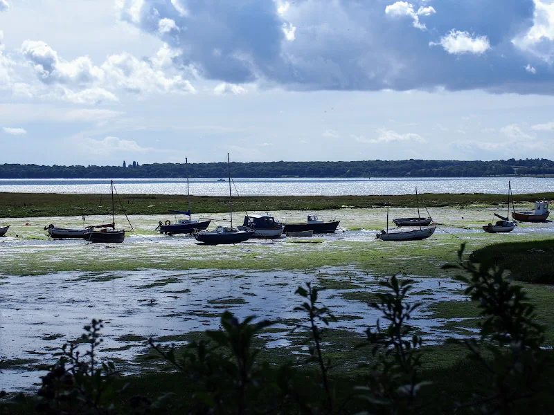
A walk along the Stour estuary following the Stour and Orwell long distance path.
The Stour and Orwell Walk is a long distance trail that follows the estuaries of South Suffolk. This 42 mile trail links Felixstowe and Manningtree and this specific walk is the southern most section that follows the north side of the River Stour estuary. There are some superb views across the wide waters that separate Suffolk and Essex and although there is not full access along the waterfront, the route provides a pleasant days ramble to the head of the Shotley peninsular. This specific route also diverges from the official route to take in the village of Erwarton, a quiet and tranquil Suffolk community that is a pleasure to meander through.
The route is waymarked throughout although it is advisable to use an OS map or GPX tracker software to clarify the route in a few specific points where the way onwards becomes ambiguous. Do check tide times as there is a short section along the beach by Sutton Ness which can become inaccessible during periods of high tide.
The main limitation of this walk is the transport access between the two ends. There is no direct bus service and one needs to use Ipswich as a link. Having said this, the services do allow ample time to perform the walk.
It is advisable to take food and drink as there are little opportunities to purchase any on the route, with the only pub encountered being that at the end of the walk.

Walk Statistics
- Start location: Cattawade
- End location: Shotley Gate
- Distance: miles ( km)
- Total Gain: ft ( metre)
- Total Descent: ft ( metre)
- Min Height: ft ( metre)
- Max Height: ft ( metre)
- Est. Walk Time:
- Walk type: Linear
- Walk Grade: easy
- Terrain: Footpaths and country lanes. Waymarked throughout with the distinctive Stour and Orwell Walk circular signs
- Obstacles: There is a short section along the beach by Sutton Ness which can become inaccessible during periods of high tide. Check tide times prior to walking

Maps
The following maps and services can assist in navigating this route. There are links to printed maps and links to downloadable GPX route data for importing into navigational software and apps.
- Ordnance Survey Explorer Map
- OS Explorer 212 - Woodbridge & Saxmundham
- GPX Route File
Transport
Ipswich Buses - Bus Service
- Service Details
- 97/98 - Ipswich Buses services 97 and 98 linking Ipswich and Shotley Gate
- Timetable
- Ipswich Buses Timetables
Ipswich Buses - Bus Service
- Service Details
- 92 - Ipswich Buses service 92 linking Ipswich, Cattawade and Manningtree
- Timetable
- Ipswich Buses Timetables
Route Validation Cards
Validation Date - 2017-08-18
- Time of Walk: 08:00 to 13:30
- Validators: Griffmonster, Kat
- Weather Conditions: Bright summers day
- Notes: Initial route undertaken
Summary of Document Changes
Last Updated: 2026-04-20
- 2021-03-17 : Update website improvements and removal of ViewRanger reliance
- 2021-12-01 : Removal of ViewRanger links due to its imminent demise
- 2026-01-12 : Major website update with all walks recast to the new format


0 comments:
Post a Comment