Essex Coast - St Lawrence to Tillingham Walk Summery
Thursday, 23 August 2018
|
No comments
|
![]()
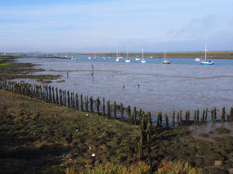
A 16 mile walk along the Blackwater estuary from St Lawrence to Tillingham
The area that is bordered by the Blackwater Estuary to the north and the River Crouch to the south is known as the Dengie peninsular, a somewhat isolated area of marsh and low lying farmland. The remoteness of this area is its beauty and given the clear blue skies and a little warmth in the air this can be a true delight to walk.
The route detailed here heads along the Blackwater estuary, passing Bradwell nuclear power station as the coast slowly curves around from the estuary to face the open sea. In the distance, Mersea island is easily seen and sitting on the mudflats as river meets sea, visible at low tide, are a line of concrete filled barges that were sunk to provide a sea defence for the marshes. Further along is the remote St Peters Chapel, the oldest church in England and said to have been constructed in AD654. It is a working place of worship and well worth the visit into its humble and peaceful confines.
It is at this point that the long distance trail known as St Peters Way reaches its destination. This 45 mile trail starts at Chipping Ongar and passes through the Essex country side and villages in its journey to the coast. This well waymarked trail serves as the return for this route to St Lawrence. The trail leads across the low lying fields and marsh into the village of Tillingham arriving through the church yard. There is a pub on the green where one can rest ones weary legs before the final stage back to St Lawrence.
The St Peters Way slowly climbs to some 30m after leaving Tillingham, and this provides glorious views of the coastline. The route departs the trail at St Lawrence to follow a country lane out onto the main road. This is busy and caution should be observed when walking along this short section to the road down to St Lawrence Bay. There is a footpath marked on the OS that would negate this section. However this was certainly inaccessible when walking the route in September 2017. .

Walk Statistics
- Start location: St Lawrence
- Distance: miles ( km)
- Total Gain: ft ( metre)
- Total Descent: ft ( metre)
- Min Height: ft ( metre)
- Max Height: ft ( metre)
- Est. Walk Time:
- Walk type: Circular
- Walk Grade: moderate
- Terrain: Coastal defence banks and footpaths. A little road walking
- Obstacles: There is a short section down the main road to the turning for St Lawrence. Care should be taken as this road is fast and busy and there are two bends either side of this section

Maps
The following maps and services can assist in navigating this route. There are links to printed maps and links to downloadable GPX route data for importing into navigational software and apps.
- Ordnance Survey Explorer Map
- OS Explorer 176 - Blackwater Estuary
- GPX Route File
Accommodation
Waterside ParkcampsiteView in OS Map | View in Google Map
- Website
- https://www.parkdeanresorts.co.uk/location/essex/
- Description
- Parkdean resorts Waterside Park on the banks of the Blackwater estuary. This was taken over by Countrywide Park Homes in December 2017 amid accusations of intimidation towards holiday park plot owners. It is uncertain whether touring sites are still available here. Certainly during Autumn 2017 the site was amenable and the staff accommodating. More recent Trip Advisor reports since the take over are not encouraging.
Route Validation Cards
Validation Date - 2017-09-10
- Time of Walk: 06:30 to 14:00
- Validators: Griffmonster, Kat
- Weather Conditions: Clear blue skies.
- Notes: Initial route undertaken
Summary of Document Changes
Last Updated: 2026-04-20
- 2021-03-17 : Update website improvements and removal of ViewRanger reliance
- 2021-12-01 : Removal of ViewRanger links due to its imminent demise
- 2026-01-12 : Major website update with all walks recast to the new format


0 comments:
Post a Comment