Somerset Coast Path - Cannington to Watchet

An extensive hike along the Somerset Coast path from Cannington to Watchet
This is an extensive 20 mile hike along the Somerset coast from the village of Cannington on the Parrot Estuary to Watchet, sitting under the Quantock hills on the coast. The extent of this walk is down to the lack of public transport in the area making it difficult to walk smaller sections without some kind of personal transport or taxi assistance to link up the ends. Even this walk is limited by the fact that there is only a single bus journey each day and that only runs weekdays during college term, departing at 7:40 from Watchet railway station.
Having outlined the negative aspects then it should be stated that this is an outstanding walk over varied terrain. The walk begins along the River Parrett and heads out alongside the marshes towards Steart Point. There is an option to continue to the point although this would add an additional 4 miles to the distance. This route follows a short cut to omit this, and cuts across to the coast up to Hinkley Point Power Station.
At this point there is a long term diversion in place due to the building works for the construction of Hinkley Point C, the first UK nuclear power station to be constructed in many decades. The diverted paths are well maintained with convenient waymarkers in place throughout the 3 mile diversion. The site is extensive with some massive earth works being undertaken and all the noise and hubbub associated with such sites.
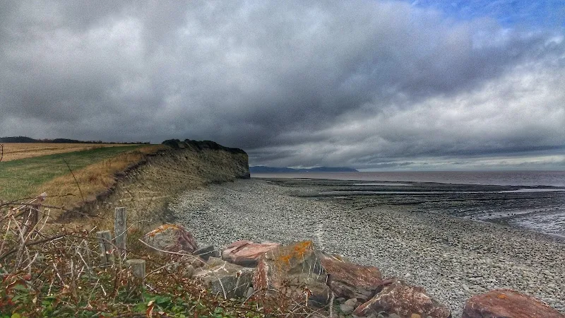
On the western side of the power station the landscape changes as the path negotiates the coastal section at the foot of the Quanktock hills. Cliffs and valleys are encountered and two beach sections need to be negotiated, one at St Audreys Bay and another at Helwell Bay, where fossils can be easily found amongst the large stones and pebbles. Do take note of the tide times as access to both beaches is limited by the tide which makes both beach routes impassable. During high tides a marked alternative inland route is provided and there is ample signage to warn the walker of progressing along the beaches during such conditions.

Walk Statistics
- Start location: Cannington
- End location: Watchet
- Distance: miles ( km)
- Total Gain: ft ( metre)
- Total Descent: ft ( metre)
- Min Height: ft ( metre)
- Max Height: ft ( metre)
- Est. Walk Time:
- Walk type: Linear
- Walk Grade: moderate
- Terrain: Defence banks to start. Coastal footpaths and two beach sections
- Obstacles: During high tides the path at Combwich can become inundated as upon this occasion. Follow this route which negotiates around the lower lying areas of the footpathNote that the two beach sections at St Audreys Bay and Helwell Bay are impassable at high tide. Do not attempt to cross these as the exit point will be in deep water - follow the alternative path signs. In this instance both beaches were passable after a high tide at 9am
Maps
The following maps and services can assist in navigating this route. There are links to printed maps and links to downloadable GPX route data for importing into navigational software and apps.
- Ordnance Survey Explorer Map
- OS Explorer 140 - Quantock Hills & Bridgwater
- GPX Route File
Accommodation
Unity Farm, Brean Sands, Burnham-on-SeacampsiteView in OS Map | View in Google Map
- Website
- https://www.hru.co.uk/
- Description
- A family oriented holiday park with entertainment, static caravans as well as touring pitches
Transport
First Group - Bus Service
- Service Details
- 15 - First Group 15 Service linking Watchet and Bridgwater via Cannington. NOTE: there is only a single journey in each direction weekdays only and only during college term time
- Timetable
- First Group (Somerset) Website
Route Validation Cards
Validation Date - 2018-09-11
- Time of Walk: 08:30 to 17:00
- Validators: Griffmonster, Kat
- Weather Conditions: Overcast threatening low clouds but very little rain
- Notes: Initial route undertaken
Summary of Document Changes
Last Updated: 2026-01-12
- 2021-03-17 : Update website improvements and removal of ViewRanger reliance
- 2021-12-01 : Removal of ViewRanger links due to its imminent demise


0 comments:
Post a Comment