Route details, maps, pubs, features, local history and folklore for a wide variety of walks focusing primarily on Norfolk and Suffolk

Walks
Showing posts sorted by relevance for query Watchet. Sort by date Show all posts

Wednesday 3 October 2018

Somerset Coast Path - Minehead to Watchet

Salt marsh

An easy ramble along the Somerset Coast Path between Minehead and Watchet

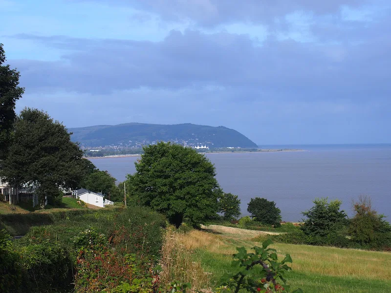
This is a scenic and easy walk along the Somerset Coast Path between Minehead and Watchet with connections between the ends provided by either bus service or the heritage railway that follows the route.

Parking in this area of Somerset is expensive and an alternative is to make use of the ample free parking along the coast road at the hamlet of Blue Anchor, midway along the route.

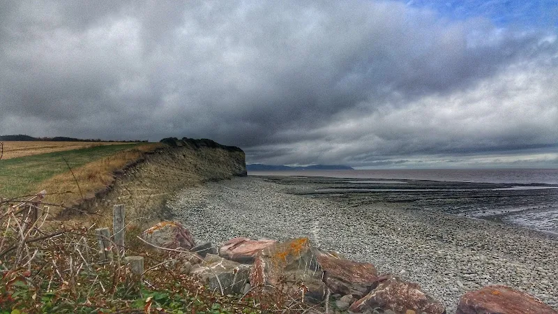
The walk encompasses a varied scenery from the flat open areas of Dunster Beach to the rolling hills between Blue Anchor and Watchet which require a little effort to ascend but are nothing too challenging. There are some beach sections although a cycle track provides an easier option from the hard going across the large pebbles

It must be noted that on this instance of the walk during September 2018 there had been cliff fall just beyond the Blue Anchor pub at the eastern end of the hamlet of the same name which had blocked the path. This necessitated following a waymarked diversion along permissive paths that follow the roadside then descend down to the cliffside through the woods known as Three Acre Covert. A stroll that made a pleasant change of scenery.

Tuesday 2 October 2018

Somerset Coast Path - Cannington to Watchet

Salt marsh

An extensive hike along the Somerset Coast path from Cannington to Watchet

This is an extensive 20 mile hike along the Somerset coast from the village of Cannington on the Parrot Estuary to Watchet, sitting under the Quantock hills on the coast. The extent of this walk is down to the lack of public transport in the area making it difficult to walk smaller sections without some kind of personal transport or taxi assistance to link up the ends. Even this walk is limited by the fact that there is only a single bus journey each day and that only runs weekdays during college term, departing at 7:40 from Watchet railway station.

Having outlined the negative aspects then it should be stated that this is an outstanding walk over varied terrain. The walk begins along the River Parrett and heads out alongside the marshes towards Steart Point. There is an option to continue to the point although this would add an additional 4 miles to the distance. This route follows a short cut to omit this, and cuts across to the coast up to Hinkley Point Power Station.

At this point there is a long term diversion in place due to the building works for the construction of Hinkley Point C, the first UK nuclear power station to be constructed in many decades. The diverted paths are well maintained with convenient waymarkers in place throughout the 3 mile diversion. The site is extensive with some massive earth works being undertaken and all the noise and hubbub associated with such sites.

On the western side of the power station the landscape changes as the path negotiates the coastal section at the foot of the Quanktock hills. Cliffs and valleys are encountered and two beach sections need to be negotiated, one at St Audreys Bay and another at Helwell Bay, where fossils can be easily found amongst the large stones and pebbles. Do take note of the tide times as access to both beaches is limited by the tide which makes both beach routes impassable. During high tides a marked alternative inland route is provided and there is ample signage to warn the walker of progressing along the beaches during such conditions.

Walk Summaries

Latest walk summaries are basic information sheets for walks that have yet to be fully documented. These provide links to maps, public transport and walks stats, although detailed notes and features are not included.

Latest Walk Summaries

Featured Walk

In Search of Sizewell Chapel

A 10 mile walk following the southern side of the parish boundary of Leiston in Suffolk This walk follows the route of a 17th century peramb...

What is GPX

All you need to know about GPX, electronic mapping and how to use modern apps and mobile devices as navigation devices

Popular Walks

Maps