The Camel Trail - Wadebridge to Padstow
Wednesday, 15 July 2020
|
No comments
|
![]()
The Camel Trail - Wadebridge to Padstow
A short section of The Camel Trail route that follows the former North Cornwall Railway trackbed. This doubles up as both a cyclepath and a walkway making it suitable to virtually anyone of average fitness. The scenery is glorious as the track winds its way along the Camel estuary.

Walk Statistics
- Start location: Wadebridge
- End location: Padstow
- Distance: miles ( km)
- Total Gain: ft ( metre)
- Total Descent: ft ( metre)
- Min Height: ft ( metre)
- Max Height: ft ( metre)
- Est. Walk Time:
- Walk type: Linear
- Walk Grade: Easy
- Terrain: Paths
- Obstacles: Beware of cyclists

Maps
The following maps and services can assist in navigating this route. There are links to printed maps and links to downloadable GPX route data for importing into navigational software and apps.
- Ordnance Survey Explorer Map
- OS Explorer 106 - Newquay & Padstow
- GPX Route File
Accommodation
Valley Camping and Caravan Park, PolzeathView in OS Map | View in Google Map
- Website
- https://www.valleyholidaypark.co.uk/
- Description
- A friendly and welcoming family owned camp and caravan site close to the beach at polzeath
Walk Notes
The south west coast path has numerous ferries to cross the many estuaries throughout its length. For the hardened walker who wants to complete the distance with no assistance of ferries then there are possibilities. The Camel estuary offers a method to navigate from Padstow to the nerest bridge at Wadebridge although the eastern side of the estuary has no dedicated route back to the official path at Rock and one would need to endure some road walking.
In this instance the walk was not due to being walkers with an agenda to not use ferries but as a diversion from the sights and scenes of the main coast walk. This is an easy trail along the former trackbed of the former North Cornwall Railway that extends to Bodmin and beyond. The line was constructed at the end of the 19th century and was used as a working railway up until 1967. The route was converted to a cycleway in the mid 1980s and attracts many visitors with cycle hire being available at Wadebridge. Being marketed as a cycleway does require one staying alert for the frequent traffic that pases in both directions throughout the entire route. Having said this, on walking this route it was found all cyclists were courteous to walkers and maintained a sedate speed.
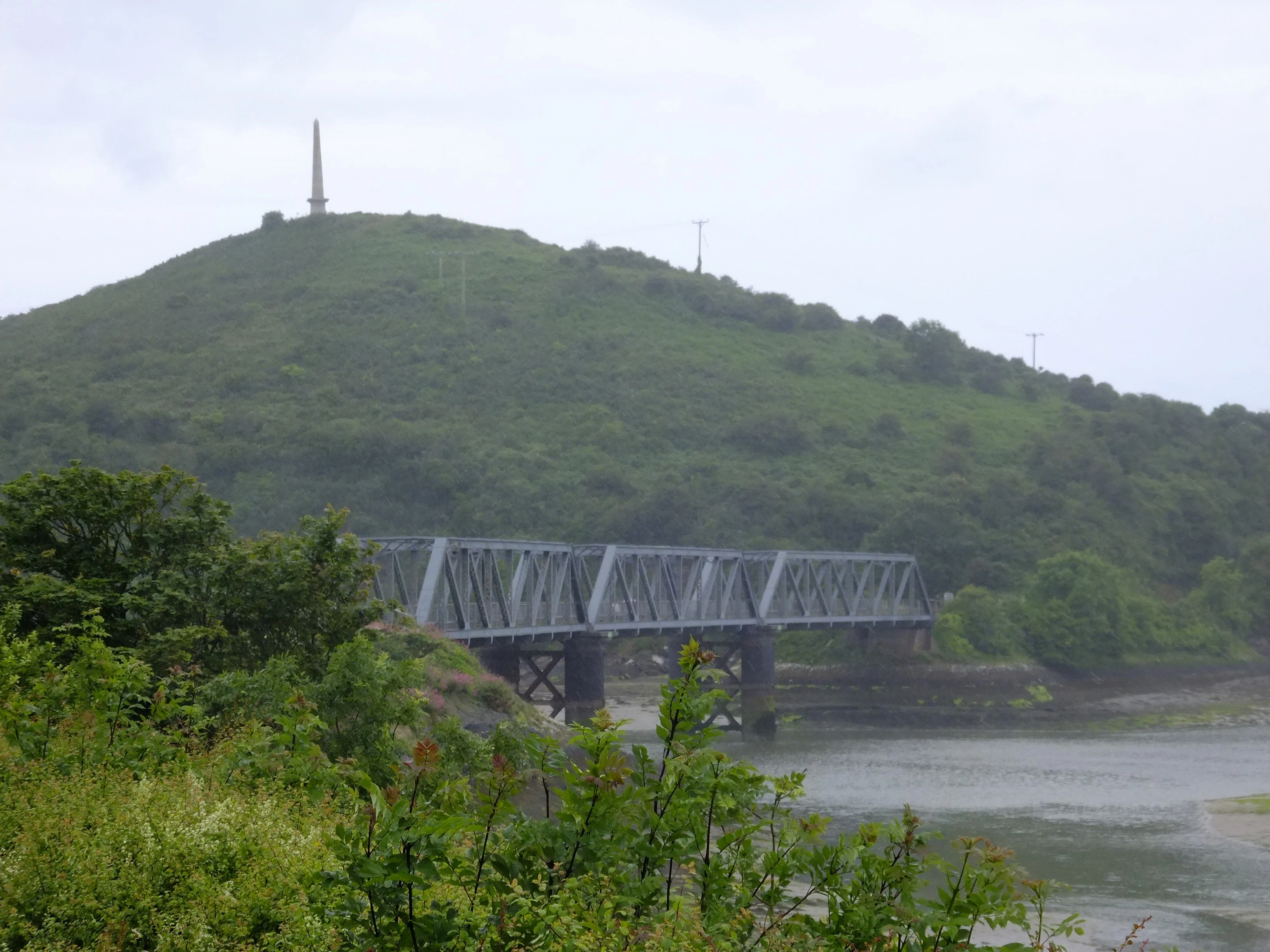
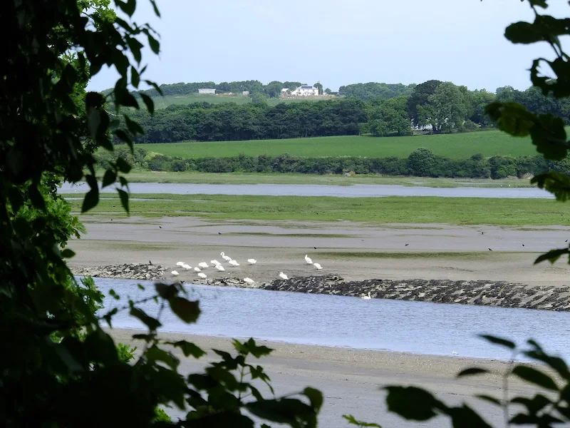
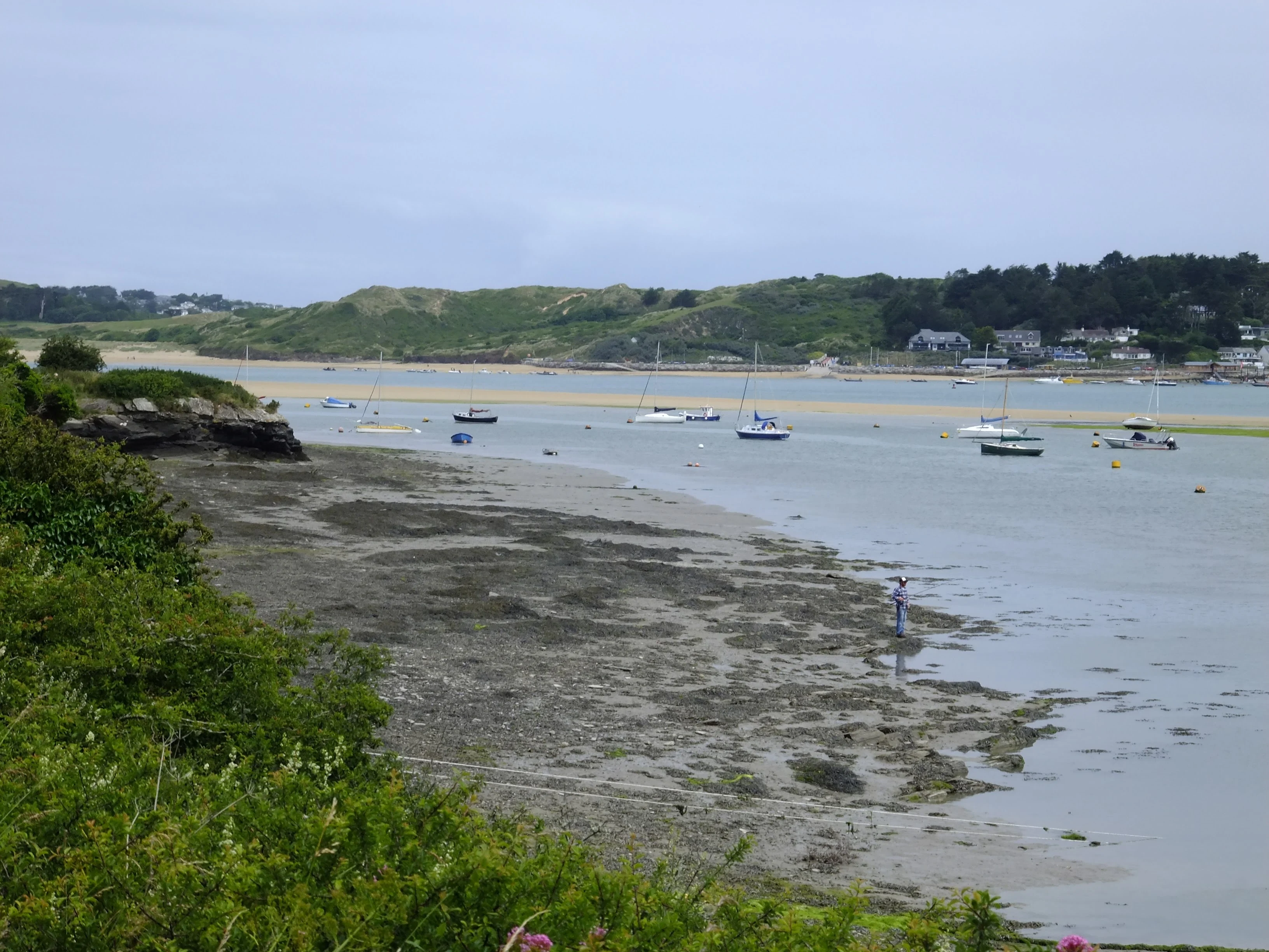
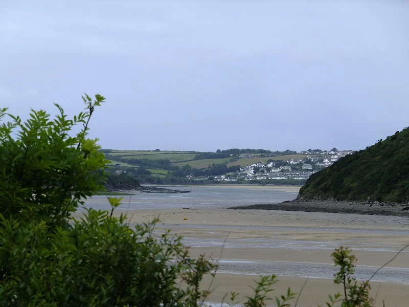
There is plenty to feast ones eyes upon along the route with the waters of the estuary being a constant companion. There are former stone quarries, old railway bridges across over the route, numerous benches where one can take a rest and admire the views. There is a magnificent iron bridge towards the end of the route, that spans Petherick Creek. Above this atop Dennis Hill stands an obelisk that marks Queen Victoria's jubilee in 1881. The route then ends at the former station buildings of Padstow with only a small walk into the centre of town.
There is a regular bus service that links Padstow and Wadebridge for those who want to onyl walk in one direction. On this occasion Griffmonster Walks was camped at Polzeath and this necessitated a bus jounrey into Wadebridge with a ferry back across the estuary to Rock in order to return to the start.
Directions
Hard surfaced trail that links Wadebridge and Padstow
On the west side of the town centre bridge in Wadebridge, take Eddystone Road on the right and follow this to the roundabout. Head straight on following the Camel Traill way markers. The route is then self evident all the way through to Padstow.
Image Gallery

Route Validation Cards
Validation Date - 2016-07-01
- Time of Walk: 09:30 to 12:30
- Validators: Griffmonster, Kat
- Weather Conditions: heavy clouds but some suny periods
- Notes: Initial route undertaken
Summary of Document Changes
Last Updated: 2026-04-20
- 2020-07-15 : Initial Publication
- 2021-03-17 : Update website improvements and removal of ViewRanger reliance
- 2021-12-01 : Removal of ViewRanger links due to its imminent demise
- 2026-01-12 : Major website update with all walks recast to the new format


0 comments:
Post a Comment