SWCP - Lulworth Cove to Hans Tout Cliff

A 12 mile hike through the Lulworth Ranges.
A demanding section of the South West Coast Path that crosses the Lulworth military ranges, then onto Hans Tout Cliff before heading inland to Kingston and the local bus services.

Walk Statistics
- Start location: Lulworth Cove
- End location: Kingston
- Distance: miles ( km)
- Total Gain: ft ( metre)
- Total Descent: ft ( metre)
- Min Height: ft ( metre)
- Max Height: ft ( metre)
- Walk Time:
- Walk Grade: Challanging
- Terrain: Footpath

Maps:
The following maps and services can assist in navigating this route. There are links to printed maps and links to downloadable GPX route data for importing into navigational software and apps.
- Ordnance Survey Explorer Map
- OS Explorer OL15 - Purbeck and South Dorset
- GPX Route File
Walk Notes
The Lulworth military ranges are only open for public access on certain weekends throughout the year which makes it difficult to plan this section as part of a broader SWCP itinerary. There had been a couple of times we planned to cross this section, once when walking the Dorset coast and another time during a holiday period and both of these times coincided with restrictions to access for the weekend in question. The other difficulty for sectional walkers is public transport logistics between the two ends of the walk with bus services to Lulworth being seasonal.
To accommodate this walk, we selected a weekend at the start of July when the seasonal bus service was in operation, then selected the Redcliffe Farm Camspite just outside of Wareham as a central location. This provided access to public transport between Wareham and Lulworth to start the walk, and the service from Swanage to Wareham, that called at Kingston, upon completion. This was undertaken on a Sunday which also included a decent bus service.
The majority of the route followed the official South West Coast Path. The exception was the start of the trail at Lulworth where we took the route across Binden Hill rather than the coastal route. This provided some magnificent views and was a little less strenuous than the official route to provide more confidence of completing the hike in time to catch the last bus at Kingston.
In addition, at Hans Tout cliff we came off route to head into Kingston where there is the Scott Arms pub and the bus service back to Wareham. Originally we had planned to go down the east face of Hans Tout cliff and head inland following the valley at the bottom. Unfortunately, following recent cliff falls, the steps down the cliff were very precarious and very close to the sheer drop of the cliff, which was unnerving. Shortly after undertaking this walk, the steps were closed off with an official diversion via Kingston added in, taking a similar route to what is defined here. This has since been rectified with new steps put in place.
It has to be stressed that although this section is only 12 miles, it is nonetheless an arduous hike and plenty of time is needed to undertake the complete distance. There are several demanding ascents and descents. One notable descent was down from Flowers Barrow to Warbarrow Bay. There were plenty of people ascending this without too much difficulty, but descending had both of us falling on our arses on the damp grass resulting in descending most of the height on our bottoms.
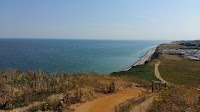
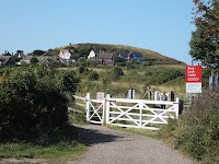
A notable feature along the route is the Clavell Tower which is covered in the features section of this page. There are plenty of photos in the Images section that provide views along the length of the route.
References
Directions
This walk predominantly follows the South West Coast Path (SWCP), with an alternative start, and end to the walk. The Lulworth Cove bus stop is at the entrance to the main car park, this is where the walk begins.
- From the car park, take Main road inland for 500m where Binden Road leads off to the right. Turn into Binden Road and continue for 75m where there is a footpath on the right.
- There are multiple footpaths around this section, immediately veer to the left, but then ignore further left branching paths. You need to head for Binden Hill. Once at the access point into the ranges, this becomes obvious with a broad track.
- After the summit of Binden Hill, the official SWCP joins the range path, ascending from below.
- Keep to the SWCP throughout the walk, this is well way marked so it is easy to follow. The going can be quite demanding with some steep ascents and descents. Take your time and meet each challenge as it comes along.
- At Kimmerage Bay, you will exit the ranges. Keep to the SWCP
- The going becomes easier as it follows the rolling hills through to Hans Tout Cliff which is a monster of a climb.
- At the summit there is a path that leads inland. Take this which follows the top of the ridge. It eventually comes to some woodland and after walking a total of 1.5 miles it meets a road. Turn right onto the road and follow this into Kingston Village.
- The Scott Arms pub is located on the junction with the main road through the village, the bus stop is to the right on the main road
Pubs
The Scott Arms, Kingston

- Address
- West Street, Kingston, Corfe Castle, Dorset BH20 5LH
- Website
- https://thescottarms.com/
Popular pub serving guest ales with some fine views of the hills from the garden. At the time of visiting there was Jurassic Brewery’s Origin and Durdle Door, complemented with Palmers Brewery Copper ale. An outside bar was offering Jamaican food and cocktails with plenty of reggae music filling the air.
Features
Clavell Tower

A notable feature along the route was the Clavell Tower, a historic 19th-century Tuscan-style folly perched on the clifftop above Kimmeridge Bay. This circular, four-storey structure was commissioned in 1830 by the Reverend John Richards Clavell of nearby Smedmore House. It features a ground-floor Tuscan colonnade, arched windows, and a parapet with mock machicolations (an architectural opening or gap in the floor of a projecting stone gallery, battlement, or parapet ). Between 2006 and 2008, because the soft cliff was crumbling into the sea, the Landmark Trust carefully dismantled the entire tower stone-by-stone and rebuilt it 25 metres inland. It now operates as a unique, self-catering holiday rental managed by the Landmark Trust.
Images


Route Validation Cards
Validation Date - 2023-07-02
- Time of Walk: 10:30:00 to 17:30:00
- Validators: Griff, Kat
- Weather Conditions: A little overcast but warm
- Notes: Initial route undertaken
Summary of Document Changes
Last Updated: 2026-11-12
- 2026-10-31 : Initial publication





Comments
Post a Comment