Route details, maps, pubs, features, local history and folklore for a wide variety of walks focusing primarily on Norfolk and Suffolk

Walks
Showing posts sorted by relevance for query Bodmin. Sort by date Show all posts

Thursday 16 July 2020

Bodmin Steam Railway Walk

XXX

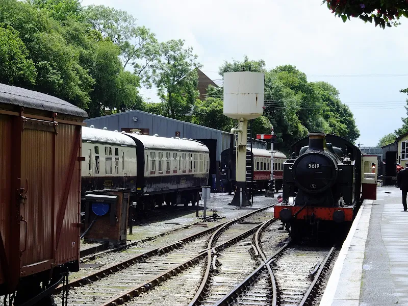
Route that connects the stations of Boscarne Junction and Bodmin General

A walk along the steam railway between Boscarne Junction and Bodmin General. Althoguh the path does not exclusively follow the railway it is nonetheless a pleasant walk for most of the distance with the attractions of the busy steam railway at Bodmin General station.

Wednesday 15 July 2020

The Camel Trail - Wadebridge to Padstow

Estuary view

The Camel Trail - Wadebridge to Padstow

A short section of The Camel Trail route that follows the former North Cornwall Railway trackbed. This doubles up as both a cyclepath and a walkway making it suitable to virtually anyone of average fitness. The scenery is glorious as the track winds its way along the Camel estuary.

Sunday 23 December 2018

South West Coast Path - Porthleven to The Lizard

The Lizard

An 15 mile walk along the Cornish section of the South West Coast Path between Porthleven and The Lizard

A walk to Britain's most southerly point, The Lizard. There are a few challenging climbs along the route although the path is predominantly across grassy cliff-tops with some fantastic views along the coast. This walk crosses the renowned Loe Bar in front of Loe Pool which is said to have been where King Arthur's sword Excalibur was thrown upon his death.

Tuesday 17 December 2019

South West Coast Path - Bude to Boscastle

View from Buckator

An 16 mile walk along the South West Coast Path between Bude and Boscastle

A challenging walk along a spectacular part of the South West Coast Path. Although this can be achieved in a single day there is the village of Crackington haven near to the half way mark which allows one to cut the walk into two smaller options. Waterfalls to see, steep valleys to cross and some amazing views of the coastline.

Tuesday 10 December 2019

Ouse Valley Way - Bedford to St Neots

River Ouse, Eaton Socon

A 17 mile riverside walk along the Ouse Valley Way between Bedford and St Neots

Despite the increasing urbanisation between Bedord and St Neots, the riverside sections of this walk provide some pleasant rambles. Particularly notable is the 15th century river bridge at Great Barford and the riverside parks at St Neots.

Walk Summaries

Latest walk summaries are basic information sheets for walks that have yet to be fully documented. These provide links to maps, public transport and walks stats, although detailed notes and features are not included.

Latest Walk Summaries

Featured Walk

In Search of Sizewell Chapel

A 10 mile walk following the southern side of the parish boundary of Leiston in Suffolk This walk follows the route of a 17th century peramb...

What is GPX

All you need to know about GPX, electronic mapping and how to use modern apps and mobile devices as navigation devices

Popular Walks

Maps