Route details, maps, pubs, features, local history and folklore for a wide variety of walks focusing primarily on Norfolk and Suffolk

Walks
Showing posts sorted by relevance for query Morston. Sort by date Show all posts

Saturday, 26 January 2019

Norfolk Coast Path - Cley to Wells-next-the-Sea

Marshes near Blakeney

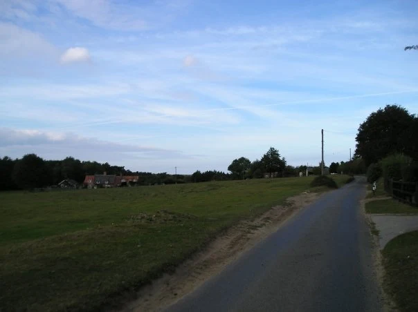
A 10 mile walk following the Norfolk Coast Path between Cley and Wells-next-the-Sea

An easy walk along the Norfolk Coast Path navigating out across the marshes to Blakeney then along the marsh perimeter to Wells. Blakeney is a worthy stopping point to explore Mariners Hill and the Guildhall and take in the legends of the Blakeney tunnels and the tragic story of the Blakeney Fiddler who is depicted on the village sign.

Tuesday, 27 November 2018

In Search of the myths and legends of Stiffkey

Freshes creek

An 8.5 mile walk along a section of the Norfolk Coast Path between Wells-next-the-Sea and Morston, with a diversion through the village of Stiffkey.

Stiffkey (locally pronounced Stewkey) is referred to as Stivecai in the Domesday Book, which means "island of tree stumps". This is thought to relate to the remains of an ancient wooden structure dating back 8,000 years, that was found on the marsh. Today it is a sleepy little village on the North Norfolk Coast Road renowned for its topiary including a line of elephants all trunk to tail at Nellie's Cottage, a guitar sitting proudly atop a hedge at the home of a guitar teacher and a fox by the gate post of the Fox family's house. It does, nevertheless, have an intriguing recent history with stories of Black Shuck, the ghostly devil dog, and the tale of the infamous Reverend Harold Davidson, Rector of Stiffkey who was defrocked in a national scandal involving ladies of the night and ended up being mauled by a lion.

Sunday, 23 October 2011

Completion of The Woodfordes Ale Trail 2011

The Woodfordes Ale Trail ended on 30th September and it was time to total up our stamps and collect our prizes. To recollect the rules, one has to visit Woodfordes outlets that are contained in their 2011 guide and on purchasing a pint of Woodfordes ale the publican will add an entry to the Trail Card with a unique stamp. There is only one stamp allowed for each venue and the trail only runs from June to the end of September. There is a different prize for collecting multiples of 10 stamps with the top prize being a polypin of ale for 60 stamps. In 2009 we managed to fill 2 Trail Cards and had started a third giving us a bounty of 2 polypins and a Nelsons Revenge t-shirt. This year we were not as successful due to being away from the area for a few weeks over the summer months. The end result was that we only completed half of the card. Nonetheless, this was thirty stamps collected which was rewarded with a mighty fine Woodfordes Hoody worth £25 as modelled by Kat in the photo above, an item that will most certainly keep us warm on our camping and walking expeditions

Tuesday, 24 December 2019

Norfolk Coast Path - Wells-next-the-Sea to Burnham Overy Staithe

Burnham Overy Staithe

A 7 mile walk following the North Norfolk Coast Path between Wells-next-the-Sea and Burnham Overy Staithe

This amble includes some magnificent beach walking along the sands in front of the Holkham National Nature Reserve. Acres upon acres of golden sand when the tide is out with big skies and thousands upon thousands of razor shells which are washed up on the high tide mark. The walk ends at Burnham Overy Staithe, the quiet hamlet which is said to be where Nelson learnt to row and sail.

Thursday, 19 December 2019

The Aftermath of the 2013 Storm Surge - Cromer and Sheringham

Damaged Beach huts

A 6 mile beach walk to witness the damage caused by the 2013 Storm Surge at Cromer and Sheringham

Both Cromer and Sheringham bore the brunt of the storm surge on the night of December 5th 2013. Although repair work is well under way there are still the signs of what damage the sea can cause. There have also been many cliff falls along this length of coastline with the cliff faces providing a fascinating view sculptured by the weather and tides and offering multi coloured strata.

Tuesday, 4 December 2018

Paston Way - Trimingham to Cromer

St Botolphs church, Trunch

A 13 mile walk along Norfolk's Paston Way from Trimingham to Cromer.

This is a customised walk linking sections of the Paston Way to provide a route passing the churches of Trimingham, Trunch, Bradfield and Southrepps as well as the local village pubs which are obligingly open all day on a Sunday. The final section from Northrepps offers an alternative wander past Sally Beans Cottage, renowned for being the lookout from the old Smuggling days of the 17th century, into Cromer.

Monday, 7 January 2019

A Walk to the Dunwich Leper Chapel (Diversion in Place)

Leper Chapel

A 14.25 mile circular walk between Leiston to Dunwich

A simple walk using the Suffolk Coast Path from Sizewell to Dunwich with a visit to the ruins of the 12th century Leper Chapel. The return uses the the footpath via Mount Pleasant to get onto the Sandlings Path across Dunwich Heath to return back to Leiston.

Wednesday, 18 December 2019

Norfolk Coast Path between Blakeney and Cley - Latest Developments

Repaired defence bank close to Blakeney

The future of the 2.5 mile walk along the sea defences between Blakeney and Cley

The December 2013 Storm Surge caused major damage to the sea defences along the Norfolk Coast Path that encompasses the Blakeney Freshes. Work is currently being carried out to repair the breaches, however the long term future of both the Freshes and the coast path at this point is uncertain.

Cley to Blakeney Norfolk Coast Path Walk - Essential Information

Walk Statistics:

  • Start location: Cley 
  • End location: Blakeney 
  • Distance:   miles (  km)
  • Total Gain:   ft (  metre)
  • Total Descent:   ft (  metre)
  • Min Height:   ft (  metre)
  • Max Height:   ft (  metre)
  • Walk Time:  
  • Walk type: Linear
  • Walk Grade: Easy
  • Terrain: Footpath along flood defences throughout

Maps:

The following maps and services can assist in navigating this route. There are links to printed maps and links to downloadable GPX route data for importing into navigational software and apps.


Accommodation:

Galley Hill Campsite, BlakeneyView in OS Map | View in Google Map
Website
Description
Set in area of Outstanding Natural Beauty, Galley Hill Farm Campsite welcomes tents, trailer tents & small campervans. A quiet site located one mile from Blakeney quay. Toilets & shower facilities.

Transport:

Details of public transport that is required for the walk

Various Operators - Bus Service
Service Details
Coasthopper CH1, CH2, CH3 - Unfortunately, in recent years the highly acclaimed Coasthopper bus service has suffered from subsequent takeovers with a consequent deterioration of the service and continuing doubts upon is viability. Due to its constant changing operators, it is therefore best to use the Traveline website to determine the current timetables and services.
Timetable

Route Verification Details

  • Date of Walk: 2014-08-22
  • Walk Time: 14:30 to 16:30
  • Walkers: Griffmonster, Kat
  • Weather Conditions: Blue skies and sunshine with threatening dark clouds

Walk Notes

The storm surge on 5th/6th December 2013 caused a lot of damage to the area around Cley and Blakeney as evidenced during an earlier walk, detailed at The Aftermath of the 2013 Storm Surge - Blakeney, Cley and Salthouse. Returning during August 2014, it would appear that repair works are in progress although the long term future of both the Blakeney Freshes and the Coast Path around them is uncertain. Currently there are several parts of the flood defence banks that the Coast Path follows that have breaches already repaired, albeit the height of the defence bank is distinctly lower than its previous incarnation. A diversion is currently in place across the marsh as works are being undertaken along the northern side of the defences. There is also a major breach adjacent to Blakeney Quay where the current footpath diverts onto the beach area in front of Blakeney. It is good to see access once again available, especially as reports earlier in the year were implying that the repair work was seriously in doubt due to lack of funding.

The Environment Agency, the authority in charge of the area, offered a July update on the matter which is available atwww.norfolkcoastaonb.org.uk/mediaps/pdfuploads/pd003272.pdf. This details the meetings and responses from the various concerned parties who have a stake in the area. The end of the update concludes with the heading 'What Happens Next' which states:

We believe it is inevitable that the habitats of the Blakeney Freshes are going to change over time in response to sea level rise. However, we want to take all practical steps to secure the existing site features for the short term and then to work with owners and occupiers to encourage new nature conservation interests to evolve.

We have concluded from our investigations that the best and most sustainable approach is to repair the damaged embankment with a profile which has a lower and wider crest and shallower slopes. This will be more resilient to damage during any future surge events than the previous embankment design. We also want to reduce the time that saltwater stands on the marshes and we are looking into improvements to the existing sluices and drainage system.

Our intention now is to make progress quickly in order to have a reasonable defence standard in place before the high tides forecast in the autumn. We are planning to be on site in early August and we will issue fact sheets with more details before we start.

It is pleasing to know that this delightful walk is being reinstated although with the defence bank being lower the risk over over-topping is increased with more frequent flooding expected which may well render the coast path along this section inaccessible at certain times. In the longer term, the reference to 'sea level change' appears to imply that eventually this area will be lost to the sea, with the resulting loss of the present route the coast path takes. This remains to be seen.

Even so, whether the long term results in the loss of the route or whether short term flooding leaves the route inaccessible for short periods of time, there are a few reasonable alternatives that enable the walker to perambulate between the two villages:

  • Follow the A149 road route - The road between Blakeney and Cley has a pavement throughout the distance. Although this presents a safe solution to walking the road, it is nonetheless not the most pleasant of routes as the road tends to be busy particularly during the summer months.
  • Diversion through Wiveton - Walking from Blakeney, this takes a permissive path along the edge of the marsh to Wiveton Hall before heading up to the road and straight across to follow the quiet lanes into Wiveton. Taking the lane across Wiveton bridge will then lead into Cley. There is a lane from the church down into the village which circumvents having to negotiate the congested main road through the village. Altogether this is a most pleasant and rewarding alternative with added features of both Wiveton and Cley churches plus two pubs along the route. The downside is that the permissive path, across National Trust land known as Friary Hills, may not always be open. The route will be detailed on this site in the coming months.
  • Diversion across Wiveton Downs - although not strictly speaking a coast path route, and certainly a little longer than the official route, this nonetheless has some spectacular views of the coast from Wiveton Downs which makes it well worth the effort. The route heads south out of Cley, and then uses quiet lanes, footpaths and the permissive path across the downs and back down to the Coast Path between Blakeney and Morston. Features include a ford across the river Glaven and the Shell museum at Glandford but the best feature are the stunning views when one gets onto the downs. Full details of this route can be found at Inland Walk between Cley and Blakeney.
Footpath diversion along the north side of the Freshes

Directions

Beach walk between Cley and Blakeney

The path leads up the embankment on the westward side of Cley village before leading out across the marshes along the defence banks.

Defence banks reduced in height at Cley

Pubs

Kings Arms, Blakeney View in OS Map | View in Google Map

Image of pub
Address
Westgate Street, Blakeney
Website

The pub is recognisable, when approaching from the coast road heading towards the quay, by the distinct characters spelled out in black on the red pantile roofing declaring 'FH 1760'. The 1760 is a reference to when the roof was replaced, however the reason for initials 'FH' are lost in time although it is thought they may have referred to the then owner. There is also speculation that this was the date that the building first became an Inn but the name of the appears to refer back to earlier times. Many pubs obtained royal names after the restoration of the monarchy in 1660 after a period of Puritan rule. This is also borne out in the royal crest which is displayed on the southern wall of the building.

The interior is decorated with memorabilia of old musical hall stars and movie posters. This highlights the career of the former pub owner, Howard Davies, who had a long career which included working with the Black and White minstrels as well as appearing in acting parts for both television and films. Additional items on display are numerous clocks which reflect Howards lifelong interest in horology. Sadly Mr Davies passed away in 2010, but the pub has been retained within the family and is now managed by his son Nic.

The pub is renowned for its fish and seafood dishes and have a specials board that changes daily. Ale from Greene King plus gravity fed barrels of ale from Woodfordes that sit under cooling jackets behind the bar.

Review

The pub is quite compact but always busy and the bar staff friendly. I have to admit that recent offerings of Woodfordes Wherry have not fulfilled expectations, but the offering from this pub, straight from the barrel, restored some faith in the fine ale. A rewarding and refreshing well kept pint.

Defence works in progress on the northern side of Blakeney Freshes

Features

Blakeney ChapelView in OS Map | View in Google Map

On the northward side of the marshes at the point where the Coast Path turns westwards towards Blakeney is the location of the old Blakeney Chapel. The site is to the north of the River Glaven and is therefore unreachable from the coast path with little to view apart from a information board to point out its whereabouts. Despite its name, Blakeney Chapel is not in the parish of Blakeney but Cley and even its use as a chapel is rather dubious. Old maps depict it as a chapel but there is no documentary or archaeological evidence to support the claim of any religious function with the only clue to its use being a small hearth which it has been suggested could imply was for smelting iron. Its first appearance on a map was in 1586 where the building was depicted but unnamed. By 1769 a map by Cranefields displayed the building as "Eye House" but by 1797 William Faden's map names the building as Chapel ruins, a name which has stuck to the present time. Little of the structure remains apart from the foundations, the original building material probably carried off for reuse in the buildings of Cley and Blakeney. Today the ruins are protected as a scheduled monument although there is no active management. With increasing sea levels and constant erosion with a steady migration southwards of the beachside shingle bank it is thought the ruins will soon be buried and then lost to the sea.

References
Defence bank at Blakeney

Gallery

Below are a selection of images taken from from the photo album for this walk. Feel free to browse through these or click on an image to view a larger version in the Gallery.

Summary of Document Changes

Last Updated: 2021-12-07

2014-08-28 : original publication
2019-12-18 : general maintenance updates
2021-03-17 : Update website improvements and removal of ViewRanger reliance
2021-12-01 : Removal of ViewRanger links due to its imminent demise

Thursday, 24 January 2019

Folklore Trail around East Runton

Railway bridge at the end of Thains Lane with Inclborough Hill in the background

A 4 mile walk between East Runton and Cromer searching out old folklore

Using country lanes and tracks, this circular trail navigates around a East Runton to visit the various locations in Runtons history and folklore. Woodhill House is the location of an unidentified skeleton found during road widening. Thains Lane has the village's old smithy. The old Windmill sets the scene for the emanation of ghostly lights that crossed over to a copse. With a pub stop at Cromer and return via the redefined course of the Norfolk Coast Path, this makes for an excellent short walk on a spooky Autumn evening.

Saturday, 29 December 2018

Weavers Way - North Walsham to Cromer

Hanworth Common late on an autumn afternoon urging us to keep up the pace to get to Cromer before the light fades

A 23 mile walk along the Weavers Way from North Walsham to Cromer

Starting along the old M&GN railway trackbed to Aylsham, the path soon heads off across country passing by the Halls at Blickling, Felbrigg and Cromer as well winding its way through the picturesque villages of Aldborough, Hanworth and Sustead. A fascinating view of Norfolk's countryside.

Thursday, 19 December 2019

Cromer to Mundesley Beach Walk

Cromer

An alternative beach walk to the official Norfolk Coast path between Cromer and Mundesley

This beach section of the Norfolk Coast can only be walked when the tide allows as high tide reaches the foot of the cliffs and is impassable at Overstrand. There is frequent erosion all along the route so the scenery changes from year to year. The beach is predominantly sand with numerous groynes that present frequent obstacles to get past - sometimes decaying steps assist getting over the groynes and sometimes, at low tide or with boots and socks off, it is possible to get around the end of some of the groynes. Mostly, it involves clambering as best as you can over these eroded, seaweed covered, mussel encrusted defences but that is half the fun of it!

Monday, 26 February 2018

A Norfolk Ramble around the Burnhams

Holkham Hall lake

A 16 mile circular walk from Wells-next-the-sea taking in Burnham Thorpe, Burnham Market and Burnham Norton

This full days walk has everything to offer the adventurous rambler. There is a wander through the stately grounds of Holkham Hall in order to reach the humble church at Burnham Thorpe with its tributes to Norfolk's most famous son, Lord Nelson who was born and grew up in the area. Country lanes lead down to Burnham Market and the church of the old parish of Burnham Ulph. Heading down to the coast there is the church of Burnham Norton with its resplendent medieval paintings. The ramble returns along the vast expansive beaches in front of Holkham.

Indexes and Info

East Suffolk PRoW Access

The Public Rights of Way (PRoW) within the Suffolk Coastal area between Aldeburgh and Southwold are subject to being blocked up and diverted due to the extensive industrial projects that are currently taking place in the area including the Sizewell C development and various wind farm projects. A PRoW Access page details known issues in the area. There is also a link to the Works Tracker that contains details of known Blocking Up and Diversion Orders

Featured Walk

In Search of Sizewell Chapel

A 10 mile walk following the southern side of the parish boundary of Leiston in Suffolk This walk follows the route of a 17th century peram...

What is GPX

All you need to know about GPX, electronic mapping and how to use modern apps and mobile devices as navigation devices

Popular Walks

Diary of a Suffolk Common

The ramblings and musing of the Griffmonster