A Norfolk Ramble around the Burnhams
Monday, 26 February 2018
|
No comments
|
![]()

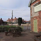
A 16 mile circular walk from Wells-next-the-sea taking in Burnham Thorpe, Burnham Market and Burnham Norton
This full days walk has everything to offer the adventurous rambler. There is a wander through the stately grounds of Holkham Hall in order to reach the humble church at Burnham Thorpe with its tributes to Norfolk's most famous son, Lord Nelson who was born and grew up in the area. Country lanes lead down to Burnham Market and the church of the old parish of Burnham Ulph. Heading down to the coast there is the church of Burnham Norton with its resplendent medieval paintings. The ramble returns along the vast expansive beaches in front of Holkham.

Walk Statistics
- Start location: Wells-next-the-Sea
- Distance: miles ( km)
- Total Gain: ft ( metre)
- Total Descent: ft ( metre)
- Min Height: ft ( metre)
- Max Height: ft ( metre)
- Est. Walk Time:
- Walk type: Circular
- Walk Grade: Easy
- Terrain: Footpaths, tracks and country lanes
- Obstacles: The route through the grounds to Hokham Hall are permissive paths and access should be checked prior to setting out. These are usually accessible to walkers in daylight hours.

Maps
The following maps and services can assist in navigating this route. There are links to printed maps and links to downloadable GPX route data for importing into navigational software and apps.
- Ordnance Survey Explorer Map
- OS Explorer 251 - Norfolk Coast Central
- GPX Route File
Accommodation
Arch House Bed and Breakfast View in OS Map | View in Google Map
- Website
- https://www.theglobeatwells.co.uk/arch-house-rooms
- Description
- This 18th century former customs lookout house makes an ideal retreat to explore North Norfolk. Friendly and welcoming and convenient both for town facilities as well as the bus services along the coast.
Walk Notes
This is an excellent all day Norfolk ramble that gets one off the beaten tourist tracks, and rightfully so. There is a lot to see and a variety of landscapes to wander through. There is the extensive park of Holkham Hall where one can set ones eyes on herds of deer. There is the vast Norfolk landscape as it heads up onto the hills above the marshy coastline. There is an amble along the edge of the marshes and a fantastic beach walk through the acres of flat sand that lie in front of Holkham. A full day. Churches to visit. Pubs for refreshment. And cups of warming tea at the beach cafe at Wells.
It must be said that the Norfolk Coast Path misses out on some things, sticking religiously to the coastline. In this instance it misses out on the villages that make up the Burnhams and it is well worth the effort of discovery to take a detour around them. There are seven Burnham's in total, two of which are on the coast path, namely Burnham Deepdale and Burnham Overy Staithe, although this is merely the coastal section of Burnham Overy Town otherwise known as Burnham Over the Water, which is today set inland on the banks of the River Burn, whose name is derived from the an old Angle-Saxon word burne
meaning a stream. Burnham Overy Town was originally the port of the Burnhams and up to the middle ages ships were able to navigate up the river to the town. In fact, one can visualize this on Fadens map of Norfolk from 1797 which depicts the river with surrounding marsh continuing all the way through to Burnham Thorpe complete with two mills along its course.
Burnham Thorpe is arguably the most famous of the Burnhams with its claim to fame being the birthplace of Lord Nelson, whose father was the rector of the parish. Burnham Norton sits on the edge of the marshes and takes its name from being the North Town
. Similarly Burnham Sutton is derived from South Town
and this parish was amalgamated with Burnham Westgate and Burnham Ulph into the modern day conglomeration of Burnham Market which was probably given this common name when the railway arrived in the area.
The route this ramble takes consists of footpaths, tracks and country lanes ending in a beach walk. The country lanes have little traffic on them and the footpaths and tracks are all easily found and make easy walking. Apart from one path! One quagmire that is best to forget about although this may no longer be the case. The directions to this ramble omit this footpath in favour of a country lane but it is worth noting the reason for doing this. The path in question leads from opposite the church at Burnham Thorpe, through a farm gate and across a field to join the former West Norfolk Branch railway trackbed, now accessible as a path. The footpath is easily found but on this occasion an obstacle awaited. The field that this path crosses appeared to have been in the process of being converted from pasture into a veritable quagmire. There was evidence of overturned grass in the deep thick mud that was trenched throughout, with a lot of standing water. It was difficult to stand up with each uncertain step descending into the mud until it reached a firmer foothold below the mire. A route along the field perimeter was barred by a tractor that was unloading bales of hay. This was working up close to the hedge with a herd of bemused cattle standing around the trailer that contained the hay. The farmer seemed unconcerned about our plight in navigating this mess. This certainly wasn't a recent plough ready for sowing crops, this was a dug up mess and totally impassable unless one had a tractor or a hot air balloon.
One would guess the footpath would hopefully be reinstated or at least given the favourable weather of a summer, some more solid ground can be established. But who knows, these days one sees more and more footpaths blocked up and extinguished by landowners. If you are following this route, then have a look and if it is still in such a state, stick to the country lane down to Burnham Market.
Next up along this route is the old station building at Burnham Market which is now described as a boutique Hotel, part of the Hoste Group which has a number of historic holiday lets and the Hoste Arms bar and restaurant. I have to admit that I do not know what a boutique hotel is although judging by their advertising it is a name to distinguish their exclusive luxurious internal decorations, although one pays for the privilege of staying in such elegance. Nonetheless it is worth having a glance at this building where there is plenty of evidence of its former use as a station up until 1952. A 19th century carriage stands on a short section of reinstated railway line from the road, down the side of the house, with a short section of platform still in existence. A signal stands adjacent to the road and mock railway crossing gates provide the entrance to the garden. There is also a traditional pub type sign that is proudly displayed on the side of the building with the name Railway House
presented in art deco font and a background of a steam engine gushing smoke from its cylinders. One could almost let ones mind drift back to them halcyon days when steam engines trundled along the Norfolk countryside. Almost. But the glaringly obvious, out of character placement of the Romanian Railways 4-6-0 230 series that forms the background to the sign certainly does not fit in with the Norfolk scenery. I doubt that the engine numbered 230 516 ever frequented these metals let alone put up a head of steam on the London and North Eastern Railway. More a curiosity. No doubt there is a reason or cryptic message to this but I am blowed if I can deduce it.
The walk then heads down to the first pub of the day, The Nelson, which is across the road to the church of Burnham Ulph with its distinctive open bell tower. We continue out of Burnham Ulph and up the hill to the round towered church of Burnham Norton before crossing the fields and descending down into the village on the edge of the marshes. From here we take the path at the edge of the marsh to join the coast path at Burnham Overy Staithe and the defence bank walk to the beach.
The beach between Burnham and Wells provides some of the best beach walking in Britain. At low tide there are acres and acres of firm golden sand. This provides such an iconic scene that it has been the backdrop to many film sets, TV programmes and video shoots including The Eagle Has Landed, Shakespeare in Love, an episode of The Avengers and the TV drama Kingdom.
Providing the tide is right one can walk a direct straight line ignoring the excursion around Holkham Gap. From Holkham Gap through to Wells there are a series of sand dunes with beach both in front and behind. These were substantially eroded in the 2013 storm surge that hit the Norfolk and Suffolk coasts. At points one can see right through to the rear beach. Whether this is permanent or whether tide and time will see them reinstated is uncertain.
One last thing. This walk was done during a February weekend getaway to Wells-next-the-sea. During summer months we would almost certainly have camped but the winter months require something a bit more comforting. In this instance we stayed over in B&B accommodation, namely The Arch House. Now I would recommend this place to anyone who wants to stay in the area and would not hesitate in using it once again despite a little uncanny nigh-time experience which I shall relate here.
After this specific walk, Kat and myself went into town, had a bite to eat at a local hostelry, then went back to our room for a well deserved nights rest. The rest was disturbed about 2am when Kat awoke me somewhat urgently. She had awoke seconds earlier and witnessed the door to the room slowly open, the tell-tale signs being the light that streamed in from the hallway, and the silhouetted figure then start to walk in. She sat up and the scene vanished. One may have put this down to another guest getting the wrong room but the door was locked. We checked it. Definitely locked. From the inside. Maybe it was the distinctive slight gap around the edge of the door where the hallway light was just visible. Maybe this induced some half awake dreams but why would such a scene awake one from ones slumbers. No, she had definitely seen the gap widen and the light come steaming in. This episode wasn't frightening, just uncanny.
We would gladly stay in this room again without any hesitation. I have found little information out about the house other than it is an 18th century listed building that was once used as a customs lookout although this appears to have been primarily down to it having the porched tower rather than being built specifically for that purpose.
Directions
The route uses paths through the Holkham estate followed by tracks, paths and country lanes down to the coast at Burnham Norton. The return is along the beach to Wells.
Depart Wells westwards using Mill Road which can be found at the Bus terminus. Keep to the pavement of this road as it exits the village and where it turns a sharp right continue straight ahead into the grounds of the Holkham Hall estate. A large gate bars the way across the track but there is a pedestrian gate on the right hand side which is open during daylight hours for public access into the estate. Keep straight ahead on this track through the parkland ignoring all other turnings. Continue past the front of the hall and follow the road around to the left, past the southern end of the lake. At the head of the lake take the track off to the right and continue to the gatehouse. Once again there is pedestrian access through a wrought iron gate.
Immediately after the gate turn left and follow a track on the left which leads along the boundary wall to the estate. After half a mile there is a track on the right, take this and continue to the road crossing. Cross directly over and follow this track as it twists round and down to Burnham Thorpe church of All Saints. Pass by the church, following the road around to the left and then take the first right which curves around onto Walsingham Road. This soon joins the country lane down to Burnham Market, turn right onto this and the field on the right is the location of the former medieval church of St Peter.
Continue along the country lane and at the road intersection bear around to the left. At the junction the former station building is directly opposite. Turn right and down to the next junction where the Nelson pub is on the right and the churhc of Burnham Ulph is directly across the road. Turn right and follow the road to the junction. Tune left and immediate right up Bellamys Lane. At the top of the hill, on the left is St Margaret's Church. Take the lane down the side of the church and proceed across to the next road. Turn right and follow the road until it bears to the right where there is a footpath off to the left following the field boundary and then crossing another field to emerge opposite the lane into Burnham Norton village.
Follow the lane through the village and at the junction on the lane along the edge of the marsh, turn right. As this turns left continue straight ahead along a footpath following the marsh edge. This meets up with the Norfolk Coast Path that then crosses a field to emerge along the road into Burnham Overy Staithe. Follow the road through the village to the Hero pub. Opposite the pub a lane leads down to the waterfront. Turn right and once again follow the waymarkers for the Norfolk Coast Path which lead along the defence banks and out to the coast.
The path leads over the sand dunes and down onto the large sandy beach. Follow the beach through to Wells. Depending on the state of the tide will determine whether one can walk a straight line across the beach or whether one needs to head to Holkham Gap and follow the dunes around. Either way there is always a vast expanse of sand to walk along.
Pubs
The Nelson Inn, Burnham Market View in OS Map | View in Google Map
- Address
- Creake Road, Burnham Market
- Website
- https://the-nelson.com/
The pub dates from 1685 when it was known as The Mermaid. Following the Battle of Trafalgar in 1805 the pub was renamed The Admiral Nelson as a tribute to Norfolk's famous son. This theme continued with variances of The Admiral Lord Nelson and then the Lord Nelson. Much to the disdain of the local community, in 2005 on the 200th anniversary of the the Battle of Trafalgar the pub name was taken over by former professional footballer Alan Miller and its name radically changed to The Jockey. This lasted until 2011 when the present owners took on the pub and following an extensive renovation renamed the pub to The Nelson Inn. The pub offers a minimalist decor, locally sourced food and accommodation. Ales are from Woodfordes and Adnams.
A quiet lunchtime and a pint of Wherry in the pub garden even though it was February. Friendly enough.
The Hero, Burnham Overy Staithe View in OS Map | View in Google Map
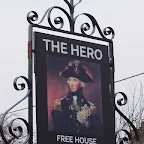
- Address
- Wells Road, Burnham Overy Staithe
- Website
- https://www.theheroburnhamovery.co.uk/
The pub certainly dates from at least the mid 19th century when it was possibly known as the Anchorage although it did not obtain a full licence until 1929. The pub was extensively refurbished in 2005 to create an open plan and modern minimalist appearance. The pub was then taken over in 2016 by the proprietor of the Anchor at Morston. The primary focus of this in is on dining with accommodation. Ales are supplied by Woodfordes and Adnams with local guest beers.
This is a modernized minimalist pub which all of North Norfolk pubs appear to be migrating towards. It is disappointing that the traditional pub is fading fast but one has to say that the place is keeping busy with customers and I think everyone would a agree an open pub is much better than a closed down pub. The pub does now have guest local Norfolk ale, on this occasion it being Grain brewery which was a welcome change from the usual Adnams and Woodfordes offerings.
Features
The Burnham ChurchesView in OS Map | View in Google Map
The locality in North Norfolk commonly described as the Norfolk Burnhams can be more specifically divided up into seven distinct parishes that were centred around their specific churches. These are namely Burnham Deepdale, Burnham Norton, Burnham Overy, Burnham Sutton, Burnham Thorpe, Burnham Ulph and Burnham Westgate. Burnham Ulph, Sutton and Westgate combined in the 19th century, with the coming of the railway, to form the locality now known as Burnham Market.
In this article, specific to this walk, we will concentrate on the parishes of Thorpe, Ulph and Norton with reference to Sutton which no longer exists as either parish or church. The name of Burnham is derived from the Anglo-Saxon word burn or burne meaning a stream, brook or river and is a common prefix or termination to English place names that are located close to a river. In this instance the river in question is itself named the Burn from the same derivation. This is only 7.6 miles in length with its source being a spring one mile south of the village of South Creak, then flowing northwards through Burnham Thorpe, Burnham Overy and out to sea. A full description of the river, its wildlife and its history can be download as a PDF document from the Norfolk River Trust.
The first village on this walk is Burnham Thorpe which has arguably the most famous of the churches of the Burnhams, All Saints. Burnham Thorpe is no more than a quiet village these days but certainly had more importance in centuries past. It was a market town in the 13th century during the reign of Henry III when it had two churches, the present day All Saints together with St Peters which is thought to have been located in what is now a field to the north of the village, adjacent to the road down to Burnham Market. The church was abandoned in 1364 when it was consolidated with All Saints. There are no visible remains from ground level although aerial photographs reveal cropmarks of the medieval church and modern ploughing has resulted in finds of human skeletons, flint and chalk walls and medieval pottery.
Burnham Thorpe is the birthplace of Admiral Lord Nelson, the English national hero who is the pride of Norfolk and whose name is reflected in a huge number of pubs across the county. His father, Reverend Edmund Nelson, was the rector of the parish and the humble church of All Saints contains his tomb stone along with many artefacts of his prestigious son which are proudly displayed within the church. Even the very fabric of the church interior exudes dedication to Nelson with timbers from Nelson's flagship, HMS Victory, being incorporated into the the altar, lectern, and rood screen when the church was renovated in the 1840s. Also on display are flags from the HMS Nelson and HMS Indomitable, the crest of the ship HMS nelson, and a memorial bust of Lord Nelson presented to the church in 1955 to mark the 150th anniversary of the Battle of Trafalgar. Beside the bust, in a framed case, is a copy of Horatio Nelson's baptism on 6 October 1758 as contained in the church registry and below it, the copies of marriages from the records where Horatio Nelson was a witness, his signature distinctively appearing on the certificates. The church has also retained the right to fly the white pre 1801 style ensign flag from the tower.
All Saints dates from the 13th century when the font was also installed. Remodelling and alterations have taken place throughout the centuries with the south aisle being demolished in 1791 only to be rebuilt one hundred years later. The 19th century saw the partial collapse of the tower which was subsequently rebuilt. There is an impressive brass set into the chancel floor dating from 1420 commemorating Sir William Calthorpe, an English knight, Lord of the Manor and one time High Sheriff of Norfolk and Suffolk. The brass depicts him in full armour with two small dogs sat at his feet.
Moving down the road we come to the old parish of Burnham Ulph. According to Francis Blomefield in his 1807 publication A Topographical history of the county of Norfolk, the name of Ulph is derived from the name of the river Ulferton or Wolferton in Freebridge hundred which is on the west side of Norfolk. It is a struggle to make this connection as the two places are geographical unconnected and the author does not expand upon how or why this deduction was made in preference to the alternative idea that the name was derived from the lord of the Manor of Burnham Westgate whose name was Ulfus. Simon Knott's Norfolk Churches website states that the name 'Ulph' comes from the Old English word for a wolf and then makes a suggestion that this may have been taken from a local overlord. Therefore, there appears no overall agreement on the origin of the name and none of the explanations sound convincing.
Francis Blomefield's description of the church of All Saints is still apt today in that he mentions there is no steeple, just a little bell that hangs outside the west end of the church
which still exists today, a single bell in a double bell arch where a tower would normally be.
One notable thing that is also mentioned is that in the time of Edward I the parish had two medieties, which in plain English means the ecclesiastical benefice had two rectors, namely the Abbott of Wendling and Hugh de Polstede. This lasted until 1288 when the records show that a person by the moniker of John became rector.
The church dates from the late 12th century with some major remodelling in the 14th century. In the 15th century the parishes of Sutton and Ulph amalgamated into a single parish, commonly known as Burnham Sutton-cum-Ulph. By the 18th century both All Saints and the Sutton church, St Ethelbert, also referred to as St Albert, were in a state of decay and remained that way until the 19th century when Edmund Nelson, the father of Lord Nelson and rector of the parish, provided the impetus to restore All Saints, using the building material from the demolition of St Ethelbert's to achieve the success of the project.
Very little remains of St Ethelbert church, no more than the stumps of the nave and square tower walls with the chancel now buried beneath a road. Until 1966 the tower walls had been more substantial but were dismantled due to their dangerous condition.
The final church visited on this ramble is that of St Margerets in the parish of Burnham Norton described by some as the most pleasing of all the Burnham churches. It is located on the hilltop above Burnham Market with views over to the coast and the village of Norton. In 1797 the church was described as having a nave, a north and south aisle with the church decayed with a round tower in which there is one bell
. The tower is thought to date from Saxon times and presumably the church was left to decay after the reformation and then restored during the Victorian period as is the case with many East Anglian churches. The graveyard provides a notable tombstone, that of Captain Richard Woodget, who mastered the Cutty Sark.
The interior of the church holds some true treasures. The rood screen bears the remnants of pre-reformation art of the Saints, defaced in this turbulent period of English history. The most outstanding item is the 15th century wineglass hexagonal pulpit that still bears the richly coloured pre-reformation paintings that are considered to be one of the finest examples of this medieval artwork in England. There are four paintings on the panels of the pulpit, one each of the so called four doctors of the Catholic church, the theologians St Ambrose, St Augustine, St Gregory the Great and St Jerome, each being depicted with quill and manuscript in hand. Quite how these escaped the desecration of the reformation iconoclasts is unknown but it is to the benefit of later generations to behold such artwork.
Simon Ketts website dedicated to Norfolk Churches - Burnham NortonSimon Ketts website dedicated to Norfolk Churches - Burnham SuttonSimon Ketts website dedicated to Norfolk Churches - Burnham UlphThe Burnhams Benefice webspageNorfolk Heritage Explorer - All Saints' Church, Burnham ThorpeNorfolk Heritage Explorer - Site of St Peter's church, Burnham ThorpeA general history of the county of Norfolk, John Chambers, 1829, pp25An essay towards a topographical history of the county of Norfolk, Francis Blomefield, 1807, pp31An essay towards a topographical history of the county of Norfolk, Francis Blomefield, 1769, pp733Britain Express Website - Norfolk ChurchesImage Gallery


Route Validation Cards
Validation Date - 2017-02-18
- Time of Walk: 09:00 to 16:30
- Validators: Griffmonster, Kat
- Weather Conditions: started overcast but slowly turned into a clear day with blue skies
- Notes: Initial route undertaken
Summary of Document Changes
Last Updated: 2026-04-20
- 2021-03-17 : Update website improvements and removal of ViewRanger reliance
- 2021-12-01 : Removal of ViewRanger links due to its imminent demise
- 2026-01-12 : Major website update with all walks recast to the new format


0 comments:
Post a Comment