Weavers Way - North Walsham to Cromer
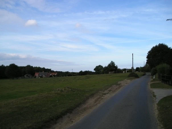
A 23 mile walk along the Weavers Way from North Walsham to Cromer
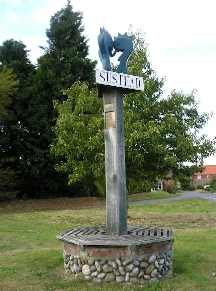
Starting along the old M&GN railway trackbed to Aylsham, the path soon heads off across country passing by the Halls at Blickling, Felbrigg and Cromer as well winding its way through the picturesque villages of Aldborough, Hanworth and Sustead. A fascinating view of Norfolk's countryside.

Walk Statistics
- Start location: North Walsham
- End location: Cromer Pier
- Distance: miles ( km)
- Total Gain: ft ( metre)
- Total Descent: ft ( metre)
- Min Height: ft ( metre)
- Max Height: ft ( metre)
- Est. Walk Time:
- Walk type: Linear
- Walk Grade: A long days walk which was fairly strenuous considering the overall mileage
- Terrain:
Maps
The following maps and services can assist in navigating this route. There are links to printed maps and links to downloadable GPX route data for importing into navigational software and apps.
- Ordnance Survey Explorer Map
- OS Explorer 252 - Norfolk Coast East
- GPX Route File
Transport
National Express - Train Service
- Service Details
- Bittern Line - Bittern Line service between Norwich and Cromer
- Timetable
- http://www.nationalrail.co.uk/
Walk Notes
This was going to be a 23 mile hike and there would only be just enough hours of light in the day to complete this at the time of year it was undertaken, late September. There are alternatives that can break the walk down into smaller sections but knowing there was always late trains back to North Walsham meant there was no urgency even if we did have to tread the last few miles in the dark. For those who wish to undertake shorter walks, then Aylsham to Cromer is 17 miles, and Stalham to Aylsham via North Walsham is 14.5 miles. On the day the walk was completed within daylight, arriving in Cromer at 6pm for a well deserved pint of ale. However, keeping to such a schedule did limit the amount of time to spend looking around the villages, grand halls and other features that this walk passes.
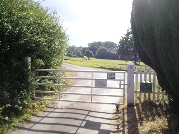
Highlights of the walk included passing through the Blickling Hall grounds where myriads of elderly tourists paraded up and down the gravel drive to the hall; Hanworth, which is a village in a timewarp from the middle ages, with its common land still at the heart of the village and gates and cattle grids to get past to get in and out.
Aldborough was everything an Englishman wants from an English village. The village is set around the traditional green with some 50 houses facing it, including two pubs, a post office, a butchers and an antique shop. The local cricket team still play their games on the green as they have done for since the early 19th century. Midsummer is the date of that traditional horse-fair is set up on the green, though these days it is a travelling fair. An ancient bylaw states that if they fail to arrive by midsummer's day then they can never come again.
Unfortunately the Spread Eagle at Erpingham had closed down when we went past, or at least that is what the lady next door told us. It did look in a very good state of repair so hopefully this is not closed for good.
Walking from Felbrigg, across the fields towards the coast we knew we were not far from the end to the walk and was expecting to be able to see Cromer from this high ground. From here it was going to be all downhill to the coast and we were constantly gazing the horizon to catch a glimpse of our destination, but there was no sign. The path headed down across the fields to the railway, where a bridge allows a little cart track over the line, but still there was no view of Cromer. The path then crossed the field and onto the road past Cromer Hall, rapidly descending. There was still no view of Cromer. Just beyond the Hall, the road is flanked by Hall Wood and East Wood. The legs were telling of the 24 miles they had covered and Cromer was nowhere to be seen. We took 10 minutes rest on a bench by the woods. It was only another 100 yards or so through the woods and we were in the centre of Cromer. Despite descending from about 250ft above sea level from Felbrigg, Cromer did not present itself until we actually set foot in it! We made our way to the Red Lion Hotel and celebrated with a well deserved pint of beer.
Directions
The Weavers Way leaves North Walsham on the old railway trackbed to Aylsham. From here it uses a mixture of country lanes and footpaths to wind its way up through Blickling, Aldborough, Hanworth and Felbrigg. The route is clearly marked with the Weavers Way waymarkers.
Pubs
The Buckinghamshire Arms, Blicking View in OS Map | View in Google Map
- Address
- Blicking Road, Blicking
- Website
- www.bucksarms.co.uk/
The Buckinghamshire Arms is a handsome 17th century coaching inn opposite Blickling hall. The pub features a delightful snug, bar and dining room featuring wood burning stoves, rich fabrics, heritage colours and for further interest original paintings from local artists. There is also a courtyard garden with fragrant kitchen herbs and sunny aspect. Local meat, Cromer Crab and local vegetables all feature on the food menu and ales are supplied by Woodfordes, Wolf and Adnams breweries. Accommodation available.
This is an excellent place to stop off for a drink. The old world charm of the small snug bar is as good as the Wherry we were supping.
The Olde Red Lion, Aldborough View in OS Map | View in Google Map
- Address
- The Green, Aldborough
- Website
- https://redlionaldborough.wordpress.com/
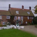
Charming pub overlooking the village green. The interior, full of traditional pub charm of beams and open fireplace, is decorated with jug, beer mats and other ale memorabilia. Food is available and there is a garden in front of the pub from where one can gaze across the village green and watch cricket when the local team plays.
Excellent old worlde charm pub on the village green. We sat and rested some tired legs with a pint of Wherry each. The ale was excellent and the landlord very friendly. I have read that the pub has since changed ownership and has lost some of its charm.
The Red Lion Hotel , Cromer View in OS Map | View in Google Map
- Address
- Brook Street, Cromer
- Website
- https://www.redlioncromer.co.uk/
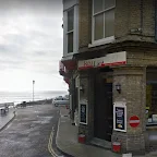
This 19th century hotel overlooks Cromer Pier and retains many of its original features, including wood panelling, open log fires and Victorian flooring. It features a traditional bar with an excellent selection of local Real Ales from Norfolk and Suffolk. Food on offer includes local delicacies such as Cromer Crab, Morston Mussels and Norfolk Sausages and Venison.
Ever since staying here after walking the North Norfolk Coast Path for the first time, I have always made a point of seeking this pub out for its range of ales. Not huge but always with something different. The ale, as expected, was excellent.
Features
Blickling HallView in OS Map | View in Google Map
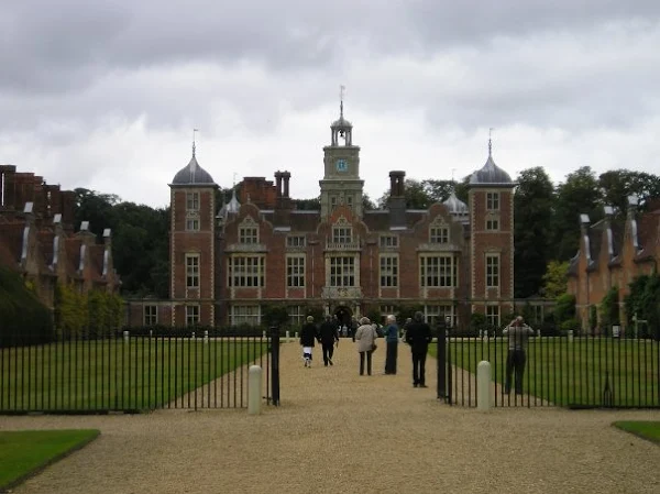
Blickling Hall can be traced back to the 15th century when Sir John Fastolf owned the building. The present hall was built by Sir Henry Hobart on the ruins of the original building during the early 17th century. The Hall was requisitioned by the RAF during WWII and is presently under the custody of the National Trust.
Between 1499 and 1505, Blickling Hall was in the possession of the Boleyn family, famous for their daughter Anne who became the second wife of Henry VIII in 1533. It is claimed that Anne was born at Blickling and this is stated under the portrait of her that hangs in the hall, its inscription declaring "Anna Bolena hic nata 1507" (Anne Boleyn born here 1507). By this year, however, the Boleyn's had moved to Hever Castle in Kent but the stories, the legends and the ghosts still haunt Blickling.
Along with her brother George Boleyn, plus associates Mark Smeaton, Sir Francis Weston, William Brereton and Sir Henry Norris, Anne Boleyn was tried for treason in the Great Hall of the Tower of London on May 15th 1536. Her father Thomas denounced the crimes of all of those accused though King Henry excused Thomas Boleyn from the task of condemning his own children to death. On May 19th 1536 Anne Boleyn was executed on Tower Hill.
Norfolk legend states that every year, on the anniversary of her execution, Anne Boleyn's headless ghost arrives at Blickling Hall in a carriage driven by an equally headless coachman. Some say the driver of the coach is none other than her father, Thomas Boleyn. After dropping Anne off at the front doors at midnight, Sir Thomas continues on, pursued by hoards of screaming demons cursing him for his betrayal of his family. He is forced to drive his spectral coach over 12 bridges that lie between Wroxham and Blickling for 1,000 years as penance. And to complete the headless ghosts, Anne's brother, Lord Rochford, also appears on the same night, he too is headless although he doesn't enjoy the comfort of a carriage, for he is dragged across the surrounding countryside by four headless horses.
It would seem that headlessness is a family trait. All of this is supposed to happen on the night of the 19th of May, so with so many headless people wandering around Norfolk you should be certain to see at least one.
Hanworth CommonView in OS Map | View in Google Map
Hanworth is an unusual place where all roads into the Common are either fenced or have a cattle grid. Hanworth Common has been managed by a committee since at least 1909 and all residents have grazing rights which are exercised to this day. In 1972 Hanworth Common was registered under the Commons Registration Act 1965, and, as there was no known owner, Possessory Title was granted to the Hanworth Commons Management Committee in 1974. The committee are responsible for managing The Common, and letting the grazing.
Felbrigg Hall View in OS Map | View in Google Map
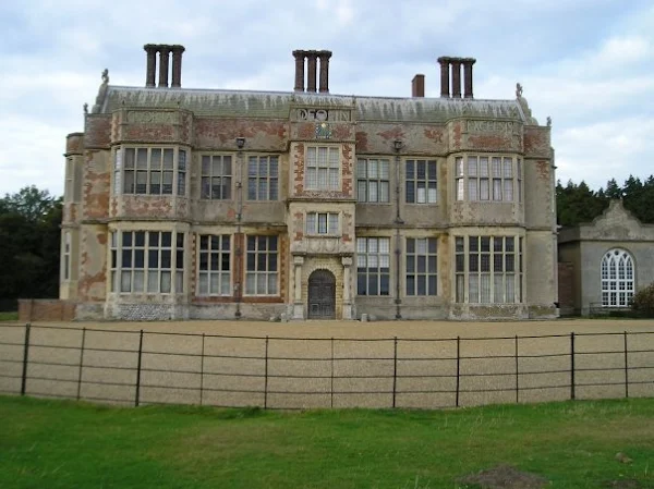
Felbrigg Hall is a 17th-century country house that is currently a National Trust property. It is noted for its Jacobean architecture and fine Georgian interior. Prior to the National Trust ownership, it was owned by Robert Ketton-Cremer whose only heir, his brother Richard, was killed in action in the Second World War. A memorial to Richard Ketton-Cremer can be seen in the woods behind the house. The West Garden is laid out in the style of a typical Victorian pleasure ground, arranged around an 18th-century orangery. Accentuating the play between light and shade, its formal lawns are interspersed with areas of dark shrubbery. This garden features a number of specimens from North America including Red Oaks, Western Red Cedars, and a meadow with a walled garden. There are double borders of mixed shrubs, a herbaceous border, and more. An orchard has been planted with varieties of fruit known to have grown in the garden during the 19th century. The gardens are home to the National Collection of Colchicums.
Cromer HallView in OS Map | View in Google Map
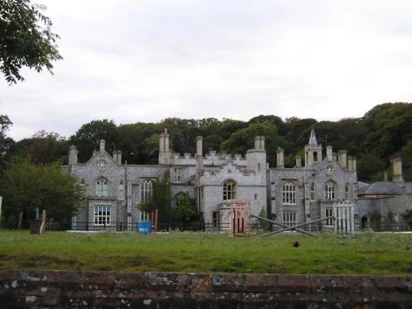
Cromer Hall is the home of the Cabbell Manners family and lies just outside of the town centre. The original hall was destroyed by fire and was rebuilt in the 1820s in Gothic revival style using a design by the Norfolk-born architect William John Donthorn. In March 1901 Sir Arthur Conan-Doyle returned from South Africa where he had contracted enteric fever. Doyle decided to recoup on the Norfolk coast where he planned to rest and play some golf. Whilst staying in Cromer he was invited to dinner at Cromer Hall by the then owner Benjamin Bond Cabbell. During this visit he was enlightened with the tales of Black Shuck, the legendary Norfolk hell hound. According to the legend one of Black Shucks tracks runs through Mill Lane past the then Royal Links Hotel over the hill into the grounds of Cromer Hall. Doyle was to use this as the basis for his book The Hound of the Baskervilles.
Image Gallery
Route Validation Cards
Validation Date - 2009-09-30
- Time of Walk: 08:00 to 18:30
- Validators: Griffmonster Kat
- Weather Conditions: overcast but warm
- Notes: Initial route undertaken
Summary of Document Changes
Last Updated: 2026-01-12
- 2009-09-30 : Initial publication
- 2017-12-13 : general link updates, make https ready, add in pics
- 2018-12-29 : General website updates
- 2021-03-17 : Update website improvements and removal of ViewRanger reliance
- 2021-12-01 : Removal of ViewRanger links due to its imminent demise


0 comments:
Post a Comment