Route details, maps, pubs, features, local history and folklore for a wide variety of walks focusing primarily on Norfolk and Suffolk

find_in_page

Keyword Search Results

Walks
Showing posts sorted by relevance for query Cromer. Sort by date Show all posts

Weavers Way - North Walsham to Cromer

Hanworth Common late on an autumn afternoon urging us to keep up the pace to get to Cromer before the light fades

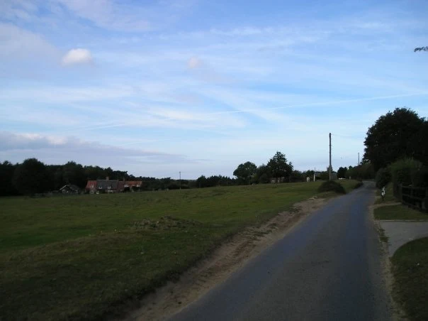
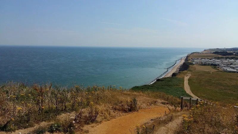
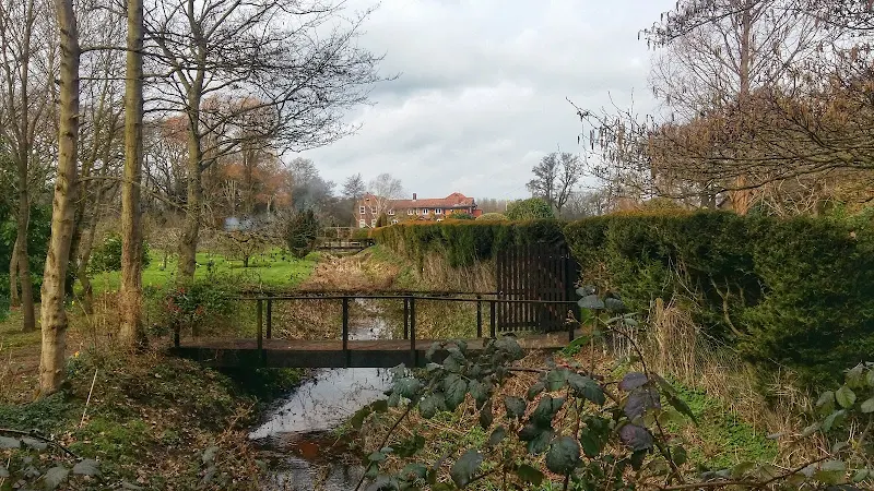
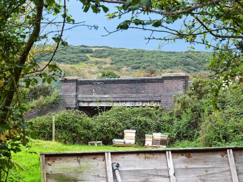
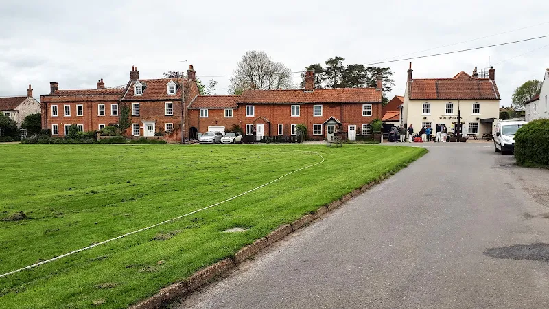
A 23 mile walk along the Weavers Way from North Walsham to Cromer

Starting along the old M&GN railway trackbed to Aylsham, the path soon heads off across country passing by the Halls at Blickling, Felbrigg and Cromer as well winding its way through the picturesque villages of Aldborough, Hanworth and Sustead. A fascinating view of Norfolk's countryside.

The Aftermath of the 2013 Storm Surge - Cromer and Sheringham

Damaged Beach huts

A 6 mile beach walk to witness the damage caused by the 2013 Storm Surge at Cromer and Sheringham

Both Cromer and Sheringham bore the brunt of the storm surge on the night of December 5th 2013. Although repair work is well under way there are still the signs of what damage the sea can cause. There have also been many cliff falls along this length of coastline with the cliff faces providing a fascinating view sculptured by the weather and tides and offering multi coloured strata.

Cromer to Mundesley Beach Walk

Cromer

An alternative beach walk to the official Norfolk Coast path between Cromer and Mundesley

This beach section of the Norfolk Coast can only be walked when the tide allows as high tide reaches the foot of the cliffs and is impassable at Overstrand. There is frequent erosion all along the route so the scenery changes from year to year. The beach is predominantly sand with numerous groynes that present frequent obstacles to get past - sometimes decaying steps assist getting over the groynes and sometimes, at low tide or with boots and socks off, it is possible to get around the end of some of the groynes. Mostly, it involves clambering as best as you can over these eroded, seaweed covered, mussel encrusted defences but that is half the fun of it!

Ale Trail - Mundesley to Cromer

Cromer

A beach walk along the Norfolk Coast between Mundesley and Cromer including a clifftop stroll from Cromer to Overstrand.

This section of the Norfolk Coast can only be walked when the tide allows as high tide reaches the foot of the cliffs and is impassable at Overstrand. There is frequent erosion all along the route so the scenery changes from year to year. The beach is predominantly sand with numerous groynes that present frequent obstacles to get past - sometimes decaying steps assist getting over the groynes and sometimes, at low tide or with boots and socks off, it is possible to get around the end of some of the groynes. Mostly, it involves clambering as best as you can over these eroded, seaweed covered, mussel encrusted defences but that is half the fun of it! Although there is a cliff top path from Cromer to Overstrand, which has some outstanding views, beyond this there is no official right of way and a full circular walk would involve heading inland, using the Paston Way. However, a frequent bus service links Overstrand and Mundesley to make a good and easy days coast walking.

The Weavers Way

Weavers Way Marker

An overview of the The Weavers Way, a 60 mile long distance footpath through Norfolk linking Cromer and Great Yarmouth.

The Weavers Way takes its name from the cottage weaving industry that established itself during Middle Ages around the North Walsham area. The path is characterised by the various sections that it passes through on route, firstly historic halls, then old railways followed by river walks before the final section across the lowland Norfolk landscape with its characteristic big skies.

Sheringham to Cromer Circular Walk

An easy 8 mile Norfolk coastal walk along beach and clifftops between Sheringham and Cromer

The Norfolk Coast Path was rerouted in 2014 as part of its inclusion to the England Coast Path. It now navigate alogn the cliff tops for most of the distance along what used to be permissive paths that have now become public. This walk uses both coast path and beach to create a delightful walk along this awe-inspiring section of the North Norfolk coast. Do check tide times and make sure the beach walk is undertaken 2 hours either side of low tide.

Old Coast Path Route - Cromer to Sheringham

Beeston Bump

A 6 mile walk along the original route of the Norfolk Coast Path between Cromer and Sheringham

Up until December 2014 the official route of the Norfolk Coast Path from its start at Cromer Pier through to Sheringham navigated inland along the hills of the Cromer Ridge, the highest ground in Norfolk. This original route can still be walked and contrasts with the cliff-top route of the realigned path which is now part of the England Coast Path. With shady lanes and tracks through the woodland, spectacular views from the summit of Beacon Hill and the challenging ascent to the iconic Beeston Bump, this walk is a worthwhile excursion from the coastal route.

Bittern Line Walk - Cromer to North Walsham

Antingham Pounds

A 11.5 mile walk following the Bittern Line between Cromer and North Walsham

The Bittern Line provides the rail gateway to North East Norfolk from Norwich. Although there are no officially documented walks that link its stations, this walk seeks to rectify this and links Cromer and North Walsham using country lanes, footpaths and tracks. Stunning countryside, typical Norfolk villages and always something new to discover.

Norfolk Coast Path Extension

Coastline from Mundesley to Happisburgh

A 21 mile extension has recently been completed to the Norfolk Coast Path taking it through to Sea Palling

As part of the English Coast Path project, the Norfolk Coast path has now been extended to Sea Palling with waymarkers and direction signs being added during the first half of July. This includes a redirected section between Beeston and Cromer that now follows the coast rather than its original route which headed inland through the hills above Cromer.

Norfolk Coast Path Extension - Essential Information

Walk Statistics:

  • Start location: Sheringham 
  • End location: Sea Palling 
  • Distance:   miles (  km)
  • Total Gain:   ft (  metre)
  • Total Descent:   ft (  metre)
  • Min Height:   ft (  metre)
  • Max Height:   ft (  metre)
  • Walk Time:  
  • Walk type: Linear
  • Walk Grade: A mixture of cliff top footpaths and beach walking. A small amount of roadside walking
  • Terrain: Sandy Beaches plus well used cliff top paths

Maps:

The following maps and services can assist in navigating this route. There are links to printed maps and links to downloadable GPX route data for importing into navigational software and apps.


Walk Notes

It has been known for sometime now that one of the first stages of the All England Coast Path would be the Norfolk coast. Well, it has started to happen. Without any fanfare or announcement the waymarker and sign posts have appeared along the Norfolk Coast declaring Norfolk Coast Path and enabling the walker to continue from Cromer all the way through to Sea Palling. This does not officially open until the winter of 2014 as detailed by the Norfolk Trails website. Even so, it is still currently accessible to the would be coast walker.

The response from the Secretary of State to the petitions and objections for the path can be viewed at www.gov.uk.

The route has used a mixture of existing public and permissive footpaths and the legislation will enable the path to recede landwards with any ensuing erosion. Some of this can already be seen between Overstrand and Trimmingham where erosion has already taken some of the existing footpath forcing the walker to rightfully take a route at a safe distance from the cliff.

In addition the route taken from Sheringham to Cromer has now been altered to take a coast route rather than diverting away from the cliff top and up to Roman Camp before coming back down to Cromer. This certainly is more in keeping with the coast path status.

The extension provides a contrast to the North Norfolk section which is typified by salt marsh and flood defences. From Sheringham the scenery changes to tall cliffs and broad beaches. Beyond Happisburgh the cliffs recede and the final section is low level dunes with acres of sandy beach. Although the path uses a mixture of both cliff top paths and beach, it can nonetheless be completed along the beach throughout providing the tides are suitable.

The sections where the official route does take to the beach there are also alternative permissive paths along the cliff top. These can be used when high tides prevent access, especially the section in front of Bacton which is regularly cut off by tides. Walks on this site provide details of both cliff top paths and beach routes.

Transport Connections

The route from Hunstanton through to Cromer continues to be served by Norfolk Greens Coasthopper service. Beyond this there is a regular service that links Cromer, Overstrand and Mundesley served by Sanders Coaches. The far reaches of the new path out to Sea Palling are unfortunately not currently well served at all. There is a bare bones service that offers just two weekday journeys between Happisburgh and Sea Palling during the morning and two in the opposite direction during the evening. Saturdays , this is reduced to a single journey in each direction. There is no service that connects Mundesley to Happisburgh which would necessitate a connection with other services from North Walsham.

Beyond Sea Palling

Consultations are already underway to extend the coast path through to Hopton with the expectation of this being opened during 2015. This section can already be walked by both beach or navigating along the low cliffs and through the housing and holiday camps that adorn the seafronts of Caister and Scratby.

Path at Mundesley
Path at Mundesley

Directions

The Norfolk Coast Path extension is well defined throughout with the usual acorn symbol waymarkers that typify a national trail

Beeston to Cromer

This section follows the original route over Beeston Bump although new steps and hand rails have been implemented for this climb. Beyond this the new route uses the old permissive paths in front of Beeston Campsite and along the clifftop, past the beach road at West Runton and on to Woodhill Park campsite. It then follows the western and southern perimeter of the campsite before exiting onto the pavement to continue into East Runton village. As the road leaves East Runton there is a track on the left between two caravan sites. The path follows this for several hundred yards before returning to the road via a footpath on the right. There is a short distance along the pavement past a terrace of cottages and the Wyndham Caravan Park before it cuts across a grassed area to the clifftop where it continues down into Cromer. There is currently no additional marker on the waymarker post in front of the pier. However the path does continue onwards along the promenade towards Happy Valley.

Cromer to Overstrand

The path proceeds along the prom and then up to the path that leads along the cliff tops to Happy Valley. Opposite an octagonal shelter is a waymarker pointing down the cliffs via a set of steps. The path then continues along the beach to Overstrand following the route of the Paston Way. It is unknown why negotiation with the golf club to use the permissive path beyond the Cromer Lighthouse was not undertaken as this would have been a much more favourable route with some spectacular views. The beach route is accessible during most states of tide but given an unusually high tide the route will be unpassable and this permissive path can act as a viable alternative route through to Overstrand.

Overstrand to Trimingham

The path follows Overstrand Prom until its end where it then ascends the steep roadway into the Eastern end of the village. This leads out onto the main coast road where there is a pavement through to a track just beyond Manor Farm. This leads up to an old permissive footpath along the cliff tops through to Trimmingham.

Trimingham to Mundesley

The route follows the coast road out of Trimingham. After a couple of field boundaries, a country lane bears off to the right. The signage here is a little poor as there is no clear indication that this lane should be taken but this is most certainly the correct route. Proceeding along the coast road is hazardous as there is no verge or pavement throughout the double bends in front of the radar station. Not far down the lane there is footpath on the right that leads around the back of the radar station and back to the main coast road. From here a high verge has been trimmed down to allow walking access alongside the road through to a junction with another lane. Opposite this junction is the entrance to the Trimingham House Holiday Park where a Coast Path waymarker directs down the entrance road. Continue on the access road, beyond the barrier and follow the road through the holiday park. At the far end another waymarker confirms that this is the correct route. The path continues along the cliff top, crosses a beach road to continue along the cliffs, in front of another holiday park. Eventually the way ahead is barred by a low wooden fence, but a path leads into the holiday park and then out to the main Coast Road where finger posts once again confirm this is the correct route. Follow the road down into Mundesley village where a waymarker then directs down to the prom adjacent to the Mundesley Maritime Museum.

Mundesley to Bacton

This is a beach walk following the route of the Paston Way. This can be blocked at the Bacton end by high tides, therefore tide times need to be consulted. The adoption of this route appears to have been taken as the making a public right of way from the permissive path that runs along the clifftops in front of the Bacton Gas Terminal is deemed a security risk for the site. Nonetheless if the tide is not right then the permissive path can be a viable alternative. This can be found by following the road out of Mundesley and just past the sharp turn inland take the left hand lane and follow this to its end where it leads into a path along the cliff tops through to Bacton.

Bacton to Happisburgh

This follows the concrete defences in front of Walcott then negotiates its way thorough Bush Estate at Ostend to the clifftop path to Happisburgh

Happisburgh to Sea Palling

The route continues along the cliff top path to Eccles and then follows Doggetts Lane behind the chalets to Cart Gap where the beach is followed to Sea Palling. An alternative route here is the track that is on the landward side of the dunes.

Summary of Document Changes

Last Updated: 2021-12-07

2021-03-17 : Update website improvements and removal of ViewRanger reliance
2021-12-01 : Removal of ViewRanger links due to its imminent demise

Paston Way to Gunton - Pubs, Churches and Wartime Conspiracies

Northrepps from the lane to Overstrand

A 7 mile walk along Norfolk's Paston Way from Cromer to Gunton.

The Paston Way has a few alternative paths that stray from its main route between North Walsham and Cromer, and this walk takes the optional route out to Gunton from where a train can be taken back to Cromer. There are some worthy country pubs along this simple walk so a good old English pub crawl can also be had along with taking in the sights of the impressive churches at Northrepps and Southrepps plus local tales of wartime German conspiracies!

Cromer to Pretty Corner

Walk from Cromer through the hills and woodland to Pretty Corner

Pretty Corner is woodland around former quarries that is located in the hills above Sheringham. For a more adventrous and rewarding walk, one can walk from Cromer, navigating through the woodland that cover the hills above the coast. Some great views and and magnificent woodland. Return can be made by bus back to Cromer

The Paston Way


The Paston Way is a 20 miles Norfolk footpath linking North Walsham and Cromer. The path takes its name from the Paston Family who, during the Medieval and Tudor periods, were the dominant and wealthy landowners in which much of the trail passes. The Paston Family in turn had taken their name after the north eastern coastal village of Paston. The route can be walked within a day and there is ample public transport connecting start and end of the route. The first time I walked this route I was so impressed that I walked it again the next year. It encompasses both coutryside and seaside and Cromer is a fitting end to the walk with plenty of refreshment houses to recuperate in.

Folklore Trail around East Runton

Railway bridge at the end of Thains Lane with Inclborough Hill in the background

A 4 mile walk between East Runton and Cromer searching out old folklore

Using country lanes and tracks, this circular trail navigates around a East Runton to visit the various locations in Runtons history and folklore. Woodhill House is the location of an unidentified skeleton found during road widening. Thains Lane has the village's old smithy. The old Windmill sets the scene for the emanation of ghostly lights that crossed over to a copse. With a pub stop at Cromer and return via the redefined course of the Norfolk Coast Path, this makes for an excellent short walk on a spooky Autumn evening.

Paston Way - Trimingham to Cromer

St Botolphs church, Trunch

A 13 mile walk along Norfolk's Paston Way from Trimingham to Cromer.

This is a customised walk linking sections of the Paston Way to provide a route passing the churches of Trimingham, Trunch, Bradfield and Southrepps as well as the local village pubs which are obligingly open all day on a Sunday. The final section from Northrepps offers an alternative wander past Sally Beans Cottage, renowned for being the lookout from the old Smuggling days of the 17th century, into Cromer.

Completion of The Woodfordes Ale Trail 2011

The Woodfordes Ale Trail ended on 30th September and it was time to total up our stamps and collect our prizes. To recollect the rules, one has to visit Woodfordes outlets that are contained in their 2011 guide and on purchasing a pint of Woodfordes ale the publican will add an entry to the Trail Card with a unique stamp. There is only one stamp allowed for each venue and the trail only runs from June to the end of September. There is a different prize for collecting multiples of 10 stamps with the top prize being a polypin of ale for 60 stamps. In 2009 we managed to fill 2 Trail Cards and had started a third giving us a bounty of 2 polypins and a Nelsons Revenge t-shirt. This year we were not as successful due to being away from the area for a few weeks over the summer months. The end result was that we only completed half of the card. Nonetheless, this was thirty stamps collected which was rewarded with a mighty fine Woodfordes Hoody worth £25 as modelled by Kat in the photo above, an item that will most certainly keep us warm on our camping and walking expeditions

Weavers Way - Cromer to Aylsham

Felbrigg Hall

A 17 mile walk along Norfolk's Weavers Way from Cromer to Aylsham

Historic halls, stately homes and ancient commons and villages are what typifies this northern section of the Weavers Way. This really is a typical old English scene throughout making a most pleasurable all day walk. There are numerous pubs along the route which serve both ale and food.

Salthouse Sculpture Trail

Pond at Kelling Heath

A 14 mile walk around the Salthouse Sculpture Trail

Inaugurated in 2008 by The North Norfolk Exhibition Projects, this trail across Kelling and Salthouse heaths was set out to exhibit both the natural beauty of North Norfolk alongside examples of contemporary Norfolk art. Although most of the sculptures have now gone, the walk nonetheless provides a peaceful route around this part of the county.

North Norfolk Railway Beer Festival 2011

The 10th North Norfolk Railway beer festival

There was a selection of 120 ales from around the country plus a range of ciders and perrys all for the price of £2.80 a pint. Entertainment and food was available throughout the weekend together with both diesel and steam train workings to make a truly unique event. Even the rain throughout the weekend could not dampen the enthusiasm of those attending, with plenty of shelter available in the carriages alongside Platform 2 where the beer tent was situated. This was an excellent weekend with ample opportunity for some walking along the picturesque coast to Cromer. There was also a late bus between Sheringham and Cromer calling at Woodhill saving us the walk across Beeston Bump in the dark back to the campstie at East Runton. When it comes to beer festivals you cannot beat this one.

North Norfolk Railway Beer Festival 2011 - Essential Information

Walk Statistics:

  • Start location: Sheringhamn 
  • Distance:   miles (  km)
  • Total Gain:   ft (  metre)
  • Total Descent:   ft (  metre)
  • Min Height:   ft (  metre)
  • Max Height:   ft (  metre)
  • Walk Time:  
  • Walk type: Circular
  • Walk Grade: Easy
  • Terrain:

Maps:

The following maps and services can assist in navigating this route. There are links to printed maps and links to downloadable GPX route data for importing into navigational software and apps.


Accommodation:

Woodhill Park CampsiteView in OS Map | View in Google Map
Website
Description
Located on the clifftops at East Runton, half way between Sheringham and Cromer, this highly recommended touring site is ideal for exploring North Norfolk with public transport available to many destinations from the entrance to the site.

Transport:

Details of public transport that is required for the walk

Various Operators - Bus Service
Service Details
Coasthopper CH1, CH2, CH3 - Unfortunately, in recent years the highly acclaimed Coasthopper bus service has suffered from subsequent takeovers with a consequent deterioration of the service and continuing doubts upon is viability. Due to its constant changing operators, it is therefore best to use the Traveline website to determine the current timetables and services.
Timetable
Sanders Coaches - bus Service
Service Details
44 - Linking Sheringham, Cromer, Aylsham and Norwich
Timetable

Route Verification Details

  • Date of Walk: 2011-07-16
  • Walk Time: 12:00 to 22:30
  • Walkers: Griffmonster Kat
  • Weather Conditions: Blustery wind, some heavy rain with some sunny spells at the end of the day

Walk Notes

Without any shadow of a doubt this beer festival is my favourite. This is the third year in attendance and it never fails to disappoint, getting better with each year. This year we spent most of the weekend at the festival being in attendance on Friday evening, throughout Saturday and Sunday lunchtime. There were some excellent beers on offer and far too many to mention here - see the slideshow for a sample of some of the ales we tasted. My personal favourites were Betty Stoggs from the Skinners brewery of Truro, a full bodied pale amber ale; O'Hanlons Yellowhammer, a very moreish well balanced pale ale; plus all the brews from the Tydd Steam Brewery, all of which were very pleasing to the palette. The predominant beer style was pale and golden beers with very few stouts and porters, but I guess that is the trend these days. I did manage to sample one stout, Panthers Black Ale which was a a fine example of a Norfolk stout.

Saturday was our main attendance when we spent most of the day at the festival. The initial intention was to walk into Sheringham but the blustery day with constant heavy showers made us take the path alongside the road in as this was a little more sheltered. As we headed into West Runton the rain became heavier and we were getting drenched. Quite amazingly the open-topped Sanders bus stopped for us despite not being at a bus stop and despite not attempting to flag the bus down. This was appreciated as we did not really want to spend the rest of the day in damp clothing. We did manage to have a wander around Sheringham during the day and have a meal at the Jolly Tar restaurant. I hate putting places down, but this was not very good food. We had a plate of haddock in breadcumbs and chips and peas and the fish was so hard you needed industrial mining gear just to get into it. The service was also very slow considering there was very few people in the restaurant.

Music at the festival was most excellent with the the entertaining Ugly Dog Skiffle Combo playing throughout Saturday. These are a great fun band who cover songs in their own distinctive style including a reggae version of the Undertones Teenage Kicks and a skiffle version of Led Zeppelins Rock n Roll. On Sunday lunchtime we watched the Jazz of the King Size Papas. Although I would never consider myself a jazz aficionado, these supplied a relaxing and entertaining lunchtime in the sunshine.

This year saw the introduction of a late 44 bus by Sanders - leaving Sheringham just before 10pm. This was much appreciated and very well used and is a lot more convenient than getting a taxi or hiking across Beeston Bump in the dark or getting the late train to West Runton and walking.

All together, a well rewarding beer festival. We already have next years beer festival marked in the calender - see you there!

Steam train operate throughout the Beer Festival

Directions

A simple circular route following clifftop paths in one direction and the beach in the other.

From Sheringham take the prom eastwards. Keep to this until one can get down on to the beach beyond the defense boulders. There now follows a great wander across the sand through to Cromer. You cant get lost! Just make sure this is done so that it coincides with low tide along the route.

Return follows the clifftop out of Cromer. Keep to the Coast Path markers. This will continue along the cliffs until the first caravan park just beyond the large grassed area used for parking. Head to the road, then navigate to just beyond the allotments on the right. The route now takes a footpath down to a track between the caravan parks to emerge in the centre of East Runton. Continue through the village, up the hill and past the grassland on the right used for Car Boot Sales. next field is the Woodhill campsite where the path leads through the first gated entrance, then follows the perimeter road up to the reception block. Turn left just beyond this and cross the entrance road over to the field beyond. The path cuts across this and back to the clifftop. There route now keeps to the cliff tops until Sheringham, leading over Beeston Bump. After it passes a putting green, take the path down to the prom, which leads down a flight of steps next to a small house with the name of The Wee Retreat, a nod to the fact that this used to be a public lavatory.

great music from The Ugly Dog Skiffle Combo

Features

Sheringham Poppy Line: View in OS Map | View in Google Map

Sheringham is the terminus for the North Norfolk Railway, also known as the Poppy Line. This preserved steam railway runs the 5 miles between Sheringham and Holt along the former route of the Midland and Great Northern Joint Railway and has recently been reconnected to the National Rail network allowing steam specials to run from London and Norwich.

Work on rebuilding the line started in 1965, and on 4 June 1967, two steam locomotives were delivered. The operating company, North Norfolk Railway plc, was launched in 1965 following the granting of two Light Railway Orders. In May 1973, the railway was the scene of filming of the episode The Royal Train of the popular TV programme Dad's Army. The main restoration sheds are located at Weybourne with new carriage storage sheds more recently built near Holt with Heritage Lottery Funding.

References
Sunday afternoon jazz from the King Size Papas

Gallery

Below are a selection of images taken from from the photo album for this walk. Feel free to browse through these or click on an image to view a larger version in the Gallery.

Summary of Document Changes

Last Updated: 2021-12-07

2021-03-17 : Update website improvements and removal of ViewRanger reliance
2021-12-01 : Removal of ViewRanger links due to its imminent demise
diversity_3

Popular Walks