Route details, maps, pubs, features, local history and folklore for a wide variety of walks focusing primarily on Norfolk and Suffolk

find_in_page

Keyword Search Results

Walks

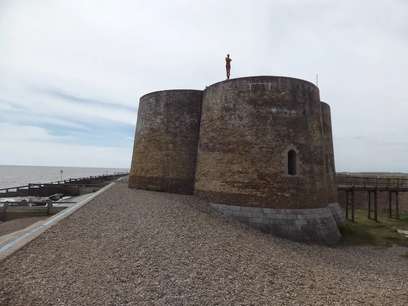
North Warren Nature Reserve - Heath Trail

Warren Heath waymarked trail

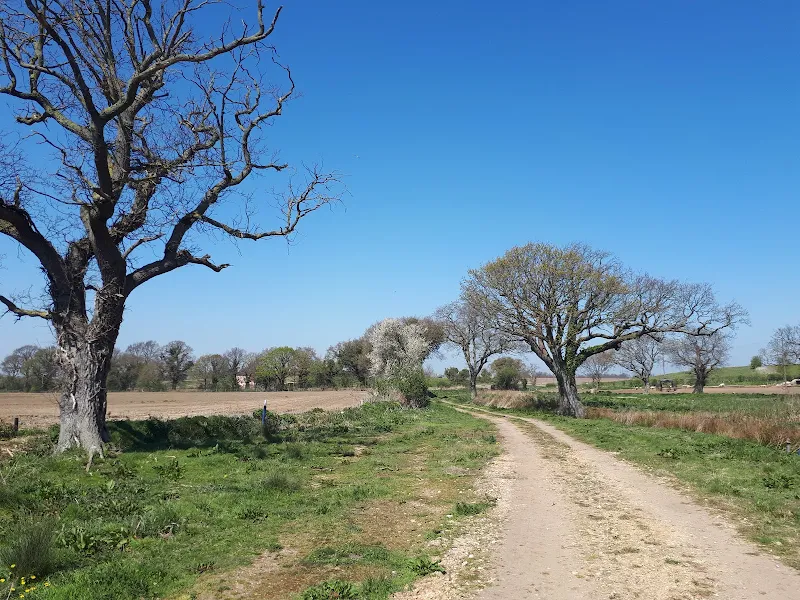
Short waymarked trail around the heathland of the North Warren Nature Reserve

This short 1 mile waymarked trail guides the visitor around the heathland at RSPB North Warren. This is part of the historic Suffolk Sandlings landscape and represents a rare example of lowland heath on the Suffolk coast. Characterised by heather, gorse and acid-tolerant grasses, this open habitat supports specialised wildlife, including heathland birds such as woodlark and nightjar as well as a variety of insects. The heath forms an important part of the diverse ecosystems within the Suffolk Coast and Heaths Area of Outstanding Natural Beauty.

The Sandlings Walk - Knodishall to Sizewell Belts

Sizewell Belts

A 9 mile circular walk that links Knodishall and Sizewell Belts along Suffolk's Sandlings Trail

An easy walk across the typical heaths and commons of Coastal East Suffolk that make up the Sandlings. There is woodland, marsh, and rambling sandy heath full of flora fauna and wildlife.

Aldeburghs Martello Tower Now Boasts an Anthony Gormley Sculpture

Martello Tower

A 7 mile walk from Thorpeness to Aldeburghs Martello Tower

For a period of 12 months starting in May 2015, a life size sculpture of a human figure will look out across the sea atop Aldeburghs Martello Tower. This is the work of Anthony Gormley, the artist who is renowned for creating the iconic Angel of the North sculpture, and is part of the celebrations to mark 50 years of the Landmark Trust.

Aldringham Fen Walk Summary (Diversion in Place)

Salt marsh

A Short Circular Walk around Aldringham Fen

This is one of Suffolk's little secrets, hidden away from roads and off the beaten track. Tranquillity is guaranteed and there are some times of the year when one can walk around the entire route without seeing a soul. The area known as Aldringham Fens is a secluded haven of nature and wildlife, an area of marsh and reed-bed fed by the Hundred river which passes to the southern side of the fens.

South West Coast Path - Hartland to Bude

Screda Cove

An 19 mile walk along the South West Coast Path between Hartland to Bude

The section from Hartland to Bude is the most challenging part of the whole South West Coast Path. There are ten deep valleys to cross which seem unrelenting but the reward is some of the most spectacular scenery of the whole trail. This is definitely something for the more experienced hiker to undertake.

Salthouse Sculpture Trail

Pond at Kelling Heath

A 14 mile walk around the Salthouse Sculpture Trail

Inaugurated in 2008 by The North Norfolk Exhibition Projects, this trail across Kelling and Salthouse heaths was set out to exhibit both the natural beauty of North Norfolk alongside examples of contemporary Norfolk art. Although most of the sculptures have now gone, the walk nonetheless provides a peaceful route around this part of the county.

The Poppy Line - Holt to Sheringham

Steam engine heading to Weybourne

A 6.5 mile walk following the Poppy Heritage Steam Railway Line between Holt and Sheringham

An easy ramble roughly following the Poppy Line from Holt to Sheringham. The varied landscape that this route navigated is heathland, woodland and coast with the ever present steam railway always in range either audibly or physically. A great way to see the engines in full steam with a return being hauled back on this iconic railway. The best place to watch the engines close up is the level crossing on Kelling Heath where the steam engines require a full head of steam to get their loads up the incline from Weybourne.

The Aftermath of the 2013 Storm Surge at Minsmere

Flattened dunes by the Northern Sea Wall to Minsmere

A 10 mile circular walk to witness the damage caused by the 2013 Storm Surge

The 2013 Storm Surge proved to be the highest tide in 60 years. Although much of the flooding had recede the evidence remained of where the waters reached. Viewing the changes in coastline shows just how vulnerable this stretch of the Suffolk coast really is, especially in view of the fact that such storms appear to be increasing in frequency. The walk returns through the heath and forest via Dunwich Heath and Eastbridge where the results of Octobers St Jude storm are evident from the many fallen trees.

The Aftermath of the 2013 Storm Surge Dunwich to Walberswick

Flattened dunes by the Northern Sea Wall to Minsmere

A 10 mile circular walk to witness the damage caused by the 2013 Storm Surge

The 2013 Storm Surge proved to be the highest tide in 60 years. Although much of the flooding had recede the evidence remained of where the waters reached. Viewing the changes in coastline shows just how vulnerable this stretch of the Suffolk coast really is, especially in view of the fact that such storms appear to be increasing in frequency. The walk returns through the heath and forest via Dunwich Heath and Eastbridge where the results of Octobers St Jude storm are evident from the many fallen trees.

In Search of Polsborough Gate

track to Aldeburgh Road

A 9.5 mile walk following the old Snape Road to the Sailors Path.

This walk links Leiston with the Sailors Path following the old traditional road that used to link the town with Snape. There is then an outstanding ramble across Black heath and Hazlewood marshes through to Aldeburgh where a regular bus service links back with the start. Along this route was what in the 1700s was known as Polsborough Gate, a landmark whose position and derivation is unknown but with a little research some information about it can be determined

An Extended Walk around the Rendlesham UFO Trail

A 12 mile circular walk starting at Eyke and incorporating the UFO Trail in Suffolk's Rendlesham Forest

The Rendlesham UFO trail is a waymarked 3 mile trail around the eastern end of Rendlesham Forest that navigates around the key areas that were involved in the Rendlesham Forest Incident of 1980 in which both civilian and military personnel witnessed unexplained craft land within the forest. Although this can be walked by parking up at the visitor car-park in the forest, a longer alternative is to take the footpaths from Eyke, and make a day of this most wonderful and intriguing part of Suffolk.

South West Coast Path - Bucks Cross to Hartland

Blockchurch rock

An 16 mile walk along the South West Coast Path between Bucks Cross and Hartland

An easy start to a walk through the tree covered cliff-tops makes a pleasant ramble through to Clovelly. There follows a couple of challenging valleys to cross and then broad open meadows for more easy walking through to Hartland Point. At this stage the coast turns South to reveal a coastline that can only be described as truly spectacular.

Norfolk Coast Path Proposed Route

Proppsed route through the Winterton dunes

Details of the proposed route for the 19.2 miles of the Norfolk Coast Path between Hopton and Sea Palling

Details have been published for the proposed route of the Norfolk leg of English Coastal Footpath between Hopton to Sea Palling. Much of the proposed route is along existing footpaths and walked routes as well as beach sections. The entire distance can be walked at present either following the proposed route or just using the beach, given the right tide conditions. This proposal, if adopted, will extend the Norfolk Coast Path from Hunstanton to Hopton.

In Search of Sizewell and Thorpe Beacons

Sizewell

A 10 mile walk following the southern side of the parish boundary of Leiston in coastal Suffolk.

This is the second article devoted to the walk following the route of a 17th century perambulation around the southern side of the Leiston Parish boundary. This article concentrates on two landmarks from the past, namely Sizewell and Thorpe Beacons, which are thought to have been part of the Armada early warning system.

Captains Wood, Sudbourne

Captains Wood

A 2.4 mile walk around the ancient woodland of Captains Wood just outside the hamlet of Sudbourne

This is a hidden gem of a walk close to the Suffolk Coast in woodland which is currently under the management of the Suffolk Wildlife Trust. The ancient woodland is full of life, colour and a natural wildness that is a pleasure to behold. A waymarked path provides easy access around the wood so one cannot get lost. Just take ones time and take it all in.

Proposed Route for the Norfolk Coast Path from Hopton to Sea Palling Released

Proppsed route through the Winterton dunes

Details of the proposed route for the 19.2 miles of the Norfolk Coast Path between Hopton and Sea Palling

Details have been published for the proposed route of the Norfolk leg of English Coastal Footpath between Hopton to Sea Palling. Much of the proposed route is along existing footpaths and walked routes as well as beach sections. The entire distance can be walked at present either following the proposed route or just using the beach, given the right tide conditions. This proposal, if adopted, will extend the Norfolk Coast Path from Hunstanton to Hopton.

South West Coast Path - Porthcothan to Padstow

Hawkers Cove

An 13.5 mile walk along the South West Coast Path between Porthcothan and Padstow

A moderate walk by South West Coastpath standards and even with a misty morning it is nonetheless spectacular. The walk includes Harlyn Bay and Mother Iveys Cottage, which is the source of a local legend of a cursed field. The end is at the bustling port of Padstow where there is plenty of opportunity for rewarding refreshments.

diversity_3

Popular Walks