The Aftermath of the 2013 Storm Surge at Minsmere
Sunday, 22 December 2013
|
No comments
|
![]()

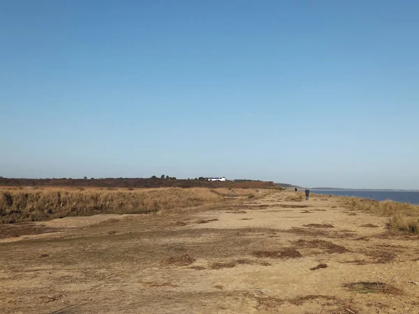
A 10 mile circular walk to witness the damage caused by the 2013 Storm Surge
The 2013 Storm Surge proved to be the highest tide in 60 years. Although much of the flooding had recede the evidence remained of where the waters reached. Viewing the changes in coastline shows just how vulnerable this stretch of the Suffolk coast really is, especially in view of the fact that such storms appear to be increasing in frequency. The walk returns through the heath and forest via Dunwich Heath and Eastbridge where the results of Octobers St Jude storm are evident from the many fallen trees.
Walk Statistics
- Start location: Leiston
- Distance: miles ( km)
- Total Gain: ft ( metre)
- Total Descent: ft ( metre)
- Min Height: ft ( metre)
- Max Height: ft ( metre)
- Est. Walk Time:
- Walk type: Circular
- Walk Grade: Easy
- Terrain: Footpaths and beach walk with some road walking on the return journey
- Obstacles: The lane from Eastbridge to Leiston is well used by vehicles, although only single track care should be taken when walking this section
Maps
The following maps and services can assist in navigating this route. There are links to printed maps and links to downloadable GPX route data for importing into navigational software and apps.
- Ordnance Survey Explorer Map
- OS Explorer 212 - Woodbridge & Saxmundham
- GPX Route File
Walk Notes
The 2013 Storm Surge occurred on the night of December 5th with following surges on the two tides of the 6th. The first of these is explored in 2013 Storm Surge at Sizewell and Thorpeness when it was unwise to venture northwards due to the low lying land beyond Sizewell. With the storm over, it was now time to venture up the coast to see what damage had occurred.
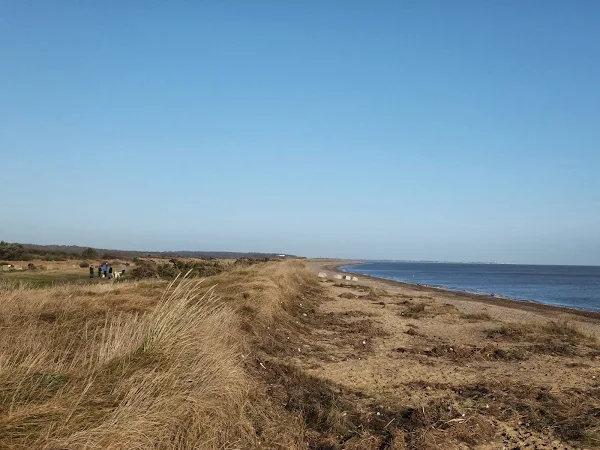
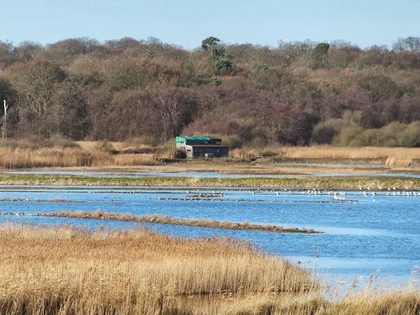
The section of coast around Minsmere is especially vulnerable with regular breaches occurring each year. The mostly shingle beach is flanked by low lying dunes throughout the distance from Sizewell Gap to Dunwich Heath with a heightened edge towards the beach that tapers down on the landward side. Beyond this is the Power Station at Sizewell which is constructed on low level Sizewell cliffs, and going northwards, are the low lying marshlands of Sizewell Belts and Minsmere, part of which constitute the RSPB Minsmere bird reserve that extends inland to Eastbridge. During the 2007 Storm Surge the face of the dunes was eroded and the northern side of Minsmere breached turning an area of dunes below Dunwich Heath into an extension of the shingle beach. After this incursion a decision was taken to allow the northern marshes to turn to salt marsh. A new sea wall was constructed in 2011/12 which extends inland from the earth bund that borders the beach and dunes to the Minsmere visitor centre to protect the southern freshwater marshes.
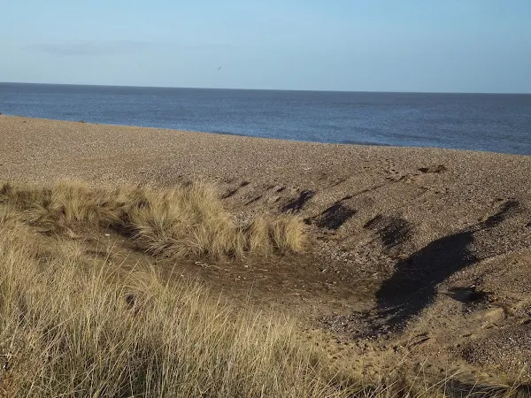
As with all storm surges along this coastline the immediate after effect is a flattened beach and a stripping of the shingle to reveal a lot of sand along the length of the beach. With time the shingle is naturally replaced by tidal action and the typical tiered profile is eventually reinstated but this takes months of calm weather. All along the coastline the dune edge had been eroded with tufts of marram grass embedded in the sandy soil that had peeled away from the edge of the dunes to be scattered along the beach. The taller grasses at Sizewell, which are more inline with the beach, had been flattened and withered by the salty incursions. Throughout the entire length of the coast debris was scattered along the tide line along the top of the dunes with larger items deposited at the foot of the dunes. The debris was made up with a variety of general rubbish and waste, mostly plastic items. A host of clear incandescent lightbulbs littered the initial stretch between Sizewell and Minsmere Sluice. Large branches and sections of tree trunk plus other large remnants of wood sat along the base of the dunes with the most impressive item being a constructed metal and wood fitting which was could have either been part of a timbered harbour wall or even a remnant of a large boat. This item appeared to have a metal platform half way up the weathered wooden upright.
At Minsmere Sluice four large metal pipes sat over the dunes from the sluice to the sea outlet pumping waters out from the Minsmere river and a large crane sat within a fenced off area. This had been put into place during the autumn as part of an engineering project on the sluice but it would appear to have played a part in pumping out flood waters. Beyond the sluice and directly in front of the Minsmere earth bund, a gulley of flood water had drained in from an incursion at the northern side of the reserve. This isn't exceptional as the northern section is regularly breached with similar results. However it was soon clear that the floods had more ferocity on this occasion, gouging out deep hollows and craters as the waters swelled along the gulley. There was a second gulley eaten out on the beach side of the dunes which was unique to this storm surge. The northern breach has, over the last few years, resulted in a length of former dune being given over to a flattened shingle beach that even a spring tide can flow over. On this occasion the surge had taken more dune extending the shingle down to the new Northern sea wall.
This surge had come over the top of the dunes on the southern side as evidenced from the debris at the tide line with multiple small incursions from the dune top, down to the lower flattened area in front of proposed site sanctioned for the building of Sizewell C power station. It would appear that any major flooding had been averted although it would have only taken another couple of inches on the surge height for the sea to have inundated this area with the potential subsequent flooding of the southern marshes and Sizewell Belts around the back of the Power Station. This was a lucky escape.
Suffolk Coast Path
The Suffolk Coast Path is routed along this section of coast and is currently still open with no sign that the route is seriously affected or restricted unless a surge is forecast. South of Sizewell the path has already been rerouted inland following serious erosion at Thorpeness. To the north, major incursions across the shingle bank at Dunwich had resulted in the flooding of Dingle marshes through which the Coast Path is routed. It is unclear what damage has been done here. Other breaches at Benacre, Covehithe and Easton broads have cut off the beach route to Lowestoft and there are breaches along the defences of the River Ore to Shingle Street. The Orford loop may have incursions with the path running along the sea defences throughout much of this length. Hopefully more details will appear on the Suffolk Coasts and Heaths website once the damage has been fully assessed.
Many of the breaches, especially where dwellings are affected, will no doubt eventually be repaired. In the case of the broads incursions, these usually become sealed by the natural tide action on the beach. The breach at Dingle Marsh appears to have been already sealed, although this shingle bank has drastically reduced in height in the past few years due to a lack of funding for these defences. The area around Snape had some severe flooding including the village itself, which lasted for a full week after the surge with the main road through the village closed throughout this period. The waters have now receded but it appears that the Hazlewood Marshes, located a little further downstream on the Alde estuary, are still flooded over two weeks after the event. It is unclear whether the Coast Path which follows the riverside from Snape Warren to Snape Maltings has been affected.
Future Trends
It can be seen that it would not take much for a major incursion at Minsmere. In recent years a general policy for this section of coastline from Southwold to Aldeburgh was to disregard all repairs to any storm damage due to a lack of funding, therefore we can probably assume that Dingle and Walberswick marshes as well as parts of Minsmere will be given over to salt marsh.
A worrying aspect of this policy of 'managed retreat' is the proximity of the nuclear power station at Sizewell. It is doubtful that the plant itself would be breached by a surge as it sits on the low level cliffs north of Sizewell Gap, but the earthen defences around it could be eroded and the plant could effectively become an island in the event of a more serious incursion which would flood Sizewell Belts on the landward side of the plant. Although most scientists are coming to terms with climate change being a human caused phenomenon, it is probably beyond doubt that sea waters are rising regardless of the cause and that future surges may well increase both in frequency and height. There does appear to be a certain amount of complacency towards the coastline in view of the fact the power station will need to be retained for hundreds of years after it is decommissioned and therefore one would have expected the coastal defence would need retaining at any cost. Alas, this appears not to be the case.
Both Norfolk and Suffolk are in great danger of losing a lot of land to the sea if the current policies towards coastal defences continues. I challenge anyone to stand on the eroding cliffs between Happisburgh and Eccles in Norfolk and first look to the sea then look inland towards the broads and not be aghast at the sight. One cannot help but notice that land appears lower than the sea! The first time I ever walked this part of the coast and saw what little protection there is from an inundation of the broads, it stirred feelings that bordered on frightening. Yet despite this, the region is still wanting to build more homes in this vulnerable area to accommodate the ever increasing population of Norwich. This is even more alarming when only a few years ago in 2008 plans were being muted to actually allow the broads to be flooded by the sea sacrificing villages, homes, farmland and broads.`
Finally, one last point on the storm surge is the lack of reporting from both authorities and the media. This was a major event yet the news media coverage was scant, all media concentrating on the death of Nelson Mandela which happened as the surge unfolded. The Government appears to be oblivious to the actual damage that has been incurred leaving the repair bills to be met by volunteer fund-raising and local councils. This has sparked an angry response from local politicians and councillors probably more notably in Norfolk where Councillor Lee Walker is quoted as saying "...the 1953 surge was meant to have been a one in 150 years event, but it had happened four times since then, making it one in 30... and we keep getting away with it by the skin of our teeth.” A colleague, Graham Jones, asserted "there is a need for a change in philosophy on sea defences. Managed retreat is inappropriate. There needs to be a rethink and look at progressively increasing defences. Too much land has been lost to the sea”, whilst councillor Michael Baker offered a more poignant but true "a similar disaster overseas would have resulted in an instant cheque from the government" at the lack of Government aid towards storm damage around the Norfolk and Suffolk coasts.
On a more positive note Peter Aldous, MP for Waveney district managed to secure a parliamentary debate on the storm surge and its impact on coastal communities, the transcript of which can be read on the Parliament website. We can only hope that those in power see sense and address the situation.
Directions
A simple walk using existing footpaths, lanes and tracks all of which are well defined.
Leiston to Dunwich Heath
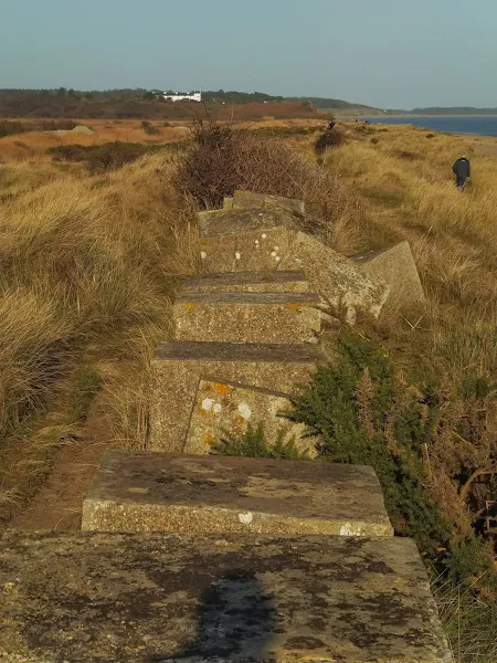
Walk down Red House Lane on the southern edge of Leiston and continue beyond the housing onto grimseys Lane and across the field at the end to emerge onto the Sizewell Road at Half Way Houses. Follow the road to Sizewell then head northwards past the Power Station. Continue to the Sluice. Between the main landward side track and the beach before the sluice are the remains of the old cottages that once made up the hamlet of Minsmere. Keep to the dunes beyond the sluice all the way through to Dunwich Heath which is denoted by the white building atop the cliffs.
Dunwich Heath to Leiston
There are two possible routes away from Dunwich Heath. The easiest is to navigate around to the back of the Coastguard cottages and then down to the toilet block. Just beyond this is a sculpture marking the Sandlings long distance path. Take the path straight ahead marked with the distinctive snadlings waymarker, a black bird on an off-white background. This will lead across the heather filled heathland and down towards some woodland.
An alternative route is to take the public footpath following Docwras Ditch. This follows the bottom of the hill on the edge of Minsmere. Keep to this ignoring all paths up to the heath. Eventually the path slowly turns to the right and joins up with the Sandlings path by a gate in a dip.
Head through the gate and follow the track through the woodland. Take the left when it joins another track, continuing to follow the Sandlings waymarkers. This will head through more woodland before it crosses a road and follows the hedgerow alongside a large meadow with views out towards the coast. The route returns to woodland to emerge on the Minsmere road. Go straight ahead onto the road and follow this through to Eastbridge. Continue along the road beyond the village until it meets the main Leiston road. At the junction turn left. There is a pavement on the opposite side of the road, just beyond Old Abbey Farm. This leads back down into Leiston.
Pubs
Eastbridge Eels Foot View in OS Map | View in Google Map

- Address
- Eastbridge Eels Foot
- Website
- www.theeelsfootinn.co.uk/
A curious name for a pub; some say it comes from a Heel's Foot, a cobblers implement, others will argue that it is named after the Eel's Boot, a type of woven reed basket used in Eel Fishing. A more fanciful explanation is that it is a derivation of Neale's Boot, named after a medieval priest who trapped the Devil in his boot and tossed him into the river. The Devil escaped disguised as an eel.
The pub is an Adnams establishment and regularly has at least three of their cask ales on tap, with the Bitter and Broadside plus seasonal ales. The pub is popular with walkers and birdwatchers from nearby Minsmere bird Reserve.
Food and Bed and Breakfast accommodation is on offer and The Eels Foot is renowned for its long tradition of Folk Music which still continue on Thursday evenings with a jam session.
Up until late 2014 the wall in the alcove adjacent to the bar was decorated with a curious painting of a medieval country feast. On a casual glance it was nothing more than an insight into times gone by but on closer inspection would could see that some of the men within it were wearing rather large codpieces. The painting appeared to be a corruption of 'The Peasants Wedding Feast' by Pieter Bruegel. His son, Pieter the Younger, would copy his fathers work and this particular article could have been a humorous copy as the original has a completely different background and no cod-pieces. Unfortunately this has now been removed, which, so I am told, caused some controversy.
A difficult decision.... Adnams Old Ale or Adnams Ghost Ship. As much as Old is a handsome winters drink the Ghost Ship was more tempting on this occasion.
Features
Storm SurgesView in OS Map | View in Google Map
A storm surge, sometimes mis-referred to as a tidal surge, is the rise of water associated with a low pressure weather system. Storm surges are caused primarily by high winds pushing on the ocean's surface causing the water to pile up higher than the ordinary sea level. Secondly, low pressure, associated with storms, exert less of a force on the sea surface allowing the sea surface to temporarily rise in the vicinity of low pressure.
In the case of the Eastern Coast of the UK, a storm surge occurs when the area of low pressure moves into the North Sea and strong northerly winds start to push the sea southwards. This forces the water into the shallower southern regions and causing a bottleneck as the water tries to escape through the narrow Dover Straits into the English Channel.
When storm surges combine with high tides, especially spring tides, and large waves the result is flooding along the exposed coasts.
References
Links and Bibliography:
- BBC News article with reference to Peter Aldous Parliamentary debate
- Parliamentary debate on Coastal Flooding
- Quotes from Norfolk councillors
- East Anglian Daily Times aerial photography of Suffolk Coast in the aftermath of the storm surge
- Article on flooding around the proposed site for Sizewell C
- Response to the NPS for energy infrastructure in relation to Sizewell C
- RSPB Minsmere report on flooding following 2013 Storm Surge
- Daily Telegraph report on plan to flood the Broads
Image Gallery


Route Validation Cards
Validation Date - 2013-12-14
- Time of Walk: 10:00 to 15:00
- Validators: Griffmonster, Kat
- Weather Conditions: Bright sunny day with clear blue skies
- Notes: Initial route undertaken
Summary of Document Changes
Last Updated: 2026-01-16
- 2013-12-22 : Initial publication
- 2016-02-01 : General website updates
- 2019-01-07 : General website updates
- 2021-03-17 : Update website improvements and removal of ViewRanger reliance
- 2021-12-01 : Removal of ViewRanger links due to its imminent demise
- 2026-01-12 : >Major website update with all walks recast to the new format


0 comments:
Post a Comment