Route details, maps, pubs, features, local history and folklore for a wide variety of walks focusing primarily on Norfolk and Suffolk

Walks
Showing posts sorted by relevance for query Porlock. Sort by date Show all posts

Thursday, 19 July 2018

Porlock Weir to Minehead Walk Summary

Salt marsh

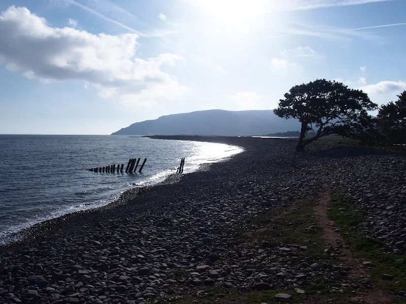
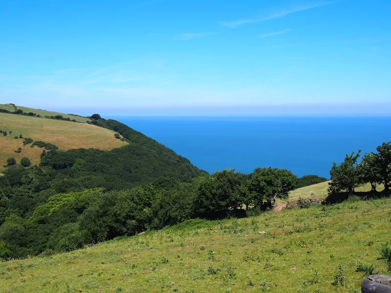
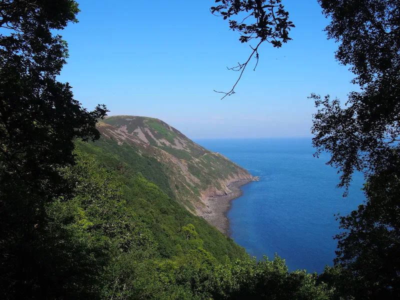
A 9 mile walk along the SWCP between Porlock Weir and Minehead

Walking in an anti-clockwise direction, this walk marks the end to the South West Coast Path. There are no gold embossed certificates handed out, no congratulating parades to cheer the triumphant walker across the finishing line, or national media around to film the completion of this mammoth 630 mile trek. Just a sculpture of a pair of hands holding an OS map and a self-satisfying sense of achievement with a hint of sadness that the trail is over and another challenge must be sought... or maybe turn around and do it all again in the opposite direction!

South West Coast Path - Porlock Weir and Minehead - Essential Information

Walk Statistics:

  • Start location: Porlock Weir 
  • End location: Minehead 
  • Distance:   miles (  km)
  • Total Gain:   ft (  metre)
  • Total Descent:   ft (  metre)
  • Min Height:   ft (  metre)
  • Max Height:   ft (  metre)
  • Walk Time:  
  • Walk type: Linear
  • Walk Grade: moderate
  • Terrain: The first section is across the beach over large pebbles. This is followed by an easy stroll around the flat marsh to Bossington before a steep climb up Bossington Hill. A broad track then leads over the hills before a footpath descends steadily down to the seafront at Minehead

Maps:

The following maps and services can assist in navigating this route. There are links to printed maps and links to downloadable GPX route data for importing into navigational software and apps.


Accommodation:

Hele Valley Holiday ParkcampsiteView in OS Map | View in Google Map
Website
Description
Situated close to Ilfracombe, this family owned holiday park is set in the picturesque valley at Hele Bay. It offers a peaceful, clean and well maintained park with static caravans and lodges, camping pitches and camping pods. This site has been awarded Silver Awards from the Devon Tourism Awards, a David Bellamy Gold Award for Conservation and a Trip Advisor Excellence Certificate.

Transport:

Details of public transport that is required for the walk

Various - Bus Service
Service Details
10 - The number 10 bus service links Minehead, Porlock and Porlock Weir. The service has been reduced in recent years but as of 2018 it still survives despite threats of abandoning it completely. It is currently operated by a variety of operators and can be picked up at Minehead Station and Porlock Weir car park.
Timetable

Route Verification Details

  • Date of Walk: 2018-06-28
  • Walk Time: 06:30 to 10:30
  • Walkers: Griffmonster, Kat
  • Weather Conditions: Warm sunny day to start although overcast across the hills

Directions

Summary of Document Changes

Last Updated: 2021-12-07

2021-03-17 : Update website improvements and removal of ViewRanger reliance
2021-12-01 : Removal of ViewRanger links due to its imminent demise

Wednesday, 18 July 2018

Porlock Weir to County Gate Walk Summary

Salt marsh

A simple 6 mile walk from Porlock Weir to County Gate Car Park

The walk navigates along the higher SWCP route through to Wheatham Combe from where the County Gate car park can be reached along bridleways. This route has the advantage of some fantastic views over the coast as opposed to the lower route through the wooded lower reaches of the cliffs. This walk does need the assistance of a friend or acquaintance to provide a return journey between the two ends of the walk, alternatively the walk can use the lower SWCP to make a circular route.

South West Coast Path - Porlock Weir to County Gate Walk - Essential Information

Walk Statistics:

  • Start location: Porlock Weir 
  • End location: County Gate Car Park, Exmoor 
  • Distance:   miles (  km)
  • Total Gain:   ft (  metre)
  • Total Descent:   ft (  metre)
  • Min Height:   ft (  metre)
  • Max Height:   ft (  metre)
  • Walk Time:  
  • Walk type: Linear
  • Walk Grade: moderate
  • Terrain: The trail follows footpaths and tracks using the SWCP. The final section is along bridleways although these are no more than footpaths up to Yenworthy Farm

Maps:

The following maps and services can assist in navigating this route. There are links to printed maps and links to downloadable GPX route data for importing into navigational software and apps.


Accommodation:

Hele Valley Holiday ParkcampsiteView in OS Map | View in Google Map
Website
Description
Situated close to Ilfracombe, this family owned holiday park is set in the picturesque valley at Hele Bay. It offers a peaceful, clean and well maintained park with static caravans and lodges, camping pitches and camping pods. This site has been awarded Silver Awards from the Devon Tourism Awards, a David Bellamy Gold Award for Conservation and a Trip Advisor Excellence Certificate.

Route Verification Details

  • Date of Walk: 2018-06-27
  • Walk Time: 08:30 to 11:30
  • Walkers: Griffmonster, Kat
  • Weather Conditions: Very warm sunny day

Directions

Summary of Document Changes

Last Updated: 2021-12-07

2021-03-17 : Update website improvements and removal of ViewRanger reliance
2021-12-01 : Removal of ViewRanger links due to its imminent demise

Tuesday, 17 July 2018

County Gate to Lynmouth Circular Walk Summary

Salt marsh

Circular walk linking the County Gate car park and Lynmouth

There is no public transport between Porlock and Lynmouth, therefore a days linear walk is not possible if one requires to return to the start. This walk uses a mid-point of the County Gate car park, located on Exmoor, to provide a circular route using the SWCP and Coleridge Way. The SWCP section is not too strenuous and provides some amazing coastal views whilst the Coleridge Way makes a very pleasant ramble alongside the East Lyn River to return to the County Gate

South West Coast Path - County Gate to Lynmouth Circular Walk - Essential Information

Walk Statistics:

  • Start location: County Gate Car Park, Exmoor 
  • Distance:   miles (  km)
  • Total Gain:   ft (  metre)
  • Total Descent:   ft (  metre)
  • Min Height:   ft (  metre)
  • Max Height:   ft (  metre)
  • Walk Time:  
  • Walk type: Circular
  • Walk Grade: moderate
  • Terrain: Footpaths link the County Gate car park and the SWCP which leads along the coast to Lynmouth. Return is along footpaths following the East Lyn river. The final section is along a country lane with a section alongside the main A39. There are broad verges that are kept mowed for walkers.

Maps:

The following maps and services can assist in navigating this route. There are links to printed maps and links to downloadable GPX route data for importing into navigational software and apps.


Accommodation:

Hele Valley Holiday ParkcampsiteView in OS Map | View in Google Map
Website
Description
Situated close to Ilfracombe, this family owned holiday park is set in the picturesque valley at Hele Bay. It offers a peaceful, clean and well maintained park with static caravans and lodges, camping pitches and camping pods. This site has been awarded Silver Awards from the Devon Tourism Awards, a David Bellamy Gold Award for Conservation and a Trip Advisor Excellence Certificate.

Route Verification Details

  • Date of Walk: 2018-06-26
  • Walk Time: 07:30 to 14:30
  • Walkers: Griffmonster, Kat
  • Weather Conditions: Bright warm sunny day

Directions

Summary of Document Changes

Last Updated: 2021-12-07

2021-03-17 : Update website improvements and removal of ViewRanger reliance
2021-12-01 : Removal of ViewRanger links due to its imminent demise

Indexes and Info

East Suffolk PRoW Access

The Public Rights of Way (PRoW) within the Suffolk Coastal area between Aldeburgh and Southwold are subject to being blocked up and diverted due to the extensive industrial projects that are currently taking place in the area including the Sizewell C development and various wind farm projects. A PRoW Access page has been written to detail known issues in the area

Walk Summaries

Latest walk summaries are basic information sheets for walks that have yet to be fully documented. These provide links to maps, public transport and walks stats, although detailed notes and features are not included.

Latest Walk Summaries

Featured Walk

In Search of Sizewell Chapel

A 10 mile walk following the southern side of the parish boundary of Leiston in Suffolk This walk follows the route of a 17th century peramb...

What is GPX

All you need to know about GPX, electronic mapping and how to use modern apps and mobile devices as navigation devices

Popular Walks

Maps

Diary of a Suffolk Common

The ramblings and musing of the Griffmonster