Porlock Weir to County Gate Walk Summary
Wednesday, 18 July 2018
|
No comments
|
![]()
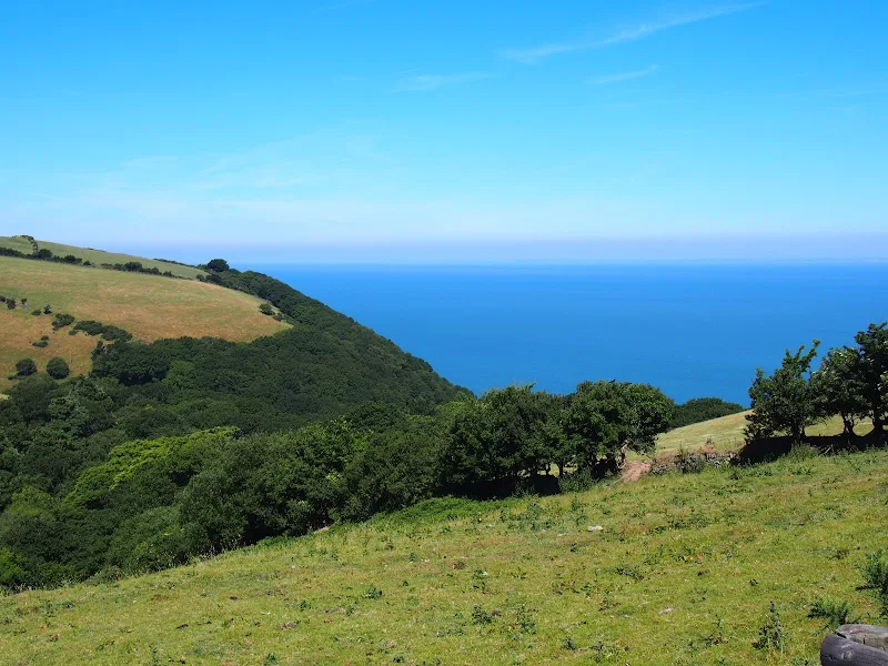
A simple 6 mile walk from Porlock Weir to County Gate Car Park
The walk navigates along the higher SWCP route through to Wheatham Combe from where the County Gate car park can be reached along bridleways. This route has the advantage of some fantastic views over the coast as opposed to the lower route through the wooded lower reaches of the cliffs. This walk does need the assistance of a friend or acquaintance to provide a return journey between the two ends of the walk, alternatively the walk can use the lower SWCP to make a circular route.

Walk Statistics
- Start location: Porlock Weir
- End location: County Gate Car Park, Exmoor
- Distance: miles ( km)
- Total Gain: ft ( metre)
- Total Descent: ft ( metre)
- Min Height: ft ( metre)
- Max Height: ft ( metre)
- Est. Walk Time:
- Walk type: Linear
- Walk Grade: moderate
- Terrain: The trail follows footpaths and tracks using the SWCP. The final section is along bridleways although these are no more than footpaths up to Yenworthy Farm
- Obstacles: There is no public transport between the ends of this walk and it requires a friend or acquaintance to link the two. Alternatively one can follow the Circular Route using the lower SWCP as a return. Note also that where the route diverges from the upper SWCP across Yenworthy Common, there is a steep climb shortly followed by a craggy stream bed to cross. This is not difficult but an alternative route can be taken which may be a little easier. There is a waymarker at the common for a permissive path to Yenworthy Farm which proceeds across the common. From here there is a track to link back to the route at Yenworthy Lodge.

Maps
The following maps and services can assist in navigating this route. There are links to printed maps and links to downloadable GPX route data for importing into navigational software and apps.
- Ordnance Survey Explorer Map
- OS Explorer OL9 - Exmoor
- GPX Route File
Accommodation
Hele Valley Holiday ParkcampsiteView in OS Map | View in Google Map
- Website
- www.helevalley.co.uk/
- Description
- Situated close to Ilfracombe, this family owned holiday park is set in the picturesque valley at Hele Bay. It offers a peaceful, clean and well maintained park with static caravans and lodges, camping pitches and camping pods. This site has been awarded Silver Awards from the Devon Tourism Awards, a David Bellamy Gold Award for Conservation and a Trip Advisor Excellence Certificate.
Route Validation Cards
Validation Date - 2018-06-27
- Time of Walk: 08:30 to 11:30
- Validators: Griffmonster, Kat
- Weather Conditions: Very warm sunny day
- Notes: Initial route undertaken
Summary of Document Changes
Last Updated: 2026-04-20
- 2021-03-17 : Update website improvements and removal of ViewRanger reliance
- 2021-12-01 : Removal of ViewRanger links due to its imminent demise
- 2026-01-12 : Major website update with all walks recast to the new format


0 comments:
Post a Comment