Porlock Weir to Minehead Walk Summary
Thursday, 19 July 2018
|
No comments
|
![]()
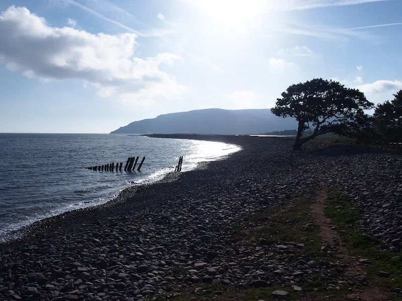
A 9 mile walk along the SWCP between Porlock Weir and Minehead
Walking in an anti-clockwise direction, this walk marks the end to the South West Coast Path. There are no gold embossed certificates handed out, no congratulating parades to cheer the triumphant walker across the finishing line, or national media around to film the completion of this mammoth 630 mile trek. Just a sculpture of a pair of hands holding an OS map and a self-satisfying sense of achievement with a hint of sadness that the trail is over and another challenge must be sought... or maybe turn around and do it all again in the opposite direction!

Walk Statistics
- Start location: Porlock Weir
- End location: Minehead
- Distance: miles ( km)
- Total Gain: ft ( metre)
- Total Descent: ft ( metre)
- Min Height: ft ( metre)
- Max Height: ft ( metre)
- Est. Walk Time:
- Walk type: Linear
- Walk Grade: moderate
- Terrain: The first section is across the beach over large pebbles. This is followed by an easy stroll around the flat marsh to Bossington before a steep climb up Bossington Hill. A broad track then leads over the hills before a footpath descends steadily down to the seafront at Minehead
- Obstacles: Overall this is a fairly easy route, however there is a long steep climb up Bossington Hill. This ascends to 250m in one go before taking the inland path across Selworthy Beacon and down to Minehead with spectacular views throughout. There is an alternative Rugged Route that is waymarked at the top of Bossington Hill. This, as it states, is more rugged and challenging, hugging the coastline.

Maps
The following maps and services can assist in navigating this route. There are links to printed maps and links to downloadable GPX route data for importing into navigational software and apps.
- Ordnance Survey Explorer Map
- OS Explorer OL9 - Exmoor
- GPX Route File
Accommodation
Hele Valley Holiday ParkcampsiteView in OS Map | View in Google Map
- Website
- www.helevalley.co.uk/
- Description
- Situated close to Ilfracombe, this family owned holiday park is set in the picturesque valley at Hele Bay. It offers a peaceful, clean and well maintained park with static caravans and lodges, camping pitches and camping pods. This site has been awarded Silver Awards from the Devon Tourism Awards, a David Bellamy Gold Award for Conservation and a Trip Advisor Excellence Certificate.
Transport
Various - Bus Service
- Service Details
- 10 - The number 10 bus service links Minehead, Porlock and Porlock Weir. The service has been reduced in recent years but as of 2018 it still survives despite threats of abandoning it completely. It is currently operated by a variety of operators and can be picked up at Minehead Station and Porlock Weir car park.
- Timetable
- Somerset Bus Timetables
Route Validation Cards
Validation Date - 2018-06-28
- Time of Walk: 06:30 to 10:30
- Validators: Griffmonster, Kat
- Weather Conditions: Warm sunny day to start although overcast across the hills
- Notes: Initial route undertaken
Summary of Document Changes
Last Updated: 2026-04-20
- 2021-03-17 : Update website improvements and removal of ViewRanger reliance
- 2021-12-01 : Removal of ViewRanger links due to its imminent demise
- 2026-01-12 : Major website update with all walks recast to the new format


0 comments:
Post a Comment