South West Coast Path - Charmouth to West Bay
Saturday, 9 February 2019
|
No comments
|
![]()
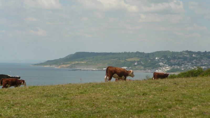
A challenging 8 mile hike along the South West Coast Path between Charmouth and West Bay
At only 8 miles, do not underestimate this walk. It is an arduous hike over the hills and across the valleys of coastal Dorest. The highlight is the peak of Golden Cap, which at 191m is the highest point on the English South Coast. The golden greensand rock that crowns the cliff top is what gives this peak its name.
This walk was due to start at Lyme Regis but a cliff fall had taken a section of the coast path and the only method to walk between the town and Charmouth was to use the main coast road which is certainly not conducive to most ramblers. The path has subsequently been reinstated with a route that cuts across timber Hill and minimizes the use of the road.
From Charmouth the route takes a country lane known as Stonebarrow Lane which quite naturally leads up Stonebarrow Hill with a slow and steady climb. At its 148m summit, the path heads to the cliff side then follows the cliff top paths. The going now gets tougher as the path descends to the valley where Westhay Water cascades down, launching itself off the cliffs below and onto the shingle beach. There is a short climb across the following ridge and back down to Ridge Water and another cascading stream that terminates itself in a similar manner. All the time Golden Cap is looming in the distance, beckoning with its challenge. Drawing the walker onwards, but first, another valley needs to be crossed first, Gabriels Mouth. The name is probably derived from a forgotten village known as Stanton St Gabriel which used to lie up the valley. The ruins of the church still exist but other than a farmhouse the village is lost in the landscape.
The ascent of Golden Cap now begins from the bottom of the valley at 40m. After the initial climb out of the valley the path flattens out a little before the major climb up the zigzagging path to the summit. A total climb of 151m. A lot of effort but oh so worth it. At the top the views are outstanding, behind one can view the panorama all around Lyme Bay and beyond. Ahead the coast tapers down to Chesil Beach and on the horizon Portland can be seen.
There is a steady descent from Golden Cap down to the hamlet of Seatown where the Anchor Inn pub is perched above the beach. Benches parade the broad grassy garden overlooking the beach and offers the ideal opportunity to celebrate ones efforts thus far. Palmers ales are on offer and a real thirst quencher. On this occasion the temperatures were an unusually balmy hot summers day with clear blue skies and a summer sun blazing with all its fury.
From Seatown the path climbs up to Ridge Cliff then continues over Doghouse Hill and Thorncombe Beacon before descending down to Eype Mouth. A stream trickles below a wooden footbridge then disappears into the shingle beach. Boats lie upturned in the shelter of the grassy banks of the valley.
There is a final hurdle over West Cliff into West Bay. One may expect another little village nestled in the valley but West Bay has grown over the years and is full of modern conurbations and chips stalls that surround the little harbour. All a little brash after the rural settings encountered on route. The river Brit flows out through the harbour. Originally known as the River Wooth, it had a name change with the establishment of Bridport.
One can continue onwards to Burton Bradstock but for this day, with the draining heat and the arduous climbs the walk was terminated at West Bay and legs were rested at The George Hotel where more of the delicious Palmers Ales were consumed with a spot of lunch.
At the time of walking this route there was a bus service all the way through from West Bay to Salcombe Regis where we had set up base camp. This no longer appears to be the case although there are buses that link West Bay with Charmouth. On this occasion it seemed a good choice to return to Charmouth to explore a little more.

Walk Statistics
- Start location: Charmouth
- End location: West Bay
- Distance: miles ( km)
- Total Gain: ft ( metre)
- Total Descent: ft ( metre)
- Min Height: ft ( metre)
- Max Height: ft ( metre)
- Est. Walk Time:
- Walk type: Linear
- Walk Grade: challenging
- Terrain: Clifftop paths passing across valleys
- Obstacles: The undercliff area is 7 miles of arduous walking with no way out other than the way one comes in.

Maps
The following maps and services can assist in navigating this route. There are links to printed maps and links to downloadable GPX route data for importing into navigational software and apps.
- Ordnance Survey Explorer Map
- OS Explorer 116 - Lyme Regis & Bridport
- GPX Route File
Accommodation
Salcombe Regis CampsiteView in OS Map | View in Google Map
- Website
- www.salcombe-regis.co.uk/
- Description
- Situated at the head of the valley going down to Salcombe Mouth with some excellent views.
Transport
Traveline - Bus Service
- Service Details
- At the time of walking the X53 Jurassic Coastlinx service provide a link between West Bay and the campsite at Salcombe Regis. This no longer appears to be the case. For the latest details of services and operators see the Traveline website
- Timetable
- https://www.traveline.info/
Route Validation Cards
Validation Date - 2010-06-20
- Time of Walk: 11:00 to 16:00
- Validators: Griffmonster, Kat
- Weather Conditions: Bright sunshine and hot
- Notes: Initial route undertaken
Summary of Document Changes
Last Updated: 2026-04-20
- 2010-06-20 : Initial publication
- 2014-01-02 : General website updates
- 2019-02-09 : Recast and rewritten to common website format
- 2021-03-17 : Update website improvements and removal of ViewRanger reliance
- 2021-12-01 : Removal of ViewRanger links due to its imminent demise
- 2026-01-12 : Major website update with all walks recast to the new format


0 comments:
Post a Comment