Hele Bay to Braunton Walk Summary
Thursday, 5 July 2018
|
No comments
|
![]()
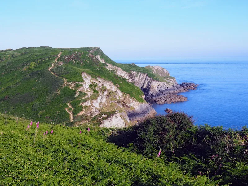
Extensive Walk along the SWCP between Hele Bay near Ilfracombe and Braunton
This route provides an alternative to the official SWCP whereby it short cuts the headland at Baggy Point and goes directly into Braunton omitting the section around Braunton Burrows. This achieves a sub 20 mile walk with bus access between Braunton and Ilfracombe. The cliffpath from Hele Bay to Woolacombe provides spectacular views and challenging walking whilst the sands of Woolacombe and Croyde make an easier terrain to navigate across.

Walk Statistics
- Start location: Hele Bay
- End location: Braunton
- Distance: miles ( km)
- Total Gain: ft ( metre)
- Total Descent: ft ( metre)
- Min Height: ft ( metre)
- Max Height: ft ( metre)
- Est. Walk Time:
- Walk type: Linear
- Walk Grade: strenuous
- Terrain: Cliff paths to start, beach walking and some road walking
- Obstacles: Some steep climbs on the initial stages. The walk into Braunton is along the road observe caution.

Maps
The following maps and services can assist in navigating this route. There are links to printed maps and links to downloadable GPX route data for importing into navigational software and apps.
- Ordnance Survey Explorer Map
- OS Explorer 139 - Bideford, Ilfracombe & Barnstaple
- GPX Route File
Accommodation
Hele Valley Holiday ParkcampsiteView in OS Map | View in Google Map
- Website
- www.helevalley.co.uk/
- Description
- Situated close to Ilfracombe, this family owned holiday park is set in the picturesque valley at Hele Bay. It offers a peaceful, clean and well maintained park with static caravans and lodges, camping pitches and camping pods. This site has been awarded Silver Awards from the Devon Tourism Awards, a David Bellamy Gold Award for Conservation and a Trip Advisor Excellence Certificate.
Transport
Stagecoach - Bus Service
- Service Details
- 21 - Stagecoach 21 Service linking Westward Ho!, Bideford, Barnstaple and Ilfracombe
- Timetable
- Stagecoach
Route Validation Cards
Validation Date - 2018-06-24
- Time of Walk: 05:00 to 14:00
- Validators: Griffmonster, Kat
- Weather Conditions: Bright warm sunny day
- Notes: Initial route undertaken
Summary of Document Changes
Last Updated: 2026-04-20
- 2021-03-17 : Update website improvements and removal of ViewRanger reliance
- 2021-12-01 : Removal of ViewRanger links due to its imminent demise
- 2026-01-12 : Major website update with all walks recast to the new format


0 comments:
Post a Comment